| diagram |
 |
| namespace |
http://www.landxml.org/schema/LandXML-1.1 |
| properties |
|
| children |
CantStation SpeedStation Feature |
| used by |
|
| attributes |
|
| annotation |
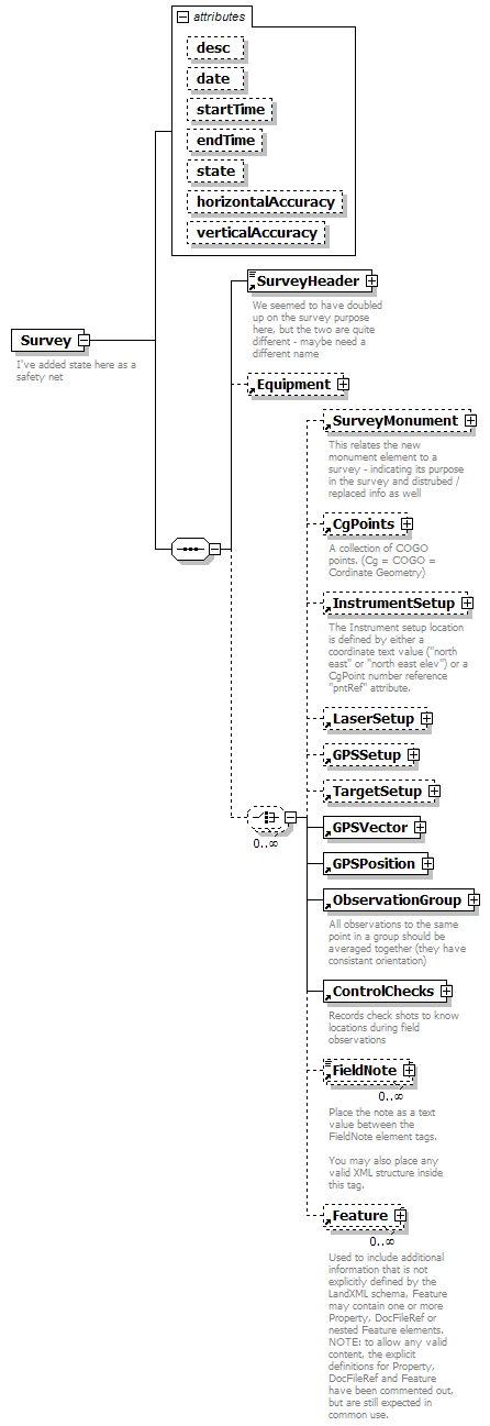
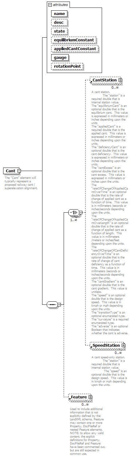
| documentation | | The "Cant" element will typically represent a proposed railway cant / superelevation alignment. | | documentation | It is defined by a sequential series of any combination of the cant stations and speed-only stations.
The “name”, “desc” and “state” attributes are typical LandXML “alignment” attributes.
The “equilibriumConstant” is a unitless optional double that is used as the equilibrium constant in the cant equilibrium equation (cant = constant * speed * speed / radius).
The “appliedCantConstant” is a unitless optional double that is used as the applied cant constant in the cant equilibrium equation (cant = constant * speed * speed / radius).
The “gauge” is a required double that is the rail to rail distance. This value is expressed in meters or feet depending upon the units.
The “rotationPoint” is an optional string that defines the rotation point. Valid values are “insideRail”, “outsideRail”, “center”, “leftRail” and “rightRail”.
|
|
| source |
<xs:element name="Cant">
<xs:annotation>
<xs:documentation>The "Cant" element will typically represent a proposed railway cant / superelevation alignment.</xs:documentation>
<xs:documentation>It is defined by a sequential series of any combination of the cant stations and speed-only stations.
The “name”, “desc” and “state” attributes are typical LandXML “alignment” attributes.
The “equilibriumConstant” is a unitless optional double that is used as the equilibrium constant in the cant equilibrium equation (cant = constant * speed * speed / radius).
The “appliedCantConstant” is a unitless optional double that is used as the applied cant constant in the cant equilibrium equation (cant = constant * speed * speed / radius).
The “gauge” is a required double that is the rail to rail distance. This value is expressed in meters or feet depending upon the units.
The “rotationPoint” is an optional string that defines the rotation point. Valid values are “insideRail”, “outsideRail”, “center”, “leftRail” and “rightRail”.
</xs:documentation>
</xs:annotation>
<xs:complexType>
<xs:sequence>
<xs:choice maxOccurs="unbounded">
<xs:element ref="CantStation" minOccurs="0" maxOccurs="unbounded"/>
<xs:element ref="SpeedStation" minOccurs="0" maxOccurs="unbounded"/>
</xs:choice>
<xs:element ref="Feature" minOccurs="0" maxOccurs="unbounded"/>
</xs:sequence>
<xs:attribute name="name" type="xs:string" use="required"/>
<xs:attribute name="desc" type="xs:string" use="optional"/>
<xs:attribute name="state" type="stateType" use="optional"/>
<xs:attribute name="equilibriumConstant" type="xs:double" use="optional"/>
<xs:attribute name="appliedCantConstant" type="xs:double" use="optional"/>
<xs:attribute name="gauge" type="xs:double" use="required"/>
<xs:attribute name="rotationPoint" type="xs:string" use="optional"/>
</xs:complexType>
</xs:element> |
| diagram |
 |
| namespace |
http://www.landxml.org/schema/LandXML-1.1 |
| type |
extension of ChainType |
| properties |
| content | complex | | mixed | true |
|
| used by |
|
| attributes |
|
| annotation |
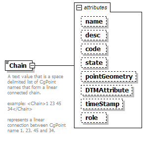
| documentation | A text value that is a space delimited list of CgPoint names that form a linear connected chain.
example: <Chain>1 23 45 34</Chain>
represents a linear connection between CgPoint name 1, 23, 45 and 34.
|
|
| source |
<xs:element name="Chain">
<xs:annotation>
<xs:documentation>A text value that is a space delimited list of CgPoint names that form a linear connected chain.
example: <Chain>1 23 45 34</Chain>
represents a linear connection between CgPoint name 1, 23, 45 and 34.
</xs:documentation>
</xs:annotation>
<xs:complexType mixed="true">
<xs:simpleContent>
<xs:extension base="ChainType">
<xs:attribute name="name" type="xs:string"/>
<xs:attribute name="desc" type="xs:string"/>
<xs:attribute name="code" type="xs:string"/>
<xs:attribute name="state" type="stateType"/>
<xs:attribute name="pointGeometry" type="pointGeometryType"/>
<xs:attribute name="DTMAttribute" type="DTMAttributeType"/>
<xs:attribute name="timeStamp" type="xs:dateTime" use="optional"/>
<xs:attribute name="role" type="surveyRoleType" use="optional"/>
</xs:extension>
</xs:simpleContent>
</xs:complexType>
</xs:element> |
| diagram |
 |
| namespace |
http://www.landxml.org/schema/LandXML-1.1 |
| properties |
|
| children |
Line IrregularLine Curve Spiral Chain Feature |
| used by |
|
| attributes |
|
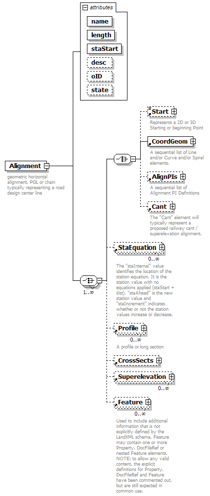
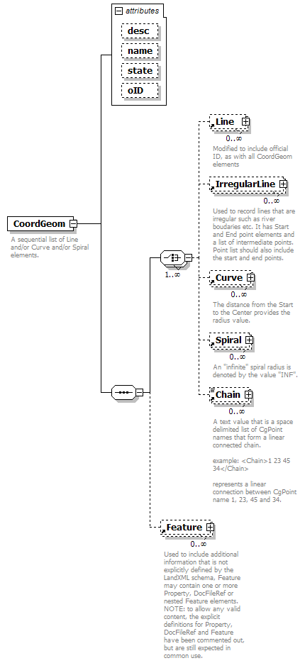
| annotation |
| documentation | | A sequential list of Line and/or Curve and/or Spiral elements. | | documentation | After the sequential list of elements an optional vertical geometry
may be defined as a profile, which may be as simple as a list of PVIs (point to point 3D line string). |
|
| source |
<xs:element name="CoordGeom">
<xs:annotation>
<xs:documentation>A sequential list of Line and/or Curve and/or Spiral elements.</xs:documentation>
<xs:documentation>After the sequential list of elements an optional vertical geometry
may be defined as a profile, which may be as simple as a list of PVIs (point to point 3D line string).</xs:documentation>
</xs:annotation>
<xs:complexType>
<xs:sequence>
<xs:choice maxOccurs="unbounded">
<xs:element ref="Line" minOccurs="0" maxOccurs="unbounded"/>
<xs:element ref="IrregularLine" minOccurs="0" maxOccurs="unbounded"/>
<xs:element ref="Curve" minOccurs="0" maxOccurs="unbounded"/>
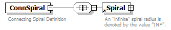
<xs:element ref="Spiral" minOccurs="0" maxOccurs="unbounded"/>
<xs:element ref="Chain" minOccurs="0" maxOccurs="unbounded"/>
</xs:choice>
<xs:element ref="Feature" minOccurs="0" maxOccurs="unbounded"/>
</xs:sequence>
<xs:attribute name="desc" type="xs:string"/>
<xs:attribute name="name" type="xs:string"/>
<xs:attribute name="state" type="stateType"/>
<xs:attribute name="oID" type="xs:string"/>
</xs:complexType>
</xs:element> |
| diagram |
 |
| namespace |
http://www.landxml.org/schema/LandXML-1.1 |
| properties |
|
| children |
Start FieldNote Feature |
| used by |
|
| attributes |
|
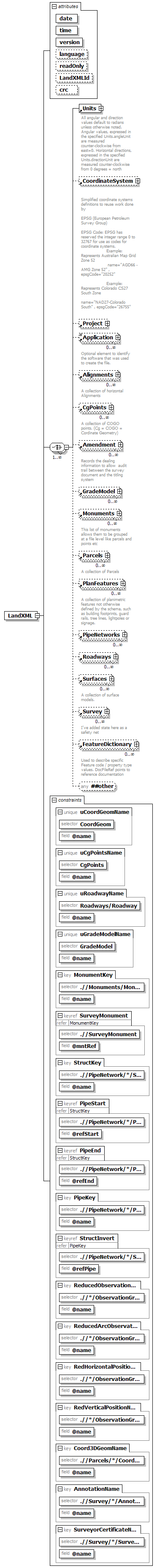
| annotation |
| documentation |
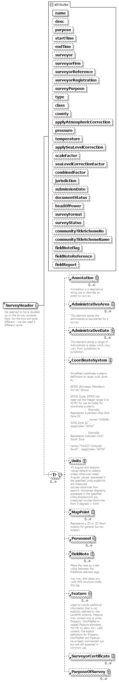
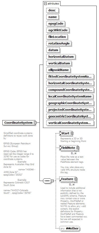
Simplified coordinate systems definitions to reuse work done by
EPSG (European Petroleum Survey Group)
EPSG Code: EPSG has reserved the integer range 0 to 32767 for use as codes for coordinate systems.
Example: Represents Australian Map Grid Zone 52
name="AGD66 - AMG Zone 52" , epsgCode="20252"
Example: Represents Colorado CS27 South Zone
name="NAD27-Colorado South" , epsgCode="26755"
|
|
| source |
<xs:element name="CoordinateSystem">
<xs:annotation>
<xs:documentation>
Simplified coordinate systems definitions to reuse work done by
EPSG (European Petroleum Survey Group)
EPSG Code: EPSG has reserved the integer range 0 to 32767 for use as codes for coordinate systems.
Example: Represents Australian Map Grid Zone 52
name="AGD66 - AMG Zone 52" , epsgCode="20252"
Example: Represents Colorado CS27 South Zone
name="NAD27-Colorado South" , epsgCode="26755"
</xs:documentation>
</xs:annotation>
<xs:complexType>
<xs:sequence>
<xs:element ref="Start" minOccurs="0"/>
<xs:element ref="FieldNote" minOccurs="0" maxOccurs="unbounded"/>
<xs:element ref="Feature" minOccurs="0" maxOccurs="unbounded"/>
<xs:any namespace="##other" processContents="skip" minOccurs="0"/>
</xs:sequence>
<xs:attribute name="desc" type="xs:string"/>
<xs:attribute name="name" type="xs:string"/>
<xs:attribute name="epsgCode" type="xs:string"/>
<xs:attribute name="ogcWktCode" type="xs:string"/>
<xs:attribute name="fileLocation" type="xs:anyURI"/>
<xs:attribute name="rotationAngle" type="angle"/>
<xs:attribute name="datum" type="xs:string"/>
<xs:attribute name="horizontalDatum" type="xs:string"/>
<xs:attribute name="verticalDatum" type="xs:string"/>
<xs:attribute name="ellipsoidName" type="xs:string"/>
<xs:attribute name="fittedCoordinateSystemName" type="xs:string"/>
<xs:attribute name="horizontalCoordinateSystemName" type="xs:string"/>
<xs:attribute name="compoundCoordinateSystemName" type="xs:string"/>
<xs:attribute name="localCoordinateSystemName" type="xs:string"/>
<xs:attribute name="geographicCoordinateSystemName" type="xs:string"/>
<xs:attribute name="projectedCoordinateSystemName" type="xs:string"/>
<xs:attribute name="geocentricCoordinateSystemName" type="xs:string"/>
<xs:attribute name="verticalCoordinateSystemName" type="xs:string"/>
<!-- The attributes below are provided for backward compatibility only and should no longer be used. -->
</xs:complexType>
</xs:element> |
| diagram |
 |
| namespace |
http://www.landxml.org/schema/LandXML-1.1 |
| type |
extension of FaceType |
| properties |
| content | complex | | mixed | true |
|
| used by |
|
| attributes |
| Name | Type | Use | Default | Fixed | Annotation | | i | xs:integer | optional | | | | | n | FaceType | optional | | | |
|
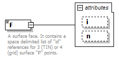
| annotation |
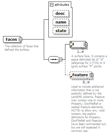
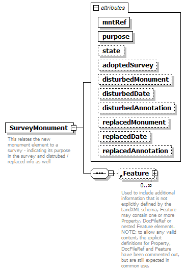
| documentation | | A surface face. It contains a space delimited list of "id" references for 3 (TIN) or 4 (grid) surface "P" points. | | documentation | | The 3 or 4 numbers represent the vertices on the face. Each number is a reference to the ID value of a surface point "P" for the face coordinates. | | documentation |
Attribute "i" is optional, where a value of "1" indicating the face is part of the triangulation but is invisible.
Attribute "n" is optional, space delimited face index values indicating the adjacent face index for each face edge, where a value of "0" (an invalid face index value) indicates the edge has NO neighboring face. The face index value is implied and defined from 1 to n number of F elements in a a single Faces collection.
Example:
<!--
<Faces>
<F>5 10 20</F> Implied face index = 1
<F>5 10 20</F> Implied face index = 2
<F>5 10 20</F> Implied face index = 3
<F n="2 0 3" i="1">10 20 30</F> Implied face index = 4
...
</Faces>
-->
Where 2 is the neighboring face index for the edge 10 to 20, 0 means no
neighbor between 20 and 30 and 3 is the neighbor index for 30 to 10.
|
|
| source |
<xs:element name="F">
<xs:annotation>
<xs:documentation>A surface face. It contains a space delimited list of "id" references for 3 (TIN) or 4 (grid) surface "P" points. </xs:documentation>
<xs:documentation>The 3 or 4 numbers represent the vertices on the face. Each number is a reference to the ID value of a surface point "P" for the face coordinates.</xs:documentation>
<xs:documentation>
Attribute "i" is optional, where a value of "1" indicating the face is part of the triangulation but is invisible.
Attribute "n" is optional, space delimited face index values indicating the adjacent face index for each face edge, where a value of "0" (an invalid face index value) indicates the edge has NO neighboring face. The face index value is implied and defined from 1 to n number of F elements in a a single Faces collection.
Example:
<!--
<Faces>
<F>5 10 20</F> Implied face index = 1
<F>5 10 20</F> Implied face index = 2
<F>5 10 20</F> Implied face index = 3
<F n="2 0 3" i="1">10 20 30</F> Implied face index = 4
...
</Faces>
-->
Where 2 is the neighboring face index for the edge 10 to 20, 0 means no
neighbor between 20 and 30 and 3 is the neighbor index for 30 to 10.
</xs:documentation>
</xs:annotation>
<xs:complexType mixed="true">
<xs:simpleContent>
<xs:extension base="FaceType">
<xs:attribute name="i" type="xs:integer" use="optional"/>
<xs:attribute name="n" type="FaceType" use="optional"/>
</xs:extension>
</xs:simpleContent>
</xs:complexType>
</xs:element> |
| diagram |
 |
| namespace |
http://www.landxml.org/schema/LandXML-1.1 |
| properties |
|
| used by |
|
| attributes |
|
| annotation |
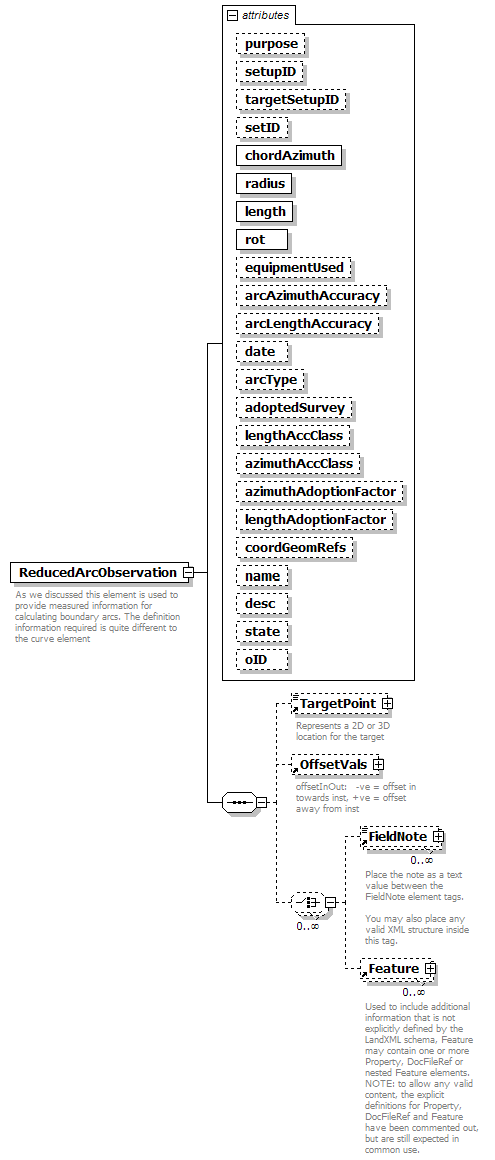
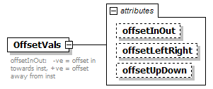
| documentation | | offsetInOut: -ve = offset in towards inst, +ve = offset away from inst | | documentation | | offsetLeftRight: -ve = left, +ve = right (as viewed from instrument) | | documentation | | offsetUpDown: -ve = down, +ve = up |
|
| source |
<xs:element name="OffsetVals">
<xs:annotation>
<xs:documentation>offsetInOut: -ve = offset in towards inst, +ve = offset away from inst </xs:documentation>
<xs:documentation>offsetLeftRight: -ve = left, +ve = right (as viewed from instrument) </xs:documentation>
<xs:documentation>offsetUpDown: -ve = down, +ve = up</xs:documentation>
</xs:annotation>
<xs:complexType>
<xs:attribute name="offsetInOut" type="xs:double"/>
<xs:attribute name="offsetLeftRight" type="xs:double"/>
<xs:attribute name="offsetUpDown" type="xs:double"/>
</xs:complexType>
</xs:element> |
| diagram |
 |
| namespace |
http://www.landxml.org/schema/LandXML-1.1 |
| properties |
|
| children |
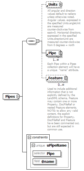
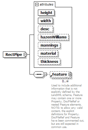
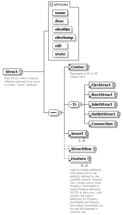
CircPipe EggPipe ElliPipe RectPipe Channel PipeFlow Center Feature |
| used by |
|
| attributes |
|
| annotation |
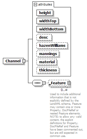
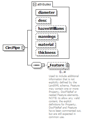
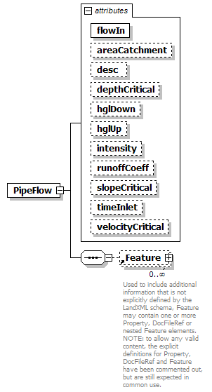
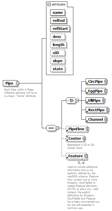
| documentation | | Each Pipe within a Pipes collection element will have a unique "name" attribute. | | documentation | | The pipe type is determined by the existance of one of the following elements: CircPipe, ElliPipe or RectPipe. | | documentation | | The "startRef and "endRef" attributes reference Struct "name" values. | | documentation | | The start and end invert elevations for the pipe are defined in the Invert elements of referenced structures. | | documentation | | Since a struct may have more than one Invert element, the Invert "pipeRef" attribute is used to select the correct invert element. |
|
| source |
<xs:element name="Pipe">
<xs:annotation>
<xs:documentation>Each Pipe within a Pipes collection element will have a unique "name" attribute.</xs:documentation>
<xs:documentation>The pipe type is determined by the existance of one of the following elements: CircPipe, ElliPipe or RectPipe.</xs:documentation>
<xs:documentation>The "startRef and "endRef" attributes reference Struct "name" values.</xs:documentation>
<xs:documentation>The start and end invert elevations for the pipe are defined in the Invert elements of referenced structures.</xs:documentation>
<xs:documentation>Since a struct may have more than one Invert element, the Invert "pipeRef" attribute is used to select the correct invert element.</xs:documentation>
</xs:annotation>
<xs:complexType>
<xs:sequence>
<xs:choice>
<xs:element ref="CircPipe"/>
<xs:element ref="EggPipe"/>
<xs:element ref="ElliPipe"/>
<xs:element ref="RectPipe"/>
<xs:element ref="Channel"/>
</xs:choice>
<xs:element ref="PipeFlow" minOccurs="0"/>
<xs:element ref="Center" minOccurs="0"/>
<xs:element ref="Feature" minOccurs="0" maxOccurs="unbounded"/>
<!-- <Center> point of the Pipe is the point of center on the curved pipe arc. If this optional element is specified, then the pipe starts at refStart, passes through the <Center> point, and end at refEnd. -->
</xs:sequence>
<xs:attribute name="name" type="xs:string" use="required"/>
<xs:attribute name="refEnd" type="structNameRef" use="required"/>
<xs:attribute name="refStart" type="structNameRef" use="required"/>
<xs:attribute name="desc" type="xs:string"/>
<xs:attribute name="length" type="xs:double"/>
<xs:attribute name="oID" type="xs:string"/>
<xs:attribute name="slope" type="xs:double"/>
<xs:attribute name="state" type="stateType"/>
</xs:complexType>
</xs:element> |
| diagram |
 |
| namespace |
http://www.landxml.org/schema/LandXML-1.1 |
| properties |
|
| children |
CoordGeom Location Feature |
| used by |
|
| attributes |
|
| annotation |
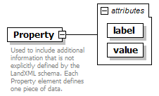
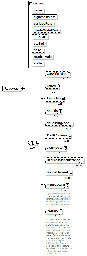
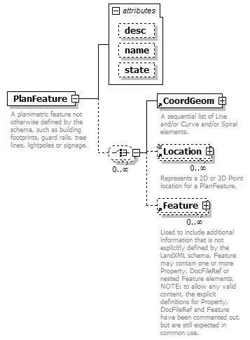
| documentation | | A planimetric feature not otherwise defined by the schema, such as building footprints, guard rails, tree lines, lightpoles or signage. |
|
| source |
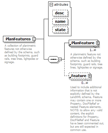
<xs:element name="PlanFeature">
<xs:annotation>
<xs:documentation>A planimetric feature not otherwise defined by the schema, such as building footprints, guard rails, tree lines, lightpoles or signage.</xs:documentation>
</xs:annotation>
<xs:complexType>
<xs:choice minOccurs="0" maxOccurs="unbounded">
<xs:element ref="CoordGeom"/>
<xs:element ref="Location" minOccurs="0" maxOccurs="unbounded"/>
<xs:element ref="Feature" minOccurs="0" maxOccurs="unbounded"/>
</xs:choice>
<xs:attribute name="desc" type="xs:string"/>
<xs:attribute name="name" type="xs:string"/>
<xs:attribute name="state" type="stateType"/>
</xs:complexType>
</xs:element> |
| diagram |
 |
| namespace |
http://www.landxml.org/schema/LandXML-1.1 |
| properties |
|
| children |
PlanFeature Feature |
| used by |
|
| attributes |
|
| annotation |
| documentation | | A collection of planimetric features not otherwise defined by the schema, such as building footprints, guard rails, tree lines, lightpoles or signage. | | documentation | | Typically a PlanFeatures element will contain a collection of similar items. |
|
| source |
<xs:element name="PlanFeatures">
<xs:annotation>
<xs:documentation>A collection of planimetric features not otherwise defined by the schema, such as building footprints, guard rails, tree lines, lightpoles or signage.</xs:documentation>
<xs:documentation>Typically a PlanFeatures element will contain a collection of similar items.</xs:documentation>
</xs:annotation>
<xs:complexType>
<xs:sequence>
<xs:element ref="PlanFeature" maxOccurs="unbounded"/>
<xs:element ref="Feature" minOccurs="0" maxOccurs="unbounded"/>
</xs:sequence>
<xs:attribute name="desc" type="xs:string"/>
<xs:attribute name="name" type="xs:string"/>
<xs:attribute name="state" type="stateType"/>
</xs:complexType>
</xs:element> |
| diagram |
 |
| namespace |
http://www.landxml.org/schema/LandXML-1.1 |
| properties |
|
| children |
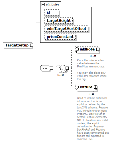
TargetPoint OffsetVals FieldNote Feature |
| used by |
|
| attributes |
|
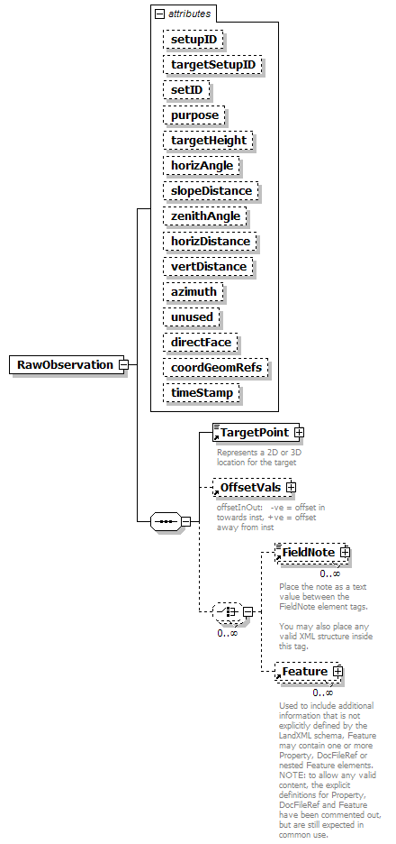
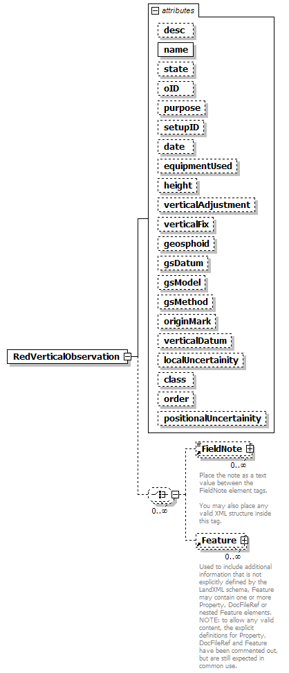
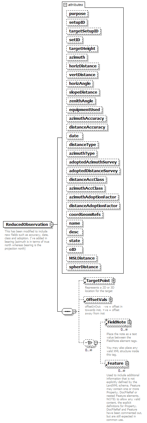
| annotation |
| documentation | | This has been modified to include new fields such as accuracy, date, class and adoption. I've added in bearing (azimuth is in terms of true north whereas bearing is the projection north) | | documentation | | - maybe this doesn't matter, may need to discuss |
|
| source |
<xs:element name="ReducedObservation">
<xs:annotation>
<xs:documentation>This has been modified to include new fields such as accuracy, date, class and adoption. I've added in bearing (azimuth is in terms of true north whereas bearing is the projection north) </xs:documentation>
<xs:documentation> - maybe this doesn't matter, may need to discuss</xs:documentation>
</xs:annotation>
<xs:complexType>
<xs:sequence>
<xs:element ref="TargetPoint" minOccurs="0"/>
<xs:element ref="OffsetVals" minOccurs="0"/>
<xs:choice minOccurs="0" maxOccurs="unbounded">
<xs:element ref="FieldNote" minOccurs="0" maxOccurs="unbounded"/>
<xs:element ref="Feature" minOccurs="0" maxOccurs="unbounded"/>
</xs:choice>
</xs:sequence>
<xs:attribute name="purpose" type="purposeType"/>
<xs:attribute name="setupID" type="xs:IDREF"/>
<xs:attribute name="targetSetupID" type="xs:IDREF"/>
<xs:attribute name="setID"/>
<xs:attribute name="targetHeight" type="xs:double"/>
<xs:attribute name="azimuth" type="direction" use="optional"/>
<xs:attribute name="horizDistance" type="xs:double" use="optional"/>
<xs:attribute name="vertDistance" type="xs:double" use="optional"/>
<xs:attribute name="horizAngle" type="angle" use="optional"/>
<xs:attribute name="slopeDistance" type="xs:double" use="optional"/>
<xs:attribute name="zenithAngle" type="zenithAngle" use="optional"/>
<xs:attribute name="equipmentUsed" type="equipmentType"/>
<xs:attribute name="azimuthAccuracy" type="xs:double"/>
<xs:attribute name="distanceAccuracy" type="xs:double"/>
<xs:attribute name="date" type="xs:date"/>
<xs:attribute name="distanceType" type="observationType"/>
<xs:attribute name="azimuthType" type="observationType"/>
<xs:attribute name="adoptedAzimuthSurvey" type="xs:string"/>
<xs:attribute name="adoptedDistanceSurvey" type="xs:string"/>
<xs:attribute name="distanceAccClass" type="xs:string"/>
<xs:attribute name="azimuthAccClass" type="xs:string"/>
<xs:attribute name="azimuthAdoptionFactor" type="xs:double"/>
<xs:attribute name="distanceAdoptionFactor" type="xs:double"/>
<xs:attribute name="coordGeomRefs" type="coordGeomNameRefs"/>
<xs:attribute name="name" type="xs:string"/>
<xs:attribute name="desc" type="xs:string"/>
<xs:attribute name="state" type="stateType"/>
<xs:attribute name="oID" type="xs:string"/>
<xs:attribute name="MSLDistance" type="xs:string"/>
<xs:attribute name="spherDistance" type="xs:string"/>
<!-- coordGeomRefs identifies one or more 'name' values that link to specific <Line>, <Curve>, <Spiral> or <IrregularLine> in a <CoordGeom> element. This allows linking an survey observation to specific <Parcel>.<CoordGeom> based geometry. -->
</xs:complexType>
</xs:element> |
| diagram |
 |
| namespace |
http://www.landxml.org/schema/LandXML-1.1 |
| type |
extension of PointType3dReq |
| properties |
| content | complex | | mixed | true |
|
| used by |
|
| facets |
|
| attributes |
|
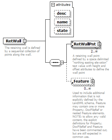
| annotation |
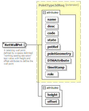
| documentation | | A retaining wall point defined by a space delimited "northing easting elevation" text value with height and offset attributes to define the wall point | | documentation | | The height value is positive if the northing/easting/elevation point is at the bottom of the wall, negative if the point is at the top of the wall. | | documentation | | The offset value is negative for left and positive for right. |
|
| source |
<xs:element name="RetWallPnt">
<xs:annotation>
<xs:documentation>A retaining wall point defined by a space delimited "northing easting elevation" text value with height and offset attributes to define the wall point</xs:documentation>
<xs:documentation>The height value is positive if the northing/easting/elevation point is at the bottom of the wall, negative if the point is at the top of the wall.</xs:documentation>
<xs:documentation>The offset value is negative for left and positive for right.</xs:documentation>
</xs:annotation>
<xs:complexType mixed="true">
<xs:simpleContent>
<xs:extension base="PointType3dReq">
<xs:attribute name="height" type="xs:double" use="required"/>
<xs:attribute name="offset" type="xs:double" use="required"/>
</xs:extension>
</xs:simpleContent>
</xs:complexType>
</xs:element> |
| diagram |
 |
| namespace |
http://www.landxml.org/schema/LandXML-1.1 |
| properties |
|
| children |
SourceData Definition Watersheds Feature |
| used by |
|
| attributes |
|
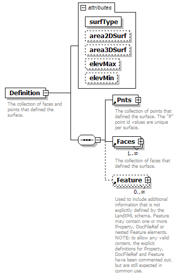
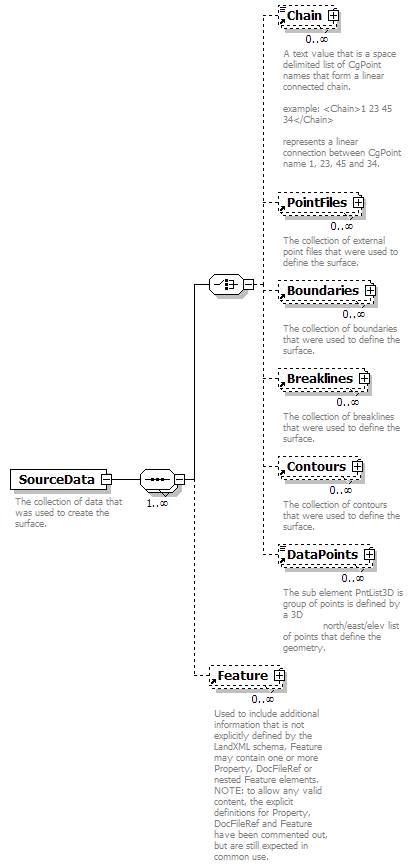
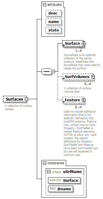
| annotation |
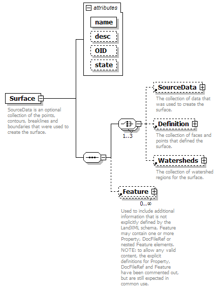
| documentation | | SourceData is an optional collection of the points, contours, breaklines and boundaries that were used to create the surface. | | documentation | | Definition is a collection of points and faces that define the surface. | | documentation | | Watersheds is a collection the watershed boundaries for the surface. |
|
| source |
<xs:element name="Surface">
<xs:annotation>
<xs:documentation>SourceData is an optional collection of the points, contours, breaklines and boundaries that were used to create the surface.</xs:documentation>
<xs:documentation>Definition is a collection of points and faces that define the surface.</xs:documentation>
<xs:documentation>Watersheds is a collection the watershed boundaries for the surface.</xs:documentation>
</xs:annotation>
<xs:complexType>
<xs:sequence>
<xs:choice maxOccurs="3">
<xs:element ref="SourceData" minOccurs="0"/>
<xs:element ref="Definition" minOccurs="0"/>
<xs:element ref="Watersheds" minOccurs="0"/>
</xs:choice>
<xs:element ref="Feature" minOccurs="0" maxOccurs="unbounded"/>
</xs:sequence>
<xs:attribute name="name" type="xs:string" use="required"/>
<xs:attribute name="desc" type="xs:string"/>
<xs:attribute name="OID" type="xs:string"/>
<xs:attribute name="state" type="stateType"/>
</xs:complexType>
</xs:element> |
| diagram |
 |
| namespace |
http://www.landxml.org/schema/LandXML-1.1 |
| type |
extension of Point3dOpt |
| properties |
| base | Point3dOpt | | mixed | true |
|
| used by |
|
| facets |
|
| attributes |
|
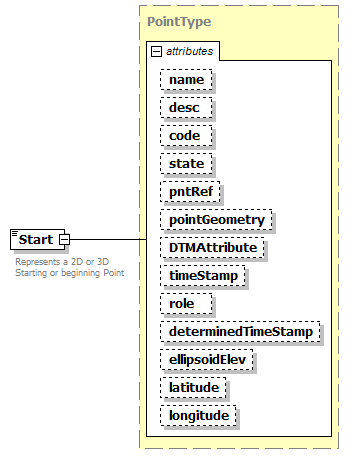
| annotation |
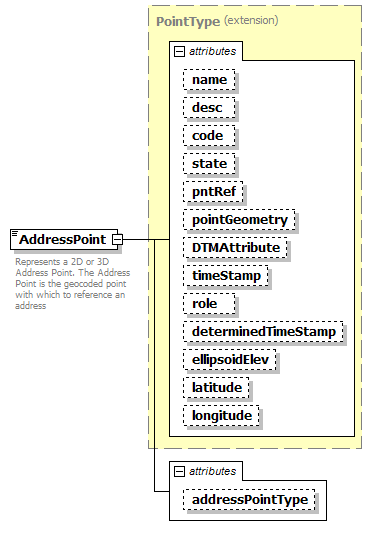
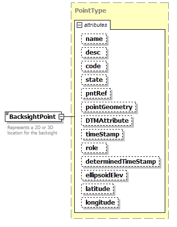
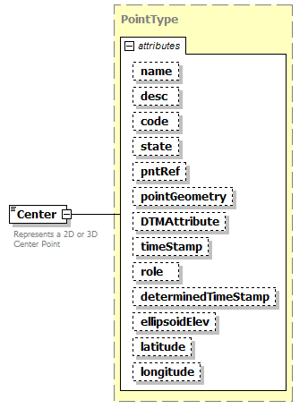
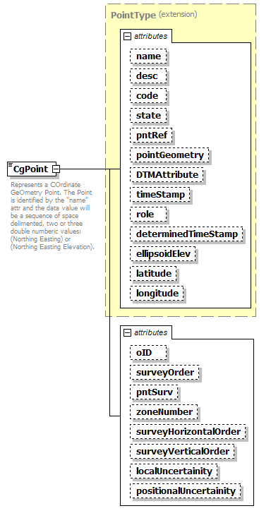
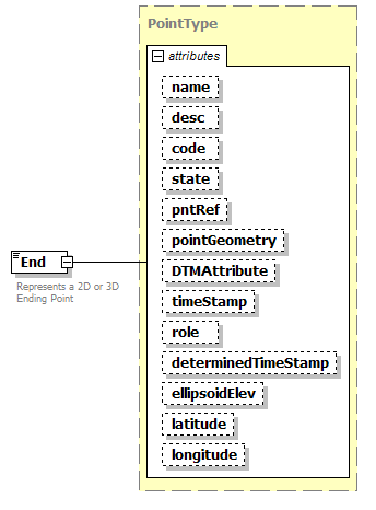
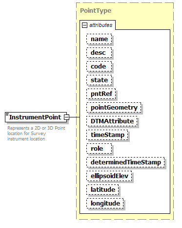
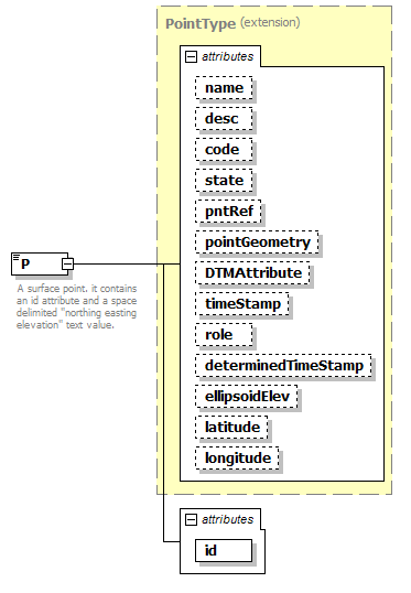
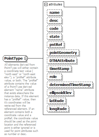
| documentation | | All elements derived from PointType will either contain a coordinate text value ( "north east" or "north east elev"), a "pntRef" attribute value, or both. The "pntRef" attribute contains the value of a PointType derived element "name" attribute that exists elsewhere the instance data. If this element has a "pntRef" value, then it's coordinates will be retrieved from the referenced element. If an element contains both a coordinate value and a pntRef, the coordinate value should be used as the point location and the referenced point is either ignored or is used for point attributes such as number or desc. |
|
| source |
<xs:complexType name="PointType" mixed="true">
<xs:annotation>
<xs:documentation>All elements derived from PointType will either contain a coordinate text value ( "north east" or "north east elev"), a "pntRef" attribute value, or both. The "pntRef" attribute contains the value of a PointType derived element "name" attribute that exists elsewhere the instance data. If this element has a "pntRef" value, then it's coordinates will be retrieved from the referenced element. If an element contains both a coordinate value and a pntRef, the coordinate value should be used as the point location and the referenced point is either ignored or is used for point attributes such as number or desc.</xs:documentation>
</xs:annotation>
<xs:simpleContent>
<xs:extension base="Point3dOpt">
<xs:attribute name="name" type="xs:string"/>
<xs:attribute name="desc" type="xs:string"/>
<xs:attribute name="code" type="xs:string"/>
<xs:attribute name="state" type="stateType"/>
<xs:attribute name="pntRef" type="pointNameRef"/>
<xs:attribute name="pointGeometry" type="pointGeometryType"/>
<xs:attribute name="DTMAttribute" type="DTMAttributeType"/>
<xs:attribute name="timeStamp" type="xs:dateTime" use="optional"/>
<xs:attribute name="role" type="surveyRoleType" use="optional"/>
<xs:attribute name="determinedTimeStamp" type="xs:dateTime" use="optional"/>
<xs:attribute name="ellipsoidElev" type="ellipsoidElevationType" use="optional"/>
<xs:attribute name="latitude" type="latLongAngle" use="optional"/>
<xs:attribute name="longitude" type="latLongAngle" use="optional"/>
</xs:extension>
<!-- FAA additions start-->
<!-- FAA additions end-->
</xs:simpleContent>
</xs:complexType> |
| namespace |
http://www.landxml.org/schema/LandXML-1.1 |
| type |
restriction of xs:string |
| used by |
|
| facets |
| enumeration | radians | | enumeration | grads | | enumeration | decimal degrees | | enumeration | decimal dd.mm.ss |
|
| annotation |
| documentation | Latitude/Longitude coordinate angular values. Latitude (range -90 to +90) positive values for the northern hemispher, negative indicate the southern. Longitude (range -180 to +180) positive values are to the east of the prime meridian, negative values are to the west. Values expressed in "decimal dd.mm.ss" units have the numeric format "45.3025" representing 45 degrees 30 minutes and 25 seconds. Both the minutes and seconds must be two characters with a numeric range between 00 to 60.
|
|
| source |
<xs:simpleType name="latLongAngularType">
<xs:annotation>
<xs:documentation>Latitude/Longitude coordinate angular values. Latitude (range -90 to +90) positive values for the northern hemispher, negative indicate the southern. Longitude (range -180 to +180) positive values are to the east of the prime meridian, negative values are to the west. Values expressed in "decimal dd.mm.ss" units have the numeric format "45.3025" representing 45 degrees 30 minutes and 25 seconds. Both the minutes and seconds must be two characters with a numeric range between 00 to 60.
</xs:documentation>
</xs:annotation>
<xs:restriction base="xs:string">
<xs:enumeration value="radians"/>
<xs:enumeration value="grads"/>
<xs:enumeration value="decimal degrees"/>
<xs:enumeration value="decimal dd.mm.ss"/>
</xs:restriction>
</xs:simpleType> |
| namespace |
http://www.landxml.org/schema/LandXML-1.1 |
| type |
list of xs:positiveInteger |
| annotation |
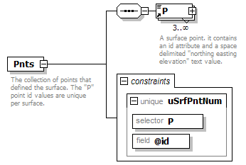
| documentation | | Represents a face on a 3D surface by referencing points from the Pnts collection" | | documentation | | The number of poitns are determined by the surfType attrinute: 3 for TIN, 4 for grid | | documentation | | Note: TIN is the acronym for "triangulated irregular network" | | documentation | | The point references are stored as a space delimited text value in the form of "id id id" | | documentation | | Example, "62 68 44" for TIN, ""62 68 44 71" for Grid |
|
| source |
<xs:simpleType name="surfFaceType">
<xs:annotation>
<xs:documentation>Represents a face on a 3D surface by referencing points from the Pnts collection"</xs:documentation>
<xs:documentation>The number of poitns are determined by the surfType attrinute: 3 for TIN, 4 for grid</xs:documentation>
<xs:documentation>Note: TIN is the acronym for "triangulated irregular network"</xs:documentation>
<xs:documentation>The point references are stored as a space delimited text value in the form of "id id id"</xs:documentation>
<xs:documentation>Example, "62 68 44" for TIN, ""62 68 44 71" for Grid</xs:documentation>
</xs:annotation>
<xs:list itemType="xs:positiveInteger"/>
</xs:simpleType> |