| diagram | 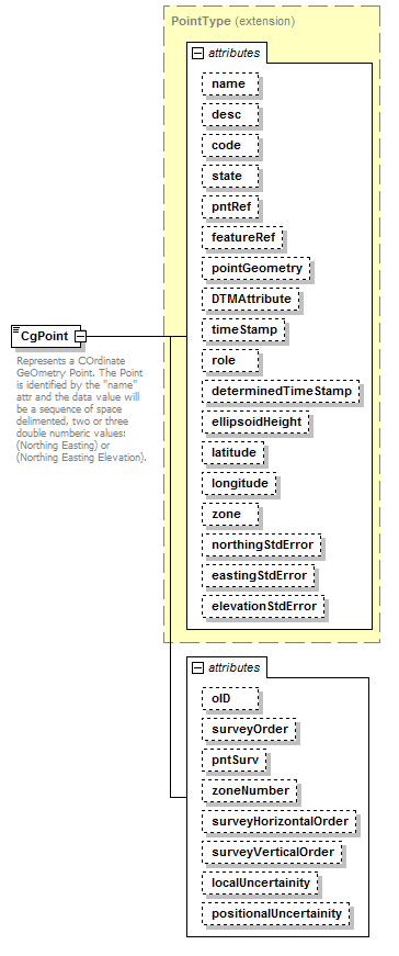 |
||||||||||||||||||||||||||||||||||||||||||||||||||||||||||||||||||||||||||||||||||||||||||||||||||||||||||||||||||||||||||||||||||||||||||||||||||||||||||||||||||
| namespace | http://www.landxml.org/schema/LandXML-1.2 | ||||||||||||||||||||||||||||||||||||||||||||||||||||||||||||||||||||||||||||||||||||||||||||||||||||||||||||||||||||||||||||||||||||||||||||||||||||||||||||||||||
| type | extension of PointType | ||||||||||||||||||||||||||||||||||||||||||||||||||||||||||||||||||||||||||||||||||||||||||||||||||||||||||||||||||||||||||||||||||||||||||||||||||||||||||||||||||
| properties |
|
||||||||||||||||||||||||||||||||||||||||||||||||||||||||||||||||||||||||||||||||||||||||||||||||||||||||||||||||||||||||||||||||||||||||||||||||||||||||||||||||||
| used by |
|
||||||||||||||||||||||||||||||||||||||||||||||||||||||||||||||||||||||||||||||||||||||||||||||||||||||||||||||||||||||||||||||||||||||||||||||||||||||||||||||||||
| facets |
|
||||||||||||||||||||||||||||||||||||||||||||||||||||||||||||||||||||||||||||||||||||||||||||||||||||||||||||||||||||||||||||||||||||||||||||||||||||||||||||||||||
| attributes |
|
||||||||||||||||||||||||||||||||||||||||||||||||||||||||||||||||||||||||||||||||||||||||||||||||||||||||||||||||||||||||||||||||||||||||||||||||||||||||||||||||||
| annotation |
|
||||||||||||||||||||||||||||||||||||||||||||||||||||||||||||||||||||||||||||||||||||||||||||||||||||||||||||||||||||||||||||||||||||||||||||||||||||||||||||||||||
| source | <xs:element name="CgPoint"> <xs:annotation> <xs:documentation>Represents a COrdinate GeOmetry Point. The Point is identified by the "name" attr and the data value will be a sequence of space delimented, two or three double numberic values: (Northing Easting) or (Northing Easting Elevation).</xs:documentation> </xs:annotation> <xs:complexType mixed="true"> <xs:simpleContent> <xs:extension base="PointType"> <xs:attribute name="oID" type="xs:string"/> <xs:attribute name="surveyOrder" type="xs:string"/> <xs:attribute name="pntSurv" type="survPntType"/> <xs:attribute name="zoneNumber" type="zoneNumberType"/> <xs:attribute name="surveyHorizontalOrder" type="xs:string"/> <xs:attribute name="surveyVerticalOrder" type="xs:string"/> <xs:attribute name="localUncertainity" type="xs:double"/> <xs:attribute name="positionalUncertainity" type="xs:double"/> </xs:extension> </xs:simpleContent> </xs:complexType> </xs:element> |
attribute CgPoint/@oID
| type | xs:string | ||
| properties |
|
||
| source | <xs:attribute name="oID" type="xs:string"/> |
attribute CgPoint/@surveyOrder
| type | xs:string | ||
| properties |
|
||
| source | <xs:attribute name="surveyOrder" type="xs:string"/> |
attribute CgPoint/@pntSurv
| type | survPntType | ||||||||||||||||
| properties |
|
||||||||||||||||
| facets |
|
||||||||||||||||
| source | <xs:attribute name="pntSurv" type="survPntType"/> |
attribute CgPoint/@zoneNumber
| type | zoneNumberType | ||||
| properties |
|
||||
| facets |
|
||||
| source | <xs:attribute name="zoneNumber" type="zoneNumberType"/> |
attribute CgPoint/@surveyHorizontalOrder
| type | xs:string | ||
| properties |
|
||
| source | <xs:attribute name="surveyHorizontalOrder" type="xs:string"/> |
attribute CgPoint/@surveyVerticalOrder
| type | xs:string | ||
| properties |
|
||
| source | <xs:attribute name="surveyVerticalOrder" type="xs:string"/> |
attribute CgPoint/@localUncertainity
| type | xs:double | ||
| properties |
|
||
| source | <xs:attribute name="localUncertainity" type="xs:double"/> |
attribute CgPoint/@positionalUncertainity
| type | xs:double | ||
| properties |
|
||
| source | <xs:attribute name="positionalUncertainity" type="xs:double"/> |
XML Schema documentation generated by XMLSpy Schema Editor http://www.altova.com/xmlspy