| schema location: | E:\LandXML Archives\LandXML\LandXML.org\schema\LandXML-2.0\LandXML-2.0.xsd |
| attributeFormDefault: | |
| elementFormDefault: | |
| targetNamespace: | http://www.landxml.org/schema/LandXML-2.0 |
element AddressPoint
| diagram | 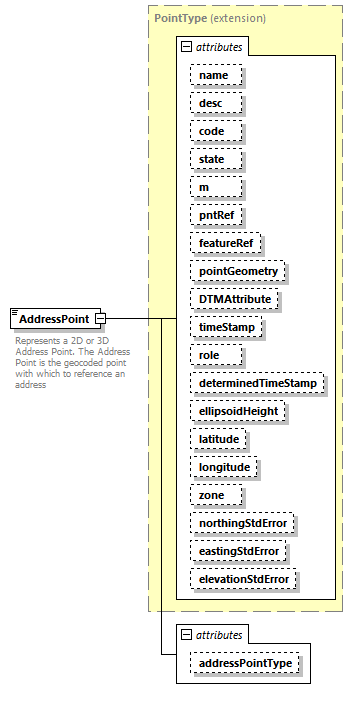 |
||||||||||||||||||||||||||||||||||||||||||||||||||||||||||||||||||||||||||||||||||||||||||||||||||||||||||||||||||||||||||||||
| namespace | http://www.landxml.org/schema/LandXML-2.0 | ||||||||||||||||||||||||||||||||||||||||||||||||||||||||||||||||||||||||||||||||||||||||||||||||||||||||||||||||||||||||||||||
| type | extension of PointType | ||||||||||||||||||||||||||||||||||||||||||||||||||||||||||||||||||||||||||||||||||||||||||||||||||||||||||||||||||||||||||||||
| properties |
|
||||||||||||||||||||||||||||||||||||||||||||||||||||||||||||||||||||||||||||||||||||||||||||||||||||||||||||||||||||||||||||||
| used by |
|
||||||||||||||||||||||||||||||||||||||||||||||||||||||||||||||||||||||||||||||||||||||||||||||||||||||||||||||||||||||||||||||
| facets |
|
||||||||||||||||||||||||||||||||||||||||||||||||||||||||||||||||||||||||||||||||||||||||||||||||||||||||||||||||||||||||||||||
| attributes |
|
||||||||||||||||||||||||||||||||||||||||||||||||||||||||||||||||||||||||||||||||||||||||||||||||||||||||||||||||||||||||||||||
| annotation |
|
||||||||||||||||||||||||||||||||||||||||||||||||||||||||||||||||||||||||||||||||||||||||||||||||||||||||||||||||||||||||||||||
| source | <xs:element name="AddressPoint"> <xs:annotation> <xs:documentation>Represents a 2D or 3D Address Point. The Address Point is the geocoded point with which to reference an address</xs:documentation> </xs:annotation> <xs:complexType> <xs:simpleContent> <xs:extension base="PointType"> <xs:attribute name="addressPointType" type="addressPointTypeType"/> </xs:extension> </xs:simpleContent> </xs:complexType> </xs:element> |
attribute AddressPoint/@addressPointType
| type | addressPointTypeType |
| source | <xs:attribute name="addressPointType" type="addressPointTypeType"/> |
element AdministrativeArea
| diagram | 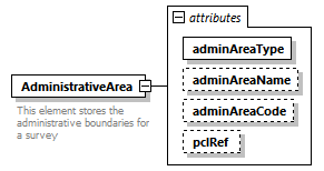 |
||||||||||||||||||||||||||||||
| namespace | http://www.landxml.org/schema/LandXML-2.0 | ||||||||||||||||||||||||||||||
| properties |
|
||||||||||||||||||||||||||||||
| used by |
|
||||||||||||||||||||||||||||||
| attributes |
|
||||||||||||||||||||||||||||||
| annotation |
|
||||||||||||||||||||||||||||||
| source | <xs:element name="AdministrativeArea"> <xs:annotation> <xs:documentation>This element stores the administrative boundaries for a survey</xs:documentation> </xs:annotation> <xs:complexType> <xs:attribute name="adminAreaType" type="adminAreaTypeType" use="required"/> <xs:attribute name="adminAreaName" type="xs:string"/> <xs:attribute name="adminAreaCode" type="xs:string"/> <xs:attribute name="pclRef" type="parcelNameRefs"/> </xs:complexType> </xs:element> |
attribute AdministrativeArea/@adminAreaType
| type | adminAreaTypeType | ||
| properties |
|
||
| source | <xs:attribute name="adminAreaType" type="adminAreaTypeType" use="required"/> |
attribute AdministrativeArea/@adminAreaName
| type | xs:string |
| source | <xs:attribute name="adminAreaName" type="xs:string"/> |
attribute AdministrativeArea/@adminAreaCode
| type | xs:string |
| source | <xs:attribute name="adminAreaCode" type="xs:string"/> |
attribute AdministrativeArea/@pclRef
| type | parcelNameRefs |
| source | <xs:attribute name="pclRef" type="parcelNameRefs"/> |
element AdministrativeDate
| diagram | 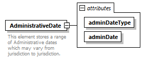 |
||||||||||||||||||
| namespace | http://www.landxml.org/schema/LandXML-2.0 | ||||||||||||||||||
| properties |
|
||||||||||||||||||
| used by |
|
||||||||||||||||||
| attributes |
|
||||||||||||||||||
| annotation |
|
||||||||||||||||||
| source | <xs:element name="AdministrativeDate"> <xs:annotation> <xs:documentation>This element stores a range of Administrative dates which may vary from jurisdiction to jurisdiction.</xs:documentation> </xs:annotation> <xs:complexType> <xs:attribute name="adminDateType" type="adminDateTypeType" use="required"/> <xs:attribute name="adminDate" type="xs:date" use="required"/> </xs:complexType> </xs:element> |
attribute AdministrativeDate/@adminDateType
| type | adminDateTypeType | ||
| properties |
|
||
| source | <xs:attribute name="adminDateType" type="adminDateTypeType" use="required"/> |
attribute AdministrativeDate/@adminDate
| type | xs:date | ||
| properties |
|
||
| source | <xs:attribute name="adminDate" type="xs:date" use="required"/> |
element AdverseSE
| diagram |  |
|||||||||
| namespace | http://www.landxml.org/schema/LandXML-2.0 | |||||||||
| type | adverseSEType | |||||||||
| properties |
|
|||||||||
| used by |
|
|||||||||
| facets |
|
|||||||||
| source | <xs:element name="AdverseSE" type="adverseSEType"/> |
element Alignment
| diagram | 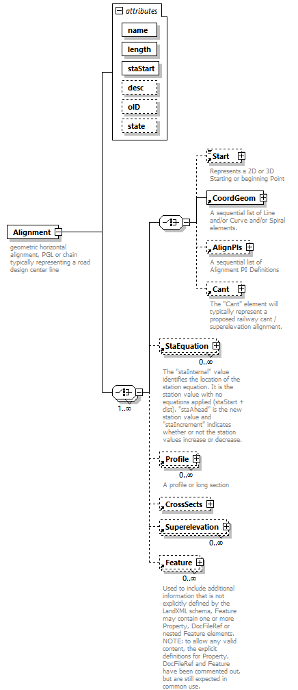 |
||||||||||||||||||||||||||||||||||||||||||
| namespace | http://www.landxml.org/schema/LandXML-2.0 | ||||||||||||||||||||||||||||||||||||||||||
| properties |
|
||||||||||||||||||||||||||||||||||||||||||
| children | Start CoordGeom AlignPIs Cant StaEquation Profile CrossSects Superelevation Feature | ||||||||||||||||||||||||||||||||||||||||||
| used by |
|
||||||||||||||||||||||||||||||||||||||||||
| attributes |
|
||||||||||||||||||||||||||||||||||||||||||
| annotation |
|
||||||||||||||||||||||||||||||||||||||||||
| source | <xs:element name="Alignment"> <xs:annotation> <xs:documentation>geometric horizontal alignment, PGL or chain typically representing a road design center line</xs:documentation> </xs:annotation> <xs:complexType> <xs:choice maxOccurs="unbounded"> <xs:choice> <xs:element ref="Start" minOccurs="0"/> <xs:element ref="CoordGeom"/> <xs:element ref="AlignPIs" minOccurs="0"/> <xs:element ref="Cant" minOccurs="0"/> </xs:choice> <xs:element ref="StaEquation" minOccurs="0" maxOccurs="unbounded"/> <xs:element ref="Profile" minOccurs="0" maxOccurs="unbounded"/> <xs:element ref="CrossSects" minOccurs="0"/> <xs:element ref="Superelevation" minOccurs="0" maxOccurs="unbounded"/> <xs:element ref="Feature" minOccurs="0" maxOccurs="unbounded"/> </xs:choice> <xs:attribute name="name" type="xs:string" use="required"/> <xs:attribute name="length" type="xs:double" use="required"/> <xs:attribute name="staStart" type="xs:double" use="required"/> <xs:attribute name="desc" type="xs:string"/> <xs:attribute name="oID" type="xs:string"/> <xs:attribute name="state" type="stateType"/> </xs:complexType> </xs:element> |
attribute Alignment/@name
| type | xs:string | ||
| properties |
|
||
| source | <xs:attribute name="name" type="xs:string" use="required"/> |
attribute Alignment/@length
| type | xs:double | ||
| properties |
|
||
| source | <xs:attribute name="length" type="xs:double" use="required"/> |
attribute Alignment/@staStart
| type | xs:double | ||
| properties |
|
||
| source | <xs:attribute name="staStart" type="xs:double" use="required"/> |
attribute Alignment/@desc
| type | xs:string |
| source | <xs:attribute name="desc" type="xs:string"/> |
attribute Alignment/@oID
| type | xs:string |
| source | <xs:attribute name="oID" type="xs:string"/> |
attribute Alignment/@state
| type | stateType | |||||||||||||||
| facets |
|
|||||||||||||||
| source | <xs:attribute name="state" type="stateType"/> |
element Alignments
| diagram | 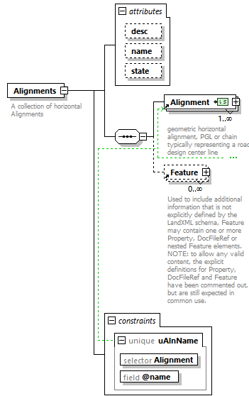 |
||||||||||||||||||||||||
| namespace | http://www.landxml.org/schema/LandXML-2.0 | ||||||||||||||||||||||||
| properties |
|
||||||||||||||||||||||||
| children | Alignment Feature | ||||||||||||||||||||||||
| used by |
|
||||||||||||||||||||||||
| attributes |
|
||||||||||||||||||||||||
| identity constraints |
|
||||||||||||||||||||||||
| annotation |
|
||||||||||||||||||||||||
| source | <xs:element name="Alignments"> <xs:annotation> <xs:documentation>A collection of horizontal Alignments</xs:documentation> </xs:annotation> <xs:complexType> <xs:sequence> <xs:element ref="Alignment" maxOccurs="unbounded"/> <xs:element ref="Feature" minOccurs="0" maxOccurs="unbounded"/> </xs:sequence> <xs:attribute name="desc" type="xs:string"/> <xs:attribute name="name" type="xs:string"/> <xs:attribute name="state" type="stateType"/> </xs:complexType> <xs:unique name="uAlnName"> <xs:selector xpath="Alignment"/> <xs:field xpath="@name"/> </xs:unique> </xs:element> |
attribute Alignments/@desc
| type | xs:string |
| source | <xs:attribute name="desc" type="xs:string"/> |
attribute Alignments/@name
| type | xs:string |
| source | <xs:attribute name="name" type="xs:string"/> |
attribute Alignments/@state
| type | stateType | |||||||||||||||
| facets |
|
|||||||||||||||
| source | <xs:attribute name="state" type="stateType"/> |
element AlignPI
| diagram | 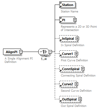 |
||
| namespace | http://www.landxml.org/schema/LandXML-2.0 | ||
| properties |
|
||
| children | Station PI InSpiral Curve1 ConnSpiral Curve2 OutSpiral | ||
| used by |
|
||
| annotation |
|
||
| source | <xs:element name="AlignPI"> <xs:annotation> <xs:documentation>A Single Alignment PI Definition</xs:documentation> </xs:annotation> <xs:complexType> <xs:choice maxOccurs="unbounded"> <xs:element ref="Station"/> <xs:element ref="PI"/> <xs:element ref="InSpiral" minOccurs="0"/> <xs:element ref="Curve1" minOccurs="0"/> <xs:element ref="ConnSpiral" minOccurs="0"/> <xs:element ref="Curve2" minOccurs="0"/> <xs:element ref="OutSpiral" minOccurs="0"/> </xs:choice> </xs:complexType> </xs:element> |
element AlignPIs
| diagram | 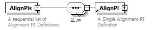 |
||
| namespace | http://www.landxml.org/schema/LandXML-2.0 | ||
| properties |
|
||
| children | AlignPI | ||
| used by |
|
||
| annotation |
|
||
| source | <xs:element name="AlignPIs"> <xs:annotation> <xs:documentation>A sequential list of Alignment PI Definitions</xs:documentation> </xs:annotation> <xs:complexType> <xs:sequence minOccurs="2" maxOccurs="unbounded"> <xs:element ref="AlignPI"/> </xs:sequence> </xs:complexType> </xs:element> |
element Amendment
| diagram | 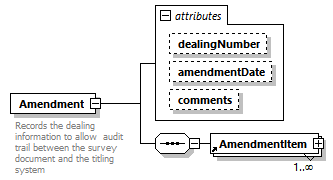 |
||||||||||||||||||||||||
| namespace | http://www.landxml.org/schema/LandXML-2.0 | ||||||||||||||||||||||||
| properties |
|
||||||||||||||||||||||||
| children | AmendmentItem | ||||||||||||||||||||||||
| used by |
|
||||||||||||||||||||||||
| attributes |
|
||||||||||||||||||||||||
| annotation |
|
||||||||||||||||||||||||
| source | <xs:element name="Amendment"> <xs:annotation> <xs:documentation>Records the dealing information to allow audit trail between the survey document and the titling system</xs:documentation> </xs:annotation> <xs:complexType> <xs:sequence> <xs:element ref="AmendmentItem" maxOccurs="unbounded"/> </xs:sequence> <xs:attribute name="dealingNumber" type="xs:string"/> <xs:attribute name="amendmentDate" type="xs:date"/> <xs:attribute name="comments" type="xs:string"/> </xs:complexType> </xs:element> |
attribute Amendment/@dealingNumber
| type | xs:string |
| source | <xs:attribute name="dealingNumber" type="xs:string"/> |
attribute Amendment/@amendmentDate
| type | xs:date |
| source | <xs:attribute name="amendmentDate" type="xs:date"/> |
attribute Amendment/@comments
| type | xs:string |
| source | <xs:attribute name="comments" type="xs:string"/> |
element AmendmentItem
| diagram | 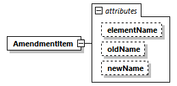 |
||||||||||||||||||||||||
| namespace | http://www.landxml.org/schema/LandXML-2.0 | ||||||||||||||||||||||||
| properties |
|
||||||||||||||||||||||||
| used by |
|
||||||||||||||||||||||||
| attributes |
|
||||||||||||||||||||||||
| source | <xs:element name="AmendmentItem"> <xs:complexType> <xs:attribute name="elementName" type="xs:string"/> <xs:attribute name="oldName" type="xs:string"/> <xs:attribute name="newName" type="xs:string"/> </xs:complexType> </xs:element> |
attribute AmendmentItem/@elementName
| type | xs:string |
| source | <xs:attribute name="elementName" type="xs:string"/> |
attribute AmendmentItem/@oldName
| type | xs:string |
| source | <xs:attribute name="oldName" type="xs:string"/> |
attribute AmendmentItem/@newName
| type | xs:string |
| source | <xs:attribute name="newName" type="xs:string"/> |
element Annotation
| diagram | 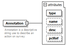 |
||||||||||||||||||||||||||||||
| namespace | http://www.landxml.org/schema/LandXML-2.0 | ||||||||||||||||||||||||||||||
| properties |
|
||||||||||||||||||||||||||||||
| used by |
|
||||||||||||||||||||||||||||||
| attributes |
|
||||||||||||||||||||||||||||||
| annotation |
|
||||||||||||||||||||||||||||||
| source | <xs:element name="Annotation"> <xs:annotation> <xs:documentation>Annotation is a descriptive string use to describe an action on survey</xs:documentation> </xs:annotation> <xs:complexType> <xs:attribute name="type" type="annotationType" use="required"/> <xs:attribute name="name" type="xs:string"/> <xs:attribute name="desc" type="xs:string"/> <xs:attribute name="pclRef" type="parcelNameRefs"/> </xs:complexType> </xs:element> |
attribute Annotation/@type
| type | annotationType | ||
| properties |
|
||
| source | <xs:attribute name="type" type="annotationType" use="required"/> |
attribute Annotation/@name
| type | xs:string |
| source | <xs:attribute name="name" type="xs:string"/> |
attribute Annotation/@desc
| type | xs:string |
| source | <xs:attribute name="desc" type="xs:string"/> |
attribute Annotation/@pclRef
| type | parcelNameRefs |
| source | <xs:attribute name="pclRef" type="parcelNameRefs"/> |
element Application
| diagram | 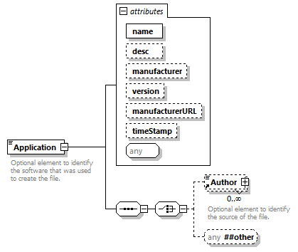 |
||||||||||||||||||||||||||||||||||||||||||
| namespace | http://www.landxml.org/schema/LandXML-2.0 | ||||||||||||||||||||||||||||||||||||||||||
| properties |
|
||||||||||||||||||||||||||||||||||||||||||
| children | Author | ||||||||||||||||||||||||||||||||||||||||||
| used by |
|
||||||||||||||||||||||||||||||||||||||||||
| attributes |
|
||||||||||||||||||||||||||||||||||||||||||
| annotation |
|
||||||||||||||||||||||||||||||||||||||||||
| source | <xs:element name="Application"> <xs:annotation> <xs:documentation>Optional element to identify the software that was used to create the file.</xs:documentation> </xs:annotation> <xs:complexType mixed="true"> <xs:sequence> <xs:choice> <xs:element ref="Author" minOccurs="0" maxOccurs="unbounded"/> <xs:any namespace="##other" processContents="skip" minOccurs="0"/> </xs:choice> </xs:sequence> <xs:attribute name="name" type="xs:string" use="required"/> <xs:attribute name="desc" type="xs:string"/> <xs:attribute name="manufacturer" type="xs:string"/> <xs:attribute name="version" type="xs:string"/> <xs:attribute name="manufacturerURL" type="xs:string"/> <xs:attribute name="timeStamp" type="xs:dateTime" use="optional"/> <xs:anyAttribute/> </xs:complexType> </xs:element> |
attribute Application/@name
| type | xs:string | ||
| properties |
|
||
| source | <xs:attribute name="name" type="xs:string" use="required"/> |
attribute Application/@desc
| type | xs:string |
| source | <xs:attribute name="desc" type="xs:string"/> |
attribute Application/@manufacturer
| type | xs:string |
| source | <xs:attribute name="manufacturer" type="xs:string"/> |
attribute Application/@version
| type | xs:string |
| source | <xs:attribute name="version" type="xs:string"/> |
attribute Application/@manufacturerURL
| type | xs:string |
| source | <xs:attribute name="manufacturerURL" type="xs:string"/> |
attribute Application/@timeStamp
| type | xs:dateTime | ||
| properties |
|
||
| source | <xs:attribute name="timeStamp" type="xs:dateTime" use="optional"/> |
element Author
| diagram | 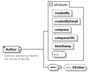 |
||||||||||||||||||||||||||||||||||||
| namespace | http://www.landxml.org/schema/LandXML-2.0 | ||||||||||||||||||||||||||||||||||||
| properties |
|
||||||||||||||||||||||||||||||||||||
| used by |
|
||||||||||||||||||||||||||||||||||||
| attributes |
|
||||||||||||||||||||||||||||||||||||
| annotation |
|
||||||||||||||||||||||||||||||||||||
| source | <xs:element name="Author"> <xs:annotation> <xs:documentation>Optional element to identify the source of the file.</xs:documentation> </xs:annotation> <xs:complexType mixed="true"> <xs:sequence> <xs:any namespace="##other" processContents="skip" minOccurs="0"/> </xs:sequence> <xs:attribute name="createdBy" type="xs:string"/> <xs:attribute name="createdByEmail" type="xs:string"/> <xs:attribute name="company" type="xs:string"/> <xs:attribute name="companyURL" type="xs:string"/> <xs:attribute name="timeStamp" type="xs:dateTime" use="optional"/> <xs:anyAttribute/> </xs:complexType> </xs:element> |
attribute Author/@createdBy
| type | xs:string |
| source | <xs:attribute name="createdBy" type="xs:string"/> |
attribute Author/@createdByEmail
| type | xs:string |
| source | <xs:attribute name="createdByEmail" type="xs:string"/> |
attribute Author/@company
| type | xs:string |
| source | <xs:attribute name="company" type="xs:string"/> |
attribute Author/@companyURL
| type | xs:string |
| source | <xs:attribute name="companyURL" type="xs:string"/> |
attribute Author/@timeStamp
| type | xs:dateTime | ||
| properties |
|
||
| source | <xs:attribute name="timeStamp" type="xs:dateTime" use="optional"/> |
element Backsight
| diagram | 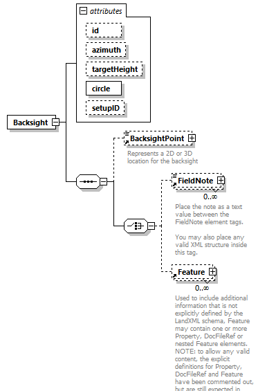 |
||||||||||||||||||||||||||||||||||||
| namespace | http://www.landxml.org/schema/LandXML-2.0 | ||||||||||||||||||||||||||||||||||||
| properties |
|
||||||||||||||||||||||||||||||||||||
| children | BacksightPoint FieldNote Feature | ||||||||||||||||||||||||||||||||||||
| used by |
|
||||||||||||||||||||||||||||||||||||
| attributes |
|
||||||||||||||||||||||||||||||||||||
| source | <xs:element name="Backsight"> <xs:annotation> <xs:documentation/> </xs:annotation> <xs:complexType> <xs:sequence> <xs:element ref="BacksightPoint" minOccurs="0"/> <xs:choice> <xs:element ref="FieldNote" minOccurs="0" maxOccurs="unbounded"/> <xs:element ref="Feature" minOccurs="0" maxOccurs="unbounded"/> </xs:choice> </xs:sequence> <xs:attribute name="id" type="xs:ID"/> <xs:attribute name="azimuth" type="direction"/> <xs:attribute name="targetHeight" type="xs:double"/> <xs:attribute name="circle" type="angle" use="required"/> <xs:attribute name="setupID" type="xs:IDREF"/> </xs:complexType> </xs:element> |
attribute Backsight/@id
| type | xs:ID |
| source | <xs:attribute name="id" type="xs:ID"/> |
attribute Backsight/@azimuth
| type | direction |
| source | <xs:attribute name="azimuth" type="direction"/> |
attribute Backsight/@targetHeight
| type | xs:double |
| source | <xs:attribute name="targetHeight" type="xs:double"/> |
attribute Backsight/@circle
| type | angle | ||
| properties |
|
||
| source | <xs:attribute name="circle" type="angle" use="required"/> |
attribute Backsight/@setupID
| type | xs:IDREF |
| source | <xs:attribute name="setupID" type="xs:IDREF"/> |
element BacksightPoint
| diagram |  |
||||||||||||||||||||||||||||||||||||||||||||||||||||||||||||||||||||||||||||||||||||||||||||||||||||||||||||||||||||||||
| namespace | http://www.landxml.org/schema/LandXML-2.0 | ||||||||||||||||||||||||||||||||||||||||||||||||||||||||||||||||||||||||||||||||||||||||||||||||||||||||||||||||||||||||
| type | PointType | ||||||||||||||||||||||||||||||||||||||||||||||||||||||||||||||||||||||||||||||||||||||||||||||||||||||||||||||||||||||||
| properties |
|
||||||||||||||||||||||||||||||||||||||||||||||||||||||||||||||||||||||||||||||||||||||||||||||||||||||||||||||||||||||||
| used by |
|
||||||||||||||||||||||||||||||||||||||||||||||||||||||||||||||||||||||||||||||||||||||||||||||||||||||||||||||||||||||||
| facets |
|
||||||||||||||||||||||||||||||||||||||||||||||||||||||||||||||||||||||||||||||||||||||||||||||||||||||||||||||||||||||||
| attributes |
|
||||||||||||||||||||||||||||||||||||||||||||||||||||||||||||||||||||||||||||||||||||||||||||||||||||||||||||||||||||||||
| annotation |
|
||||||||||||||||||||||||||||||||||||||||||||||||||||||||||||||||||||||||||||||||||||||||||||||||||||||||||||||||||||||||
| source | <xs:element name="BacksightPoint" type="PointType"> <xs:annotation> <xs:documentation>Represents a 2D or 3D location for the backsight</xs:documentation> <xs:documentation>It is defined by either a coordinate text value ("north east" or "north east elev") or a CgPoint number reference "pntRef" attribute.</xs:documentation> </xs:annotation> </xs:element> |
element BeginRunoffSta
| diagram |  |
||||
| namespace | http://www.landxml.org/schema/LandXML-2.0 | ||||
| type | station | ||||
| properties |
|
||||
| used by |
|
||||
| source | <xs:element name="BeginRunoffSta" type="station" nillable="true"/> |
element BeginRunoutSta
| diagram |  |
||||
| namespace | http://www.landxml.org/schema/LandXML-2.0 | ||||
| type | station | ||||
| properties |
|
||||
| used by |
|
||||
| source | <xs:element name="BeginRunoutSta" type="station" nillable="true"/> |
element BikeFacilities
| diagram | 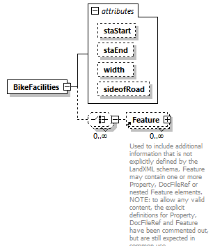 |
||||||||||||||||||||||||||||||
| namespace | http://www.landxml.org/schema/LandXML-2.0 | ||||||||||||||||||||||||||||||
| properties |
|
||||||||||||||||||||||||||||||
| children | Feature | ||||||||||||||||||||||||||||||
| used by |
|
||||||||||||||||||||||||||||||
| attributes |
|
||||||||||||||||||||||||||||||
| source | <xs:element name="BikeFacilities"> <xs:complexType> <xs:choice minOccurs="0" maxOccurs="unbounded"> <xs:element ref="Feature" minOccurs="0" maxOccurs="unbounded"/> </xs:choice> <xs:attribute name="staStart" type="station"/> <xs:attribute name="staEnd" type="station"/> <xs:attribute name="width" type="xs:double"/> <xs:attribute name="sideofRoad" type="sideofRoadType"/> </xs:complexType> </xs:element> |
attribute BikeFacilities/@staStart
| type | station |
| source | <xs:attribute name="staStart" type="station"/> |
attribute BikeFacilities/@staEnd
| type | station |
| source | <xs:attribute name="staEnd" type="station"/> |
attribute BikeFacilities/@width
| type | xs:double |
| source | <xs:attribute name="width" type="xs:double"/> |
attribute BikeFacilities/@sideofRoad
| type | sideofRoadType | ||||||||||||
| facets |
|
||||||||||||
| source | <xs:attribute name="sideofRoad" type="sideofRoadType"/> |
element Boundaries
| diagram | 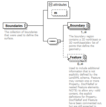 |
||||||||||||
| namespace | http://www.landxml.org/schema/LandXML-2.0 | ||||||||||||
| properties |
|
||||||||||||
| children | Boundary Feature | ||||||||||||
| used by |
|
||||||||||||
| attributes |
|
||||||||||||
| annotation |
|
||||||||||||
| source | <xs:element name="Boundaries"> <xs:annotation> <xs:documentation>The collection of boundaries that were used to define the surface.</xs:documentation> <xs:documentation>Use is optional.</xs:documentation> </xs:annotation> <xs:complexType> <xs:sequence> <xs:element ref="Boundary" maxOccurs="unbounded"/> <xs:element ref="Feature" minOccurs="0" maxOccurs="unbounded"/> </xs:sequence> <xs:attribute name="m" type="materialTableIndexRef" use="optional"/> </xs:complexType> </xs:element> |
attribute Boundaries/@m
| type | materialTableIndexRef | ||
| properties |
|
||
| source | <xs:attribute name="m" type="materialTableIndexRef" use="optional"/> |
element Boundary
| diagram | 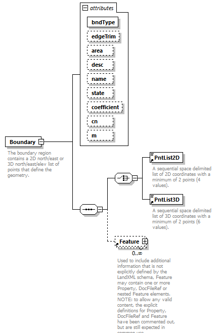 |
||||||||||||||||||||||||||||||||||||||||||||||||||||||||||||
| namespace | http://www.landxml.org/schema/LandXML-2.0 | ||||||||||||||||||||||||||||||||||||||||||||||||||||||||||||
| properties |
|
||||||||||||||||||||||||||||||||||||||||||||||||||||||||||||
| children | PntList2D PntList3D Feature | ||||||||||||||||||||||||||||||||||||||||||||||||||||||||||||
| used by |
|
||||||||||||||||||||||||||||||||||||||||||||||||||||||||||||
| attributes |
|
||||||||||||||||||||||||||||||||||||||||||||||||||||||||||||
| annotation |
|
||||||||||||||||||||||||||||||||||||||||||||||||||||||||||||
| source | <xs:element name="Boundary"> <xs:annotation> <xs:documentation>The boundary region contains a 2D north/east or 3D north/east/elev list of points that define the geometry.</xs:documentation> <xs:documentation>is identified by the "name" attribute.</xs:documentation> <xs:documentation>If the "edgeTrim" attribute is true the faces are trimmed at the boundary edge, otherwise faces are not trimmed</xs:documentation> <xs:documentation>and must exist entirely within the boundary.</xs:documentation> <xs:documentation>coefficient = Hydrology Rational method runoff coefficient (double value between 0.0-1.0) for the land cover type.</xs:documentation> <xs:documentation>cn = Hydrology SCS runoff method CN number (Integer value between 0-100).</xs:documentation> <xs:documentation>m is the material table index for color and texture data.</xs:documentation> </xs:annotation> <xs:complexType> <xs:sequence> <xs:choice> <xs:element ref="PntList2D"/> <xs:element ref="PntList3D"/> <!-- Here PntList2D represents 2D planametric coordinate pairs expressed as space delimited Northing Easting pairs. --> </xs:choice> <xs:element ref="Feature" minOccurs="0" maxOccurs="unbounded"/> </xs:sequence> <xs:attribute name="bndType" type="surfBndType" use="required"/> <xs:attribute name="edgeTrim" type="xs:boolean"/> <xs:attribute name="area" type="xs:double"/> <xs:attribute name="desc" type="xs:string"/> <xs:attribute name="name" type="xs:string"/> <xs:attribute name="state" type="stateType"/> <xs:attribute name="coefficient" type="xs:double"/> <xs:attribute name="cn" type="xs:integer"/> <xs:attribute name="m" type="materialTableIndexRef" use="optional"/> </xs:complexType> </xs:element> |
attribute Boundary/@bndType
| type | surfBndType | |||||||||||||||
| properties |
|
|||||||||||||||
| facets |
|
|||||||||||||||
| source | <xs:attribute name="bndType" type="surfBndType" use="required"/> |
attribute Boundary/@edgeTrim
| type | xs:boolean |
| source | <xs:attribute name="edgeTrim" type="xs:boolean"/> |
attribute Boundary/@area
| type | xs:double |
| source | <xs:attribute name="area" type="xs:double"/> |
attribute Boundary/@desc
| type | xs:string |
| source | <xs:attribute name="desc" type="xs:string"/> |
attribute Boundary/@name
| type | xs:string |
| source | <xs:attribute name="name" type="xs:string"/> |
attribute Boundary/@state
| type | stateType | |||||||||||||||
| facets |
|
|||||||||||||||
| source | <xs:attribute name="state" type="stateType"/> |
attribute Boundary/@coefficient
| type | xs:double |
| source | <xs:attribute name="coefficient" type="xs:double"/> |
attribute Boundary/@cn
| type | xs:integer |
| source | <xs:attribute name="cn" type="xs:integer"/> |
attribute Boundary/@m
| type | materialTableIndexRef | ||
| properties |
|
||
| source | <xs:attribute name="m" type="materialTableIndexRef" use="optional"/> |
element Breakline
| diagram | 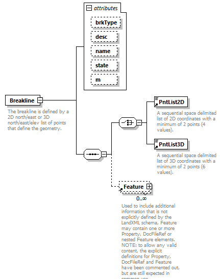 |
||||||||||||||||||||||||||||||||||||
| namespace | http://www.landxml.org/schema/LandXML-2.0 | ||||||||||||||||||||||||||||||||||||
| properties |
|
||||||||||||||||||||||||||||||||||||
| children | PntList2D PntList3D Feature | ||||||||||||||||||||||||||||||||||||
| used by |
|
||||||||||||||||||||||||||||||||||||
| attributes |
|
||||||||||||||||||||||||||||||||||||
| annotation |
|
||||||||||||||||||||||||||||||||||||
| source | <xs:element name="Breakline"> <xs:annotation> <xs:documentation>The breakline is defined by a 2D north/east or 3D north/east/elev list of points that define the geometry.</xs:documentation> <xs:documentation>is identified by the "name" attribute.</xs:documentation> </xs:annotation> <xs:complexType> <xs:sequence> <xs:choice> <xs:element ref="PntList2D"/> <xs:element ref="PntList3D"/> <!-- Here PntList2D represents 2D planametric coordinate pairs expressed as space delimited Northing Easting pairs. --> </xs:choice> <xs:element ref="Feature" minOccurs="0" maxOccurs="unbounded"/> </xs:sequence> <xs:attribute name="brkType" type="breakLineType"/> <xs:attribute name="desc" type="xs:string"/> <xs:attribute name="name" type="xs:string"/> <xs:attribute name="state" type="stateType"/> <xs:attribute name="m" type="materialTableIndexRef" use="optional"/> </xs:complexType> </xs:element> |
attribute Breakline/@brkType
| type | breakLineType | |||||||||||||||
| facets |
|
|||||||||||||||
| source | <xs:attribute name="brkType" type="breakLineType"/> |
attribute Breakline/@desc
| type | xs:string |
| source | <xs:attribute name="desc" type="xs:string"/> |
attribute Breakline/@name
| type | xs:string |
| source | <xs:attribute name="name" type="xs:string"/> |
attribute Breakline/@state
| type | stateType | |||||||||||||||
| facets |
|
|||||||||||||||
| source | <xs:attribute name="state" type="stateType"/> |
attribute Breakline/@m
| type | materialTableIndexRef | ||
| properties |
|
||
| source | <xs:attribute name="m" type="materialTableIndexRef" use="optional"/> |
element Breaklines
| diagram | 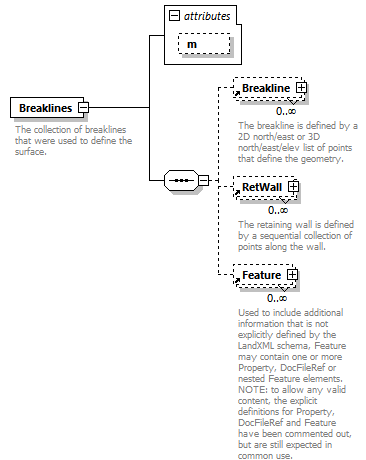 |
||||||||||||
| namespace | http://www.landxml.org/schema/LandXML-2.0 | ||||||||||||
| properties |
|
||||||||||||
| children | Breakline RetWall Feature | ||||||||||||
| used by |
|
||||||||||||
| attributes |
|
||||||||||||
| annotation |
|
||||||||||||
| source | <xs:element name="Breaklines"> <xs:annotation> <xs:documentation>The collection of breaklines that were used to define the surface.</xs:documentation> <xs:documentation>Use is optional.</xs:documentation> </xs:annotation> <xs:complexType> <xs:sequence> <xs:element ref="Breakline" minOccurs="0" maxOccurs="unbounded"/> <xs:element ref="RetWall" minOccurs="0" maxOccurs="unbounded"/> <xs:element ref="Feature" minOccurs="0" maxOccurs="unbounded"/> </xs:sequence> <xs:attribute name="m" type="materialTableIndexRef" use="optional"/> </xs:complexType> </xs:element> |
attribute Breaklines/@m
| type | materialTableIndexRef | ||
| properties |
|
||
| source | <xs:attribute name="m" type="materialTableIndexRef" use="optional"/> |
element BridgeElement
| diagram | 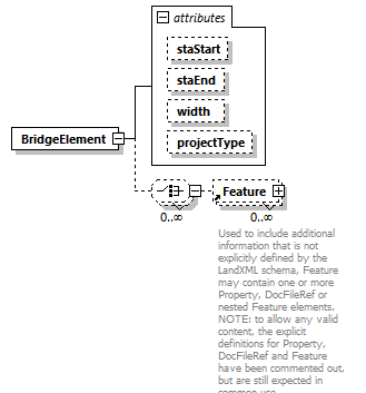 |
||||||||||||||||||||||||||||||
| namespace | http://www.landxml.org/schema/LandXML-2.0 | ||||||||||||||||||||||||||||||
| properties |
|
||||||||||||||||||||||||||||||
| children | Feature | ||||||||||||||||||||||||||||||
| used by |
|
||||||||||||||||||||||||||||||
| attributes |
|
||||||||||||||||||||||||||||||
| source | <xs:element name="BridgeElement"> <xs:complexType> <xs:choice minOccurs="0" maxOccurs="unbounded"> <xs:element ref="Feature" minOccurs="0" maxOccurs="unbounded"/> </xs:choice> <xs:attribute name="staStart" type="station"/> <xs:attribute name="staEnd" type="station"/> <xs:attribute name="width" type="xs:double"/> <xs:attribute name="projectType" type="bridgeProjectType"/> </xs:complexType> </xs:element> |
attribute BridgeElement/@staStart
| type | station |
| source | <xs:attribute name="staStart" type="station"/> |
attribute BridgeElement/@staEnd
| type | station |
| source | <xs:attribute name="staEnd" type="station"/> |
attribute BridgeElement/@width
| type | xs:double |
| source | <xs:attribute name="width" type="xs:double"/> |
attribute BridgeElement/@projectType
| type | bridgeProjectType | |||||||||
| facets |
|
|||||||||
| source | <xs:attribute name="projectType" type="bridgeProjectType"/> |
element Cant
| diagram | 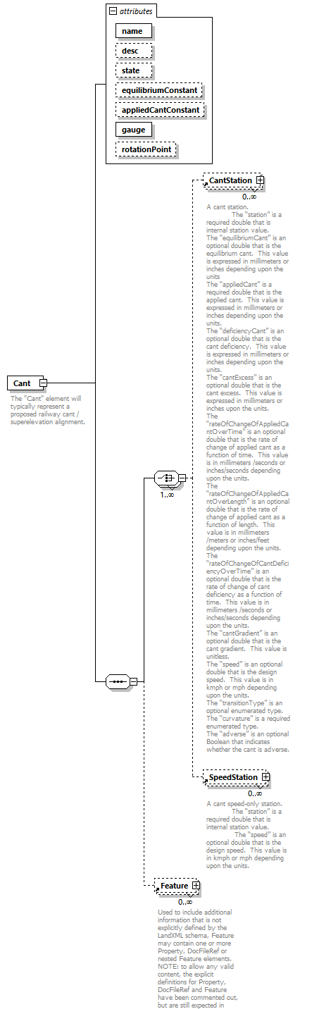 |
||||||||||||||||||||||||||||||||||||||||||||||||
| namespace | http://www.landxml.org/schema/LandXML-2.0 | ||||||||||||||||||||||||||||||||||||||||||||||||
| properties |
|
||||||||||||||||||||||||||||||||||||||||||||||||
| children | CantStation SpeedStation Feature | ||||||||||||||||||||||||||||||||||||||||||||||||
| used by |
|
||||||||||||||||||||||||||||||||||||||||||||||||
| attributes |
|
||||||||||||||||||||||||||||||||||||||||||||||||
| annotation |
|
||||||||||||||||||||||||||||||||||||||||||||||||
| source | <xs:element name="Cant"> <xs:annotation> <xs:documentation>The "Cant" element will typically represent a proposed railway cant / superelevation alignment.</xs:documentation> <xs:documentation>It is defined by a sequential series of any combination of the cant stations and speed-only stations. The “name”, “desc” and “state” attributes are typical LandXML “alignment” attributes. The “equilibriumConstant” is a unitless optional double that is used as the equilibrium constant in the cant equilibrium equation (cant = constant * speed * speed / radius). The “appliedCantConstant” is a unitless optional double that is used as the applied cant constant in the cant equilibrium equation (cant = constant * speed * speed / radius). The “gauge” is a required double that is the rail to rail distance. This value is expressed in meters or feet depending upon the units. The “rotationPoint” is an optional string that defines the rotation point. Valid values are “insideRail”, “outsideRail”, “center”, “leftRail” and “rightRail”. </xs:documentation> </xs:annotation> <xs:complexType> <xs:sequence> <xs:choice maxOccurs="unbounded"> <xs:element ref="CantStation" minOccurs="0" maxOccurs="unbounded"/> <xs:element ref="SpeedStation" minOccurs="0" maxOccurs="unbounded"/> </xs:choice> <xs:element ref="Feature" minOccurs="0" maxOccurs="unbounded"/> </xs:sequence> <xs:attribute name="name" type="xs:string" use="required"/> <xs:attribute name="desc" type="xs:string" use="optional"/> <xs:attribute name="state" type="stateType" use="optional"/> <xs:attribute name="equilibriumConstant" type="xs:double" use="optional"/> <xs:attribute name="appliedCantConstant" type="xs:double" use="optional"/> <xs:attribute name="gauge" type="xs:double" use="required"/> <xs:attribute name="rotationPoint" type="xs:string" use="optional"/> </xs:complexType> </xs:element> |
attribute Cant/@name
| type | xs:string | ||
| properties |
|
||
| source | <xs:attribute name="name" type="xs:string" use="required"/> |
attribute Cant/@desc
| type | xs:string | ||
| properties |
|
||
| source | <xs:attribute name="desc" type="xs:string" use="optional"/> |
attribute Cant/@state
| type | stateType | |||||||||||||||
| properties |
|
|||||||||||||||
| facets |
|
|||||||||||||||
| source | <xs:attribute name="state" type="stateType" use="optional"/> |
attribute Cant/@equilibriumConstant
| type | xs:double | ||
| properties |
|
||
| source | <xs:attribute name="equilibriumConstant" type="xs:double" use="optional"/> |
attribute Cant/@appliedCantConstant
| type | xs:double | ||
| properties |
|
||
| source | <xs:attribute name="appliedCantConstant" type="xs:double" use="optional"/> |
attribute Cant/@gauge
| type | xs:double | ||
| properties |
|
||
| source | <xs:attribute name="gauge" type="xs:double" use="required"/> |
attribute Cant/@rotationPoint
| type | xs:string | ||
| properties |
|
||
| source | <xs:attribute name="rotationPoint" type="xs:string" use="optional"/> |
element CantStation
| diagram | 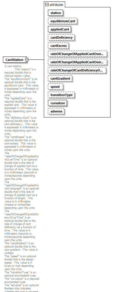 |
||||||||||||||||||||||||||||||||||||||||||||||||||||||||||||||||||||||||||||||||||||
| namespace | http://www.landxml.org/schema/LandXML-2.0 | ||||||||||||||||||||||||||||||||||||||||||||||||||||||||||||||||||||||||||||||||||||
| properties |
|
||||||||||||||||||||||||||||||||||||||||||||||||||||||||||||||||||||||||||||||||||||
| used by |
|
||||||||||||||||||||||||||||||||||||||||||||||||||||||||||||||||||||||||||||||||||||
| attributes |
|
||||||||||||||||||||||||||||||||||||||||||||||||||||||||||||||||||||||||||||||||||||
| annotation |
|
||||||||||||||||||||||||||||||||||||||||||||||||||||||||||||||||||||||||||||||||||||
| source | <xs:element name="CantStation"> <xs:annotation> <xs:documentation>A cant station. The “station” is a required double that is internal station value. The “equilibriumCant” is an optional double that is the equilibrium cant. This value is expressed in millimeters or inches depending upon the units The “appliedCant” is a required double that is the applied cant. This value is expressed in millimeters or inches depending upon the units. The “deficiencyCant” is an optional double that is the cant deficiency. This value is expressed in millimeters or inches depending upon the units. The “cantExcess” is an optional double that is the cant excess. This value is expressed in millimeters or inches upon the units. The “rateOfChangeOfAppliedCantOverTime” is an optional double that is the rate of change of applied cant as a function of time. This value is in millimeters /seconds or inches/seconds depending upon the units. The “rateOfChangeOfAppliedCantOverLength” is an optional double that is the rate of change of applied cant as a function of length. This value is in millimeters /meters or inches/feet depending upon the units. The “rateOfChangeOfCantDeficiencyOverTime” is an optional double that is the rate of change of cant deficiency as a function of time. This value is in millimeters /seconds or inches/seconds depending upon the units. The “cantGradient” is an optional double that is the cant gradient. This value is unitless. The “speed” is an optional double that is the design speed. This value is in kmph or mph depending upon the units. The “transitionType” is an optional enumerated type. The “curvature” is a required enumerated type. The “adverse” is an optional Boolean that indicates whether the cant is adverse. </xs:documentation> </xs:annotation> <xs:complexType> <xs:attribute name="station" type="xs:double" use="required"/> <xs:attribute name="equilibriumCant" type="xs:double" use="optional"/> <xs:attribute name="appliedCant" type="xs:double" use="required"/> <xs:attribute name="cantDeficiency" type="xs:double" use="optional"/> <xs:attribute name="cantExcess" type="xs:double" use="optional"/> <xs:attribute name="rateOfChangeOfAppliedCantOverTime" type="xs:double" use="optional"/> <xs:attribute name="rateOfChangeOfAppliedCantOverLength" type="xs:double" use="optional"/> <xs:attribute name="rateOfChangeOfCantDeficiencyOverTime" type="xs:double" use="optional"/> <xs:attribute name="cantGradient" type="xs:double" use="optional"/> <xs:attribute name="speed" type="xs:double" use="optional"/> <xs:attribute name="transitionType" type="spiralType" use="optional"/> <xs:attribute name="curvature" type="clockwise" use="required"/> <xs:attribute name="adverse" type="xs:boolean" use="optional"/> </xs:complexType> </xs:element> |
attribute CantStation/@station
| type | xs:double | ||
| properties |
|
||
| source | <xs:attribute name="station" type="xs:double" use="required"/> |
attribute CantStation/@equilibriumCant
| type | xs:double | ||
| properties |
|
||
| source | <xs:attribute name="equilibriumCant" type="xs:double" use="optional"/> |
attribute CantStation/@appliedCant
| type | xs:double | ||
| properties |
|
||
| source | <xs:attribute name="appliedCant" type="xs:double" use="required"/> |
attribute CantStation/@cantDeficiency
| type | xs:double | ||
| properties |
|
||
| source | <xs:attribute name="cantDeficiency" type="xs:double" use="optional"/> |
attribute CantStation/@cantExcess
| type | xs:double | ||
| properties |
|
||
| source | <xs:attribute name="cantExcess" type="xs:double" use="optional"/> |
attribute CantStation/@rateOfChangeOfAppliedCantOverTime
| type | xs:double | ||
| properties |
|
||
| source | <xs:attribute name="rateOfChangeOfAppliedCantOverTime" type="xs:double" use="optional"/> |
attribute CantStation/@rateOfChangeOfAppliedCantOverLength
| type | xs:double | ||
| properties |
|
||
| source | <xs:attribute name="rateOfChangeOfAppliedCantOverLength" type="xs:double" use="optional"/> |
attribute CantStation/@rateOfChangeOfCantDeficiencyOverTime
| type | xs:double | ||
| properties |
|
||
| source | <xs:attribute name="rateOfChangeOfCantDeficiencyOverTime" type="xs:double" use="optional"/> |
attribute CantStation/@cantGradient
| type | xs:double | ||
| properties |
|
||
| source | <xs:attribute name="cantGradient" type="xs:double" use="optional"/> |
attribute CantStation/@speed
| type | xs:double | ||
| properties |
|
||
| source | <xs:attribute name="speed" type="xs:double" use="optional"/> |
attribute CantStation/@transitionType
| type | spiralType | |||||||||||||||||||||||||||||||||||||||||||||||||||
| properties |
|
|||||||||||||||||||||||||||||||||||||||||||||||||||
| facets |
|
|||||||||||||||||||||||||||||||||||||||||||||||||||
| source | <xs:attribute name="transitionType" type="spiralType" use="optional"/> |
attribute CantStation/@curvature
| type | clockwise | |||||||||
| properties |
|
|||||||||
| facets |
|
|||||||||
| source | <xs:attribute name="curvature" type="clockwise" use="required"/> |
attribute CantStation/@adverse
| type | xs:boolean | ||
| properties |
|
||
| source | <xs:attribute name="adverse" type="xs:boolean" use="optional"/> |
element Center
| diagram | 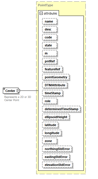 |
||||||||||||||||||||||||||||||||||||||||||||||||||||||||||||||||||||||||||||||||||||||||||||||||||||||||||||||||||||||||
| namespace | http://www.landxml.org/schema/LandXML-2.0 | ||||||||||||||||||||||||||||||||||||||||||||||||||||||||||||||||||||||||||||||||||||||||||||||||||||||||||||||||||||||||
| type | PointType | ||||||||||||||||||||||||||||||||||||||||||||||||||||||||||||||||||||||||||||||||||||||||||||||||||||||||||||||||||||||||
| properties |
|
||||||||||||||||||||||||||||||||||||||||||||||||||||||||||||||||||||||||||||||||||||||||||||||||||||||||||||||||||||||||
| used by |
|
||||||||||||||||||||||||||||||||||||||||||||||||||||||||||||||||||||||||||||||||||||||||||||||||||||||||||||||||||||||||
| facets |
|
||||||||||||||||||||||||||||||||||||||||||||||||||||||||||||||||||||||||||||||||||||||||||||||||||||||||||||||||||||||||
| attributes |
|
||||||||||||||||||||||||||||||||||||||||||||||||||||||||||||||||||||||||||||||||||||||||||||||||||||||||||||||||||||||||
| annotation |
|
||||||||||||||||||||||||||||||||||||||||||||||||||||||||||||||||||||||||||||||||||||||||||||||||||||||||||||||||||||||||
| source | <xs:element name="Center" type="PointType"> <xs:annotation> <xs:documentation>Represents a 2D or 3D Center Point</xs:documentation> <xs:documentation>Defined by either a coordinate text value ("north east" or "north east elev") or a CgPoint number reference "pntRef" attribute.</xs:documentation> </xs:annotation> </xs:element> |
element CgPoint
| diagram | 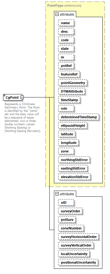 |
||||||||||||||||||||||||||||||||||||||||||||||||||||||||||||||||||||||||||||||||||||||||||||||||||||||||||||||||||||||||||||||||||||||||||||||||||||||||||||||||||||||||
| namespace | http://www.landxml.org/schema/LandXML-2.0 | ||||||||||||||||||||||||||||||||||||||||||||||||||||||||||||||||||||||||||||||||||||||||||||||||||||||||||||||||||||||||||||||||||||||||||||||||||||||||||||||||||||||||
| type | extension of PointType | ||||||||||||||||||||||||||||||||||||||||||||||||||||||||||||||||||||||||||||||||||||||||||||||||||||||||||||||||||||||||||||||||||||||||||||||||||||||||||||||||||||||||
| properties |
|
||||||||||||||||||||||||||||||||||||||||||||||||||||||||||||||||||||||||||||||||||||||||||||||||||||||||||||||||||||||||||||||||||||||||||||||||||||||||||||||||||||||||
| used by |
|
||||||||||||||||||||||||||||||||||||||||||||||||||||||||||||||||||||||||||||||||||||||||||||||||||||||||||||||||||||||||||||||||||||||||||||||||||||||||||||||||||||||||
| facets |
|
||||||||||||||||||||||||||||||||||||||||||||||||||||||||||||||||||||||||||||||||||||||||||||||||||||||||||||||||||||||||||||||||||||||||||||||||||||||||||||||||||||||||
| attributes |
|
||||||||||||||||||||||||||||||||||||||||||||||||||||||||||||||||||||||||||||||||||||||||||||||||||||||||||||||||||||||||||||||||||||||||||||||||||||||||||||||||||||||||
| annotation |
|
||||||||||||||||||||||||||||||||||||||||||||||||||||||||||||||||||||||||||||||||||||||||||||||||||||||||||||||||||||||||||||||||||||||||||||||||||||||||||||||||||||||||
| source | <xs:element name="CgPoint"> <xs:annotation> <xs:documentation>Represents a COrdinate GeOmetry Point. The Point is identified by the "name" attr and the data value will be a sequence of space delimented, two or three double numberic values: (Northing Easting) or (Northing Easting Elevation).</xs:documentation> </xs:annotation> <xs:complexType mixed="true"> <xs:simpleContent> <xs:extension base="PointType"> <xs:attribute name="oID" type="xs:string"/> <xs:attribute name="surveyOrder" type="xs:string"/> <xs:attribute name="pntSurv" type="survPntType"/> <xs:attribute name="zoneNumber" type="zoneNumberType"/> <xs:attribute name="surveyHorizontalOrder" type="xs:string"/> <xs:attribute name="surveyVerticalOrder" type="xs:string"/> <xs:attribute name="localUncertainity" type="xs:double"/> <xs:attribute name="positionalUncertainity" type="xs:double"/> </xs:extension> </xs:simpleContent> </xs:complexType> </xs:element> |
attribute CgPoint/@oID
| type | xs:string |
| source | <xs:attribute name="oID" type="xs:string"/> |
attribute CgPoint/@surveyOrder
| type | xs:string |
| source | <xs:attribute name="surveyOrder" type="xs:string"/> |
attribute CgPoint/@pntSurv
| type | survPntType | |||||||||||||||||||||||||||
| facets |
|
|||||||||||||||||||||||||||
| source | <xs:attribute name="pntSurv" type="survPntType"/> |
attribute CgPoint/@zoneNumber
| type | zoneNumberType | |||||||||
| facets |
|
|||||||||
| source | <xs:attribute name="zoneNumber" type="zoneNumberType"/> |
attribute CgPoint/@surveyHorizontalOrder
| type | xs:string |
| source | <xs:attribute name="surveyHorizontalOrder" type="xs:string"/> |
attribute CgPoint/@surveyVerticalOrder
| type | xs:string |
| source | <xs:attribute name="surveyVerticalOrder" type="xs:string"/> |
attribute CgPoint/@localUncertainity
| type | xs:double |
| source | <xs:attribute name="localUncertainity" type="xs:double"/> |
attribute CgPoint/@positionalUncertainity
| type | xs:double |
| source | <xs:attribute name="positionalUncertainity" type="xs:double"/> |
element CgPoints
| diagram | 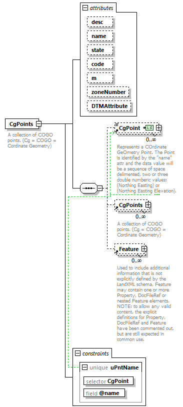 |
||||||||||||||||||||||||||||||||||||||||||||||||
| namespace | http://www.landxml.org/schema/LandXML-2.0 | ||||||||||||||||||||||||||||||||||||||||||||||||
| properties |
|
||||||||||||||||||||||||||||||||||||||||||||||||
| children | CgPoint CgPoints Feature | ||||||||||||||||||||||||||||||||||||||||||||||||
| used by |
|
||||||||||||||||||||||||||||||||||||||||||||||||
| attributes |
|
||||||||||||||||||||||||||||||||||||||||||||||||
| identity constraints |
|
||||||||||||||||||||||||||||||||||||||||||||||||
| annotation |
|
||||||||||||||||||||||||||||||||||||||||||||||||
| source | <xs:element name="CgPoints"> <xs:annotation> <xs:documentation>A collection of COGO points. (Cg = COGO = Cordinate Geometry)</xs:documentation> </xs:annotation> <xs:complexType> <xs:sequence> <xs:element ref="CgPoint" minOccurs="0" maxOccurs="unbounded"/> <xs:element ref="CgPoints" minOccurs="0" maxOccurs="unbounded"/> <xs:element ref="Feature" minOccurs="0" maxOccurs="unbounded"/> <!-- Allow nested CgPoints collections --> </xs:sequence> <xs:attribute name="desc" type="xs:string"/> <xs:attribute name="name" type="xs:string"/> <xs:attribute name="state" type="stateType"/> <xs:attribute name="code" type="xs:string"/> <xs:attribute name="m" type="materialTableIndexRef" use="optional"/> <xs:attribute name="zoneNumber" type="zoneNumberType"/> <xs:attribute name="DTMAttribute" type="DTMAttributeType"/> </xs:complexType> <xs:unique name="uPntName"> <xs:selector xpath="CgPoint"/> <xs:field xpath="@name"/> </xs:unique> </xs:element> |
attribute CgPoints/@desc
| type | xs:string |
| source | <xs:attribute name="desc" type="xs:string"/> |
attribute CgPoints/@name
| type | xs:string |
| source | <xs:attribute name="name" type="xs:string"/> |
attribute CgPoints/@state
| type | stateType | |||||||||||||||
| facets |
|
|||||||||||||||
| source | <xs:attribute name="state" type="stateType"/> |
attribute CgPoints/@code
| type | xs:string |
| source | <xs:attribute name="code" type="xs:string"/> |
attribute CgPoints/@m
| type | materialTableIndexRef | ||
| properties |
|
||
| source | <xs:attribute name="m" type="materialTableIndexRef" use="optional"/> |
attribute CgPoints/@zoneNumber
| type | zoneNumberType | |||||||||
| facets |
|
|||||||||
| source | <xs:attribute name="zoneNumber" type="zoneNumberType"/> |
attribute CgPoints/@DTMAttribute
| type | DTMAttributeType | |||||||||||||||||||||||||||||||||||||||||||||
| facets |
|
|||||||||||||||||||||||||||||||||||||||||||||
| source | <xs:attribute name="DTMAttribute" type="DTMAttributeType"/> |
element Chain
| diagram | 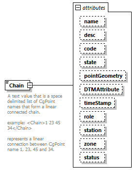 |
||||||||||||||||||||||||||||||||||||||||||||||||||||||||||||||||||||||||
| namespace | http://www.landxml.org/schema/LandXML-2.0 | ||||||||||||||||||||||||||||||||||||||||||||||||||||||||||||||||||||||||
| type | extension of ChainType | ||||||||||||||||||||||||||||||||||||||||||||||||||||||||||||||||||||||||
| properties |
|
||||||||||||||||||||||||||||||||||||||||||||||||||||||||||||||||||||||||
| used by |
|
||||||||||||||||||||||||||||||||||||||||||||||||||||||||||||||||||||||||
| attributes |
|
||||||||||||||||||||||||||||||||||||||||||||||||||||||||||||||||||||||||
| annotation |
|
||||||||||||||||||||||||||||||||||||||||||||||||||||||||||||||||||||||||
| source | <xs:element name="Chain"> <xs:annotation> <xs:documentation>A text value that is a space delimited list of CgPoint names that form a linear connected chain. example: <Chain>1 23 45 34</Chain> represents a linear connection between CgPoint name 1, 23, 45 and 34. </xs:documentation> </xs:annotation> <xs:complexType mixed="true"> <xs:simpleContent> <xs:extension base="ChainType"> <xs:attribute name="name" type="xs:string"/> <xs:attribute name="desc" type="xs:string"/> <xs:attribute name="code" type="xs:string"/> <xs:attribute name="state" type="stateType"/> <xs:attribute name="pointGeometry" type="pointGeometryType"/> <xs:attribute name="DTMAttribute" type="DTMAttributeType"/> <xs:attribute name="timeStamp" type="xs:dateTime" use="optional"/> <xs:attribute name="role" type="surveyRoleType" use="optional"/> <xs:attribute name="station" type="station"/> <xs:attribute name="zone" type="xs:string"/> <xs:attribute name="status" type="observationStatusType"/> </xs:extension> </xs:simpleContent> </xs:complexType> </xs:element> |
attribute Chain/@name
| type | xs:string |
| source | <xs:attribute name="name" type="xs:string"/> |
attribute Chain/@desc
| type | xs:string |
| source | <xs:attribute name="desc" type="xs:string"/> |
attribute Chain/@code
| type | xs:string |
| source | <xs:attribute name="code" type="xs:string"/> |
attribute Chain/@state
| type | stateType | |||||||||||||||
| facets |
|
|||||||||||||||
| source | <xs:attribute name="state" type="stateType"/> |
attribute Chain/@pointGeometry
| type | pointGeometryType | |||||||||
| facets |
|
|||||||||
| source | <xs:attribute name="pointGeometry" type="pointGeometryType"/> |
attribute Chain/@DTMAttribute
| type | DTMAttributeType | |||||||||||||||||||||||||||||||||||||||||||||
| facets |
|
|||||||||||||||||||||||||||||||||||||||||||||
| source | <xs:attribute name="DTMAttribute" type="DTMAttributeType"/> |
attribute Chain/@timeStamp
| type | xs:dateTime | ||
| properties |
|
||
| source | <xs:attribute name="timeStamp" type="xs:dateTime" use="optional"/> |
attribute Chain/@role
| type | surveyRoleType | ||||||||||||||||||||||||
| properties |
|
||||||||||||||||||||||||
| facets |
|
||||||||||||||||||||||||
| source | <xs:attribute name="role" type="surveyRoleType" use="optional"/> |
attribute Chain/@station
| type | station |
| source | <xs:attribute name="station" type="station"/> |
attribute Chain/@zone
| type | xs:string |
| source | <xs:attribute name="zone" type="xs:string"/> |
attribute Chain/@status
| type | observationStatusType | |||||||||
| facets |
|
|||||||||
| source | <xs:attribute name="status" type="observationStatusType"/> |
element Channel
| diagram | 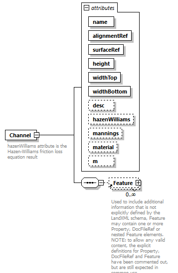 |
||||||||||||||||||||||||||||||||||||||||||||||||||||||||||||||||||||||||
| namespace | http://www.landxml.org/schema/LandXML-2.0 | ||||||||||||||||||||||||||||||||||||||||||||||||||||||||||||||||||||||||
| properties |
|
||||||||||||||||||||||||||||||||||||||||||||||||||||||||||||||||||||||||
| children | Feature | ||||||||||||||||||||||||||||||||||||||||||||||||||||||||||||||||||||||||
| used by |
|
||||||||||||||||||||||||||||||||||||||||||||||||||||||||||||||||||||||||
| attributes |
|
||||||||||||||||||||||||||||||||||||||||||||||||||||||||||||||||||||||||
| annotation |
|
||||||||||||||||||||||||||||||||||||||||||||||||||||||||||||||||||||||||
| source | <xs:element name="Channel"> <xs:annotation> <xs:documentation>hazenWilliams attribute is the Hazen-Williams friction loss equation result</xs:documentation> <xs:documentation>mannings attribute is the Mannings coeffecient of roughness</xs:documentation> </xs:annotation> <xs:complexType> <xs:sequence> <xs:element ref="Feature" minOccurs="0" maxOccurs="unbounded"/> </xs:sequence> <xs:attribute name="name" type="xs:string" use="required"/> <xs:attribute name="alignmentRef" type="alignmentNameRef" use="required"/> <xs:attribute name="surfaceRef" type="surfaceNameRef" use="required"/> <xs:attribute name="height" type="xs:double" use="required"/> <xs:attribute name="widthTop" type="xs:double" use="required"/> <xs:attribute name="widthBottom" type="xs:double" use="required"/> <xs:attribute name="desc" type="xs:string"/> <xs:attribute name="hazenWilliams" type="xs:double"/> <xs:attribute name="mannings" type="xs:double"/> <xs:attribute name="material" type="pipeMaterialType"/> <xs:attribute name="m" type="materialTableIndexRef"/> </xs:complexType> </xs:element> |
attribute Channel/@name
| type | xs:string | ||
| properties |
|
||
| source | <xs:attribute name="name" type="xs:string" use="required"/> |
attribute Channel/@alignmentRef
| type | alignmentNameRef | ||
| properties |
|
||
| source | <xs:attribute name="alignmentRef" type="alignmentNameRef" use="required"/> |
attribute Channel/@surfaceRef
| type | surfaceNameRef | ||
| properties |
|
||
| source | <xs:attribute name="surfaceRef" type="surfaceNameRef" use="required"/> |
attribute Channel/@height
| type | xs:double | ||
| properties |
|
||
| source | <xs:attribute name="height" type="xs:double" use="required"/> |
attribute Channel/@widthTop
| type | xs:double | ||
| properties |
|
||
| source | <xs:attribute name="widthTop" type="xs:double" use="required"/> |
attribute Channel/@widthBottom
| type | xs:double | ||
| properties |
|
||
| source | <xs:attribute name="widthBottom" type="xs:double" use="required"/> |
attribute Channel/@desc
| type | xs:string |
| source | <xs:attribute name="desc" type="xs:string"/> |
attribute Channel/@hazenWilliams
| type | xs:double |
| source | <xs:attribute name="hazenWilliams" type="xs:double"/> |
attribute Channel/@mannings
| type | xs:double |
| source | <xs:attribute name="mannings" type="xs:double"/> |
attribute Channel/@material
| type | pipeMaterialType | ||||||||||||||||||||||||||||||
| facets |
|
||||||||||||||||||||||||||||||
| source | <xs:attribute name="material" type="pipeMaterialType"/> |
attribute Channel/@m
| type | materialTableIndexRef |
| source | <xs:attribute name="m" type="materialTableIndexRef"/> |
element CircCurve
| diagram | 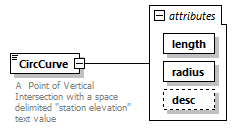 |
||||||||||||||||||||||||
| namespace | http://www.landxml.org/schema/LandXML-2.0 | ||||||||||||||||||||||||
| type | extension of Point | ||||||||||||||||||||||||
| properties |
|
||||||||||||||||||||||||
| used by |
|
||||||||||||||||||||||||
| attributes |
|
||||||||||||||||||||||||
| annotation |
|
||||||||||||||||||||||||
| source | <xs:element name="CircCurve"> <xs:annotation> <xs:documentation>A Point of Vertical Intersection with a space delimited "station elevation" text value</xs:documentation> <xs:documentation>with a circular vertical curve defined by "length and "radius" attributes.</xs:documentation> </xs:annotation> <xs:complexType mixed="true"> <xs:simpleContent> <xs:extension base="Point"> <xs:attribute name="length" type="xs:double" use="required"/> <xs:attribute name="radius" type="xs:double" use="required"/> <xs:attribute name="desc" type="xs:string"/> </xs:extension> </xs:simpleContent> </xs:complexType> </xs:element> |
attribute CircCurve/@length
| type | xs:double | ||
| properties |
|
||
| source | <xs:attribute name="length" type="xs:double" use="required"/> |
attribute CircCurve/@radius
| type | xs:double | ||
| properties |
|
||
| source | <xs:attribute name="radius" type="xs:double" use="required"/> |
attribute CircCurve/@desc
| type | xs:string |
| source | <xs:attribute name="desc" type="xs:string"/> |
element CircPipe
| diagram | 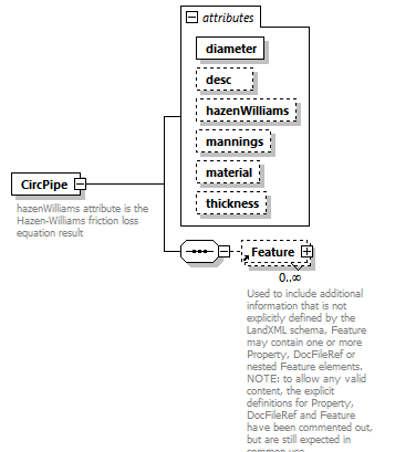 |
||||||||||||||||||||||||||||||||||||||||||
| namespace | http://www.landxml.org/schema/LandXML-2.0 | ||||||||||||||||||||||||||||||||||||||||||
| properties |
|
||||||||||||||||||||||||||||||||||||||||||
| children | Feature | ||||||||||||||||||||||||||||||||||||||||||
| used by |
|
||||||||||||||||||||||||||||||||||||||||||
| attributes |
|
||||||||||||||||||||||||||||||||||||||||||
| annotation |
|
||||||||||||||||||||||||||||||||||||||||||
| source | <xs:element name="CircPipe"> <xs:annotation> <xs:documentation>hazenWilliams attribute is the Hazen-Williams friction loss equation result</xs:documentation> <xs:documentation>mannings attribute is the Mannings coeffecient of roughness</xs:documentation> <xs:documentation/> </xs:annotation> <xs:complexType> <xs:sequence> <xs:element ref="Feature" minOccurs="0" maxOccurs="unbounded"/> </xs:sequence> <xs:attribute name="diameter" type="pipeDiameter" use="required"/> <xs:attribute name="desc" type="xs:string"/> <xs:attribute name="hazenWilliams" type="xs:double"/> <xs:attribute name="mannings" type="xs:double"/> <xs:attribute name="material" type="pipeMaterialType"/> <xs:attribute name="thickness" type="xs:double"/> </xs:complexType> </xs:element> |
attribute CircPipe/@diameter
| type | pipeDiameter | ||
| properties |
|
||
| source | <xs:attribute name="diameter" type="pipeDiameter" use="required"/> |
attribute CircPipe/@desc
| type | xs:string |
| source | <xs:attribute name="desc" type="xs:string"/> |
attribute CircPipe/@hazenWilliams
| type | xs:double |
| source | <xs:attribute name="hazenWilliams" type="xs:double"/> |
attribute CircPipe/@mannings
| type | xs:double |
| source | <xs:attribute name="mannings" type="xs:double"/> |
attribute CircPipe/@material
| type | pipeMaterialType | ||||||||||||||||||||||||||||||
| facets |
|
||||||||||||||||||||||||||||||
| source | <xs:attribute name="material" type="pipeMaterialType"/> |
attribute CircPipe/@thickness
| type | xs:double |
| source | <xs:attribute name="thickness" type="xs:double"/> |
element CircStruct
| diagram | 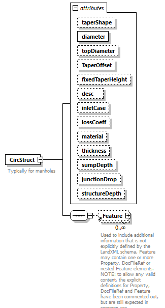 |
||||||||||||||||||||||||||||||||||||||||||||||||||||||||||||||||||||||||||||||||||||
| namespace | http://www.landxml.org/schema/LandXML-2.0 | ||||||||||||||||||||||||||||||||||||||||||||||||||||||||||||||||||||||||||||||||||||
| properties |
|
||||||||||||||||||||||||||||||||||||||||||||||||||||||||||||||||||||||||||||||||||||
| children | Feature | ||||||||||||||||||||||||||||||||||||||||||||||||||||||||||||||||||||||||||||||||||||
| used by |
|
||||||||||||||||||||||||||||||||||||||||||||||||||||||||||||||||||||||||||||||||||||
| attributes |
|
||||||||||||||||||||||||||||||||||||||||||||||||||||||||||||||||||||||||||||||||||||
| annotation |
|
||||||||||||||||||||||||||||||||||||||||||||||||||||||||||||||||||||||||||||||||||||
| source | <xs:element name="CircStruct"> <xs:annotation> <xs:documentation>Typically for manholes</xs:documentation> </xs:annotation> <xs:complexType> <xs:sequence> <xs:element ref="Feature" minOccurs="0" maxOccurs="unbounded"/> </xs:sequence> <xs:attribute name="taperShape" type="circularTaperShape"/> <xs:attribute name="diameter" type="xs:double" use="required"/> <xs:attribute name="topDiameter" type="xs:double"/> <xs:attribute name="TaperOffset" type="xs:double"/> <xs:attribute name="fixedTaperHeight" type="xs:double"/> <xs:attribute name="desc" type="xs:string"/> <xs:attribute name="inletCase"/> <xs:attribute name="lossCoeff" type="xs:double"/> <xs:attribute name="material"/> <xs:attribute name="thickness" type="xs:double"/> <xs:attribute name="sumpDepth" type="xs:double"/> <xs:attribute name="junctionDrop" type="xs:double"/> <xs:attribute name="structureDepth" type="xs:double"/> </xs:complexType> </xs:element> |
attribute CircStruct/@taperShape
| type | circularTaperShape | ||||||||||||
| facets |
|
||||||||||||
| source | <xs:attribute name="taperShape" type="circularTaperShape"/> |
attribute CircStruct/@diameter
| type | xs:double | ||
| properties |
|
||
| source | <xs:attribute name="diameter" type="xs:double" use="required"/> |
attribute CircStruct/@topDiameter
| type | xs:double |
| source | <xs:attribute name="topDiameter" type="xs:double"/> |
attribute CircStruct/@TaperOffset
| type | xs:double |
| source | <xs:attribute name="TaperOffset" type="xs:double"/> |
attribute CircStruct/@fixedTaperHeight
| type | xs:double |
| source | <xs:attribute name="fixedTaperHeight" type="xs:double"/> |
attribute CircStruct/@desc
| type | xs:string |
| source | <xs:attribute name="desc" type="xs:string"/> |
attribute CircStruct/@inletCase
| source | <xs:attribute name="inletCase"/> |
attribute CircStruct/@lossCoeff
| type | xs:double |
| source | <xs:attribute name="lossCoeff" type="xs:double"/> |
attribute CircStruct/@material
| source | <xs:attribute name="material"/> |
attribute CircStruct/@thickness
| type | xs:double |
| source | <xs:attribute name="thickness" type="xs:double"/> |
attribute CircStruct/@sumpDepth
| type | xs:double |
| source | <xs:attribute name="sumpDepth" type="xs:double"/> |
attribute CircStruct/@junctionDrop
| type | xs:double |
| source | <xs:attribute name="junctionDrop" type="xs:double"/> |
attribute CircStruct/@structureDepth
| type | xs:double |
| source | <xs:attribute name="structureDepth" type="xs:double"/> |
element Classification
| diagram | 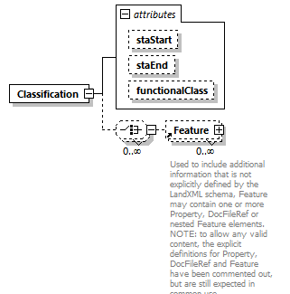 |
||||||||||||||||||||||||
| namespace | http://www.landxml.org/schema/LandXML-2.0 | ||||||||||||||||||||||||
| properties |
|
||||||||||||||||||||||||
| children | Feature | ||||||||||||||||||||||||
| used by |
|
||||||||||||||||||||||||
| attributes |
|
||||||||||||||||||||||||
| source | <xs:element name="Classification"> <xs:complexType> <xs:choice minOccurs="0" maxOccurs="unbounded"> <xs:element ref="Feature" minOccurs="0" maxOccurs="unbounded"/> </xs:choice> <xs:attribute name="staStart" type="station"/> <xs:attribute name="staEnd" type="station"/> <xs:attribute name="functionalClass" type="functionalClassType"/> </xs:complexType> </xs:element> |
attribute Classification/@staStart
| type | station |
| source | <xs:attribute name="staStart" type="station"/> |
attribute Classification/@staEnd
| type | station |
| source | <xs:attribute name="staEnd" type="station"/> |
attribute Classification/@functionalClass
| type | functionalClassType | ||||||||||||
| facets |
|
||||||||||||
| source | <xs:attribute name="functionalClass" type="functionalClassType"/> |
element ClimbLane
| diagram | 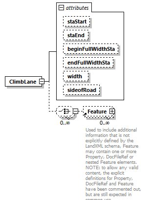 |
||||||||||||||||||||||||||||||||||||||||||
| namespace | http://www.landxml.org/schema/LandXML-2.0 | ||||||||||||||||||||||||||||||||||||||||||
| properties |
|
||||||||||||||||||||||||||||||||||||||||||
| children | Feature | ||||||||||||||||||||||||||||||||||||||||||
| used by |
|
||||||||||||||||||||||||||||||||||||||||||
| attributes |
|
||||||||||||||||||||||||||||||||||||||||||
| source | <xs:element name="ClimbLane"> <xs:complexType> <xs:choice minOccurs="0" maxOccurs="unbounded"> <xs:element ref="Feature" minOccurs="0" maxOccurs="unbounded"/> </xs:choice> <xs:attribute name="staStart" type="station"/> <xs:attribute name="staEnd" type="station"/> <xs:attribute name="beginFullWidthSta" type="station"/> <xs:attribute name="endFullWidthSta" type="station"/> <xs:attribute name="width" type="xs:double"/> <xs:attribute name="sideofRoad" type="sideofRoadType"/> </xs:complexType> </xs:element> |
attribute ClimbLane/@staStart
| type | station |
| source | <xs:attribute name="staStart" type="station"/> |
attribute ClimbLane/@staEnd
| type | station |
| source | <xs:attribute name="staEnd" type="station"/> |
attribute ClimbLane/@beginFullWidthSta
| type | station |
| source | <xs:attribute name="beginFullWidthSta" type="station"/> |
attribute ClimbLane/@endFullWidthSta
| type | station |
| source | <xs:attribute name="endFullWidthSta" type="station"/> |
attribute ClimbLane/@width
| type | xs:double |
| source | <xs:attribute name="width" type="xs:double"/> |
attribute ClimbLane/@sideofRoad
| type | sideofRoadType | ||||||||||||
| facets |
|
||||||||||||
| source | <xs:attribute name="sideofRoad" type="sideofRoadType"/> |
element ComboInlet
| diagram | 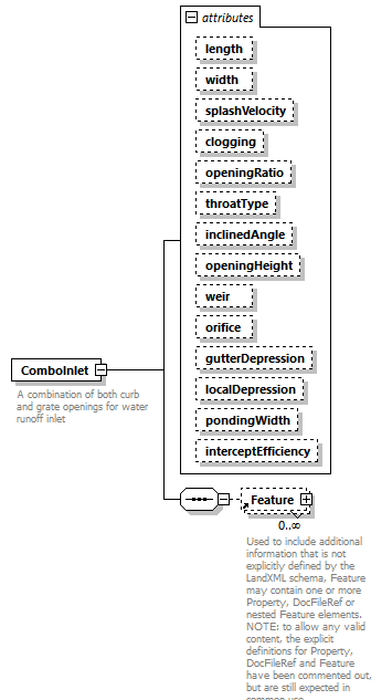 |
||||||||||||||||||||||||||||||||||||||||||||||||||||||||||||||||||||||||||||||||||||||||||
| namespace | http://www.landxml.org/schema/LandXML-2.0 | ||||||||||||||||||||||||||||||||||||||||||||||||||||||||||||||||||||||||||||||||||||||||||
| properties |
|
||||||||||||||||||||||||||||||||||||||||||||||||||||||||||||||||||||||||||||||||||||||||||
| children | Feature | ||||||||||||||||||||||||||||||||||||||||||||||||||||||||||||||||||||||||||||||||||||||||||
| used by |
|
||||||||||||||||||||||||||||||||||||||||||||||||||||||||||||||||||||||||||||||||||||||||||
| attributes |
|
||||||||||||||||||||||||||||||||||||||||||||||||||||||||||||||||||||||||||||||||||||||||||
| annotation |
|
||||||||||||||||||||||||||||||||||||||||||||||||||||||||||||||||||||||||||||||||||||||||||
| source | <xs:element name="ComboInlet"> <xs:annotation> <xs:documentation>A combination of both curb and grate openings for water runoff inlet</xs:documentation> <xs:documentation>interceptEfficiency = % of inflow that gets intercepted by vegetation and doesn't enter inlet or % of inflow that isn't intercepted</xs:documentation> </xs:annotation> <xs:complexType> <xs:sequence> <xs:element ref="Feature" minOccurs="0" maxOccurs="unbounded"/> </xs:sequence> <xs:attribute name="length" type="xs:double"/> <xs:attribute name="width" type="xs:double"/> <xs:attribute name="splashVelocity" type="xs:double"/> <xs:attribute name="clogging" type="xs:double"/> <xs:attribute name="openingRatio" type="xs:double"/> <xs:attribute name="throatType" type="curbThroatType"/> <xs:attribute name="inclinedAngle" type="xs:double"/> <xs:attribute name="openingHeight" type="xs:double"/> <xs:attribute name="weir" type="xs:double"/> <xs:attribute name="orifice" type="xs:double"/> <xs:attribute name="gutterDepression" type="xs:double"/> <xs:attribute name="localDepression" type="xs:double"/> <xs:attribute name="pondingWidth" type="xs:double"/> <xs:attribute name="interceptEfficiency" type="xs:double"/> </xs:complexType> </xs:element> |
attribute ComboInlet/@length
| type | xs:double |
| source | <xs:attribute name="length" type="xs:double"/> |
attribute ComboInlet/@width
| type | xs:double |
| source | <xs:attribute name="width" type="xs:double"/> |
attribute ComboInlet/@splashVelocity
| type | xs:double |
| source | <xs:attribute name="splashVelocity" type="xs:double"/> |
attribute ComboInlet/@clogging
| type | xs:double |
| source | <xs:attribute name="clogging" type="xs:double"/> |
attribute ComboInlet/@openingRatio
| type | xs:double |
| source | <xs:attribute name="openingRatio" type="xs:double"/> |
attribute ComboInlet/@throatType
| type | curbThroatType | ||||||||||||
| facets |
|
||||||||||||
| source | <xs:attribute name="throatType" type="curbThroatType"/> |
attribute ComboInlet/@inclinedAngle
| type | xs:double |
| source | <xs:attribute name="inclinedAngle" type="xs:double"/> |
attribute ComboInlet/@openingHeight
| type | xs:double |
| source | <xs:attribute name="openingHeight" type="xs:double"/> |
attribute ComboInlet/@weir
| type | xs:double |
| source | <xs:attribute name="weir" type="xs:double"/> |
attribute ComboInlet/@orifice
| type | xs:double |
| source | <xs:attribute name="orifice" type="xs:double"/> |
attribute ComboInlet/@gutterDepression
| type | xs:double |
| source | <xs:attribute name="gutterDepression" type="xs:double"/> |
attribute ComboInlet/@localDepression
| type | xs:double |
| source | <xs:attribute name="localDepression" type="xs:double"/> |
attribute ComboInlet/@pondingWidth
| type | xs:double |
| source | <xs:attribute name="pondingWidth" type="xs:double"/> |
attribute ComboInlet/@interceptEfficiency
| type | xs:double |
| source | <xs:attribute name="interceptEfficiency" type="xs:double"/> |
element ComplexName
| diagram | 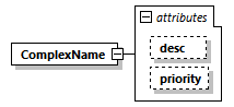 |
||||||||||||||||||
| namespace | http://www.landxml.org/schema/LandXML-2.0 | ||||||||||||||||||
| properties |
|
||||||||||||||||||
| used by |
|
||||||||||||||||||
| attributes |
|
||||||||||||||||||
| source | <xs:element name="ComplexName"> <xs:complexType> <xs:attribute name="desc" type="xs:string"/> <xs:attribute name="priority" type="xs:int"/> </xs:complexType> </xs:element> |
attribute ComplexName/@desc
| type | xs:string |
| source | <xs:attribute name="desc" type="xs:string"/> |
attribute ComplexName/@priority
| type | xs:int |
| source | <xs:attribute name="priority" type="xs:int"/> |
element Connection
| diagram | 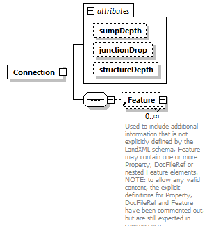 |
||||||||||||||||||||||||
| namespace | http://www.landxml.org/schema/LandXML-2.0 | ||||||||||||||||||||||||
| properties |
|
||||||||||||||||||||||||
| children | Feature | ||||||||||||||||||||||||
| used by |
|
||||||||||||||||||||||||
| attributes |
|
||||||||||||||||||||||||
| source | <xs:element name="Connection"> <xs:annotation> <xs:documentation/> </xs:annotation> <xs:complexType> <xs:sequence> <xs:element ref="Feature" minOccurs="0" maxOccurs="unbounded"/> </xs:sequence> <xs:attribute name="sumpDepth" type="xs:double"/> <xs:attribute name="junctionDrop" type="xs:double"/> <xs:attribute name="structureDepth" type="xs:double"/> </xs:complexType> </xs:element> |
attribute Connection/@sumpDepth
| type | xs:double |
| source | <xs:attribute name="sumpDepth" type="xs:double"/> |
attribute Connection/@junctionDrop
| type | xs:double |
| source | <xs:attribute name="junctionDrop" type="xs:double"/> |
attribute Connection/@structureDepth
| type | xs:double |
| source | <xs:attribute name="structureDepth" type="xs:double"/> |
element ConnSpiral
| diagram | 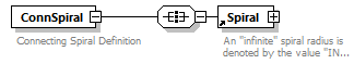 |
||
| namespace | http://www.landxml.org/schema/LandXML-2.0 | ||
| properties |
|
||
| children | Spiral | ||
| used by |
|
||
| annotation |
|
||
| source | <xs:element name="ConnSpiral"> <xs:annotation> <xs:documentation>Connecting Spiral Definition</xs:documentation> </xs:annotation> <xs:complexType> <xs:all> <xs:element ref="Spiral"/> </xs:all> </xs:complexType> </xs:element> |
element Contour
| diagram | 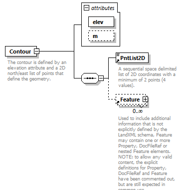 |
||||||||||||||||||
| namespace | http://www.landxml.org/schema/LandXML-2.0 | ||||||||||||||||||
| properties |
|
||||||||||||||||||
| children | PntList2D Feature | ||||||||||||||||||
| used by |
|
||||||||||||||||||
| attributes |
|
||||||||||||||||||
| annotation |
|
||||||||||||||||||
| source | <xs:element name="Contour"> <xs:annotation> <xs:documentation>The contour is defined by an elevation attribute and a 2D north/east list of points that define the geometry.</xs:documentation> <xs:documentation>is identified by the "name" attribute.</xs:documentation> </xs:annotation> <xs:complexType> <xs:sequence> <xs:element ref="PntList2D"/> <xs:element ref="Feature" minOccurs="0" maxOccurs="unbounded"/> <!-- Here PntList2D represents 2D planametric coordinate pairs expressed as space delimited Northing Easting pairs. --> </xs:sequence> <xs:attribute name="elev" type="xs:double" use="required"/> <xs:attribute name="m" type="materialTableIndexRef" use="optional"/> </xs:complexType> </xs:element> |
attribute Contour/@elev
| type | xs:double | ||
| properties |
|
||
| source | <xs:attribute name="elev" type="xs:double" use="required"/> |
attribute Contour/@m
| type | materialTableIndexRef | ||
| properties |
|
||
| source | <xs:attribute name="m" type="materialTableIndexRef" use="optional"/> |
element Contours
| diagram | 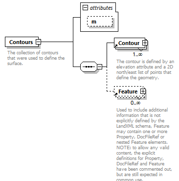 |
||||||||||||
| namespace | http://www.landxml.org/schema/LandXML-2.0 | ||||||||||||
| properties |
|
||||||||||||
| children | Contour Feature | ||||||||||||
| used by |
|
||||||||||||
| attributes |
|
||||||||||||
| annotation |
|
||||||||||||
| source | <xs:element name="Contours"> <xs:annotation> <xs:documentation>The collection of contours that were used to define the surface.</xs:documentation> </xs:annotation> <xs:complexType> <xs:sequence> <xs:element ref="Contour" maxOccurs="unbounded"/> <xs:element ref="Feature" minOccurs="0" maxOccurs="unbounded"/> </xs:sequence> <xs:attribute name="m" type="materialTableIndexRef" use="optional"/> </xs:complexType> </xs:element> |
attribute Contours/@m
| type | materialTableIndexRef | ||
| properties |
|
||
| source | <xs:attribute name="m" type="materialTableIndexRef" use="optional"/> |
element ControlChecks
| diagram | 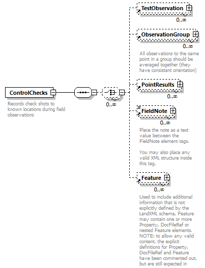 |
||
| namespace | http://www.landxml.org/schema/LandXML-2.0 | ||
| properties |
|
||
| children | TestObservation ObservationGroup PointResults FieldNote Feature | ||
| used by |
|
||
| annotation |
|
||
| source | <xs:element name="ControlChecks"> <xs:annotation> <xs:documentation>Records check shots to known locations during field observations</xs:documentation> </xs:annotation> <xs:complexType> <xs:sequence> <xs:choice minOccurs="0" maxOccurs="unbounded"> <xs:element ref="TestObservation" minOccurs="0" maxOccurs="unbounded"/> <!-- LandXML-1.2 schema note: Use of ObservationGroup is depricated and used for backward compatibility, use multiple TestObservation elements --> <xs:element ref="ObservationGroup" minOccurs="0" maxOccurs="unbounded"/> <xs:element ref="PointResults" minOccurs="0" maxOccurs="unbounded"/> <xs:element ref="FieldNote" minOccurs="0" maxOccurs="unbounded"/> <xs:element ref="Feature" minOccurs="0" maxOccurs="unbounded"/> </xs:choice> </xs:sequence> </xs:complexType> </xs:element> |
element CoordGeom
| diagram | 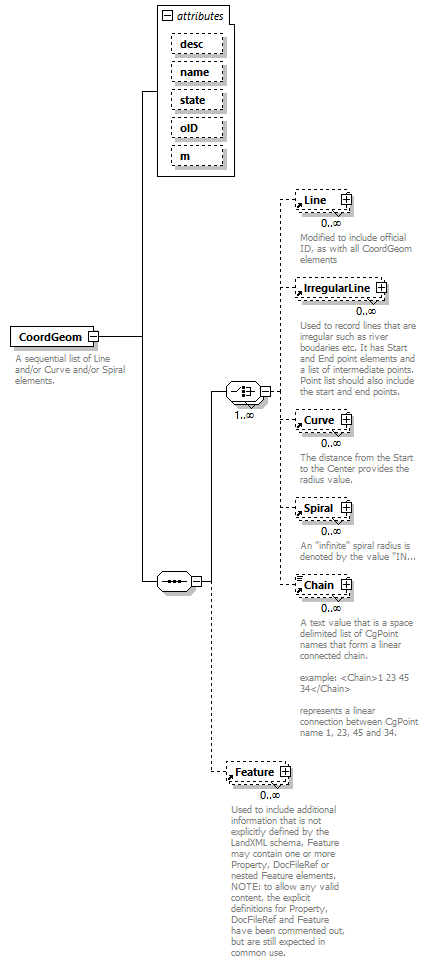 |
||||||||||||||||||||||||||||||||||||
| namespace | http://www.landxml.org/schema/LandXML-2.0 | ||||||||||||||||||||||||||||||||||||
| properties |
|
||||||||||||||||||||||||||||||||||||
| children | Line IrregularLine Curve Spiral Chain Feature | ||||||||||||||||||||||||||||||||||||
| used by |
|
||||||||||||||||||||||||||||||||||||
| attributes |
|
||||||||||||||||||||||||||||||||||||
| annotation |
|
||||||||||||||||||||||||||||||||||||
| source | <xs:element name="CoordGeom"> <xs:annotation> <xs:documentation>A sequential list of Line and/or Curve and/or Spiral elements.</xs:documentation> <xs:documentation>After the sequential list of elements an optional vertical geometry may be defined as a profile, which may be as simple as a list of PVIs (point to point 3D line string).</xs:documentation> </xs:annotation> <xs:complexType> <xs:sequence> <xs:choice maxOccurs="unbounded"> <xs:element ref="Line" minOccurs="0" maxOccurs="unbounded"/> <xs:element ref="IrregularLine" minOccurs="0" maxOccurs="unbounded"/> <xs:element ref="Curve" minOccurs="0" maxOccurs="unbounded"/> <xs:element ref="Spiral" minOccurs="0" maxOccurs="unbounded"/> <xs:element ref="Chain" minOccurs="0" maxOccurs="unbounded"/> </xs:choice> <xs:element ref="Feature" minOccurs="0" maxOccurs="unbounded"/> </xs:sequence> <xs:attribute name="desc" type="xs:string"/> <xs:attribute name="name" type="xs:string"/> <xs:attribute name="state" type="stateType"/> <xs:attribute name="oID" type="xs:string"/> <xs:attribute name="m" type="materialTableIndexRef" use="optional"/> </xs:complexType> </xs:element> |
attribute CoordGeom/@desc
| type | xs:string |
| source | <xs:attribute name="desc" type="xs:string"/> |
attribute CoordGeom/@name
| type | xs:string |
| source | <xs:attribute name="name" type="xs:string"/> |
attribute CoordGeom/@state
| type | stateType | |||||||||||||||
| facets |
|
|||||||||||||||
| source | <xs:attribute name="state" type="stateType"/> |
attribute CoordGeom/@oID
| type | xs:string |
| source | <xs:attribute name="oID" type="xs:string"/> |
attribute CoordGeom/@m
| type | materialTableIndexRef | ||
| properties |
|
||
| source | <xs:attribute name="m" type="materialTableIndexRef" use="optional"/> |
element CoordinateSystem
| diagram | 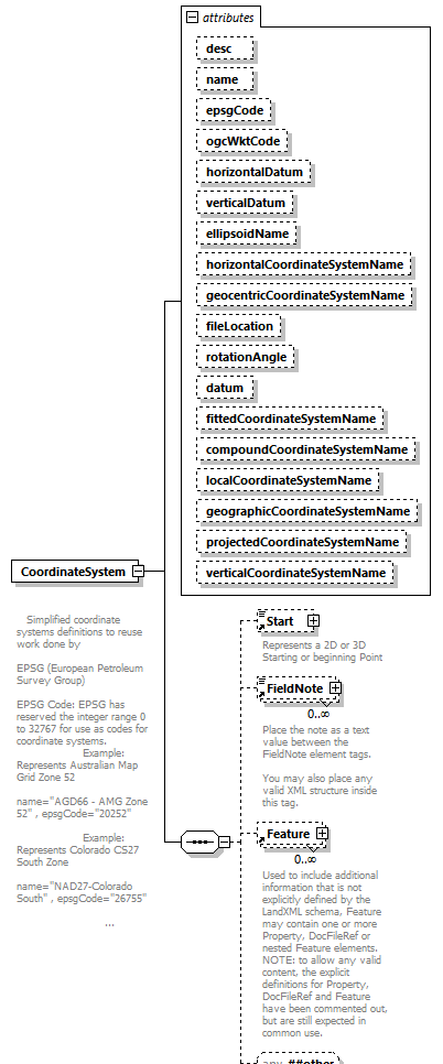 |
||||||||||||||||||||||||||||||||||||||||||||||||||||||||||||||||||||||||||||||||||||||||||||||||||||||||||||||||||
| namespace | http://www.landxml.org/schema/LandXML-2.0 | ||||||||||||||||||||||||||||||||||||||||||||||||||||||||||||||||||||||||||||||||||||||||||||||||||||||||||||||||||
| properties |
|
||||||||||||||||||||||||||||||||||||||||||||||||||||||||||||||||||||||||||||||||||||||||||||||||||||||||||||||||||
| children | Start FieldNote Feature | ||||||||||||||||||||||||||||||||||||||||||||||||||||||||||||||||||||||||||||||||||||||||||||||||||||||||||||||||||
| used by |
|
||||||||||||||||||||||||||||||||||||||||||||||||||||||||||||||||||||||||||||||||||||||||||||||||||||||||||||||||||
| attributes |
|
||||||||||||||||||||||||||||||||||||||||||||||||||||||||||||||||||||||||||||||||||||||||||||||||||||||||||||||||||
| annotation |
|
||||||||||||||||||||||||||||||||||||||||||||||||||||||||||||||||||||||||||||||||||||||||||||||||||||||||||||||||||
| source | <xs:element name="CoordinateSystem"> <xs:annotation> <xs:documentation> Simplified coordinate systems definitions to reuse work done by EPSG (European Petroleum Survey Group) EPSG Code: EPSG has reserved the integer range 0 to 32767 for use as codes for coordinate systems. Example: Represents Australian Map Grid Zone 52 name="AGD66 - AMG Zone 52" , epsgCode="20252" Example: Represents Colorado CS27 South Zone name="NAD27-Colorado South" , epsgCode="26755" </xs:documentation> </xs:annotation> <xs:complexType> <xs:sequence> <xs:element ref="Start" minOccurs="0"/> <xs:element ref="FieldNote" minOccurs="0" maxOccurs="unbounded"/> <xs:element ref="Feature" minOccurs="0" maxOccurs="unbounded"/> <xs:any namespace="##other" processContents="skip" minOccurs="0"/> </xs:sequence> <xs:attribute name="desc" type="xs:string"/> <xs:attribute name="name" type="xs:string"/> <xs:attribute name="epsgCode" type="xs:string"/> <xs:attribute name="ogcWktCode" type="xs:string"/> <xs:attribute name="horizontalDatum" type="xs:string"/> <xs:attribute name="verticalDatum" type="xs:string"/> <xs:attribute name="ellipsoidName" type="xs:string"/> <xs:attribute name="horizontalCoordinateSystemName" type="xs:string"/> <xs:attribute name="geocentricCoordinateSystemName" type="xs:string"/> <xs:attribute name="fileLocation" type="xs:anyURI"/> <xs:attribute name="rotationAngle" type="angle"/> <xs:attribute name="datum" type="xs:string"/> <xs:attribute name="fittedCoordinateSystemName" type="xs:string"/> <xs:attribute name="compoundCoordinateSystemName" type="xs:string"/> <xs:attribute name="localCoordinateSystemName" type="xs:string"/> <xs:attribute name="geographicCoordinateSystemName" type="xs:string"/> <xs:attribute name="projectedCoordinateSystemName" type="xs:string"/> <xs:attribute name="verticalCoordinateSystemName" type="xs:string"/> <!-- The attributes below are provided for backward compatibility only and should no longer be used. --> </xs:complexType> </xs:element> |
attribute CoordinateSystem/@desc
| type | xs:string |
| source | <xs:attribute name="desc" type="xs:string"/> |
attribute CoordinateSystem/@name
| type | xs:string |
| source | <xs:attribute name="name" type="xs:string"/> |
attribute CoordinateSystem/@epsgCode
| type | xs:string |
| source | <xs:attribute name="epsgCode" type="xs:string"/> |
attribute CoordinateSystem/@ogcWktCode
| type | xs:string |
| source | <xs:attribute name="ogcWktCode" type="xs:string"/> |
attribute CoordinateSystem/@horizontalDatum
| type | xs:string |
| source | <xs:attribute name="horizontalDatum" type="xs:string"/> |
attribute CoordinateSystem/@verticalDatum
| type | xs:string |
| source | <xs:attribute name="verticalDatum" type="xs:string"/> |
attribute CoordinateSystem/@ellipsoidName
| type | xs:string |
| source | <xs:attribute name="ellipsoidName" type="xs:string"/> |
attribute CoordinateSystem/@horizontalCoordinateSystemName
| type | xs:string |
| source | <xs:attribute name="horizontalCoordinateSystemName" type="xs:string"/> |
attribute CoordinateSystem/@geocentricCoordinateSystemName
| type | xs:string |
| source | <xs:attribute name="geocentricCoordinateSystemName" type="xs:string"/> |
attribute CoordinateSystem/@fileLocation
| type | xs:anyURI |
| source | <xs:attribute name="fileLocation" type="xs:anyURI"/> |
attribute CoordinateSystem/@rotationAngle
| type | angle |
| source | <xs:attribute name="rotationAngle" type="angle"/> |
attribute CoordinateSystem/@datum
| type | xs:string |
| source | <xs:attribute name="datum" type="xs:string"/> |
attribute CoordinateSystem/@fittedCoordinateSystemName
| type | xs:string |
| source | <xs:attribute name="fittedCoordinateSystemName" type="xs:string"/> |
attribute CoordinateSystem/@compoundCoordinateSystemName
| type | xs:string |
| source | <xs:attribute name="compoundCoordinateSystemName" type="xs:string"/> |
attribute CoordinateSystem/@localCoordinateSystemName
| type | xs:string |
| source | <xs:attribute name="localCoordinateSystemName" type="xs:string"/> |
attribute CoordinateSystem/@geographicCoordinateSystemName
| type | xs:string |
| source | <xs:attribute name="geographicCoordinateSystemName" type="xs:string"/> |
attribute CoordinateSystem/@projectedCoordinateSystemName
| type | xs:string |
| source | <xs:attribute name="projectedCoordinateSystemName" type="xs:string"/> |
attribute CoordinateSystem/@verticalCoordinateSystemName
| type | xs:string |
| source | <xs:attribute name="verticalCoordinateSystemName" type="xs:string"/> |
element Corner
| diagram | 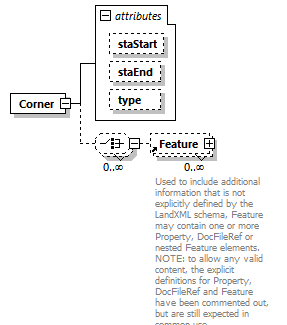 |
||||||||||||||||||||||||
| namespace | http://www.landxml.org/schema/LandXML-2.0 | ||||||||||||||||||||||||
| properties |
|
||||||||||||||||||||||||
| children | Feature | ||||||||||||||||||||||||
| used by |
|
||||||||||||||||||||||||
| attributes |
|
||||||||||||||||||||||||
| source | <xs:element name="Corner"> <xs:complexType> <xs:choice minOccurs="0" maxOccurs="unbounded"> <xs:element ref="Feature" minOccurs="0" maxOccurs="unbounded"/> </xs:choice> <xs:attribute name="staStart" type="station"/> <xs:attribute name="staEnd" type="station"/> <xs:attribute name="type" type="cornerType"/> </xs:complexType> </xs:element> |
attribute Corner/@staStart
| type | station |
| source | <xs:attribute name="staStart" type="station"/> |
attribute Corner/@staEnd
| type | station |
| source | <xs:attribute name="staEnd" type="station"/> |
attribute Corner/@type
| type | cornerType | ||||||
| facets |
|
||||||
| source | <xs:attribute name="type" type="cornerType"/> |
element Corrections
| diagram | 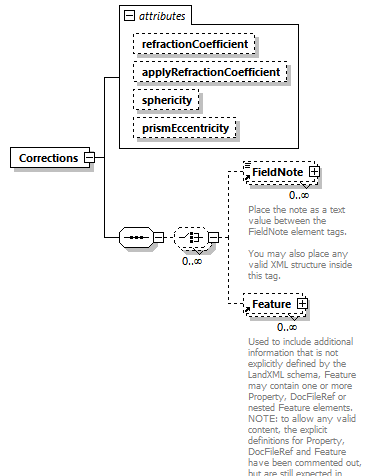 |
||||||||||||||||||||||||||||||
| namespace | http://www.landxml.org/schema/LandXML-2.0 | ||||||||||||||||||||||||||||||
| properties |
|
||||||||||||||||||||||||||||||
| children | FieldNote Feature | ||||||||||||||||||||||||||||||
| used by |
|
||||||||||||||||||||||||||||||
| attributes |
|
||||||||||||||||||||||||||||||
| source | <xs:element name="Corrections"> <xs:annotation> <xs:documentation/> </xs:annotation> <xs:complexType> <xs:sequence> <xs:choice minOccurs="0" maxOccurs="unbounded"> <xs:element ref="FieldNote" minOccurs="0" maxOccurs="unbounded"/> <xs:element ref="Feature" minOccurs="0" maxOccurs="unbounded"/> </xs:choice> </xs:sequence> <xs:attribute name="refractionCoefficient" type="xs:double"/> <xs:attribute name="applyRefractionCoefficient" type="xs:boolean"/> <xs:attribute name="sphericity" type="xs:double"/> <xs:attribute name="prismEccentricity" type="xs:double"/> <!-- if 'true' then atmospheric corrections are to be applied to the measured distances read from the file --> <!-- if 'true' then sea level corrections are to be applied to the measured distances read from the file --> <!-- this is for recording the refraction coefficient used in the curvature and refraction correction of zenith angles --> <!-- if 'true' then RefractionCoefficient should be applied to the measured zenith angles read from the file --> </xs:complexType> </xs:element> |
attribute Corrections/@refractionCoefficient
| type | xs:double |
| source | <xs:attribute name="refractionCoefficient" type="xs:double"/> |
attribute Corrections/@applyRefractionCoefficient
| type | xs:boolean |
| source | <xs:attribute name="applyRefractionCoefficient" type="xs:boolean"/> |
attribute Corrections/@sphericity
| type | xs:double |
| source | <xs:attribute name="sphericity" type="xs:double"/> |
attribute Corrections/@prismEccentricity
| type | xs:double |
| source | <xs:attribute name="prismEccentricity" type="xs:double"/> |
element CrashData
| diagram | 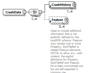 |
||
| namespace | http://www.landxml.org/schema/LandXML-2.0 | ||
| properties |
|
||
| children | CrashHistory Feature | ||
| used by |
|
||
| source | <xs:element name="CrashData"> <xs:complexType> <xs:choice maxOccurs="unbounded"> <xs:element ref="CrashHistory" maxOccurs="unbounded"/> <xs:element ref="Feature" minOccurs="0" maxOccurs="unbounded"/> </xs:choice> </xs:complexType> </xs:element> |
element CrashHistory
| diagram | 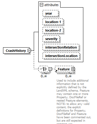 |
||||||||||||||||||||||||||||||||||||||||||
| namespace | http://www.landxml.org/schema/LandXML-2.0 | ||||||||||||||||||||||||||||||||||||||||||
| properties |
|
||||||||||||||||||||||||||||||||||||||||||
| children | Feature | ||||||||||||||||||||||||||||||||||||||||||
| used by |
|
||||||||||||||||||||||||||||||||||||||||||
| attributes |
|
||||||||||||||||||||||||||||||||||||||||||
| source | <xs:element name="CrashHistory"> <xs:complexType> <xs:choice minOccurs="0" maxOccurs="unbounded"> <xs:element ref="Feature" minOccurs="0" maxOccurs="unbounded"/> </xs:choice> <xs:attribute name="year" type="xs:date"/> <xs:attribute name="location-1" type="station"/> <xs:attribute name="location-2" type="station"/> <xs:attribute name="severity" type="crashSeverityType"/> <xs:attribute name="intersectionRelation" type="crashIntersectionRelation"/> <xs:attribute name="intersectionLocation" type="station"/> </xs:complexType> </xs:element> |
attribute CrashHistory/@year
| type | xs:date |
| source | <xs:attribute name="year" type="xs:date"/> |
attribute CrashHistory/@location-1
| type | station |
| source | <xs:attribute name="location-1" type="station"/> |
attribute CrashHistory/@location-2
| type | station |
| source | <xs:attribute name="location-2" type="station"/> |
attribute CrashHistory/@severity
| type | crashSeverityType | ||||||||||||
| facets |
|
||||||||||||
| source | <xs:attribute name="severity" type="crashSeverityType"/> |
attribute CrashHistory/@intersectionRelation
| type | crashIntersectionRelation | ||||||||||||
| facets |
|
||||||||||||
| source | <xs:attribute name="intersectionRelation" type="crashIntersectionRelation"/> |
attribute CrashHistory/@intersectionLocation
| type | station |
| source | <xs:attribute name="intersectionLocation" type="station"/> |
element CrossSect
| diagram | 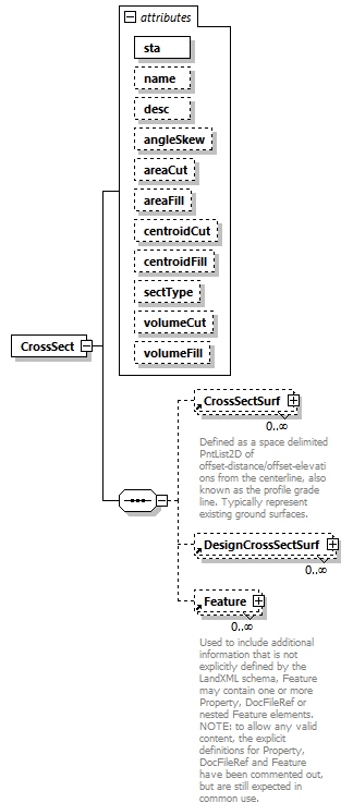 |
||||||||||||||||||||||||||||||||||||||||||||||||||||||||||||||||||||||||
| namespace | http://www.landxml.org/schema/LandXML-2.0 | ||||||||||||||||||||||||||||||||||||||||||||||||||||||||||||||||||||||||
| properties |
|
||||||||||||||||||||||||||||||||||||||||||||||||||||||||||||||||||||||||
| children | CrossSectSurf DesignCrossSectSurf Feature | ||||||||||||||||||||||||||||||||||||||||||||||||||||||||||||||||||||||||
| used by |
|
||||||||||||||||||||||||||||||||||||||||||||||||||||||||||||||||||||||||
| attributes |
|
||||||||||||||||||||||||||||||||||||||||||||||||||||||||||||||||||||||||
| source | <xs:element name="CrossSect"> <xs:annotation> <xs:documentation/> </xs:annotation> <xs:complexType> <xs:sequence> <xs:element ref="CrossSectSurf" minOccurs="0" maxOccurs="unbounded"/> <xs:element ref="DesignCrossSectSurf" minOccurs="0" maxOccurs="unbounded"/> <xs:element ref="Feature" minOccurs="0" maxOccurs="unbounded"/> </xs:sequence> <xs:attribute name="sta" type="xs:double" use="required"/> <xs:attribute name="name" type="xs:string"/> <xs:attribute name="desc" type="xs:string"/> <xs:attribute name="angleSkew" type="angle"/> <xs:attribute name="areaCut" type="crossSectSurfaceArea"/> <xs:attribute name="areaFill" type="crossSectSurfaceArea"/> <xs:attribute name="centroidCut" type="xs:double"/> <xs:attribute name="centroidFill" type="xs:double"/> <xs:attribute name="sectType" type="xs:string"/> <xs:attribute name="volumeCut" type="crossSectSurfaceVolume"/> <xs:attribute name="volumeFill" type="crossSectSurfaceVolume"/> </xs:complexType> </xs:element> |
attribute CrossSect/@sta
| type | xs:double | ||
| properties |
|
||
| source | <xs:attribute name="sta" type="xs:double" use="required"/> |
attribute CrossSect/@name
| type | xs:string |
| source | <xs:attribute name="name" type="xs:string"/> |
attribute CrossSect/@desc
| type | xs:string |
| source | <xs:attribute name="desc" type="xs:string"/> |
attribute CrossSect/@angleSkew
| type | angle |
| source | <xs:attribute name="angleSkew" type="angle"/> |
attribute CrossSect/@areaCut
| type | crossSectSurfaceArea |
| source | <xs:attribute name="areaCut" type="crossSectSurfaceArea"/> |
attribute CrossSect/@areaFill
| type | crossSectSurfaceArea |
| source | <xs:attribute name="areaFill" type="crossSectSurfaceArea"/> |
attribute CrossSect/@centroidCut
| type | xs:double |
| source | <xs:attribute name="centroidCut" type="xs:double"/> |
attribute CrossSect/@centroidFill
| type | xs:double |
| source | <xs:attribute name="centroidFill" type="xs:double"/> |
attribute CrossSect/@sectType
| type | xs:string |
| source | <xs:attribute name="sectType" type="xs:string"/> |
attribute CrossSect/@volumeCut
| type | crossSectSurfaceVolume |
| source | <xs:attribute name="volumeCut" type="crossSectSurfaceVolume"/> |
attribute CrossSect/@volumeFill
| type | crossSectSurfaceVolume |
| source | <xs:attribute name="volumeFill" type="crossSectSurfaceVolume"/> |
element CrossSectPnt
| diagram | 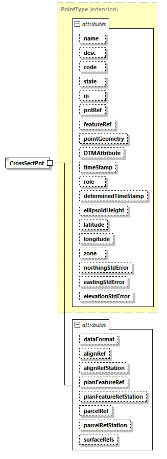 |
||||||||||||||||||||||||||||||||||||||||||||||||||||||||||||||||||||||||||||||||||||||||||||||||||||||||||||||||||||||||||||||||||||||||||||||||||||||||||||||||||||||||
| namespace | http://www.landxml.org/schema/LandXML-2.0 | ||||||||||||||||||||||||||||||||||||||||||||||||||||||||||||||||||||||||||||||||||||||||||||||||||||||||||||||||||||||||||||||||||||||||||||||||||||||||||||||||||||||||
| type | extension of PointType | ||||||||||||||||||||||||||||||||||||||||||||||||||||||||||||||||||||||||||||||||||||||||||||||||||||||||||||||||||||||||||||||||||||||||||||||||||||||||||||||||||||||||
| properties |
|
||||||||||||||||||||||||||||||||||||||||||||||||||||||||||||||||||||||||||||||||||||||||||||||||||||||||||||||||||||||||||||||||||||||||||||||||||||||||||||||||||||||||
| used by |
|
||||||||||||||||||||||||||||||||||||||||||||||||||||||||||||||||||||||||||||||||||||||||||||||||||||||||||||||||||||||||||||||||||||||||||||||||||||||||||||||||||||||||
| facets |
|
||||||||||||||||||||||||||||||||||||||||||||||||||||||||||||||||||||||||||||||||||||||||||||||||||||||||||||||||||||||||||||||||||||||||||||||||||||||||||||||||||||||||
| attributes |
|
||||||||||||||||||||||||||||||||||||||||||||||||||||||||||||||||||||||||||||||||||||||||||||||||||||||||||||||||||||||||||||||||||||||||||||||||||||||||||||||||||||||||
| source | <xs:element name="CrossSectPnt"> <xs:annotation> <xs:documentation/> </xs:annotation> <xs:complexType mixed="true"> <xs:simpleContent> <xs:extension base="PointType"> <xs:attribute name="dataFormat" type="dataFormatType" default="Offset Elevation"/> <xs:attribute name="alignRef" type="alignmentNameRef"/> <xs:attribute name="alignRefStation" type="station"/> <xs:attribute name="planFeatureRef" type="planFeatureNameRef"/> <xs:attribute name="planFeatureRefStation" type="station"/> <xs:attribute name="parcelRef" type="parcelNameRef"/> <xs:attribute name="parcelRefStation" type="station"/> <xs:attribute name="surfaceRefs" type="surfaceNameRefs"/> </xs:extension> </xs:simpleContent> </xs:complexType> </xs:element> |
attribute CrossSectPnt/@dataFormat
| type | dataFormatType | |||||||||
| properties |
|
|||||||||
| facets |
|
|||||||||
| source | <xs:attribute name="dataFormat" type="dataFormatType" default="Offset Elevation"/> |
attribute CrossSectPnt/@alignRef
| type | alignmentNameRef |
| source | <xs:attribute name="alignRef" type="alignmentNameRef"/> |
attribute CrossSectPnt/@alignRefStation
| type | station |
| source | <xs:attribute name="alignRefStation" type="station"/> |
attribute CrossSectPnt/@planFeatureRef
| type | planFeatureNameRef |
| source | <xs:attribute name="planFeatureRef" type="planFeatureNameRef"/> |
attribute CrossSectPnt/@planFeatureRefStation
| type | station |
| source | <xs:attribute name="planFeatureRefStation" type="station"/> |
attribute CrossSectPnt/@parcelRef
| type | parcelNameRef |
| source | <xs:attribute name="parcelRef" type="parcelNameRef"/> |
attribute CrossSectPnt/@parcelRefStation
| type | station |
| source | <xs:attribute name="parcelRefStation" type="station"/> |
attribute CrossSectPnt/@surfaceRefs
| type | surfaceNameRefs |
| source | <xs:attribute name="surfaceRefs" type="surfaceNameRefs"/> |
element CrossSects
| diagram | 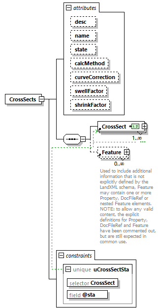 |
||||||||||||||||||||||||||||||||||||||||||||||||
| namespace | http://www.landxml.org/schema/LandXML-2.0 | ||||||||||||||||||||||||||||||||||||||||||||||||
| properties |
|
||||||||||||||||||||||||||||||||||||||||||||||||
| children | CrossSect Feature | ||||||||||||||||||||||||||||||||||||||||||||||||
| used by |
|
||||||||||||||||||||||||||||||||||||||||||||||||
| attributes |
|
||||||||||||||||||||||||||||||||||||||||||||||||
| identity constraints |
|
||||||||||||||||||||||||||||||||||||||||||||||||
| source | <xs:element name="CrossSects"> <xs:annotation> <xs:documentation/> </xs:annotation> <xs:complexType> <xs:sequence> <xs:element ref="CrossSect" maxOccurs="unbounded"/> <xs:element ref="Feature" minOccurs="0" maxOccurs="unbounded"/> </xs:sequence> <xs:attribute name="desc" type="xs:string"/> <xs:attribute name="name" type="xs:string"/> <xs:attribute name="state" type="stateType"/> <xs:attribute name="calcMethod" type="xsVolCalcMethodType"/> <xs:attribute name="curveCorrection" type="xs:boolean"/> <xs:attribute name="swellFactor" type="xs:double"/> <xs:attribute name="shrinkFactor" type="xs:double"/> </xs:complexType> <xs:unique name="uCrossSectSta"> <xs:selector xpath="CrossSect"/> <xs:field xpath="@sta"/> </xs:unique> </xs:element> |
attribute CrossSects/@desc
| type | xs:string |
| source | <xs:attribute name="desc" type="xs:string"/> |
attribute CrossSects/@name
| type | xs:string |
| source | <xs:attribute name="name" type="xs:string"/> |
attribute CrossSects/@state
| type | stateType | |||||||||||||||
| facets |
|
|||||||||||||||
| source | <xs:attribute name="state" type="stateType"/> |
attribute CrossSects/@calcMethod
| type | xsVolCalcMethodType | |||||||||
| facets |
|
|||||||||
| source | <xs:attribute name="calcMethod" type="xsVolCalcMethodType"/> |
attribute CrossSects/@curveCorrection
| type | xs:boolean |
| source | <xs:attribute name="curveCorrection" type="xs:boolean"/> |
attribute CrossSects/@swellFactor
| type | xs:double |
| source | <xs:attribute name="swellFactor" type="xs:double"/> |
attribute CrossSects/@shrinkFactor
| type | xs:double |
| source | <xs:attribute name="shrinkFactor" type="xs:double"/> |
element CrossSectSurf
| diagram | 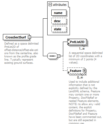 |
||||||||||||||||||||||||
| namespace | http://www.landxml.org/schema/LandXML-2.0 | ||||||||||||||||||||||||
| properties |
|
||||||||||||||||||||||||
| children | PntList2D Feature | ||||||||||||||||||||||||
| used by |
|
||||||||||||||||||||||||
| attributes |
|
||||||||||||||||||||||||
| annotation |
|
||||||||||||||||||||||||
| source | <xs:element name="CrossSectSurf"> <xs:annotation> <xs:documentation>Defined as a space delimited PntList2D of offset-distance/offset-elevations from the centerline, also known as the profile grade line. Typically represent existing ground surfaces.</xs:documentation> <xs:documentation>Example: "-60.00 1.52 -36.26 0.89 12.41 2.01 60.00 1.83"</xs:documentation> <xs:documentation>Note: Gaps in the surface are handled by having 2 or more PntList2D elements.</xs:documentation> </xs:annotation> <xs:complexType> <xs:sequence> <xs:element ref="PntList2D" maxOccurs="unbounded"/> <xs:element ref="Feature" minOccurs="0" maxOccurs="unbounded"/> </xs:sequence> <xs:attribute name="name" type="xs:string" use="required"/> <xs:attribute name="desc" type="xs:string"/> <xs:attribute name="state" type="stateType"/> </xs:complexType> </xs:element> |
attribute CrossSectSurf/@name
| type | xs:string | ||
| properties |
|
||
| source | <xs:attribute name="name" type="xs:string" use="required"/> |
attribute CrossSectSurf/@desc
| type | xs:string |
| source | <xs:attribute name="desc" type="xs:string"/> |
attribute CrossSectSurf/@state
| type | stateType | |||||||||||||||
| facets |
|
|||||||||||||||
| source | <xs:attribute name="state" type="stateType"/> |
element Curb
| diagram | 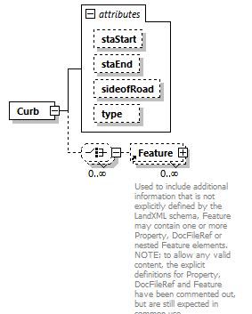 |
||||||||||||||||||||||||||||||
| namespace | http://www.landxml.org/schema/LandXML-2.0 | ||||||||||||||||||||||||||||||
| properties |
|
||||||||||||||||||||||||||||||
| children | Feature | ||||||||||||||||||||||||||||||
| used by |
|
||||||||||||||||||||||||||||||
| attributes |
|
||||||||||||||||||||||||||||||
| source | <xs:element name="Curb"> <xs:complexType> <xs:choice minOccurs="0" maxOccurs="unbounded"> <xs:element ref="Feature" minOccurs="0" maxOccurs="unbounded"/> </xs:choice> <xs:attribute name="staStart" type="station"/> <xs:attribute name="staEnd" type="station"/> <xs:attribute name="sideofRoad" type="sideofRoadType"/> <xs:attribute name="type" type="curbType"/> </xs:complexType> </xs:element> |
attribute Curb/@staStart
| type | station |
| source | <xs:attribute name="staStart" type="station"/> |
attribute Curb/@staEnd
| type | station |
| source | <xs:attribute name="staEnd" type="station"/> |
attribute Curb/@sideofRoad
| type | sideofRoadType | ||||||||||||
| facets |
|
||||||||||||
| source | <xs:attribute name="sideofRoad" type="sideofRoadType"/> |
attribute Curb/@type
| type | curbType | ||||||
| facets |
|
||||||
| source | <xs:attribute name="type" type="curbType"/> |
element CurbInlet
| diagram | 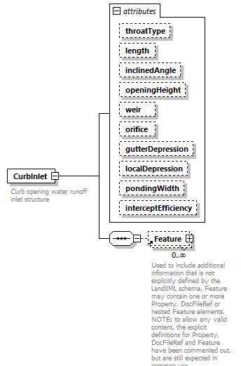 |
||||||||||||||||||||||||||||||||||||||||||||||||||||||||||||||||||
| namespace | http://www.landxml.org/schema/LandXML-2.0 | ||||||||||||||||||||||||||||||||||||||||||||||||||||||||||||||||||
| properties |
|
||||||||||||||||||||||||||||||||||||||||||||||||||||||||||||||||||
| children | Feature | ||||||||||||||||||||||||||||||||||||||||||||||||||||||||||||||||||
| used by |
|
||||||||||||||||||||||||||||||||||||||||||||||||||||||||||||||||||
| attributes |
|
||||||||||||||||||||||||||||||||||||||||||||||||||||||||||||||||||
| annotation |
|
||||||||||||||||||||||||||||||||||||||||||||||||||||||||||||||||||
| source | <xs:element name="CurbInlet"> <xs:annotation> <xs:documentation>Curb opening water runoff inlet structure</xs:documentation> <xs:documentation>interceptEfficiency = % of inflow that gets intercepted by vegetation and doesn't enter inlet or % of inflow that isn't intercepted</xs:documentation> </xs:annotation> <xs:complexType> <xs:sequence> <xs:element ref="Feature" minOccurs="0" maxOccurs="unbounded"/> </xs:sequence> <xs:attribute name="throatType" type="curbThroatType"/> <xs:attribute name="length" type="xs:double"/> <xs:attribute name="inclinedAngle" type="xs:double"/> <xs:attribute name="openingHeight" type="xs:double"/> <xs:attribute name="weir" type="xs:double"/> <xs:attribute name="orifice" type="xs:double"/> <xs:attribute name="gutterDepression" type="xs:double"/> <xs:attribute name="localDepression" type="xs:double"/> <xs:attribute name="pondingWidth" type="xs:double"/> <xs:attribute name="interceptEfficiency" type="xs:double"/> </xs:complexType> </xs:element> |
attribute CurbInlet/@throatType
| type | curbThroatType | ||||||||||||
| facets |
|
||||||||||||
| source | <xs:attribute name="throatType" type="curbThroatType"/> |
attribute CurbInlet/@length
| type | xs:double |
| source | <xs:attribute name="length" type="xs:double"/> |
attribute CurbInlet/@inclinedAngle
| type | xs:double |
| source | <xs:attribute name="inclinedAngle" type="xs:double"/> |
attribute CurbInlet/@openingHeight
| type | xs:double |
| source | <xs:attribute name="openingHeight" type="xs:double"/> |
attribute CurbInlet/@weir
| type | xs:double |
| source | <xs:attribute name="weir" type="xs:double"/> |
attribute CurbInlet/@orifice
| type | xs:double |
| source | <xs:attribute name="orifice" type="xs:double"/> |
attribute CurbInlet/@gutterDepression
| type | xs:double |
| source | <xs:attribute name="gutterDepression" type="xs:double"/> |
attribute CurbInlet/@localDepression
| type | xs:double |
| source | <xs:attribute name="localDepression" type="xs:double"/> |
attribute CurbInlet/@pondingWidth
| type | xs:double |
| source | <xs:attribute name="pondingWidth" type="xs:double"/> |
attribute CurbInlet/@interceptEfficiency
| type | xs:double |
| source | <xs:attribute name="interceptEfficiency" type="xs:double"/> |
element Curve
| diagram | 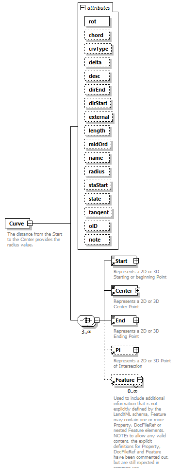 |
||||||||||||||||||||||||||||||||||||||||||||||||||||||||||||||||||||||||||||||||||||||||||||||||||||||||||||
| namespace | http://www.landxml.org/schema/LandXML-2.0 | ||||||||||||||||||||||||||||||||||||||||||||||||||||||||||||||||||||||||||||||||||||||||||||||||||||||||||||
| properties |
|
||||||||||||||||||||||||||||||||||||||||||||||||||||||||||||||||||||||||||||||||||||||||||||||||||||||||||||
| children | Start Center End PI Feature | ||||||||||||||||||||||||||||||||||||||||||||||||||||||||||||||||||||||||||||||||||||||||||||||||||||||||||||
| used by |
|
||||||||||||||||||||||||||||||||||||||||||||||||||||||||||||||||||||||||||||||||||||||||||||||||||||||||||||
| attributes |
|
||||||||||||||||||||||||||||||||||||||||||||||||||||||||||||||||||||||||||||||||||||||||||||||||||||||||||||
| annotation |
|
||||||||||||||||||||||||||||||||||||||||||||||||||||||||||||||||||||||||||||||||||||||||||||||||||||||||||||
| source | <xs:element name="Curve"> <xs:annotation> <xs:documentation>The distance from the Start to the Center provides the radius value.</xs:documentation> <xs:documentation>The rotation attribute "rot" defines whether the arc travels clockwise or counter-clockwise from the Start to End point.</xs:documentation> </xs:annotation> <xs:complexType> <xs:choice minOccurs="3" maxOccurs="unbounded"> <xs:element ref="Start"/> <xs:element ref="Center"/> <xs:element ref="End"/> <xs:element ref="PI" minOccurs="0"/> <xs:element ref="Feature" minOccurs="0" maxOccurs="unbounded"/> </xs:choice> <xs:attribute name="rot" type="clockwise" use="required"/> <xs:attribute name="chord" type="xs:double"/> <xs:attribute name="crvType" type="curveType"/> <xs:attribute name="delta" type="angle"/> <xs:attribute name="desc" type="xs:string"/> <xs:attribute name="dirEnd" type="direction"/> <xs:attribute name="dirStart" type="direction"/> <xs:attribute name="external" type="xs:double"/> <xs:attribute name="length" type="xs:double"/> <xs:attribute name="midOrd" type="xs:double"/> <xs:attribute name="name" type="xs:string"/> <xs:attribute name="radius" type="xs:double"/> <xs:attribute name="staStart" type="xs:double"/> <xs:attribute name="state" type="stateType"/> <xs:attribute name="tangent" type="xs:double"/> <xs:attribute name="oID" type="xs:string"/> <xs:attribute name="note" type="xs:string"/> </xs:complexType> </xs:element> |
attribute Curve/@rot
| type | clockwise | |||||||||
| properties |
|
|||||||||
| facets |
|
|||||||||
| source | <xs:attribute name="rot" type="clockwise" use="required"/> |
attribute Curve/@chord
| type | xs:double |
| source | <xs:attribute name="chord" type="xs:double"/> |
attribute Curve/@crvType
| type | curveType | |||||||||
| facets |
|
|||||||||
| source | <xs:attribute name="crvType" type="curveType"/> |
attribute Curve/@delta
| type | angle |
| source | <xs:attribute name="delta" type="angle"/> |
attribute Curve/@desc
| type | xs:string |
| source | <xs:attribute name="desc" type="xs:string"/> |
attribute Curve/@dirEnd
| type | direction |
| source | <xs:attribute name="dirEnd" type="direction"/> |
attribute Curve/@dirStart
| type | direction |
| source | <xs:attribute name="dirStart" type="direction"/> |
attribute Curve/@external
| type | xs:double |
| source | <xs:attribute name="external" type="xs:double"/> |
attribute Curve/@length
| type | xs:double |
| source | <xs:attribute name="length" type="xs:double"/> |
attribute Curve/@midOrd
| type | xs:double |
| source | <xs:attribute name="midOrd" type="xs:double"/> |
attribute Curve/@name
| type | xs:string |
| source | <xs:attribute name="name" type="xs:string"/> |
attribute Curve/@radius
| type | xs:double |
| source | <xs:attribute name="radius" type="xs:double"/> |
attribute Curve/@staStart
| type | xs:double |
| source | <xs:attribute name="staStart" type="xs:double"/> |
attribute Curve/@state
| type | stateType | |||||||||||||||
| facets |
|
|||||||||||||||
| source | <xs:attribute name="state" type="stateType"/> |
attribute Curve/@tangent
| type | xs:double |
| source | <xs:attribute name="tangent" type="xs:double"/> |
attribute Curve/@oID
| type | xs:string |
| source | <xs:attribute name="oID" type="xs:string"/> |
attribute Curve/@note
| type | xs:string |
| source | <xs:attribute name="note" type="xs:string"/> |
element Curve1
| diagram | 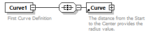 |
||
| namespace | http://www.landxml.org/schema/LandXML-2.0 | ||
| properties |
|
||
| children | Curve | ||
| used by |
|
||
| annotation |
|
||
| source | <xs:element name="Curve1"> <xs:annotation> <xs:documentation>First Curve Definition</xs:documentation> </xs:annotation> <xs:complexType> <xs:all> <xs:element ref="Curve"/> </xs:all> </xs:complexType> </xs:element> |
element Curve2
| diagram |  |
||
| namespace | http://www.landxml.org/schema/LandXML-2.0 | ||
| properties |
|
||
| children | Curve | ||
| used by |
|
||
| annotation |
|
||
| source | <xs:element name="Curve2"> <xs:annotation> <xs:documentation>Second Curve Definition</xs:documentation> </xs:annotation> <xs:complexType> <xs:all> <xs:element ref="Curve"/> </xs:all> </xs:complexType> </xs:element> |
element DailyTrafficVolume
| diagram | 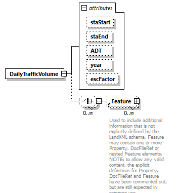 |
||||||||||||||||||||||||||||||||||||
| namespace | http://www.landxml.org/schema/LandXML-2.0 | ||||||||||||||||||||||||||||||||||||
| properties |
|
||||||||||||||||||||||||||||||||||||
| children | Feature | ||||||||||||||||||||||||||||||||||||
| used by |
|
||||||||||||||||||||||||||||||||||||
| attributes |
|
||||||||||||||||||||||||||||||||||||
| source | <xs:element name="DailyTrafficVolume"> <xs:complexType> <xs:choice minOccurs="0" maxOccurs="unbounded"> <xs:element ref="Feature" minOccurs="0" maxOccurs="unbounded"/> </xs:choice> <xs:attribute name="staStart" type="station"/> <xs:attribute name="staEnd" type="station"/> <xs:attribute name="ADT" type="xs:double"/> <xs:attribute name="year" type="xs:date"/> <xs:attribute name="escFactor" type="xs:double"/> <!-- ADT, the average daily traffic for the specified year. This item specifies the average daily traffic for the specified year. No value needs to be specified for this item. The unit of measure for this item is vehicles/day. --> <!-- escFactor is the subsequent year annual traffic volume escalation factor. This item specifies the annual percent increase (or decrease) in traffic volume for subsequent traffic volume years. No value needs to be specified for this item. The unit of measure for this item is percent %. --> </xs:complexType> </xs:element> |
attribute DailyTrafficVolume/@staStart
| type | station |
| source | <xs:attribute name="staStart" type="station"/> |
attribute DailyTrafficVolume/@staEnd
| type | station |
| source | <xs:attribute name="staEnd" type="station"/> |
attribute DailyTrafficVolume/@ADT
| type | xs:double |
| source | <xs:attribute name="ADT" type="xs:double"/> |
attribute DailyTrafficVolume/@year
| type | xs:date |
| source | <xs:attribute name="year" type="xs:date"/> |
attribute DailyTrafficVolume/@escFactor
| type | xs:double |
| source | <xs:attribute name="escFactor" type="xs:double"/> |
element DataPoints
| diagram | 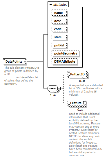 |
||||||||||||||||||||||||||||||||||||||||||||||||
| namespace | http://www.landxml.org/schema/LandXML-2.0 | ||||||||||||||||||||||||||||||||||||||||||||||||
| properties |
|
||||||||||||||||||||||||||||||||||||||||||||||||
| children | PntList3D Feature | ||||||||||||||||||||||||||||||||||||||||||||||||
| used by |
|
||||||||||||||||||||||||||||||||||||||||||||||||
| attributes |
|
||||||||||||||||||||||||||||||||||||||||||||||||
| annotation |
|
||||||||||||||||||||||||||||||||||||||||||||||||
| source | <xs:element name="DataPoints"> <xs:annotation> <xs:documentation>The sub element PntList3D is group of points is defined by a 3D north/east/elev list of points that define the geometry.</xs:documentation> </xs:annotation> <xs:complexType mixed="true"> <xs:sequence maxOccurs="unbounded"> <xs:element ref="PntList3D" minOccurs="0" maxOccurs="unbounded"/> <xs:element ref="Feature" minOccurs="0" maxOccurs="unbounded"/> </xs:sequence> <xs:attribute name="name" type="xs:string"/> <xs:attribute name="desc" type="xs:string"/> <xs:attribute name="code" type="xs:string"/> <xs:attribute name="state" type="stateType"/> <xs:attribute name="pntRef" type="pointNameRef"/> <xs:attribute name="pointGeometry" type="pointGeometryType"/> <xs:attribute name="DTMAttribute" type="DTMAttributeType"/> </xs:complexType> </xs:element> |
attribute DataPoints/@name
| type | xs:string |
| source | <xs:attribute name="name" type="xs:string"/> |
attribute DataPoints/@desc
| type | xs:string |
| source | <xs:attribute name="desc" type="xs:string"/> |
attribute DataPoints/@code
| type | xs:string |
| source | <xs:attribute name="code" type="xs:string"/> |
attribute DataPoints/@state
| type | stateType | |||||||||||||||
| facets |
|
|||||||||||||||
| source | <xs:attribute name="state" type="stateType"/> |
attribute DataPoints/@pntRef
| type | pointNameRef |
| source | <xs:attribute name="pntRef" type="pointNameRef"/> |
attribute DataPoints/@pointGeometry
| type | pointGeometryType | |||||||||
| facets |
|
|||||||||
| source | <xs:attribute name="pointGeometry" type="pointGeometryType"/> |
attribute DataPoints/@DTMAttribute
| type | DTMAttributeType | |||||||||||||||||||||||||||||||||||||||||||||
| facets |
|
|||||||||||||||||||||||||||||||||||||||||||||
| source | <xs:attribute name="DTMAttribute" type="DTMAttributeType"/> |
element DecisionSightDistance
| diagram | 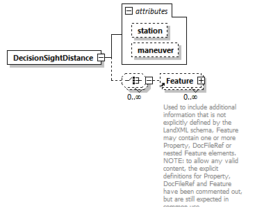 |
||||||||||||||||||
| namespace | http://www.landxml.org/schema/LandXML-2.0 | ||||||||||||||||||
| properties |
|
||||||||||||||||||
| children | Feature | ||||||||||||||||||
| used by |
|
||||||||||||||||||
| attributes |
|
||||||||||||||||||
| source | <xs:element name="DecisionSightDistance"> <xs:complexType> <xs:choice minOccurs="0" maxOccurs="unbounded"> <xs:element ref="Feature" minOccurs="0" maxOccurs="unbounded"/> </xs:choice> <xs:attribute name="station" type="station"/> <xs:attribute name="maneuver" type="maneuverType"/> </xs:complexType> </xs:element> |
attribute DecisionSightDistance/@station
| type | station |
| source | <xs:attribute name="station" type="station"/> |
attribute DecisionSightDistance/@maneuver
| type | maneuverType | |||||||||
| facets |
|
|||||||||
| source | <xs:attribute name="maneuver" type="maneuverType"/> |
element Definition
| diagram | 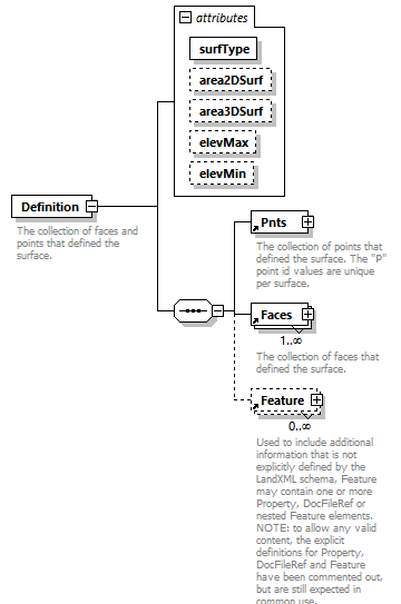 |
||||||||||||||||||||||||||||||||||||
| namespace | http://www.landxml.org/schema/LandXML-2.0 | ||||||||||||||||||||||||||||||||||||
| properties |
|
||||||||||||||||||||||||||||||||||||
| children | Pnts Faces Feature | ||||||||||||||||||||||||||||||||||||
| used by |
|
||||||||||||||||||||||||||||||||||||
| attributes |
|
||||||||||||||||||||||||||||||||||||
| annotation |
|
||||||||||||||||||||||||||||||||||||
| source | <xs:element name="Definition"> <xs:annotation> <xs:documentation>The collection of faces and points that defined the surface.</xs:documentation> </xs:annotation> <xs:complexType> <xs:sequence> <xs:element ref="Pnts"/> <xs:element ref="Faces" maxOccurs="unbounded"/> <xs:element ref="Feature" minOccurs="0" maxOccurs="unbounded"/> </xs:sequence> <xs:attribute name="surfType" type="surfTypeEnum" use="required"/> <xs:attribute name="area2DSurf" type="xs:double"/> <xs:attribute name="area3DSurf" type="xs:double"/> <xs:attribute name="elevMax" type="xs:double"/> <xs:attribute name="elevMin" type="xs:double"/> </xs:complexType> </xs:element> |
attribute Definition/@surfType
| type | surfTypeEnum | |||||||||
| properties |
|
|||||||||
| facets |
|
|||||||||
| source | <xs:attribute name="surfType" type="surfTypeEnum" use="required"/> |
attribute Definition/@area2DSurf
| type | xs:double |
| source | <xs:attribute name="area2DSurf" type="xs:double"/> |
attribute Definition/@area3DSurf
| type | xs:double |
| source | <xs:attribute name="area3DSurf" type="xs:double"/> |
attribute Definition/@elevMax
| type | xs:double |
| source | <xs:attribute name="elevMax" type="xs:double"/> |
attribute Definition/@elevMin
| type | xs:double |
| source | <xs:attribute name="elevMin" type="xs:double"/> |
element DesignCrossSectionTemplate
| diagram | 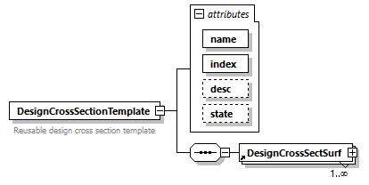 |
||||||||||||||||||||||||||||||
| namespace | http://www.landxml.org/schema/LandXML-2.0 | ||||||||||||||||||||||||||||||
| properties |
|
||||||||||||||||||||||||||||||
| children | DesignCrossSectSurf | ||||||||||||||||||||||||||||||
| used by |
|
||||||||||||||||||||||||||||||
| attributes |
|
||||||||||||||||||||||||||||||
| annotation |
|
||||||||||||||||||||||||||||||
| source | <xs:element name="DesignCrossSectionTemplate"> <xs:annotation> <xs:documentation>Reusable design cross section template </xs:documentation> </xs:annotation> <xs:complexType> <xs:sequence> <xs:element ref="DesignCrossSectSurf" maxOccurs="unbounded"/> </xs:sequence> <xs:attribute name="name" type="xs:string" use="required"/> <xs:attribute name="index" type="xs:integer" use="required"/> <xs:attribute name="desc" type="xs:string"/> <xs:attribute name="state" type="stateType"/> </xs:complexType> </xs:element> |
attribute DesignCrossSectionTemplate/@name
| type | xs:string | ||
| properties |
|
||
| source | <xs:attribute name="name" type="xs:string" use="required"/> |
attribute DesignCrossSectionTemplate/@index
| type | xs:integer | ||
| properties |
|
||
| source | <xs:attribute name="index" type="xs:integer" use="required"/> |
attribute DesignCrossSectionTemplate/@desc
| type | xs:string |
| source | <xs:attribute name="desc" type="xs:string"/> |
attribute DesignCrossSectionTemplate/@state
| type | stateType | |||||||||||||||
| facets |
|
|||||||||||||||
| source | <xs:attribute name="state" type="stateType"/> |
element DesignCrossSectionTemplateTable
| diagram | 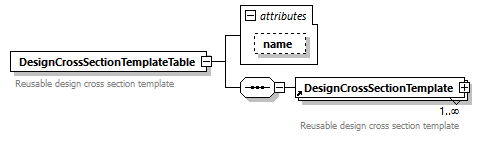 |
||||||||||||
| namespace | http://www.landxml.org/schema/LandXML-2.0 | ||||||||||||
| properties |
|
||||||||||||
| children | DesignCrossSectionTemplate | ||||||||||||
| used by |
|
||||||||||||
| attributes |
|
||||||||||||
| annotation |
|
||||||||||||
| source | <xs:element name="DesignCrossSectionTemplateTable"> <xs:annotation> <xs:documentation>Reusable design cross section template </xs:documentation> </xs:annotation> <xs:complexType> <xs:sequence> <xs:element ref="DesignCrossSectionTemplate" maxOccurs="unbounded"/> </xs:sequence> <xs:attribute name="name" type="xs:string"/> </xs:complexType> </xs:element> |
attribute DesignCrossSectionTemplateTable/@name
| type | xs:string |
| source | <xs:attribute name="name" type="xs:string"/> |
element DesignCrossSectSurf
| diagram | 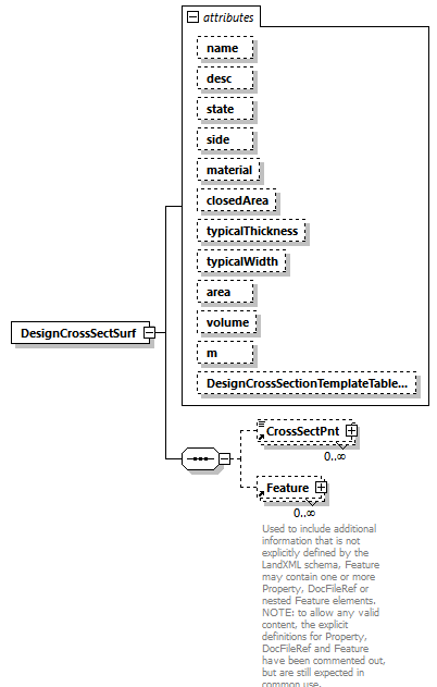 |
||||||||||||||||||||||||||||||||||||||||||||||||||||||||||||||||||||||||||||||
| namespace | http://www.landxml.org/schema/LandXML-2.0 | ||||||||||||||||||||||||||||||||||||||||||||||||||||||||||||||||||||||||||||||
| properties |
|
||||||||||||||||||||||||||||||||||||||||||||||||||||||||||||||||||||||||||||||
| children | CrossSectPnt Feature | ||||||||||||||||||||||||||||||||||||||||||||||||||||||||||||||||||||||||||||||
| used by |
|
||||||||||||||||||||||||||||||||||||||||||||||||||||||||||||||||||||||||||||||
| attributes |
|
||||||||||||||||||||||||||||||||||||||||||||||||||||||||||||||||||||||||||||||
| source | <xs:element name="DesignCrossSectSurf"> <xs:annotation> <xs:documentation/> </xs:annotation> <xs:complexType> <xs:sequence> <xs:element ref="CrossSectPnt" minOccurs="0" maxOccurs="unbounded"/> <xs:element ref="Feature" minOccurs="0" maxOccurs="unbounded"/> </xs:sequence> <xs:attribute name="name" type="xs:string"/> <xs:attribute name="desc" type="xs:string"/> <xs:attribute name="state" type="stateType"/> <xs:attribute name="side" type="sideofRoadType"/> <xs:attribute name="material" type="xs:string"/> <xs:attribute name="closedArea" type="xs:boolean"/> <xs:attribute name="typicalThickness" type="xs:double"/> <xs:attribute name="typicalWidth" type="xs:double"/> <xs:attribute name="area" type="crossSectSurfaceArea"/> <xs:attribute name="volume" type="crossSectSurfaceVolume"/> <xs:attribute name="m" type="materialTableIndexRef"/> <xs:attribute name="DesignCrossSectionTemplateTableIndex" type="DesignCrossSectionTemplateTableIndexRef"/> </xs:complexType> </xs:element> |
attribute DesignCrossSectSurf/@name
| type | xs:string |
| source | <xs:attribute name="name" type="xs:string"/> |
attribute DesignCrossSectSurf/@desc
| type | xs:string |
| source | <xs:attribute name="desc" type="xs:string"/> |
attribute DesignCrossSectSurf/@state
| type | stateType | |||||||||||||||
| facets |
|
|||||||||||||||
| source | <xs:attribute name="state" type="stateType"/> |
attribute DesignCrossSectSurf/@side
| type | sideofRoadType | ||||||||||||
| facets |
|
||||||||||||
| source | <xs:attribute name="side" type="sideofRoadType"/> |
attribute DesignCrossSectSurf/@material
| type | xs:string |
| source | <xs:attribute name="material" type="xs:string"/> |
attribute DesignCrossSectSurf/@closedArea
| type | xs:boolean |
| source | <xs:attribute name="closedArea" type="xs:boolean"/> |
attribute DesignCrossSectSurf/@typicalThickness
| type | xs:double |
| source | <xs:attribute name="typicalThickness" type="xs:double"/> |
attribute DesignCrossSectSurf/@typicalWidth
| type | xs:double |
| source | <xs:attribute name="typicalWidth" type="xs:double"/> |
attribute DesignCrossSectSurf/@area
| type | crossSectSurfaceArea |
| source | <xs:attribute name="area" type="crossSectSurfaceArea"/> |
attribute DesignCrossSectSurf/@volume
| type | crossSectSurfaceVolume |
| source | <xs:attribute name="volume" type="crossSectSurfaceVolume"/> |
attribute DesignCrossSectSurf/@m
| type | materialTableIndexRef |
| source | <xs:attribute name="m" type="materialTableIndexRef"/> |
attribute DesignCrossSectSurf/@DesignCrossSectionTemplateTableIndex
| type | DesignCrossSectionTemplateTableIndexRef |
| source | <xs:attribute name="DesignCrossSectionTemplateTableIndex" type="DesignCrossSectionTemplateTableIndexRef"/> |
element DesignHour
| diagram | 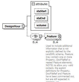 |
||||||||||||||||||||||||
| namespace | http://www.landxml.org/schema/LandXML-2.0 | ||||||||||||||||||||||||
| properties |
|
||||||||||||||||||||||||
| children | Feature | ||||||||||||||||||||||||
| used by |
|
||||||||||||||||||||||||
| attributes |
|
||||||||||||||||||||||||
| source | <xs:element name="DesignHour"> <xs:complexType> <xs:choice minOccurs="0" maxOccurs="unbounded"> <xs:element ref="Feature" minOccurs="0" maxOccurs="unbounded"/> </xs:choice> <xs:attribute name="staStart" type="station"/> <xs:attribute name="staEnd" type="station"/> <xs:attribute name="volume" type="xs:double"/> </xs:complexType> <!-- Design Hour Volume - This item is the design hourly volume (DHV). The 30th highest volume of the year should be used as the DHV, which can be approximated as 15 percent of the average daily traffic (ADT). On two-lane rural highways, the DHV is the total traffic in both directions of travel. The unit of measure for this item is vehicles/hour. --> </xs:element> |
attribute DesignHour/@staStart
| type | station |
| source | <xs:attribute name="staStart" type="station"/> |
attribute DesignHour/@staEnd
| type | station |
| source | <xs:attribute name="staEnd" type="station"/> |
attribute DesignHour/@volume
| type | xs:double |
| source | <xs:attribute name="volume" type="xs:double"/> |
element DesignSpeed
| diagram | 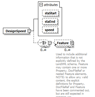 |
||||||||||||||||||||||||
| namespace | http://www.landxml.org/schema/LandXML-2.0 | ||||||||||||||||||||||||
| properties |
|
||||||||||||||||||||||||
| children | Feature | ||||||||||||||||||||||||
| used by |
|
||||||||||||||||||||||||
| attributes |
|
||||||||||||||||||||||||
| source | <xs:element name="DesignSpeed"> <xs:complexType> <xs:choice minOccurs="0" maxOccurs="unbounded"> <xs:element ref="Feature" minOccurs="0" maxOccurs="unbounded"/> </xs:choice> <xs:attribute name="staStart" type="station"/> <xs:attribute name="staEnd" type="station"/> <xs:attribute name="speed" type="speed"/> </xs:complexType> </xs:element> |
attribute DesignSpeed/@staStart
| type | station |
| source | <xs:attribute name="staStart" type="station"/> |
attribute DesignSpeed/@staEnd
| type | station |
| source | <xs:attribute name="staEnd" type="station"/> |
attribute DesignSpeed/@speed
| type | speed |
| source | <xs:attribute name="speed" type="speed"/> |
element DesignSpeed85th
| diagram | 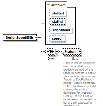 |
||||||||||||||||||||||||||||||
| namespace | http://www.landxml.org/schema/LandXML-2.0 | ||||||||||||||||||||||||||||||
| properties |
|
||||||||||||||||||||||||||||||
| children | Feature | ||||||||||||||||||||||||||||||
| used by |
|
||||||||||||||||||||||||||||||
| attributes |
|
||||||||||||||||||||||||||||||
| source | <xs:element name="DesignSpeed85th"> <xs:complexType> <xs:choice minOccurs="0" maxOccurs="unbounded"> <xs:element ref="Feature" minOccurs="0" maxOccurs="unbounded"/> </xs:choice> <xs:attribute name="staStart" type="station"/> <xs:attribute name="staEnd" type="station"/> <xs:attribute name="sideofRoad" type="sideofRoadType"/> <xs:attribute name="speed" type="speed"/> </xs:complexType> </xs:element> |
attribute DesignSpeed85th/@staStart
| type | station |
| source | <xs:attribute name="staStart" type="station"/> |
attribute DesignSpeed85th/@staEnd
| type | station |
| source | <xs:attribute name="staEnd" type="station"/> |
attribute DesignSpeed85th/@sideofRoad
| type | sideofRoadType | ||||||||||||
| facets |
|
||||||||||||
| source | <xs:attribute name="sideofRoad" type="sideofRoadType"/> |
attribute DesignSpeed85th/@speed
| type | speed |
| source | <xs:attribute name="speed" type="speed"/> |
element Ditch
| diagram | 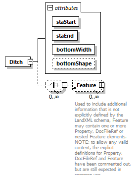 |
||||||||||||||||||||||||||||||
| namespace | http://www.landxml.org/schema/LandXML-2.0 | ||||||||||||||||||||||||||||||
| properties |
|
||||||||||||||||||||||||||||||
| children | Feature | ||||||||||||||||||||||||||||||
| used by |
|
||||||||||||||||||||||||||||||
| attributes |
|
||||||||||||||||||||||||||||||
| source | <xs:element name="Ditch"> <xs:complexType> <xs:choice minOccurs="0" maxOccurs="unbounded"> <xs:element ref="Feature" minOccurs="0" maxOccurs="unbounded"/> </xs:choice> <xs:attribute name="staStart" type="station" use="required"/> <xs:attribute name="staEnd" type="station" use="required"/> <xs:attribute name="bottomWidth" type="xs:double" use="required"/> <xs:attribute name="bottomShape" type="ditchBottomShape"/> </xs:complexType> </xs:element> |
attribute Ditch/@staStart
| type | station | ||
| properties |
|
||
| source | <xs:attribute name="staStart" type="station" use="required"/> |
attribute Ditch/@staEnd
| type | station | ||
| properties |
|
||
| source | <xs:attribute name="staEnd" type="station" use="required"/> |
attribute Ditch/@bottomWidth
| type | xs:double | ||
| properties |
|
||
| source | <xs:attribute name="bottomWidth" type="xs:double" use="required"/> |
attribute Ditch/@bottomShape
| type | ditchBottomShape | |||||||||||||||
| facets |
|
|||||||||||||||
| source | <xs:attribute name="bottomShape" type="ditchBottomShape"/> |
element DitchInlet
| diagram | 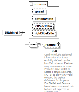 |
||||||||||||||||||||||||||||||
| namespace | http://www.landxml.org/schema/LandXML-2.0 | ||||||||||||||||||||||||||||||
| properties |
|
||||||||||||||||||||||||||||||
| children | Feature | ||||||||||||||||||||||||||||||
| used by |
|
||||||||||||||||||||||||||||||
| attributes |
|
||||||||||||||||||||||||||||||
| source | <xs:element name="DitchInlet"> <xs:annotation> <xs:documentation/> </xs:annotation> <xs:complexType> <xs:sequence> <xs:element ref="Feature" minOccurs="0" maxOccurs="unbounded"/> </xs:sequence> <xs:attribute name="spread" type="xs:double"/> <xs:attribute name="bottomWidth" type="xs:double"/> <xs:attribute name="leftSideRatio" type="xs:double"/> <xs:attribute name="rightSideRatio" type="xs:double"/> </xs:complexType> </xs:element> |
attribute DitchInlet/@spread
| type | xs:double |
| source | <xs:attribute name="spread" type="xs:double"/> |
attribute DitchInlet/@bottomWidth
| type | xs:double |
| source | <xs:attribute name="bottomWidth" type="xs:double"/> |
attribute DitchInlet/@leftSideRatio
| type | xs:double |
| source | <xs:attribute name="leftSideRatio" type="xs:double"/> |
attribute DitchInlet/@rightSideRatio
| type | xs:double |
| source | <xs:attribute name="rightSideRatio" type="xs:double"/> |
element DocFileRef
| diagram | 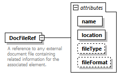 |
||||||||||||||||||||||||||||||
| namespace | http://www.landxml.org/schema/LandXML-2.0 | ||||||||||||||||||||||||||||||
| properties |
|
||||||||||||||||||||||||||||||
| used by |
|
||||||||||||||||||||||||||||||
| attributes |
|
||||||||||||||||||||||||||||||
| annotation |
|
||||||||||||||||||||||||||||||
| source | <xs:element name="DocFileRef"> <xs:annotation> <xs:documentation>A reference to any external document file containing related information for the associated element.</xs:documentation> </xs:annotation> <xs:complexType> <xs:attribute name="name" use="required"/> <xs:attribute name="location" type="xs:anyURI" use="required"/> <xs:attribute name="fileType" type="xs:string"/> <xs:attribute name="fileFormat" type="xs:string"/> </xs:complexType> </xs:element> |
attribute DocFileRef/@name
| properties |
|
||
| source | <xs:attribute name="name" use="required"/> |
attribute DocFileRef/@location
| type | xs:anyURI | ||
| properties |
|
||
| source | <xs:attribute name="location" type="xs:anyURI" use="required"/> |
attribute DocFileRef/@fileType
| type | xs:string |
| source | <xs:attribute name="fileType" type="xs:string"/> |
attribute DocFileRef/@fileFormat
| type | xs:string |
| source | <xs:attribute name="fileFormat" type="xs:string"/> |
element DrivewayDensity
| diagram | 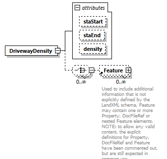 |
||||||||||||||||||||||||
| namespace | http://www.landxml.org/schema/LandXML-2.0 | ||||||||||||||||||||||||
| properties |
|
||||||||||||||||||||||||
| children | Feature | ||||||||||||||||||||||||
| used by |
|
||||||||||||||||||||||||
| attributes |
|
||||||||||||||||||||||||
| source | <xs:element name="DrivewayDensity"> <xs:complexType> <xs:choice minOccurs="0" maxOccurs="unbounded"> <xs:element ref="Feature" minOccurs="0" maxOccurs="unbounded"/> </xs:choice> <xs:attribute name="staStart" type="station"/> <xs:attribute name="staEnd" type="station"/> <xs:attribute name="density" type="xs:int"/> <!-- Driveway Density - Unit of measure: integer. The driveway density for both sides of the roadway combined. The unit of measure for this item is driveways/kilometer (driveways/mile). --> </xs:complexType> </xs:element> |
attribute DrivewayDensity/@staStart
| type | station |
| source | <xs:attribute name="staStart" type="station"/> |
attribute DrivewayDensity/@staEnd
| type | station |
| source | <xs:attribute name="staEnd" type="station"/> |
attribute DrivewayDensity/@density
| type | xs:int |
| source | <xs:attribute name="density" type="xs:int"/> |
element EggPipe
| diagram | 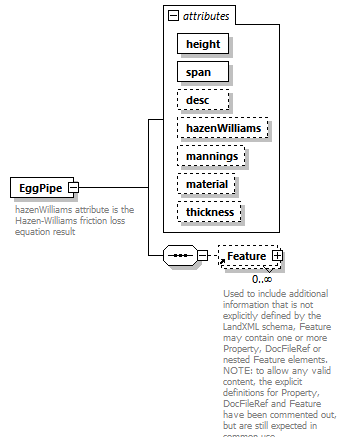 |
||||||||||||||||||||||||||||||||||||||||||||||||
| namespace | http://www.landxml.org/schema/LandXML-2.0 | ||||||||||||||||||||||||||||||||||||||||||||||||
| properties |
|
||||||||||||||||||||||||||||||||||||||||||||||||
| children | Feature | ||||||||||||||||||||||||||||||||||||||||||||||||
| used by |
|
||||||||||||||||||||||||||||||||||||||||||||||||
| attributes |
|
||||||||||||||||||||||||||||||||||||||||||||||||
| annotation |
|
||||||||||||||||||||||||||||||||||||||||||||||||
| source | <xs:element name="EggPipe"> <xs:annotation> <xs:documentation>hazenWilliams attribute is the Hazen-Williams friction loss equation result</xs:documentation> <xs:documentation>mannings attribute is the Mannings coeffecient of roughness</xs:documentation> </xs:annotation> <xs:complexType> <xs:sequence> <xs:element ref="Feature" minOccurs="0" maxOccurs="unbounded"/> </xs:sequence> <xs:attribute name="height" type="xs:double" use="required"/> <xs:attribute name="span" type="xs:double" use="required"/> <xs:attribute name="desc" type="xs:string"/> <xs:attribute name="hazenWilliams" type="xs:double"/> <xs:attribute name="mannings" type="xs:double"/> <xs:attribute name="material" type="pipeMaterialType"/> <xs:attribute name="thickness" type="xs:double"/> </xs:complexType> </xs:element> |
attribute EggPipe/@height
| type | xs:double | ||
| properties |
|
||
| source | <xs:attribute name="height" type="xs:double" use="required"/> |
attribute EggPipe/@span
| type | xs:double | ||
| properties |
|
||
| source | <xs:attribute name="span" type="xs:double" use="required"/> |
attribute EggPipe/@desc
| type | xs:string |
| source | <xs:attribute name="desc" type="xs:string"/> |
attribute EggPipe/@hazenWilliams
| type | xs:double |
| source | <xs:attribute name="hazenWilliams" type="xs:double"/> |
attribute EggPipe/@mannings
| type | xs:double |
| source | <xs:attribute name="mannings" type="xs:double"/> |
attribute EggPipe/@material
| type | pipeMaterialType | ||||||||||||||||||||||||||||||
| facets |
|
||||||||||||||||||||||||||||||
| source | <xs:attribute name="material" type="pipeMaterialType"/> |
attribute EggPipe/@thickness
| type | xs:double |
| source | <xs:attribute name="thickness" type="xs:double"/> |
element ElliPipe
| diagram |  |
||||||||||||||||||||||||||||||||||||||||||||||||
| namespace | http://www.landxml.org/schema/LandXML-2.0 | ||||||||||||||||||||||||||||||||||||||||||||||||
| properties |
|
||||||||||||||||||||||||||||||||||||||||||||||||
| children | Feature | ||||||||||||||||||||||||||||||||||||||||||||||||
| used by |
|
||||||||||||||||||||||||||||||||||||||||||||||||
| attributes |
|
||||||||||||||||||||||||||||||||||||||||||||||||
| annotation |
|
||||||||||||||||||||||||||||||||||||||||||||||||
| source | <xs:element name="ElliPipe"> <xs:annotation> <xs:documentation>hazenWilliams attribute is the Hazen-Williams friction loss equation result</xs:documentation> <xs:documentation>mannings attribute is the Mannings coeffecient of roughness</xs:documentation> </xs:annotation> <xs:complexType> <xs:sequence> <xs:element ref="Feature" minOccurs="0" maxOccurs="unbounded"/> </xs:sequence> <xs:attribute name="height" type="xs:double" use="required"/> <xs:attribute name="span" type="xs:double" use="required"/> <xs:attribute name="desc" type="xs:string"/> <xs:attribute name="hazenWilliams" type="xs:double"/> <xs:attribute name="mannings" type="xs:double"/> <xs:attribute name="material" type="pipeMaterialType"/> <xs:attribute name="thickness" type="xs:double"/> </xs:complexType> </xs:element> |
attribute ElliPipe/@height
| type | xs:double | ||
| properties |
|
||
| source | <xs:attribute name="height" type="xs:double" use="required"/> |
attribute ElliPipe/@span
| type | xs:double | ||
| properties |
|
||
| source | <xs:attribute name="span" type="xs:double" use="required"/> |
attribute ElliPipe/@desc
| type | xs:string |
| source | <xs:attribute name="desc" type="xs:string"/> |
attribute ElliPipe/@hazenWilliams
| type | xs:double |
| source | <xs:attribute name="hazenWilliams" type="xs:double"/> |
attribute ElliPipe/@mannings
| type | xs:double |
| source | <xs:attribute name="mannings" type="xs:double"/> |
attribute ElliPipe/@material
| type | pipeMaterialType | ||||||||||||||||||||||||||||||
| facets |
|
||||||||||||||||||||||||||||||
| source | <xs:attribute name="material" type="pipeMaterialType"/> |
attribute ElliPipe/@thickness
| type | xs:double |
| source | <xs:attribute name="thickness" type="xs:double"/> |
element End
| diagram |  |
||||||||||||||||||||||||||||||||||||||||||||||||||||||||||||||||||||||||||||||||||||||||||||||||||||||||||||||||||||||||
| namespace | http://www.landxml.org/schema/LandXML-2.0 | ||||||||||||||||||||||||||||||||||||||||||||||||||||||||||||||||||||||||||||||||||||||||||||||||||||||||||||||||||||||||
| type | PointType | ||||||||||||||||||||||||||||||||||||||||||||||||||||||||||||||||||||||||||||||||||||||||||||||||||||||||||||||||||||||||
| properties |
|
||||||||||||||||||||||||||||||||||||||||||||||||||||||||||||||||||||||||||||||||||||||||||||||||||||||||||||||||||||||||
| used by |
|
||||||||||||||||||||||||||||||||||||||||||||||||||||||||||||||||||||||||||||||||||||||||||||||||||||||||||||||||||||||||
| facets |
|
||||||||||||||||||||||||||||||||||||||||||||||||||||||||||||||||||||||||||||||||||||||||||||||||||||||||||||||||||||||||
| attributes |
|
||||||||||||||||||||||||||||||||||||||||||||||||||||||||||||||||||||||||||||||||||||||||||||||||||||||||||||||||||||||||
| annotation |
|
||||||||||||||||||||||||||||||||||||||||||||||||||||||||||||||||||||||||||||||||||||||||||||||||||||||||||||||||||||||||
| source | <xs:element name="End" type="PointType"> <xs:annotation> <xs:documentation>Represents a 2D or 3D Ending Point</xs:documentation> <xs:documentation>Defined by either a coordinate text value ("north east" or "north east elev") or a CgPoint number reference "pntRef" attribute.</xs:documentation> </xs:annotation> </xs:element> |
element EndofRunoutSta
| diagram |  |
||||
| namespace | http://www.landxml.org/schema/LandXML-2.0 | ||||
| type | station | ||||
| properties |
|
||||
| used by |
|
||||
| source | <xs:element name="EndofRunoutSta" type="station" nillable="true"/> |
element Equipment
| diagram | 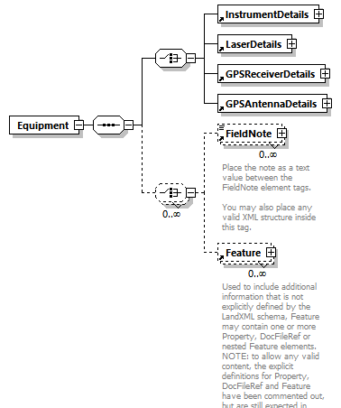 |
||
| namespace | http://www.landxml.org/schema/LandXML-2.0 | ||
| properties |
|
||
| children | InstrumentDetails LaserDetails GPSReceiverDetails GPSAntennaDetails FieldNote Feature | ||
| used by |
|
||
| source | <xs:element name="Equipment"> <xs:annotation> <xs:documentation/> </xs:annotation> <xs:complexType> <xs:sequence> <xs:choice> <xs:element ref="InstrumentDetails"/> <xs:element ref="LaserDetails"/> <xs:element ref="GPSReceiverDetails"/> <xs:element ref="GPSAntennaDetails"/> </xs:choice> <xs:choice minOccurs="0" maxOccurs="unbounded"> <xs:element ref="FieldNote" minOccurs="0" maxOccurs="unbounded"/> <xs:element ref="Feature" minOccurs="0" maxOccurs="unbounded"/> </xs:choice> </xs:sequence> </xs:complexType> </xs:element> |
element Exclusions
| diagram | 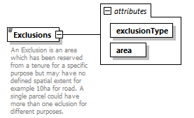 |
||||||||||||||||||
| namespace | http://www.landxml.org/schema/LandXML-2.0 | ||||||||||||||||||
| properties |
|
||||||||||||||||||
| used by |
|
||||||||||||||||||
| attributes |
|
||||||||||||||||||
| annotation |
|
||||||||||||||||||
| source | <xs:element name="Exclusions"> <xs:annotation> <xs:documentation>An Exclusion is an area which has been reserved from a tenure for a specific purpose but may have no defined spatial extent for example 10ha for road. A single parcel could have more than one eclusion for different purposes.</xs:documentation> </xs:annotation> <xs:complexType mixed="true"> <xs:attribute name="exclusionType" type="exclusType" use="required"/> <xs:attribute name="area" type="xs:double" use="required"/> </xs:complexType> </xs:element> |
attribute Exclusions/@exclusionType
| type | exclusType | ||
| properties |
|
||
| source | <xs:attribute name="exclusionType" type="exclusType" use="required"/> |
attribute Exclusions/@area
| type | xs:double | ||
| properties |
|
||
| source | <xs:attribute name="area" type="xs:double" use="required"/> |
element F
| diagram | 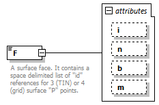 |
||||||||||||||||||||||||||||||
| namespace | http://www.landxml.org/schema/LandXML-2.0 | ||||||||||||||||||||||||||||||
| type | extension of FaceType | ||||||||||||||||||||||||||||||
| properties |
|
||||||||||||||||||||||||||||||
| used by |
|
||||||||||||||||||||||||||||||
| attributes |
|
||||||||||||||||||||||||||||||
| annotation |
|
||||||||||||||||||||||||||||||
| source | <xs:element name="F"> <xs:annotation> <xs:documentation>A surface face. It contains a space delimited list of "id" references for 3 (TIN) or 4 (grid) surface "P" points. </xs:documentation> <xs:documentation>The 3 or 4 numbers represent the vertices on the face. Each number is a reference to the ID value of a surface point "P" for the face coordinates.</xs:documentation> <xs:documentation> Attribute "i" is optional, where a value of "1" indicating the face is part of the triangulation but is invisible. Attribute "n" is optional, space delimited face index values indicating the adjacent face index for each face edge, where a value of "0" (an invalid face index value) indicates the edge has NO neighboring face. The face index value is implied and defined from 1 to n number of F elements in a a single Faces collection. Example: <!-- <Faces> <F>5 10 20</F> Implied face index = 1 <F>5 10 20</F> Implied face index = 2 <F>5 10 20</F> Implied face index = 3 <F n="2 0 3" i="1">10 20 30</F> Implied face index = 4 ... </Faces> --> Where 2 is the neighboring face index for the edge 10 to 20, 0 means no neighbor between 20 and 30 and 3 is the neighbor index for 30 to 10. Attribute “b” is used to indicate the edges of the face that coincide with breakline data. b=an integer bitmask sum of the sides of the face that had breaklines in the original data. This gives a valid integer range of 0 to 7 for each TIN face: 1 = side 1 2 = side 2 4 = side 3 For example b="5" has breakline data on TIN face sides 1 and 3. Attribute "m" is the index value from the SurfaceMaterial table that indicates the material, color and texture for the face. m is the index attribute value for a SurfaceMaterial element in the SurfacematerialTable element. example: <!-- <Faces> <F m="1">5 10 20</F> material index = 1 <F m="2">5 10 20</F> material index = 2 <F m="1">5 10 20</F> material index = 1 --> </xs:documentation> </xs:annotation> <xs:complexType mixed="true"> <xs:simpleContent> <xs:extension base="FaceType"> <xs:attribute name="i" type="xs:integer" use="optional"/> <xs:attribute name="n" type="FaceType" use="optional"/> <xs:attribute name="b" type="xs:positiveInteger" use="optional"/> <xs:attribute name="m" type="materialTableIndexRef" use="optional"/> </xs:extension> </xs:simpleContent> </xs:complexType> </xs:element> |
attribute F/@i
| type | xs:integer | ||
| properties |
|
||
| source | <xs:attribute name="i" type="xs:integer" use="optional"/> |
attribute F/@n
| type | FaceType | ||
| properties |
|
||
| source | <xs:attribute name="n" type="FaceType" use="optional"/> |
attribute F/@b
| type | xs:positiveInteger | ||
| properties |
|
||
| source | <xs:attribute name="b" type="xs:positiveInteger" use="optional"/> |
attribute F/@m
| type | materialTableIndexRef | ||
| properties |
|
||
| source | <xs:attribute name="m" type="materialTableIndexRef" use="optional"/> |
element Faces
| diagram | 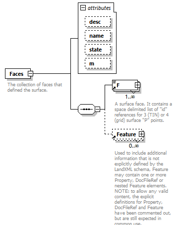 |
||||||||||||||||||||||||||||||
| namespace | http://www.landxml.org/schema/LandXML-2.0 | ||||||||||||||||||||||||||||||
| properties |
|
||||||||||||||||||||||||||||||
| children | F Feature | ||||||||||||||||||||||||||||||
| used by |
|
||||||||||||||||||||||||||||||
| attributes |
|
||||||||||||||||||||||||||||||
| annotation |
|
||||||||||||||||||||||||||||||
| source | <xs:element name="Faces"> <xs:annotation> <xs:documentation>The collection of faces that defined the surface.</xs:documentation> <xs:documentation>The faces are defined by either 3 (TIN) or 4 (grid) points, as indicated by the "surfType" attribute</xs:documentation> <xs:documentation>For the north/east/elev values, each point of the face references a "P"point element point in the SurfPnts collection.</xs:documentation> </xs:annotation> <xs:complexType> <xs:sequence> <xs:element ref="F" maxOccurs="unbounded"/> <xs:element ref="Feature" minOccurs="0" maxOccurs="unbounded"/> </xs:sequence> <xs:attribute name="desc" type="xs:string"/> <xs:attribute name="name" type="xs:string"/> <xs:attribute name="state" type="stateType"/> <xs:attribute name="m" type="materialTableIndexRef" use="optional"/> </xs:complexType> </xs:element> |
attribute Faces/@desc
| type | xs:string |
| source | <xs:attribute name="desc" type="xs:string"/> |
attribute Faces/@name
| type | xs:string |
| source | <xs:attribute name="name" type="xs:string"/> |
attribute Faces/@state
| type | stateType | |||||||||||||||
| facets |
|
|||||||||||||||
| source | <xs:attribute name="state" type="stateType"/> |
attribute Faces/@m
| type | materialTableIndexRef | ||
| properties |
|
||
| source | <xs:attribute name="m" type="materialTableIndexRef" use="optional"/> |
element Feature
| diagram | 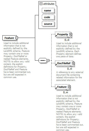 |
||||||||||||||||||||||||
| namespace | http://www.landxml.org/schema/LandXML-2.0 | ||||||||||||||||||||||||
| properties |
|
||||||||||||||||||||||||
| children | Property DocFileRef Feature | ||||||||||||||||||||||||
| used by | |||||||||||||||||||||||||
| attributes |
|
||||||||||||||||||||||||
| annotation |
|
||||||||||||||||||||||||
| source | <xs:element name="Feature"> <xs:annotation> <xs:documentation>Used to include additional information that is not explicitly defined by the LandXML schema, Feature may contain one or more Property, DocFileRef or nested Feature elements. NOTE: to allow any valid content, the explicit definitions for Property, DocFileRef and Feature have been commented out, but are still expected in common use.</xs:documentation> <xs:documentation>Each Property element defines one piece of data.</xs:documentation> </xs:annotation> <xs:complexType> <xs:sequence> <xs:element ref="Property" minOccurs="0" maxOccurs="unbounded"/> <xs:element ref="DocFileRef" minOccurs="0" maxOccurs="unbounded"/> <xs:element ref="Feature" minOccurs="0" maxOccurs="unbounded"/> <!-- <xs:any namespace="##any" processContents="skip" minOccurs="0" maxOccurs="unbounded"/> --> </xs:sequence> <xs:attribute name="name" type="xs:string" use="optional"/> <xs:attribute name="code" type="xs:string"/> <xs:attribute name="source" use="optional"/> </xs:complexType> </xs:element> |
attribute Feature/@name
| type | xs:string | ||
| properties |
|
||
| source | <xs:attribute name="name" type="xs:string" use="optional"/> |
attribute Feature/@code
| type | xs:string |
| source | <xs:attribute name="code" type="xs:string"/> |
attribute Feature/@source
| properties |
|
||
| source | <xs:attribute name="source" use="optional"/> |
element FeatureDictionary
| diagram | 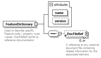 |
||||||||||||||||||
| namespace | http://www.landxml.org/schema/LandXML-2.0 | ||||||||||||||||||
| properties |
|
||||||||||||||||||
| children | DocFileRef | ||||||||||||||||||
| used by |
|
||||||||||||||||||
| attributes |
|
||||||||||||||||||
| annotation |
|
||||||||||||||||||
| source | <xs:element name="FeatureDictionary"> <xs:annotation> <xs:documentation>Used to describe specific Feature code / property type values. DocFileRef points to reference documentation</xs:documentation> <xs:documentation>Each Property element defines one piece of data.</xs:documentation> </xs:annotation> <xs:complexType> <xs:sequence> <xs:element ref="DocFileRef" minOccurs="0" maxOccurs="unbounded"/> </xs:sequence> <xs:attribute name="name" type="xs:string" use="required"/> <xs:attribute name="version" type="xs:string" use="optional"/> </xs:complexType> </xs:element> |
attribute FeatureDictionary/@name
| type | xs:string | ||
| properties |
|
||
| source | <xs:attribute name="name" type="xs:string" use="required"/> |
attribute FeatureDictionary/@version
| type | xs:string | ||
| properties |
|
||
| source | <xs:attribute name="version" type="xs:string" use="optional"/> |
element FieldNote
| diagram |  |
||||
| namespace | http://www.landxml.org/schema/LandXML-2.0 | ||||
| properties |
|
||||
| used by | |||||
| annotation |
|
||||
| source | <xs:element name="FieldNote"> <xs:annotation> <xs:documentation>Place the note as a text value between the FieldNote element tags. You may also place any valid XML structure inside this tag.</xs:documentation> </xs:annotation> <xs:complexType mixed="true"> <xs:choice maxOccurs="unbounded"> <xs:any namespace="##other" processContents="skip" minOccurs="0"/> </xs:choice> </xs:complexType> </xs:element> |
element Flowline
| diagram | 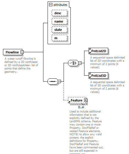 |
||||||||||||||||||||||||||||||
| namespace | http://www.landxml.org/schema/LandXML-2.0 | ||||||||||||||||||||||||||||||
| properties |
|
||||||||||||||||||||||||||||||
| children | PntList2D PntList3D Feature | ||||||||||||||||||||||||||||||
| used by |
|
||||||||||||||||||||||||||||||
| attributes |
|
||||||||||||||||||||||||||||||
| annotation |
|
||||||||||||||||||||||||||||||
| source | <xs:element name="Flowline"> <xs:annotation> <xs:documentation>A water runoff flowline is defined by a 2D north/east or 3D north/east/elev list of points that define the geometry.</xs:documentation> <xs:documentation>is identified by the "name" attribute.</xs:documentation> </xs:annotation> <xs:complexType> <xs:sequence> <xs:choice> <xs:element ref="PntList2D"/> <xs:element ref="PntList3D"/> <!-- Here PntList2D represents 2D planametric coordinate pairs expressed as space delimited Northing Easting pairs. --> </xs:choice> <xs:element ref="Feature" minOccurs="0" maxOccurs="unbounded"/> </xs:sequence> <xs:attribute name="desc" type="xs:string"/> <xs:attribute name="name" type="xs:string"/> <xs:attribute name="state" type="stateType"/> <xs:attribute name="m" type="materialTableIndexRef" use="optional"/> </xs:complexType> </xs:element> |
attribute Flowline/@desc
| type | xs:string |
| source | <xs:attribute name="desc" type="xs:string"/> |
attribute Flowline/@name
| type | xs:string |
| source | <xs:attribute name="name" type="xs:string"/> |
attribute Flowline/@state
| type | stateType | |||||||||||||||
| facets |
|
|||||||||||||||
| source | <xs:attribute name="state" type="stateType"/> |
attribute Flowline/@m
| type | materialTableIndexRef | ||
| properties |
|
||
| source | <xs:attribute name="m" type="materialTableIndexRef" use="optional"/> |
element Flowlines
| diagram |  |
||||||||||||
| namespace | http://www.landxml.org/schema/LandXML-2.0 | ||||||||||||
| properties |
|
||||||||||||
| children | Flowline | ||||||||||||
| used by |
|
||||||||||||
| attributes |
|
||||||||||||
| annotation |
|
||||||||||||
| source | <xs:element name="Flowlines"> <xs:annotation> <xs:documentation>The collection of water runoff Flowlines calculated for the associated surface.</xs:documentation> <xs:documentation>Use is optional.</xs:documentation> </xs:annotation> <xs:complexType> <xs:sequence> <xs:element ref="Flowline" minOccurs="0" maxOccurs="unbounded"/> </xs:sequence> <xs:attribute name="m" type="materialTableIndexRef" use="optional"/> </xs:complexType> </xs:element> |
attribute Flowlines/@m
| type | materialTableIndexRef | ||
| properties |
|
||
| source | <xs:attribute name="m" type="materialTableIndexRef" use="optional"/> |
element FullSuperelev
| diagram |  |
||
| namespace | http://www.landxml.org/schema/LandXML-2.0 | ||
| type | slope | ||
| properties |
|
||
| used by |
|
||
| source | <xs:element name="FullSuperelev" type="slope"/> |
element FullSuperSta
| diagram |  |
||
| namespace | http://www.landxml.org/schema/LandXML-2.0 | ||
| type | station | ||
| properties |
|
||
| used by |
|
||
| source | <xs:element name="FullSuperSta" type="station"/> |
element GPSAntennaDetails
| diagram |  |
||||||||||||||||||||||||||||||||||||||||||||||||||||||||||||
| namespace | http://www.landxml.org/schema/LandXML-2.0 | ||||||||||||||||||||||||||||||||||||||||||||||||||||||||||||
| properties |
|
||||||||||||||||||||||||||||||||||||||||||||||||||||||||||||
| children | Monument FieldNote Feature | ||||||||||||||||||||||||||||||||||||||||||||||||||||||||||||
| used by |
|
||||||||||||||||||||||||||||||||||||||||||||||||||||||||||||
| attributes |
|
||||||||||||||||||||||||||||||||||||||||||||||||||||||||||||
| source | <xs:element name="GPSAntennaDetails"> <xs:annotation> <xs:documentation/> </xs:annotation> <xs:complexType> <xs:sequence> <xs:choice minOccurs="0" maxOccurs="unbounded"> <xs:element ref="Monument" minOccurs="0" maxOccurs="unbounded"/> <xs:element ref="FieldNote" minOccurs="0" maxOccurs="unbounded"/> <xs:element ref="Feature" minOccurs="0" maxOccurs="unbounded"/> </xs:choice> </xs:sequence> <xs:attribute name="id" type="xs:ID" use="required"/> <xs:attribute name="manufacturer" type="xs:string"/> <xs:attribute name="model" type="xs:string"/> <xs:attribute name="serialNumber" type="xs:string"/> <xs:attribute name="latitude" type="xs:double"/> <xs:attribute name="longitude" type="xs:double"/> <xs:attribute name="altitude" type="xs:double"/> <xs:attribute name="ellipsiodalHeight" type="xs:double"/> <xs:attribute name="orthometricHeight" type="xs:double"/> </xs:complexType> </xs:element> |
attribute GPSAntennaDetails/@id
| type | xs:ID | ||
| properties |
|
||
| source | <xs:attribute name="id" type="xs:ID" use="required"/> |
attribute GPSAntennaDetails/@manufacturer
| type | xs:string |
| source | <xs:attribute name="manufacturer" type="xs:string"/> |
attribute GPSAntennaDetails/@model
| type | xs:string |
| source | <xs:attribute name="model" type="xs:string"/> |
attribute GPSAntennaDetails/@serialNumber
| type | xs:string |
| source | <xs:attribute name="serialNumber" type="xs:string"/> |
attribute GPSAntennaDetails/@latitude
| type | xs:double |
| source | <xs:attribute name="latitude" type="xs:double"/> |
attribute GPSAntennaDetails/@longitude
| type | xs:double |
| source | <xs:attribute name="longitude" type="xs:double"/> |
attribute GPSAntennaDetails/@altitude
| type | xs:double |
| source | <xs:attribute name="altitude" type="xs:double"/> |
attribute GPSAntennaDetails/@ellipsiodalHeight
| type | xs:double |
| source | <xs:attribute name="ellipsiodalHeight" type="xs:double"/> |
attribute GPSAntennaDetails/@orthometricHeight
| type | xs:double |
| source | <xs:attribute name="orthometricHeight" type="xs:double"/> |
element GPSPosition
| diagram |  |
||||||||||||||||||||||||||||||||||||||||||||||||||||||
| namespace | http://www.landxml.org/schema/LandXML-2.0 | ||||||||||||||||||||||||||||||||||||||||||||||||||||||
| properties |
|
||||||||||||||||||||||||||||||||||||||||||||||||||||||
| children | TargetPoint GPSQCInfoLevel1 GPSQCInfoLevel2 FieldNote Feature | ||||||||||||||||||||||||||||||||||||||||||||||||||||||
| used by |
|
||||||||||||||||||||||||||||||||||||||||||||||||||||||
| attributes |
|
||||||||||||||||||||||||||||||||||||||||||||||||||||||
| source | <xs:element name="GPSPosition"> <xs:annotation> <xs:documentation/> </xs:annotation> <xs:complexType> <xs:sequence> <xs:element ref="TargetPoint"/> <xs:element ref="GPSQCInfoLevel1" minOccurs="0"/> <xs:element ref="GPSQCInfoLevel2" minOccurs="0"/> <xs:choice minOccurs="0" maxOccurs="unbounded"> <xs:element ref="FieldNote" minOccurs="0" maxOccurs="unbounded"/> <xs:element ref="Feature" minOccurs="0" maxOccurs="unbounded"/> </xs:choice> </xs:sequence> <xs:attribute name="setupID" type="xs:IDREF"/> <xs:attribute name="setID"/> <xs:attribute name="wgsHeight" type="xs:double" use="required"/> <xs:attribute name="wgsLatitude" type="xs:double" use="required"/> <xs:attribute name="wgsLongitude" type="xs:double" use="required"/> <xs:attribute name="purpose"/> <xs:attribute name="coordGeomRefs" type="coordGeomNameRefs"/> <xs:attribute name="pntRef" type="pointNameRef"/> <!-- coordGeomRefs identifies one or more 'name' values that link to specific <Line>, <Curve>, <Spiral> or <IrregularLine> in a <CoordGeom> element. This allows linking an survey observation to specific <Parcel>.<CoordGeom> based geometry. --> </xs:complexType> </xs:element> |
attribute GPSPosition/@setupID
| type | xs:IDREF |
| source | <xs:attribute name="setupID" type="xs:IDREF"/> |
attribute GPSPosition/@setID
| source | <xs:attribute name="setID"/> |
attribute GPSPosition/@wgsHeight
| type | xs:double | ||
| properties |
|
||
| source | <xs:attribute name="wgsHeight" type="xs:double" use="required"/> |
attribute GPSPosition/@wgsLatitude
| type | xs:double | ||
| properties |
|
||
| source | <xs:attribute name="wgsLatitude" type="xs:double" use="required"/> |
attribute GPSPosition/@wgsLongitude
| type | xs:double | ||
| properties |
|
||
| source | <xs:attribute name="wgsLongitude" type="xs:double" use="required"/> |
attribute GPSPosition/@purpose
| source | <xs:attribute name="purpose"/> |
attribute GPSPosition/@coordGeomRefs
| type | coordGeomNameRefs |
| source | <xs:attribute name="coordGeomRefs" type="coordGeomNameRefs"/> |
attribute GPSPosition/@pntRef
| type | pointNameRef |
| source | <xs:attribute name="pntRef" type="pointNameRef"/> |
element GPSQCInfoLevel1
| diagram | 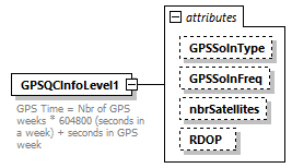 |
||||||||||||||||||||||||||||||
| namespace | http://www.landxml.org/schema/LandXML-2.0 | ||||||||||||||||||||||||||||||
| properties |
|
||||||||||||||||||||||||||||||
| used by |
|
||||||||||||||||||||||||||||||
| attributes |
|
||||||||||||||||||||||||||||||
| annotation |
|
||||||||||||||||||||||||||||||
| source | <xs:element name="GPSQCInfoLevel1"> <xs:annotation> <xs:documentation>GPS Time = Nbr of GPS weeks * 604800 (seconds in a week) + seconds in GPS week </xs:documentation> </xs:annotation> <xs:complexType> <xs:attribute name="GPSSolnType" type="GPSSolutionTypeEnum"/> <xs:attribute name="GPSSolnFreq" type="GPSSolutionFrequencyEnum"/> <xs:attribute name="nbrSatellites" type="xs:integer"/> <xs:attribute name="RDOP" type="xs:double"/> </xs:complexType> </xs:element> |
attribute GPSQCInfoLevel1/@GPSSolnType
| type | GPSSolutionTypeEnum | |||||||||||||||||||||||||||
| facets |
|
|||||||||||||||||||||||||||
| source | <xs:attribute name="GPSSolnType" type="GPSSolutionTypeEnum"/> |
attribute GPSQCInfoLevel1/@GPSSolnFreq
| type | GPSSolutionFrequencyEnum | ||||||||||||||||||||||||
| facets |
|
||||||||||||||||||||||||
| source | <xs:attribute name="GPSSolnFreq" type="GPSSolutionFrequencyEnum"/> |
attribute GPSQCInfoLevel1/@nbrSatellites
| type | xs:integer |
| source | <xs:attribute name="nbrSatellites" type="xs:integer"/> |
attribute GPSQCInfoLevel1/@RDOP
| type | xs:double |
| source | <xs:attribute name="RDOP" type="xs:double"/> |
element GPSQCInfoLevel2
| diagram | 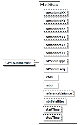 |
||||||||||||||||||||||||||||||||||||||||||||||||||||||||||||||||||||||||||||||||||||||||||
| namespace | http://www.landxml.org/schema/LandXML-2.0 | ||||||||||||||||||||||||||||||||||||||||||||||||||||||||||||||||||||||||||||||||||||||||||
| properties |
|
||||||||||||||||||||||||||||||||||||||||||||||||||||||||||||||||||||||||||||||||||||||||||
| used by |
|
||||||||||||||||||||||||||||||||||||||||||||||||||||||||||||||||||||||||||||||||||||||||||
| attributes |
|
||||||||||||||||||||||||||||||||||||||||||||||||||||||||||||||||||||||||||||||||||||||||||
| source | <xs:element name="GPSQCInfoLevel2"> <xs:annotation> <xs:documentation/> </xs:annotation> <xs:complexType> <xs:attribute name="covarianceXX" type="xs:double"/> <xs:attribute name="covarianceXY" type="xs:double"/> <xs:attribute name="covarianceXZ" type="xs:double"/> <xs:attribute name="covarianceYY" type="xs:double"/> <xs:attribute name="covarianceYZ" type="xs:double"/> <xs:attribute name="covarianceZZ" type="xs:double"/> <xs:attribute name="GPSSolnType" type="GPSSolutionTypeEnum"/> <xs:attribute name="GPSSolnFreq" type="GPSSolutionFrequencyEnum"/> <xs:attribute name="RMS" type="xs:double"/> <xs:attribute name="ratio" type="xs:double"/> <xs:attribute name="referenceVariance" type="xs:double"/> <xs:attribute name="nbrSatellites" type="xs:integer"/> <xs:attribute name="startTime" type="GPSTime"/> <xs:attribute name="stopTime" type="GPSTime"/> <!-- GPS Time = Nbr of GPS weeks * 604800 (seconds in a week) + seconds in GPS week --> </xs:complexType> </xs:element> |
attribute GPSQCInfoLevel2/@covarianceXX
| type | xs:double |
| source | <xs:attribute name="covarianceXX" type="xs:double"/> |
attribute GPSQCInfoLevel2/@covarianceXY
| type | xs:double |
| source | <xs:attribute name="covarianceXY" type="xs:double"/> |
attribute GPSQCInfoLevel2/@covarianceXZ
| type | xs:double |
| source | <xs:attribute name="covarianceXZ" type="xs:double"/> |
attribute GPSQCInfoLevel2/@covarianceYY
| type | xs:double |
| source | <xs:attribute name="covarianceYY" type="xs:double"/> |
attribute GPSQCInfoLevel2/@covarianceYZ
| type | xs:double |
| source | <xs:attribute name="covarianceYZ" type="xs:double"/> |
attribute GPSQCInfoLevel2/@covarianceZZ
| type | xs:double |
| source | <xs:attribute name="covarianceZZ" type="xs:double"/> |
attribute GPSQCInfoLevel2/@GPSSolnType
| type | GPSSolutionTypeEnum | |||||||||||||||||||||||||||
| facets |
|
|||||||||||||||||||||||||||
| source | <xs:attribute name="GPSSolnType" type="GPSSolutionTypeEnum"/> |
attribute GPSQCInfoLevel2/@GPSSolnFreq
| type | GPSSolutionFrequencyEnum | ||||||||||||||||||||||||
| facets |
|
||||||||||||||||||||||||
| source | <xs:attribute name="GPSSolnFreq" type="GPSSolutionFrequencyEnum"/> |
attribute GPSQCInfoLevel2/@RMS
| type | xs:double |
| source | <xs:attribute name="RMS" type="xs:double"/> |
attribute GPSQCInfoLevel2/@ratio
| type | xs:double |
| source | <xs:attribute name="ratio" type="xs:double"/> |
attribute GPSQCInfoLevel2/@referenceVariance
| type | xs:double |
| source | <xs:attribute name="referenceVariance" type="xs:double"/> |
attribute GPSQCInfoLevel2/@nbrSatellites
| type | xs:integer |
| source | <xs:attribute name="nbrSatellites" type="xs:integer"/> |
attribute GPSQCInfoLevel2/@startTime
| type | GPSTime |
| source | <xs:attribute name="startTime" type="GPSTime"/> |
attribute GPSQCInfoLevel2/@stopTime
| type | GPSTime |
| source | <xs:attribute name="stopTime" type="GPSTime"/> |
element GPSReceiverDetails
| diagram | 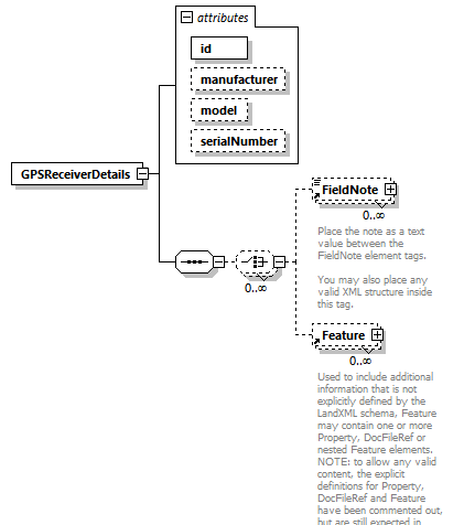 |
||||||||||||||||||||||||||||||
| namespace | http://www.landxml.org/schema/LandXML-2.0 | ||||||||||||||||||||||||||||||
| properties |
|
||||||||||||||||||||||||||||||
| children | FieldNote Feature | ||||||||||||||||||||||||||||||
| used by |
|
||||||||||||||||||||||||||||||
| attributes |
|
||||||||||||||||||||||||||||||
| source | <xs:element name="GPSReceiverDetails"> <xs:annotation> <xs:documentation/> </xs:annotation> <xs:complexType> <xs:sequence> <xs:choice minOccurs="0" maxOccurs="unbounded"> <xs:element ref="FieldNote" minOccurs="0" maxOccurs="unbounded"/> <xs:element ref="Feature" minOccurs="0" maxOccurs="unbounded"/> </xs:choice> </xs:sequence> <xs:attribute name="id" type="xs:ID" use="required"/> <xs:attribute name="manufacturer" type="xs:string"/> <xs:attribute name="model" type="xs:string"/> <xs:attribute name="serialNumber" type="xs:string"/> </xs:complexType> </xs:element> |
attribute GPSReceiverDetails/@id
| type | xs:ID | ||
| properties |
|
||
| source | <xs:attribute name="id" type="xs:ID" use="required"/> |
attribute GPSReceiverDetails/@manufacturer
| type | xs:string |
| source | <xs:attribute name="manufacturer" type="xs:string"/> |
attribute GPSReceiverDetails/@model
| type | xs:string |
| source | <xs:attribute name="model" type="xs:string"/> |
attribute GPSReceiverDetails/@serialNumber
| type | xs:string |
| source | <xs:attribute name="serialNumber" type="xs:string"/> |
element GPSSetup
| diagram | 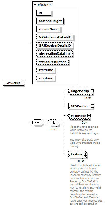 |
||||||||||||||||||||||||||||||||||||||||||||||||||||||||||||
| namespace | http://www.landxml.org/schema/LandXML-2.0 | ||||||||||||||||||||||||||||||||||||||||||||||||||||||||||||
| properties |
|
||||||||||||||||||||||||||||||||||||||||||||||||||||||||||||
| children | TargetSetup GPSPosition FieldNote Feature | ||||||||||||||||||||||||||||||||||||||||||||||||||||||||||||
| used by |
|
||||||||||||||||||||||||||||||||||||||||||||||||||||||||||||
| attributes |
|
||||||||||||||||||||||||||||||||||||||||||||||||||||||||||||
| source | <xs:element name="GPSSetup"> <xs:annotation> <xs:documentation/> </xs:annotation> <xs:complexType> <xs:sequence> <xs:choice minOccurs="0" maxOccurs="unbounded"> <xs:element ref="TargetSetup" minOccurs="0" maxOccurs="unbounded"/> <xs:element ref="GPSPosition"/> <xs:element ref="FieldNote" minOccurs="0" maxOccurs="unbounded"/> <xs:element ref="Feature" minOccurs="0" maxOccurs="unbounded"/> </xs:choice> </xs:sequence> <xs:attribute name="id" type="xs:ID" use="required"/> <xs:attribute name="antennaHeight" type="xs:double" use="required"/> <xs:attribute name="stationName" use="required"/> <xs:attribute name="GPSAntennaDetailsID" type="xs:IDREF"/> <xs:attribute name="GPSReceiverDetailsID" type="xs:IDREF"/> <xs:attribute name="observationDataLink"/> <xs:attribute name="stationDescription"/> <xs:attribute name="startTime" type="GPSTime"/> <xs:attribute name="stopTime" type="GPSTime"/> <!-- GPS Time = Nbr of GPS weeks * 604800 (seconds in a week) + seconds in GPS week --> </xs:complexType> </xs:element> |
attribute GPSSetup/@id
| type | xs:ID | ||
| properties |
|
||
| source | <xs:attribute name="id" type="xs:ID" use="required"/> |
attribute GPSSetup/@antennaHeight
| type | xs:double | ||
| properties |
|
||
| source | <xs:attribute name="antennaHeight" type="xs:double" use="required"/> |
attribute GPSSetup/@stationName
| properties |
|
||
| source | <xs:attribute name="stationName" use="required"/> |
attribute GPSSetup/@GPSAntennaDetailsID
| type | xs:IDREF |
| source | <xs:attribute name="GPSAntennaDetailsID" type="xs:IDREF"/> |
attribute GPSSetup/@GPSReceiverDetailsID
| type | xs:IDREF |
| source | <xs:attribute name="GPSReceiverDetailsID" type="xs:IDREF"/> |
attribute GPSSetup/@observationDataLink
| source | <xs:attribute name="observationDataLink"/> |
attribute GPSSetup/@stationDescription
| source | <xs:attribute name="stationDescription"/> |
attribute GPSSetup/@startTime
| type | GPSTime |
| source | <xs:attribute name="startTime" type="GPSTime"/> |
attribute GPSSetup/@stopTime
| type | GPSTime |
| source | <xs:attribute name="stopTime" type="GPSTime"/> |
element GPSVector
| diagram | 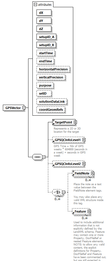 |
||||||||||||||||||||||||||||||||||||||||||||||||||||||||||||||||||||||||||||||||||||
| namespace | http://www.landxml.org/schema/LandXML-2.0 | ||||||||||||||||||||||||||||||||||||||||||||||||||||||||||||||||||||||||||||||||||||
| properties |
|
||||||||||||||||||||||||||||||||||||||||||||||||||||||||||||||||||||||||||||||||||||
| children | TargetPoint GPSQCInfoLevel1 GPSQCInfoLevel2 FieldNote Feature | ||||||||||||||||||||||||||||||||||||||||||||||||||||||||||||||||||||||||||||||||||||
| used by |
|
||||||||||||||||||||||||||||||||||||||||||||||||||||||||||||||||||||||||||||||||||||
| attributes |
|
||||||||||||||||||||||||||||||||||||||||||||||||||||||||||||||||||||||||||||||||||||
| source | <xs:element name="GPSVector"> <xs:annotation> <xs:documentation/> </xs:annotation> <xs:complexType> <xs:sequence> <xs:element ref="TargetPoint"/> <xs:element ref="GPSQCInfoLevel1" minOccurs="0"/> <xs:element ref="GPSQCInfoLevel2" minOccurs="0"/> <xs:choice minOccurs="0" maxOccurs="unbounded"> <xs:element ref="FieldNote" minOccurs="0" maxOccurs="unbounded"/> <xs:element ref="Feature" minOccurs="0" maxOccurs="unbounded"/> </xs:choice> </xs:sequence> <xs:attribute name="dX" type="xs:double" use="required"/> <xs:attribute name="dY" type="xs:double" use="required"/> <xs:attribute name="dZ" type="xs:double" use="required"/> <xs:attribute name="setupID_A" type="xs:IDREF" use="required"/> <xs:attribute name="setupID_B" type="xs:IDREF" use="required"/> <xs:attribute name="startTime" type="xs:dateTime" use="optional"/> <xs:attribute name="endTime" type="xs:dateTime" use="optional"/> <xs:attribute name="horizontalPrecision" type="xs:double" use="optional"/> <xs:attribute name="verticalPrecision" type="xs:double" use="optional"/> <xs:attribute name="purpose" type="purposeType"/> <xs:attribute name="setID"/> <xs:attribute name="solutionDataLink"/> <xs:attribute name="coordGeomRefs" type="coordGeomNameRefs"/> <!-- coordGeomRefs identifies one or more 'name' values that link to specific <Line>, <Curve>, <Spiral> or <IrregularLine> in a <CoordGeom> element. This allows linking an survey observation to specific <Parcel>.<CoordGeom> based geometry. --> </xs:complexType> </xs:element> |
attribute GPSVector/@dX
| type | xs:double | ||
| properties |
|
||
| source | <xs:attribute name="dX" type="xs:double" use="required"/> |
attribute GPSVector/@dY
| type | xs:double | ||
| properties |
|
||
| source | <xs:attribute name="dY" type="xs:double" use="required"/> |
attribute GPSVector/@dZ
| type | xs:double | ||
| properties |
|
||
| source | <xs:attribute name="dZ" type="xs:double" use="required"/> |
attribute GPSVector/@setupID_A
| type | xs:IDREF | ||
| properties |
|
||
| source | <xs:attribute name="setupID_A" type="xs:IDREF" use="required"/> |
attribute GPSVector/@setupID_B
| type | xs:IDREF | ||
| properties |
|
||
| source | <xs:attribute name="setupID_B" type="xs:IDREF" use="required"/> |
attribute GPSVector/@startTime
| type | xs:dateTime | ||
| properties |
|
||
| source | <xs:attribute name="startTime" type="xs:dateTime" use="optional"/> |
attribute GPSVector/@endTime
| type | xs:dateTime | ||
| properties |
|
||
| source | <xs:attribute name="endTime" type="xs:dateTime" use="optional"/> |
attribute GPSVector/@horizontalPrecision
| type | xs:double | ||
| properties |
|
||
| source | <xs:attribute name="horizontalPrecision" type="xs:double" use="optional"/> |
attribute GPSVector/@verticalPrecision
| type | xs:double | ||
| properties |
|
||
| source | <xs:attribute name="verticalPrecision" type="xs:double" use="optional"/> |
attribute GPSVector/@purpose
| type | purposeType | |||||||||||||||||||||||||||||||||||||||||||||
| facets |
|
|||||||||||||||||||||||||||||||||||||||||||||
| source | <xs:attribute name="purpose" type="purposeType"/> |
attribute GPSVector/@setID
| source | <xs:attribute name="setID"/> |
attribute GPSVector/@solutionDataLink
| source | <xs:attribute name="solutionDataLink"/> |
attribute GPSVector/@coordGeomRefs
| type | coordGeomNameRefs |
| source | <xs:attribute name="coordGeomRefs" type="coordGeomNameRefs"/> |
element GradeModel
| diagram | 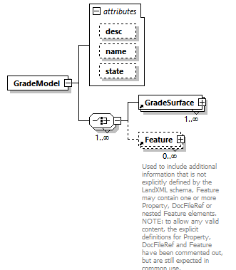 |
||||||||||||||||||||||||
| namespace | http://www.landxml.org/schema/LandXML-2.0 | ||||||||||||||||||||||||
| properties |
|
||||||||||||||||||||||||
| children | GradeSurface Feature | ||||||||||||||||||||||||
| used by |
|
||||||||||||||||||||||||
| attributes |
|
||||||||||||||||||||||||
| source | <xs:element name="GradeModel"> <xs:complexType> <xs:choice maxOccurs="unbounded"> <xs:element ref="GradeSurface" maxOccurs="unbounded"/> <xs:element ref="Feature" minOccurs="0" maxOccurs="unbounded"/> </xs:choice> <xs:attribute name="desc" type="xs:string"/> <xs:attribute name="name" type="xs:string"/> <xs:attribute name="state" type="stateType"/> </xs:complexType> </xs:element> |
attribute GradeModel/@desc
| type | xs:string |
| source | <xs:attribute name="desc" type="xs:string"/> |
attribute GradeModel/@name
| type | xs:string |
| source | <xs:attribute name="name" type="xs:string"/> |
attribute GradeModel/@state
| type | stateType | |||||||||||||||
| facets |
|
|||||||||||||||
| source | <xs:attribute name="state" type="stateType"/> |
element GradeSurface
| diagram | 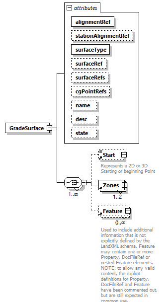 |
||||||||||||||||||||||||||||||||||||||||||||||||||||||||||||
| namespace | http://www.landxml.org/schema/LandXML-2.0 | ||||||||||||||||||||||||||||||||||||||||||||||||||||||||||||
| properties |
|
||||||||||||||||||||||||||||||||||||||||||||||||||||||||||||
| children | Start Zones Feature | ||||||||||||||||||||||||||||||||||||||||||||||||||||||||||||
| used by |
|
||||||||||||||||||||||||||||||||||||||||||||||||||||||||||||
| attributes |
|
||||||||||||||||||||||||||||||||||||||||||||||||||||||||||||
| source | <xs:element name="GradeSurface"> <xs:complexType> <xs:choice maxOccurs="unbounded"> <xs:element ref="Start" minOccurs="0"/> <xs:element ref="Zones" maxOccurs="2"/> <xs:element ref="Feature" minOccurs="0" maxOccurs="unbounded"/> </xs:choice> <xs:attribute name="alignmentRef" type="alignmentNameRef" use="required"/> <xs:attribute name="stationAlignmentRef" type="alignmentNameRef"/> <xs:attribute name="surfaceType" type="zoneSurfaceType" use="required"/> <xs:attribute name="surfaceRef" type="surfaceNameRef"/> <xs:attribute name="surfaceRefs" type="xs:IDREFS"/> <xs:attribute name="cgPointRefs" type="pointNameRefs"/> <xs:attribute name="name" type="xs:string"/> <xs:attribute name="desc" type="xs:string"/> <xs:attribute name="state" type="stateType"/> </xs:complexType> </xs:element> |
attribute GradeSurface/@alignmentRef
| type | alignmentNameRef | ||
| properties |
|
||
| source | <xs:attribute name="alignmentRef" type="alignmentNameRef" use="required"/> |
attribute GradeSurface/@stationAlignmentRef
| type | alignmentNameRef |
| source | <xs:attribute name="stationAlignmentRef" type="alignmentNameRef"/> |
attribute GradeSurface/@surfaceType
| type | zoneSurfaceType | |||||||||
| properties |
|
|||||||||
| facets |
|
|||||||||
| source | <xs:attribute name="surfaceType" type="zoneSurfaceType" use="required"/> |
attribute GradeSurface/@surfaceRef
| type | surfaceNameRef |
| source | <xs:attribute name="surfaceRef" type="surfaceNameRef"/> |
attribute GradeSurface/@surfaceRefs
| type | xs:IDREFS |
| source | <xs:attribute name="surfaceRefs" type="xs:IDREFS"/> |
attribute GradeSurface/@cgPointRefs
| type | pointNameRefs |
| source | <xs:attribute name="cgPointRefs" type="pointNameRefs"/> |
attribute GradeSurface/@name
| type | xs:string |
| source | <xs:attribute name="name" type="xs:string"/> |
attribute GradeSurface/@desc
| type | xs:string |
| source | <xs:attribute name="desc" type="xs:string"/> |
attribute GradeSurface/@state
| type | stateType | |||||||||||||||
| facets |
|
|||||||||||||||
| source | <xs:attribute name="state" type="stateType"/> |
element GrateInlet
| diagram | 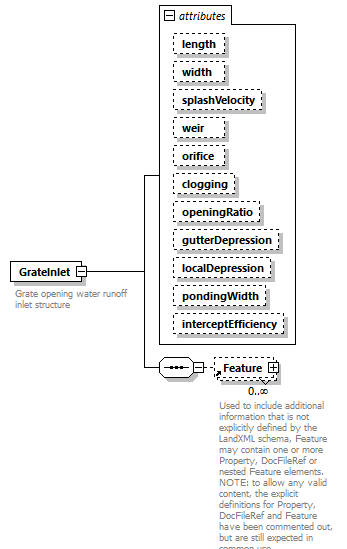 |
||||||||||||||||||||||||||||||||||||||||||||||||||||||||||||||||||||||||
| namespace | http://www.landxml.org/schema/LandXML-2.0 | ||||||||||||||||||||||||||||||||||||||||||||||||||||||||||||||||||||||||
| properties |
|
||||||||||||||||||||||||||||||||||||||||||||||||||||||||||||||||||||||||
| children | Feature | ||||||||||||||||||||||||||||||||||||||||||||||||||||||||||||||||||||||||
| used by |
|
||||||||||||||||||||||||||||||||||||||||||||||||||||||||||||||||||||||||
| attributes |
|
||||||||||||||||||||||||||||||||||||||||||||||||||||||||||||||||||||||||
| annotation |
|
||||||||||||||||||||||||||||||||||||||||||||||||||||||||||||||||||||||||
| source | <xs:element name="GrateInlet"> <xs:annotation> <xs:documentation>Grate opening water runoff inlet structure</xs:documentation> <xs:documentation>interceptEfficiency = % of inflow that gets intercepted by vegetation and doesn't enter inlet or % of inflow that isn't intercepted</xs:documentation> </xs:annotation> <xs:complexType> <xs:sequence> <xs:element ref="Feature" minOccurs="0" maxOccurs="unbounded"/> </xs:sequence> <xs:attribute name="length" type="xs:double"/> <xs:attribute name="width" type="xs:double"/> <xs:attribute name="splashVelocity" type="pipeFlow"/> <xs:attribute name="weir" type="xs:double"/> <xs:attribute name="orifice" type="xs:double"/> <xs:attribute name="clogging" type="xs:double"/> <xs:attribute name="openingRatio" type="xs:double"/> <xs:attribute name="gutterDepression" type="xs:double"/> <xs:attribute name="localDepression" type="xs:double"/> <xs:attribute name="pondingWidth" type="xs:double"/> <xs:attribute name="interceptEfficiency" type="xs:double"/> </xs:complexType> </xs:element> |
attribute GrateInlet/@length
| type | xs:double |
| source | <xs:attribute name="length" type="xs:double"/> |
attribute GrateInlet/@width
| type | xs:double |
| source | <xs:attribute name="width" type="xs:double"/> |
attribute GrateInlet/@splashVelocity
| type | pipeFlow |
| source | <xs:attribute name="splashVelocity" type="pipeFlow"/> |
attribute GrateInlet/@weir
| type | xs:double |
| source | <xs:attribute name="weir" type="xs:double"/> |
attribute GrateInlet/@orifice
| type | xs:double |
| source | <xs:attribute name="orifice" type="xs:double"/> |
attribute GrateInlet/@clogging
| type | xs:double |
| source | <xs:attribute name="clogging" type="xs:double"/> |
attribute GrateInlet/@openingRatio
| type | xs:double |
| source | <xs:attribute name="openingRatio" type="xs:double"/> |
attribute GrateInlet/@gutterDepression
| type | xs:double |
| source | <xs:attribute name="gutterDepression" type="xs:double"/> |
attribute GrateInlet/@localDepression
| type | xs:double |
| source | <xs:attribute name="localDepression" type="xs:double"/> |
attribute GrateInlet/@pondingWidth
| type | xs:double |
| source | <xs:attribute name="pondingWidth" type="xs:double"/> |
attribute GrateInlet/@interceptEfficiency
| type | xs:double |
| source | <xs:attribute name="interceptEfficiency" type="xs:double"/> |
element HazardRating
| diagram | 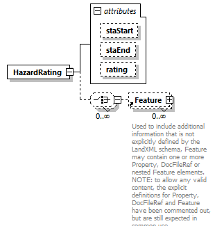 |
||||||||||||||||||||||||
| namespace | http://www.landxml.org/schema/LandXML-2.0 | ||||||||||||||||||||||||
| properties |
|
||||||||||||||||||||||||
| children | Feature | ||||||||||||||||||||||||
| used by |
|
||||||||||||||||||||||||
| attributes |
|
||||||||||||||||||||||||
| source | <xs:element name="HazardRating"> <xs:complexType> <xs:choice minOccurs="0" maxOccurs="unbounded"> <xs:element ref="Feature" minOccurs="0" maxOccurs="unbounded"/> </xs:choice> <xs:attribute name="staStart" type="station"/> <xs:attribute name="staEnd" type="station"/> <xs:attribute name="rating" type="xs:int"/> <!-- Unit of measure: INT. Roadside Hazard Rating - The roadside hazard rating for both sides of the road. The enumeration values are: 1, 2, 3, 4, 5, 6 and 7. --> </xs:complexType> </xs:element> |
attribute HazardRating/@staStart
| type | station |
| source | <xs:attribute name="staStart" type="station"/> |
attribute HazardRating/@staEnd
| type | station |
| source | <xs:attribute name="staEnd" type="station"/> |
attribute HazardRating/@rating
| type | xs:int |
| source | <xs:attribute name="rating" type="xs:int"/> |
element HeadOfPower
| diagram | 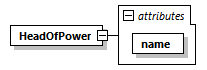 |
||||||||||||
| namespace | http://www.landxml.org/schema/LandXML-2.0 | ||||||||||||
| properties |
|
||||||||||||
| used by |
|
||||||||||||
| attributes |
|
||||||||||||
| source | <xs:element name="HeadOfPower"> <xs:complexType> <xs:attribute name="name" type="headOfPowerType" use="required"/> </xs:complexType> </xs:element> |
attribute HeadOfPower/@name
| type | headOfPowerType | ||
| properties |
|
||
| source | <xs:attribute name="name" type="headOfPowerType" use="required"/> |
element HydrologyConstraints
| diagram | 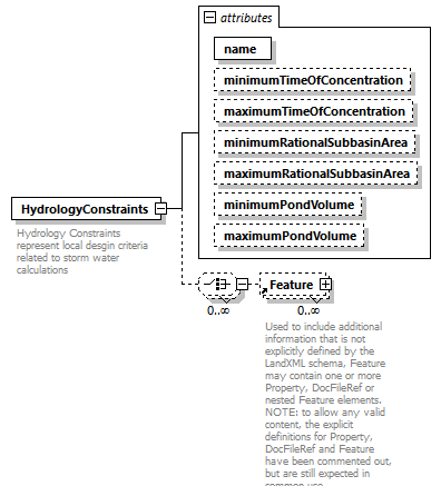 |
||||||||||||||||||||||||||||||||||||||||||||||||
| namespace | http://www.landxml.org/schema/LandXML-2.0 | ||||||||||||||||||||||||||||||||||||||||||||||||
| properties |
|
||||||||||||||||||||||||||||||||||||||||||||||||
| children | Feature | ||||||||||||||||||||||||||||||||||||||||||||||||
| used by |
|
||||||||||||||||||||||||||||||||||||||||||||||||
| attributes |
|
||||||||||||||||||||||||||||||||||||||||||||||||
| annotation |
|
||||||||||||||||||||||||||||||||||||||||||||||||
| source | <xs:element name="HydrologyConstraints"> <xs:annotation> <xs:documentation>Hydrology Constraints represent local desgin criteria related to storm water calculations</xs:documentation> <xs:documentation>Time Of Concentration values are expressed minutes</xs:documentation> <xs:documentation>Pond Volume is the geometric volume (area * height) expressed in the defined volume unit of measure</xs:documentation> <xs:documentation>Subbasin Area values are expressed in the defined area unit of measure</xs:documentation> </xs:annotation> <xs:complexType> <xs:choice minOccurs="0" maxOccurs="unbounded"> <xs:element ref="Feature" minOccurs="0" maxOccurs="unbounded"/> </xs:choice> <xs:attribute name="name" type="xs:string" use="required"/> <xs:attribute name="minimumTimeOfConcentration" type="timeOfConcentration"/> <xs:attribute name="maximumTimeOfConcentration" type="timeOfConcentration"/> <xs:attribute name="minimumRationalSubbasinArea" type="area"/> <xs:attribute name="maximumRationalSubbasinArea" type="area"/> <xs:attribute name="minimumPondVolume" type="volume"/> <xs:attribute name="maximumPondVolume" type="volume"/> </xs:complexType> </xs:element> |
attribute HydrologyConstraints/@name
| type | xs:string | ||
| properties |
|
||
| source | <xs:attribute name="name" type="xs:string" use="required"/> |
attribute HydrologyConstraints/@minimumTimeOfConcentration
| type | timeOfConcentration |
| source | <xs:attribute name="minimumTimeOfConcentration" type="timeOfConcentration"/> |
attribute HydrologyConstraints/@maximumTimeOfConcentration
| type | timeOfConcentration |
| source | <xs:attribute name="maximumTimeOfConcentration" type="timeOfConcentration"/> |
attribute HydrologyConstraints/@minimumRationalSubbasinArea
| type | area |
| source | <xs:attribute name="minimumRationalSubbasinArea" type="area"/> |
attribute HydrologyConstraints/@maximumRationalSubbasinArea
| type | area |
| source | <xs:attribute name="maximumRationalSubbasinArea" type="area"/> |
attribute HydrologyConstraints/@minimumPondVolume
| type | volume |
| source | <xs:attribute name="minimumPondVolume" type="volume"/> |
attribute HydrologyConstraints/@maximumPondVolume
| type | volume |
| source | <xs:attribute name="maximumPondVolume" type="volume"/> |
element Imperial
| diagram | 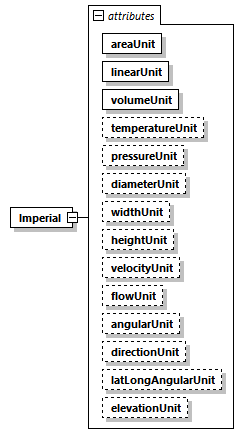 |
||||||||||||||||||||||||||||||||||||||||||||||||||||||||||||||||||||||||||||||||||||||||||
| namespace | http://www.landxml.org/schema/LandXML-2.0 | ||||||||||||||||||||||||||||||||||||||||||||||||||||||||||||||||||||||||||||||||||||||||||
| properties |
|
||||||||||||||||||||||||||||||||||||||||||||||||||||||||||||||||||||||||||||||||||||||||||
| used by |
|
||||||||||||||||||||||||||||||||||||||||||||||||||||||||||||||||||||||||||||||||||||||||||
| attributes |
|
||||||||||||||||||||||||||||||||||||||||||||||||||||||||||||||||||||||||||||||||||||||||||
| source | <xs:element name="Imperial"> <xs:annotation> <xs:documentation/> </xs:annotation> <xs:complexType> <xs:attribute name="areaUnit" type="impArea" use="required"/> <xs:attribute name="linearUnit" type="impLinear" use="required"/> <xs:attribute name="volumeUnit" type="impVolume" use="required"/> <xs:attribute name="temperatureUnit" type="impTemperature" use="optional"/> <xs:attribute name="pressureUnit" type="impPressure" use="optional"/> <xs:attribute name="diameterUnit" type="impDiameter"/> <xs:attribute name="widthUnit" type="impWidth"/> <xs:attribute name="heightUnit" type="impHeight"/> <xs:attribute name="velocityUnit" type="impVelocity"/> <xs:attribute name="flowUnit" type="impFlow"/> <xs:attribute name="angularUnit" type="angularType" default="radians"/> <xs:attribute name="directionUnit" type="angularType" default="radians"/> <xs:attribute name="latLongAngularUnit" type="latLongAngularType" default="decimal degrees"/> <xs:attribute name="elevationUnit" type="elevationType" default="meter"/> </xs:complexType> </xs:element> |
attribute Imperial/@areaUnit
| type | impArea | |||||||||||||||
| properties |
|
|||||||||||||||
| facets |
|
|||||||||||||||
| source | <xs:attribute name="areaUnit" type="impArea" use="required"/> |
attribute Imperial/@linearUnit
| type | impLinear | |||||||||||||||
| properties |
|
|||||||||||||||
| facets |
|
|||||||||||||||
| source | <xs:attribute name="linearUnit" type="impLinear" use="required"/> |
attribute Imperial/@volumeUnit
| type | impVolume | |||||||||||||||||||||
| properties |
|
|||||||||||||||||||||
| facets |
|
|||||||||||||||||||||
| source | <xs:attribute name="volumeUnit" type="impVolume" use="required"/> |
attribute Imperial/@temperatureUnit
| type | impTemperature | |||||||||
| properties |
|
|||||||||
| facets |
|
|||||||||
| source | <xs:attribute name="temperatureUnit" type="impTemperature" use="optional"/> |
attribute Imperial/@pressureUnit
| type | impPressure | |||||||||
| properties |
|
|||||||||
| facets |
|
|||||||||
| source | <xs:attribute name="pressureUnit" type="impPressure" use="optional"/> |
attribute Imperial/@diameterUnit
| type | impDiameter | ||||||||||||
| facets |
|
||||||||||||
| source | <xs:attribute name="diameterUnit" type="impDiameter"/> |
attribute Imperial/@widthUnit
| type | impWidth | ||||||||||||
| facets |
|
||||||||||||
| source | <xs:attribute name="widthUnit" type="impWidth"/> |
attribute Imperial/@heightUnit
| type | impHeight | ||||||||||||
| facets |
|
||||||||||||
| source | <xs:attribute name="heightUnit" type="impHeight"/> |
attribute Imperial/@velocityUnit
| type | impVelocity | |||||||||
| facets |
|
|||||||||
| source | <xs:attribute name="velocityUnit" type="impVelocity"/> |
attribute Imperial/@flowUnit
| type | impFlow | |||||||||||||||||||||||||||
| facets |
|
|||||||||||||||||||||||||||
| source | <xs:attribute name="flowUnit" type="impFlow"/> |
attribute Imperial/@angularUnit
| type | angularType | |||||||||||||||
| properties |
|
|||||||||||||||
| facets |
|
|||||||||||||||
| source | <xs:attribute name="angularUnit" type="angularType" default="radians"/> |
attribute Imperial/@directionUnit
| type | angularType | |||||||||||||||
| properties |
|
|||||||||||||||
| facets |
|
|||||||||||||||
| source | <xs:attribute name="directionUnit" type="angularType" default="radians"/> |
attribute Imperial/@latLongAngularUnit
| type | latLongAngularType | |||||||||||||||
| properties |
|
|||||||||||||||
| facets |
|
|||||||||||||||
| source | <xs:attribute name="latLongAngularUnit" type="latLongAngularType" default="decimal degrees"/> |
attribute Imperial/@elevationUnit
| type | elevationType | |||||||||||||||
| properties |
|
|||||||||||||||
| facets |
|
|||||||||||||||
| source | <xs:attribute name="elevationUnit" type="elevationType" default="meter"/> |
element InletStruct
| diagram | 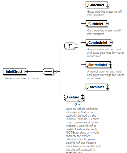 |
||||
| namespace | http://www.landxml.org/schema/LandXML-2.0 | ||||
| properties |
|
||||
| children | GrateInlet CurbInlet ComboInlet SlottedInlet DitchInlet Feature | ||||
| used by |
|
||||
| annotation |
|
||||
| source | <xs:element name="InletStruct"> <xs:annotation> <xs:documentation>Water runoff inlet structure</xs:documentation> <xs:documentation>Must contain at least one water runoff inlet element</xs:documentation> </xs:annotation> <xs:complexType> <xs:sequence> <xs:choice minOccurs="1" maxOccurs="1"> <xs:element ref="GrateInlet"/> <xs:element ref="CurbInlet"/> <xs:element ref="ComboInlet"/> <xs:element ref="SlottedInlet"/> <xs:element ref="DitchInlet"/> </xs:choice> <xs:element ref="Feature" minOccurs="0" maxOccurs="unbounded"/> </xs:sequence> </xs:complexType> </xs:element> |
element InSpiral
| diagram | 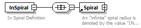 |
||
| namespace | http://www.landxml.org/schema/LandXML-2.0 | ||
| properties |
|
||
| children | Spiral | ||
| used by |
|
||
| annotation |
|
||
| source | <xs:element name="InSpiral"> <xs:annotation> <xs:documentation>In Spiral Definition</xs:documentation> </xs:annotation> <xs:complexType> <xs:all> <xs:element ref="Spiral"/> </xs:all> </xs:complexType> </xs:element> |
element InstrumentDetails
| diagram | 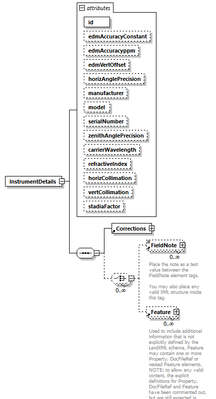 |
||||||||||||||||||||||||||||||||||||||||||||||||||||||||||||||||||||||||||||||||||||||||||
| namespace | http://www.landxml.org/schema/LandXML-2.0 | ||||||||||||||||||||||||||||||||||||||||||||||||||||||||||||||||||||||||||||||||||||||||||
| properties |
|
||||||||||||||||||||||||||||||||||||||||||||||||||||||||||||||||||||||||||||||||||||||||||
| children | Corrections FieldNote Feature | ||||||||||||||||||||||||||||||||||||||||||||||||||||||||||||||||||||||||||||||||||||||||||
| used by |
|
||||||||||||||||||||||||||||||||||||||||||||||||||||||||||||||||||||||||||||||||||||||||||
| attributes |
|
||||||||||||||||||||||||||||||||||||||||||||||||||||||||||||||||||||||||||||||||||||||||||
| source | <xs:element name="InstrumentDetails"> <xs:annotation> <xs:documentation/> </xs:annotation> <xs:complexType> <xs:sequence> <xs:element ref="Corrections"/> <xs:choice minOccurs="0" maxOccurs="unbounded"> <xs:element ref="FieldNote" minOccurs="0" maxOccurs="unbounded"/> <xs:element ref="Feature" minOccurs="0" maxOccurs="unbounded"/> </xs:choice> </xs:sequence> <xs:attribute name="id" type="xs:ID" use="required"/> <xs:attribute name="edmAccuracyConstant" type="xs:double"/> <xs:attribute name="edmAccuracyppm" type="xs:double"/> <xs:attribute name="edmVertOffset" type="xs:double"/> <xs:attribute name="horizAnglePrecision" type="xs:double"/> <xs:attribute name="manufacturer" type="xs:string"/> <xs:attribute name="model" type="xs:string"/> <xs:attribute name="serialNumber" type="xs:string"/> <xs:attribute name="zenithAnglePrecision" type="xs:double"/> <xs:attribute name="carrierWavelength" type="xs:double"/> <xs:attribute name="refractiveIndex" type="xs:double"/> <xs:attribute name="horizCollimation" type="xs:double"/> <xs:attribute name="vertCollimation" type="xs:double"/> <xs:attribute name="stadiaFactor" type="xs:double"/> <!-- In order to compute the atmospheric corrections correctly record the EDM instrument carrier wavelength (carrierWavelength) and the group refractive index for the instrument (refractiveIndex). --> <!-- To allow for older style top mounted EDM's --> </xs:complexType> </xs:element> |
attribute InstrumentDetails/@id
| type | xs:ID | ||
| properties |
|
||
| source | <xs:attribute name="id" type="xs:ID" use="required"/> |
attribute InstrumentDetails/@edmAccuracyConstant
| type | xs:double |
| source | <xs:attribute name="edmAccuracyConstant" type="xs:double"/> |
attribute InstrumentDetails/@edmAccuracyppm
| type | xs:double |
| source | <xs:attribute name="edmAccuracyppm" type="xs:double"/> |
attribute InstrumentDetails/@edmVertOffset
| type | xs:double |
| source | <xs:attribute name="edmVertOffset" type="xs:double"/> |
attribute InstrumentDetails/@horizAnglePrecision
| type | xs:double |
| source | <xs:attribute name="horizAnglePrecision" type="xs:double"/> |
attribute InstrumentDetails/@manufacturer
| type | xs:string |
| source | <xs:attribute name="manufacturer" type="xs:string"/> |
attribute InstrumentDetails/@model
| type | xs:string |
| source | <xs:attribute name="model" type="xs:string"/> |
attribute InstrumentDetails/@serialNumber
| type | xs:string |
| source | <xs:attribute name="serialNumber" type="xs:string"/> |
attribute InstrumentDetails/@zenithAnglePrecision
| type | xs:double |
| source | <xs:attribute name="zenithAnglePrecision" type="xs:double"/> |
attribute InstrumentDetails/@carrierWavelength
| type | xs:double |
| source | <xs:attribute name="carrierWavelength" type="xs:double"/> |
attribute InstrumentDetails/@refractiveIndex
| type | xs:double |
| source | <xs:attribute name="refractiveIndex" type="xs:double"/> |
attribute InstrumentDetails/@horizCollimation
| type | xs:double |
| source | <xs:attribute name="horizCollimation" type="xs:double"/> |
attribute InstrumentDetails/@vertCollimation
| type | xs:double |
| source | <xs:attribute name="vertCollimation" type="xs:double"/> |
attribute InstrumentDetails/@stadiaFactor
| type | xs:double |
| source | <xs:attribute name="stadiaFactor" type="xs:double"/> |
element InstrumentPoint
| diagram | 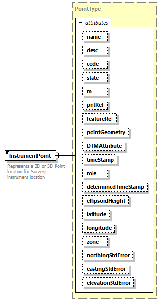 |
||||||||||||||||||||||||||||||||||||||||||||||||||||||||||||||||||||||||||||||||||||||||||||||||||||||||||||||||||||||||
| namespace | http://www.landxml.org/schema/LandXML-2.0 | ||||||||||||||||||||||||||||||||||||||||||||||||||||||||||||||||||||||||||||||||||||||||||||||||||||||||||||||||||||||||
| type | PointType | ||||||||||||||||||||||||||||||||||||||||||||||||||||||||||||||||||||||||||||||||||||||||||||||||||||||||||||||||||||||||
| properties |
|
||||||||||||||||||||||||||||||||||||||||||||||||||||||||||||||||||||||||||||||||||||||||||||||||||||||||||||||||||||||||
| used by |
|
||||||||||||||||||||||||||||||||||||||||||||||||||||||||||||||||||||||||||||||||||||||||||||||||||||||||||||||||||||||||
| facets |
|
||||||||||||||||||||||||||||||||||||||||||||||||||||||||||||||||||||||||||||||||||||||||||||||||||||||||||||||||||||||||
| attributes |
|
||||||||||||||||||||||||||||||||||||||||||||||||||||||||||||||||||||||||||||||||||||||||||||||||||||||||||||||||||||||||
| annotation |
|
||||||||||||||||||||||||||||||||||||||||||||||||||||||||||||||||||||||||||||||||||||||||||||||||||||||||||||||||||||||||
| source | <xs:element name="InstrumentPoint" type="PointType"> <xs:annotation> <xs:documentation>Represents a 2D or 3D Point location for Survey instrument location</xs:documentation> <xs:documentation>Defined by either a coordinate text value ("north east" or "north east elev") or a PointType number reference "pntRef" attribute.</xs:documentation> </xs:annotation> </xs:element> |
element InstrumentSetup
| diagram | 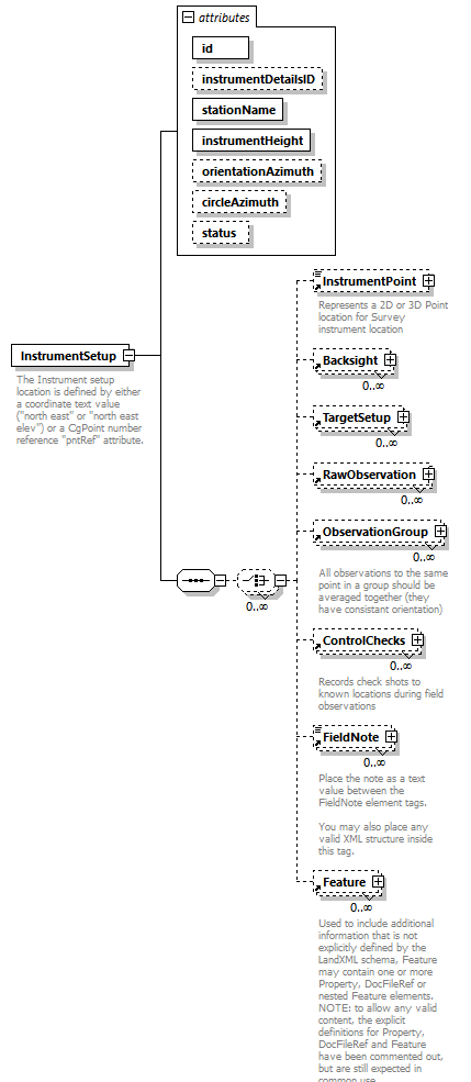 |
||||||||||||||||||||||||||||||||||||||||||||||||
| namespace | http://www.landxml.org/schema/LandXML-2.0 | ||||||||||||||||||||||||||||||||||||||||||||||||
| properties |
|
||||||||||||||||||||||||||||||||||||||||||||||||
| children | InstrumentPoint Backsight TargetSetup RawObservation ObservationGroup ControlChecks FieldNote Feature | ||||||||||||||||||||||||||||||||||||||||||||||||
| used by |
|
||||||||||||||||||||||||||||||||||||||||||||||||
| attributes |
|
||||||||||||||||||||||||||||||||||||||||||||||||
| annotation |
|
||||||||||||||||||||||||||||||||||||||||||||||||
| source | <xs:element name="InstrumentSetup"> <xs:annotation> <xs:documentation>The Instrument setup location is defined by either a coordinate text value ("north east" or "north east elev") or a CgPoint number reference "pntRef" attribute.</xs:documentation> </xs:annotation> <xs:complexType> <xs:sequence> <xs:choice minOccurs="0" maxOccurs="unbounded"> <xs:element ref="InstrumentPoint" minOccurs="0"/> <xs:element ref="Backsight" minOccurs="0" maxOccurs="unbounded"/> <xs:element ref="TargetSetup" minOccurs="0" maxOccurs="unbounded"/> <xs:element ref="RawObservation" minOccurs="0" maxOccurs="unbounded"/> <xs:element ref="ObservationGroup" minOccurs="0" maxOccurs="unbounded"/> <xs:element ref="ControlChecks" minOccurs="0" maxOccurs="unbounded"/> <xs:element ref="FieldNote" minOccurs="0" maxOccurs="unbounded"/> <xs:element ref="Feature" minOccurs="0" maxOccurs="unbounded"/> </xs:choice> </xs:sequence> <xs:attribute name="id" type="xs:ID" use="required"/> <xs:attribute name="instrumentDetailsID" type="xs:IDREF"/> <xs:attribute name="stationName" type="xs:string" use="required"/> <xs:attribute name="instrumentHeight" type="xs:double" use="required"/> <xs:attribute name="orientationAzimuth" type="direction"/> <xs:attribute name="circleAzimuth" type="direction"/> <xs:attribute name="status" type="observationStatusType"/> </xs:complexType> </xs:element> |
attribute InstrumentSetup/@id
| type | xs:ID | ||
| properties |
|
||
| source | <xs:attribute name="id" type="xs:ID" use="required"/> |
attribute InstrumentSetup/@instrumentDetailsID
| type | xs:IDREF |
| source | <xs:attribute name="instrumentDetailsID" type="xs:IDREF"/> |
attribute InstrumentSetup/@stationName
| type | xs:string | ||
| properties |
|
||
| source | <xs:attribute name="stationName" type="xs:string" use="required"/> |
attribute InstrumentSetup/@instrumentHeight
| type | xs:double | ||
| properties |
|
||
| source | <xs:attribute name="instrumentHeight" type="xs:double" use="required"/> |
attribute InstrumentSetup/@orientationAzimuth
| type | direction |
| source | <xs:attribute name="orientationAzimuth" type="direction"/> |
attribute InstrumentSetup/@circleAzimuth
| type | direction |
| source | <xs:attribute name="circleAzimuth" type="direction"/> |
attribute InstrumentSetup/@status
| type | observationStatusType | |||||||||
| facets |
|
|||||||||
| source | <xs:attribute name="status" type="observationStatusType"/> |
element Intersection
| diagram |  |
||||||||||||||||||||||||||||||||||||
| namespace | http://www.landxml.org/schema/LandXML-2.0 | ||||||||||||||||||||||||||||||||||||
| properties |
|
||||||||||||||||||||||||||||||||||||
| children | TrafficControl Timing Volume TurnSpeed TurnRestriction Curb Corner Feature | ||||||||||||||||||||||||||||||||||||
| used by |
|
||||||||||||||||||||||||||||||||||||
| attributes |
|
||||||||||||||||||||||||||||||||||||
| source | <xs:element name="Intersection"> <xs:complexType> <xs:choice minOccurs="0" maxOccurs="unbounded"> <xs:element ref="TrafficControl" minOccurs="0" maxOccurs="unbounded"/> <xs:element ref="Timing" minOccurs="0" maxOccurs="unbounded"/> <xs:element ref="Volume" minOccurs="0" maxOccurs="unbounded"/> <xs:element ref="TurnSpeed" minOccurs="0" maxOccurs="unbounded"/> <xs:element ref="TurnRestriction" minOccurs="0" maxOccurs="unbounded"/> <xs:element ref="Curb" minOccurs="0" maxOccurs="unbounded"/> <xs:element ref="Corner" minOccurs="0" maxOccurs="unbounded"/> <xs:element ref="Feature" minOccurs="0" maxOccurs="unbounded"/> </xs:choice> <xs:attribute name="roadwayRef" type="roadwayNameRef"/> <xs:attribute name="roadwayPI" type="station"/> <xs:attribute name="intersectingRoadwayRef" type="roadwayNameRef"/> <xs:attribute name="intersectRoadwayPI" type="station"/> <xs:attribute name="contructionType" type="intersectionConstructionType"/> </xs:complexType> </xs:element> |
attribute Intersection/@roadwayRef
| type | roadwayNameRef |
| source | <xs:attribute name="roadwayRef" type="roadwayNameRef"/> |
attribute Intersection/@roadwayPI
| type | station |
| source | <xs:attribute name="roadwayPI" type="station"/> |
attribute Intersection/@intersectingRoadwayRef
| type | roadwayNameRef |
| source | <xs:attribute name="intersectingRoadwayRef" type="roadwayNameRef"/> |
attribute Intersection/@intersectRoadwayPI
| type | station |
| source | <xs:attribute name="intersectRoadwayPI" type="station"/> |
attribute Intersection/@contructionType
| type | intersectionConstructionType | ||||||||||||
| facets |
|
||||||||||||
| source | <xs:attribute name="contructionType" type="intersectionConstructionType"/> |
element Intersections
| diagram |  |
||
| namespace | http://www.landxml.org/schema/LandXML-2.0 | ||
| properties |
|
||
| children | Intersection Feature | ||
| used by |
|
||
| source | <xs:element name="Intersections"> <xs:complexType> <xs:choice maxOccurs="unbounded"> <xs:element ref="Intersection" minOccurs="0" maxOccurs="unbounded"/> <xs:element ref="Feature" minOccurs="0" maxOccurs="unbounded"/> </xs:choice> </xs:complexType> </xs:element> |
element Invert
| diagram |  |
||||||||||||||||||||||||||||||
| namespace | http://www.landxml.org/schema/LandXML-2.0 | ||||||||||||||||||||||||||||||
| properties |
|
||||||||||||||||||||||||||||||
| used by |
|
||||||||||||||||||||||||||||||
| attributes |
|
||||||||||||||||||||||||||||||
| source | <xs:element name="Invert"> <xs:annotation> <xs:documentation/> </xs:annotation> <xs:complexType> <xs:attribute name="desc" type="xs:string"/> <xs:attribute name="elev" type="xs:double" use="required"/> <xs:attribute name="flowDir" type="inOut" use="required"/> <xs:attribute name="refPipe" type="pipeNameRef" use="required"/> </xs:complexType> </xs:element> |
attribute Invert/@desc
| type | xs:string |
| source | <xs:attribute name="desc" type="xs:string"/> |
attribute Invert/@elev
| type | xs:double | ||
| properties |
|
||
| source | <xs:attribute name="elev" type="xs:double" use="required"/> |
attribute Invert/@flowDir
| type | inOut | ||||||||||||
| properties |
|
||||||||||||
| facets |
|
||||||||||||
| source | <xs:attribute name="flowDir" type="inOut" use="required"/> |
attribute Invert/@refPipe
| type | pipeNameRef | ||
| properties |
|
||
| source | <xs:attribute name="refPipe" type="pipeNameRef" use="required"/> |
element IrregularLine
| diagram | 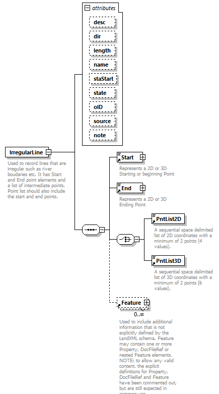 |
||||||||||||||||||||||||||||||||||||||||||||||||||||||||||||
| namespace | http://www.landxml.org/schema/LandXML-2.0 | ||||||||||||||||||||||||||||||||||||||||||||||||||||||||||||
| properties |
|
||||||||||||||||||||||||||||||||||||||||||||||||||||||||||||
| children | Start End PntList2D PntList3D Feature | ||||||||||||||||||||||||||||||||||||||||||||||||||||||||||||
| used by |
|
||||||||||||||||||||||||||||||||||||||||||||||||||||||||||||
| attributes |
|
||||||||||||||||||||||||||||||||||||||||||||||||||||||||||||
| annotation |
|
||||||||||||||||||||||||||||||||||||||||||||||||||||||||||||
| source | <xs:element name="IrregularLine"> <xs:annotation> <xs:documentation>Used to record lines that are irregular such as river boudaries etc. It has Start and End point elements and a list of intermediate points. Point list should also include the start and end points.</xs:documentation> </xs:annotation> <xs:complexType> <xs:sequence> <xs:element ref="Start"/> <xs:element ref="End"/> <xs:choice> <xs:element ref="PntList2D"/> <xs:element ref="PntList3D"/> <!-- Here PntList2D represents 2D planametric coordinate pairs expressed as space delimited Northing Easting pairs. --> </xs:choice> <xs:element ref="Feature" minOccurs="0" maxOccurs="unbounded"/> </xs:sequence> <xs:attribute name="desc" type="xs:string"/> <xs:attribute name="dir" type="direction"/> <xs:attribute name="length" type="xs:double"/> <xs:attribute name="name" type="xs:string"/> <xs:attribute name="staStart" type="xs:double"/> <xs:attribute name="state" type="stateType"/> <xs:attribute name="oID" type="xs:string"/> <xs:attribute name="source" type="xs:string"/> <xs:attribute name="note" type="xs:string"/> </xs:complexType> </xs:element> |
attribute IrregularLine/@desc
| type | xs:string |
| source | <xs:attribute name="desc" type="xs:string"/> |
attribute IrregularLine/@dir
| type | direction |
| source | <xs:attribute name="dir" type="direction"/> |
attribute IrregularLine/@length
| type | xs:double |
| source | <xs:attribute name="length" type="xs:double"/> |
attribute IrregularLine/@name
| type | xs:string |
| source | <xs:attribute name="name" type="xs:string"/> |
attribute IrregularLine/@staStart
| type | xs:double |
| source | <xs:attribute name="staStart" type="xs:double"/> |
attribute IrregularLine/@state
| type | stateType | |||||||||||||||
| facets |
|
|||||||||||||||
| source | <xs:attribute name="state" type="stateType"/> |
attribute IrregularLine/@oID
| type | xs:string |
| source | <xs:attribute name="oID" type="xs:string"/> |
attribute IrregularLine/@source
| type | xs:string |
| source | <xs:attribute name="source" type="xs:string"/> |
attribute IrregularLine/@note
| type | xs:string |
| source | <xs:attribute name="note" type="xs:string"/> |
element JurisdictionConstraints
| diagram | 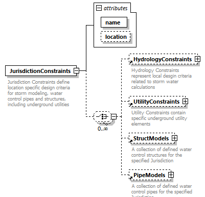 |
||||||||||||||||||
| namespace | http://www.landxml.org/schema/LandXML-2.0 | ||||||||||||||||||
| properties |
|
||||||||||||||||||
| children | HydrologyConstraints UtilityConstraints StructModels PipeModels | ||||||||||||||||||
| used by |
|
||||||||||||||||||
| attributes |
|
||||||||||||||||||
| annotation |
|
||||||||||||||||||
| source | <xs:element name="JurisdictionConstraints"> <xs:annotation> <xs:documentation>Jurisdiction Constraints define location specific design criteria for storm modeling, water control pipes and structures, including underground utilities</xs:documentation> </xs:annotation> <xs:complexType> <xs:choice minOccurs="0" maxOccurs="unbounded"> <xs:element ref="HydrologyConstraints" minOccurs="0" maxOccurs="1"/> <xs:element ref="UtilityConstraints" minOccurs="0" maxOccurs="1"/> <xs:element ref="StructModels" minOccurs="0" maxOccurs="1"/> <xs:element ref="PipeModels" minOccurs="0" maxOccurs="1"/> </xs:choice> <xs:attribute name="name" type="xs:string" use="required"/> <xs:attribute name="location" type="xs:string"/> </xs:complexType> </xs:element> |
attribute JurisdictionConstraints/@name
| type | xs:string | ||
| properties |
|
||
| source | <xs:attribute name="name" type="xs:string" use="required"/> |
attribute JurisdictionConstraints/@location
| type | xs:string |
| source | <xs:attribute name="location" type="xs:string"/> |
element LandXML
| diagram |  |
||||||||||||||||||||||||||||||||||||||||||||||||||||||||||||||||||||||||||||||||||||||||||||||||||||||||||||||||||
| namespace | http://www.landxml.org/schema/LandXML-2.0 | ||||||||||||||||||||||||||||||||||||||||||||||||||||||||||||||||||||||||||||||||||||||||||||||||||||||||||||||||||
| properties |
|
||||||||||||||||||||||||||||||||||||||||||||||||||||||||||||||||||||||||||||||||||||||||||||||||||||||||||||||||||
| children | Units CoordinateSystem Project Application Alignments CgPoints Amendment GradeModel Monuments Parcels PlanFeatures PipeNetworks Roadways Surfaces Survey FeatureDictionary MaterialTable DesignCrossSectionTemplateTable TextureImageTable SymbolTable JurisdictionConstraints | ||||||||||||||||||||||||||||||||||||||||||||||||||||||||||||||||||||||||||||||||||||||||||||||||||||||||||||||||||
| attributes |
|
||||||||||||||||||||||||||||||||||||||||||||||||||||||||||||||||||||||||||||||||||||||||||||||||||||||||||||||||||
| identity constraints |
|
||||||||||||||||||||||||||||||||||||||||||||||||||||||||||||||||||||||||||||||||||||||||||||||||||||||||||||||||||
| source | <xs:element name="LandXML"> <xs:complexType> <xs:choice maxOccurs="unbounded"> <xs:element ref="Units"/> <xs:element ref="CoordinateSystem" minOccurs="0"/> <xs:element ref="Project" minOccurs="0"/> <xs:element ref="Application" minOccurs="0" maxOccurs="unbounded"/> <xs:element ref="Alignments" minOccurs="0" maxOccurs="unbounded"/> <xs:element ref="CgPoints" minOccurs="0" maxOccurs="unbounded"/> <xs:element ref="Amendment" minOccurs="0" maxOccurs="unbounded"/> <xs:element ref="GradeModel" minOccurs="0" maxOccurs="unbounded"/> <xs:element ref="Monuments" minOccurs="0" maxOccurs="unbounded"/> <xs:element ref="Parcels" minOccurs="0" maxOccurs="unbounded"/> <xs:element ref="PlanFeatures" minOccurs="0" maxOccurs="unbounded"/> <xs:element ref="PipeNetworks" minOccurs="0" maxOccurs="unbounded"/> <xs:element ref="Roadways" minOccurs="0" maxOccurs="unbounded"/> <xs:element ref="Surfaces" minOccurs="0" maxOccurs="unbounded"/> <xs:element ref="Survey" minOccurs="0" maxOccurs="unbounded"/> <xs:element ref="FeatureDictionary" minOccurs="0" maxOccurs="unbounded"/> <xs:element ref="MaterialTable" minOccurs="0"/> <xs:element ref="DesignCrossSectionTemplateTable" minOccurs="0"/> <xs:element ref="TextureImageTable" minOccurs="0"/> <xs:element ref="SymbolTable" minOccurs="0"/> <xs:element ref="JurisdictionConstraints" minOccurs="0"/> <xs:any namespace="##other" processContents="skip" minOccurs="0"/> </xs:choice> <xs:attribute name="date" type="xs:date" use="required"/> <xs:attribute name="time" type="xs:time" use="required"/> <xs:attribute name="version" type="xs:string" use="required"/> <xs:attribute name="language" type="xs:string"/> <xs:attribute name="readOnly" type="xs:boolean"/> <xs:attribute name="LandXMLId" type="xs:int"/> <xs:attribute name="crc" type="xs:integer"/> </xs:complexType> <xs:unique name="uCoordGeomName"> <xs:selector xpath=".//CoordGeom"/> <xs:field xpath="@name"/> </xs:unique> <xs:unique name="uCgPointsName"> <xs:selector xpath=".//CgPoints"/> <xs:field xpath="@name"/> </xs:unique> <xs:unique name="uRoadwayName"> <xs:selector xpath="Roadways/Roadway"/> <xs:field xpath="@name"/> </xs:unique> <xs:unique name="uGradeModelName"> <xs:selector xpath="GradeModel"/> <xs:field xpath="@name"/> </xs:unique> <xs:key name="MonumentKey"> <xs:selector xpath=".//Monuments/Monument"/> <xs:field xpath="@name"/> </xs:key> <xs:keyref name="SurveyMonument" refer="MonumentKey"> <xs:selector xpath=".//SurveyMonument"/> <xs:field xpath="@mntRef"/> </xs:keyref> <xs:key name="StructKey"> <xs:selector xpath=".//PipeNetwork/*/Struct"/> <xs:field xpath="@name"/> </xs:key> <xs:keyref name="PipeStart" refer="StructKey"> <xs:selector xpath=".//PipeNetwork/*/Pipe"/> <xs:field xpath="@refStart"/> </xs:keyref> <xs:keyref name="PipeEnd" refer="StructKey"> <xs:selector xpath=".//PipeNetwork/*/Pipe"/> <xs:field xpath="@refEnd"/> </xs:keyref> <xs:key name="PipeKey"> <xs:selector xpath=".//PipeNetwork/*/Pipe"/> <xs:field xpath="@name"/> </xs:key> <xs:keyref name="StructInvert" refer="PipeKey"> <xs:selector xpath=".//PipeNetwork/*/Struct/Invert"/> <xs:field xpath="@refPipe"/> </xs:keyref> <xs:key name="ReducedObservationName"> <xs:selector xpath=".//*/ObservationGroup/*/ReducedObservation"/> <xs:field xpath="@name"/> </xs:key> <xs:key name="ReducedArcObservationName"> <xs:selector xpath=".//*/ObservationGroup/*/ReducedArcObservation"/> <xs:field xpath="@name"/> </xs:key> <xs:key name="RedHorizontalPositionName"> <xs:selector xpath=".//*/ObservationGroup/*/RedHorizontalPosition"/> <xs:field xpath="@name"/> </xs:key> <xs:key name="RedVerticalPositionName"> <xs:selector xpath=".//*/ObservationGroup/*/RedVerticalPosition"/> <xs:field xpath="@name"/> </xs:key> <xs:key name="Coord3DGeomName"> <xs:selector xpath=".//*/Parcels/*/Coord3DGeom"/> <xs:field xpath="@name"/> </xs:key> <xs:key name="AnnotationName"> <xs:selector xpath=".//Survey/*/Annotation"/> <xs:field xpath="@name"/> </xs:key> <xs:key name="SurveyorCertificateName"> <xs:selector xpath=".//Survey/*/SurveyorCertificate"/> <xs:field xpath="@name"/> </xs:key> </xs:element> |
attribute LandXML/@date
| type | xs:date | ||
| properties |
|
||
| source | <xs:attribute name="date" type="xs:date" use="required"/> |
attribute LandXML/@time
| type | xs:time | ||
| properties |
|
||
| source | <xs:attribute name="time" type="xs:time" use="required"/> |
attribute LandXML/@version
| type | xs:string | ||
| properties |
|
||
| source | <xs:attribute name="version" type="xs:string" use="required"/> |
attribute LandXML/@language
| type | xs:string |
| source | <xs:attribute name="language" type="xs:string"/> |
attribute LandXML/@readOnly
| type | xs:boolean |
| source | <xs:attribute name="readOnly" type="xs:boolean"/> |
attribute LandXML/@LandXMLId
| type | xs:int |
| source | <xs:attribute name="LandXMLId" type="xs:int"/> |
attribute LandXML/@crc
| type | xs:integer |
| source | <xs:attribute name="crc" type="xs:integer"/> |
element Lanes
| diagram | 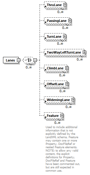 |
||
| namespace | http://www.landxml.org/schema/LandXML-2.0 | ||
| properties |
|
||
| children | ThruLane PassingLane TurnLane TwoWayLeftTurnLane ClimbLane OffsetLane WideningLane Feature | ||
| used by |
|
||
| source | <xs:element name="Lanes"> <xs:complexType> <xs:choice minOccurs="0" maxOccurs="unbounded"> <xs:element ref="ThruLane" minOccurs="0" maxOccurs="unbounded"/> <xs:element ref="PassingLane" minOccurs="0" maxOccurs="unbounded"/> <xs:element ref="TurnLane" minOccurs="0" maxOccurs="unbounded"/> <xs:element ref="TwoWayLeftTurnLane" minOccurs="0" maxOccurs="unbounded"/> <xs:element ref="ClimbLane" minOccurs="0" maxOccurs="unbounded"/> <xs:element ref="OffsetLane" minOccurs="0" maxOccurs="unbounded"/> <xs:element ref="WideningLane" minOccurs="0" maxOccurs="unbounded"/> <xs:element ref="Feature" minOccurs="0" maxOccurs="unbounded"/> </xs:choice> </xs:complexType> </xs:element> |
element LaserDetails
| diagram | 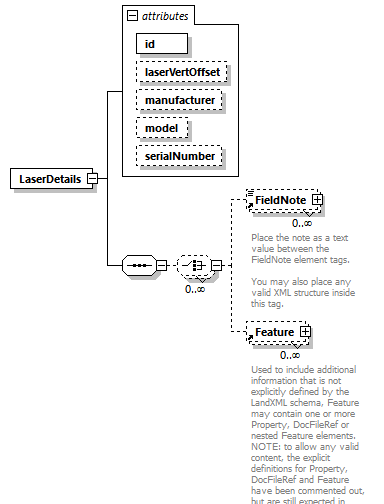 |
||||||||||||||||||||||||||||||||||||
| namespace | http://www.landxml.org/schema/LandXML-2.0 | ||||||||||||||||||||||||||||||||||||
| properties |
|
||||||||||||||||||||||||||||||||||||
| children | FieldNote Feature | ||||||||||||||||||||||||||||||||||||
| used by |
|
||||||||||||||||||||||||||||||||||||
| attributes |
|
||||||||||||||||||||||||||||||||||||
| source | <xs:element name="LaserDetails"> <xs:annotation> <xs:documentation/> </xs:annotation> <xs:complexType> <xs:sequence> <xs:choice minOccurs="0" maxOccurs="unbounded"> <xs:element ref="FieldNote" minOccurs="0" maxOccurs="unbounded"/> <xs:element ref="Feature" minOccurs="0" maxOccurs="unbounded"/> </xs:choice> </xs:sequence> <xs:attribute name="id" type="xs:ID" use="required"/> <xs:attribute name="laserVertOffset" type="xs:double"/> <xs:attribute name="manufacturer" type="xs:string"/> <xs:attribute name="model" type="xs:string"/> <xs:attribute name="serialNumber" type="xs:string"/> </xs:complexType> </xs:element> |
attribute LaserDetails/@id
| type | xs:ID | ||
| properties |
|
||
| source | <xs:attribute name="id" type="xs:ID" use="required"/> |
attribute LaserDetails/@laserVertOffset
| type | xs:double |
| source | <xs:attribute name="laserVertOffset" type="xs:double"/> |
attribute LaserDetails/@manufacturer
| type | xs:string |
| source | <xs:attribute name="manufacturer" type="xs:string"/> |
attribute LaserDetails/@model
| type | xs:string |
| source | <xs:attribute name="model" type="xs:string"/> |
attribute LaserDetails/@serialNumber
| type | xs:string |
| source | <xs:attribute name="serialNumber" type="xs:string"/> |
element LaserSetup
| diagram | 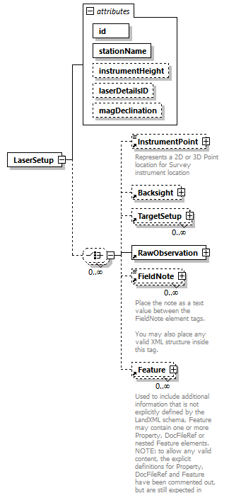 |
||||||||||||||||||||||||||||||||||||
| namespace | http://www.landxml.org/schema/LandXML-2.0 | ||||||||||||||||||||||||||||||||||||
| properties |
|
||||||||||||||||||||||||||||||||||||
| children | InstrumentPoint Backsight TargetSetup RawObservation FieldNote Feature | ||||||||||||||||||||||||||||||||||||
| used by |
|
||||||||||||||||||||||||||||||||||||
| attributes |
|
||||||||||||||||||||||||||||||||||||
| source | <xs:element name="LaserSetup"> <xs:annotation> <xs:documentation/> </xs:annotation> <xs:complexType> <xs:choice minOccurs="0" maxOccurs="unbounded"> <xs:element ref="InstrumentPoint" minOccurs="0"/> <xs:element ref="Backsight" minOccurs="0"/> <xs:element ref="TargetSetup" minOccurs="0" maxOccurs="unbounded"/> <xs:element ref="RawObservation"/> <xs:element ref="FieldNote" minOccurs="0" maxOccurs="unbounded"/> <xs:element ref="Feature" minOccurs="0" maxOccurs="unbounded"/> </xs:choice> <xs:attribute name="id" type="xs:ID" use="required"/> <xs:attribute name="stationName" use="required"/> <xs:attribute name="instrumentHeight" type="xs:double"/> <xs:attribute name="laserDetailsID" type="xs:IDREF"/> <xs:attribute name="magDeclination" type="xs:double"/> </xs:complexType> </xs:element> |
attribute LaserSetup/@id
| type | xs:ID | ||
| properties |
|
||
| source | <xs:attribute name="id" type="xs:ID" use="required"/> |
attribute LaserSetup/@stationName
| properties |
|
||
| source | <xs:attribute name="stationName" use="required"/> |
attribute LaserSetup/@instrumentHeight
| type | xs:double |
| source | <xs:attribute name="instrumentHeight" type="xs:double"/> |
attribute LaserSetup/@laserDetailsID
| type | xs:IDREF |
| source | <xs:attribute name="laserDetailsID" type="xs:IDREF"/> |
attribute LaserSetup/@magDeclination
| type | xs:double |
| source | <xs:attribute name="magDeclination" type="xs:double"/> |
element Line
| diagram | 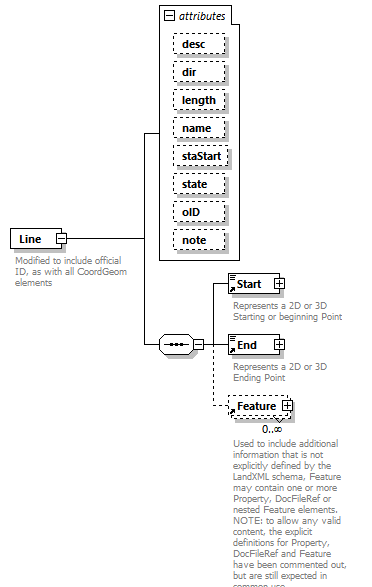 |
||||||||||||||||||||||||||||||||||||||||||||||||||||||
| namespace | http://www.landxml.org/schema/LandXML-2.0 | ||||||||||||||||||||||||||||||||||||||||||||||||||||||
| properties |
|
||||||||||||||||||||||||||||||||||||||||||||||||||||||
| children | Start End Feature | ||||||||||||||||||||||||||||||||||||||||||||||||||||||
| used by |
|
||||||||||||||||||||||||||||||||||||||||||||||||||||||
| attributes |
|
||||||||||||||||||||||||||||||||||||||||||||||||||||||
| annotation |
|
||||||||||||||||||||||||||||||||||||||||||||||||||||||
| source | <xs:element name="Line"> <xs:annotation> <xs:documentation>Modified to include official ID, as with all CoordGeom elements</xs:documentation> </xs:annotation> <xs:complexType> <xs:sequence> <xs:element ref="Start"/> <xs:element ref="End"/> <xs:element ref="Feature" minOccurs="0" maxOccurs="unbounded"/> </xs:sequence> <xs:attribute name="desc" type="xs:string"/> <xs:attribute name="dir" type="direction"/> <xs:attribute name="length" type="xs:double"/> <xs:attribute name="name" type="xs:string"/> <xs:attribute name="staStart" type="xs:double"/> <xs:attribute name="state" type="stateType"/> <xs:attribute name="oID" type="xs:string"/> <xs:attribute name="note" type="xs:string"/> </xs:complexType> </xs:element> |
attribute Line/@desc
| type | xs:string |
| source | <xs:attribute name="desc" type="xs:string"/> |
attribute Line/@dir
| type | direction |
| source | <xs:attribute name="dir" type="direction"/> |
attribute Line/@length
| type | xs:double |
| source | <xs:attribute name="length" type="xs:double"/> |
attribute Line/@name
| type | xs:string |
| source | <xs:attribute name="name" type="xs:string"/> |
attribute Line/@staStart
| type | xs:double |
| source | <xs:attribute name="staStart" type="xs:double"/> |
attribute Line/@state
| type | stateType | |||||||||||||||
| facets |
|
|||||||||||||||
| source | <xs:attribute name="state" type="stateType"/> |
attribute Line/@oID
| type | xs:string |
| source | <xs:attribute name="oID" type="xs:string"/> |
attribute Line/@note
| type | xs:string |
| source | <xs:attribute name="note" type="xs:string"/> |
element Location
| diagram | 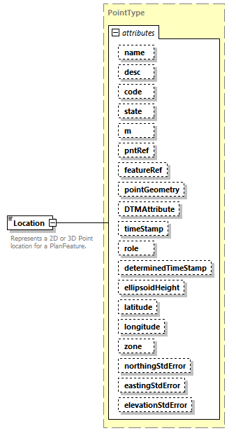 |
||||||||||||||||||||||||||||||||||||||||||||||||||||||||||||||||||||||||||||||||||||||||||||||||||||||||||||||||||||||||
| namespace | http://www.landxml.org/schema/LandXML-2.0 | ||||||||||||||||||||||||||||||||||||||||||||||||||||||||||||||||||||||||||||||||||||||||||||||||||||||||||||||||||||||||
| type | PointType | ||||||||||||||||||||||||||||||||||||||||||||||||||||||||||||||||||||||||||||||||||||||||||||||||||||||||||||||||||||||||
| properties |
|
||||||||||||||||||||||||||||||||||||||||||||||||||||||||||||||||||||||||||||||||||||||||||||||||||||||||||||||||||||||||
| used by |
|
||||||||||||||||||||||||||||||||||||||||||||||||||||||||||||||||||||||||||||||||||||||||||||||||||||||||||||||||||||||||
| facets |
|
||||||||||||||||||||||||||||||||||||||||||||||||||||||||||||||||||||||||||||||||||||||||||||||||||||||||||||||||||||||||
| attributes |
|
||||||||||||||||||||||||||||||||||||||||||||||||||||||||||||||||||||||||||||||||||||||||||||||||||||||||||||||||||||||||
| annotation |
|
||||||||||||||||||||||||||||||||||||||||||||||||||||||||||||||||||||||||||||||||||||||||||||||||||||||||||||||||||||||||
| source | <xs:element name="Location" type="PointType"> <xs:annotation> <xs:documentation>Represents a 2D or 3D Point location for a PlanFeature.</xs:documentation> <xs:documentation>Defined by either a coordinate text value ("north east" or "north east elev") or a CgPoint number reference "pntRef" attribute.</xs:documentation> </xs:annotation> </xs:element> |
element LocationAddress
| diagram | 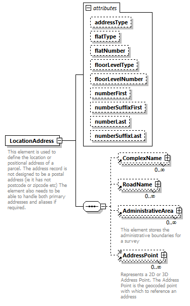 |
||||||||||||||||||||||||||||||||||||||||||||||||||||||||||||
| namespace | http://www.landxml.org/schema/LandXML-2.0 | ||||||||||||||||||||||||||||||||||||||||||||||||||||||||||||
| properties |
|
||||||||||||||||||||||||||||||||||||||||||||||||||||||||||||
| children | ComplexName RoadName AdministrativeArea AddressPoint | ||||||||||||||||||||||||||||||||||||||||||||||||||||||||||||
| used by |
|
||||||||||||||||||||||||||||||||||||||||||||||||||||||||||||
| attributes |
|
||||||||||||||||||||||||||||||||||||||||||||||||||||||||||||
| annotation |
|
||||||||||||||||||||||||||||||||||||||||||||||||||||||||||||
| source | <xs:element name="LocationAddress"> <xs:annotation> <xs:documentation>This element is used to define the location or positional address of a parcel. The address record is not designed to be a postal address (ie it has not postcode or zipcode etc) The element also needs to be able to handle both primary addresses and aliases if required.</xs:documentation> </xs:annotation> <xs:complexType> <xs:sequence> <xs:element ref="ComplexName" minOccurs="0" maxOccurs="unbounded"/> <xs:element ref="RoadName" minOccurs="0" maxOccurs="unbounded"/> <xs:element ref="AdministrativeArea" minOccurs="0" maxOccurs="unbounded"/> <xs:element ref="AddressPoint" minOccurs="0" maxOccurs="unbounded"/> <!-- <xs:any namespace="##any" processContents="skip" minOccurs="0"/> --> </xs:sequence> <xs:attribute name="addressType" type="addressTypeType"/> <xs:attribute name="flatType" type="flatTypeType"/> <xs:attribute name="flatNumber" type="xs:string"/> <xs:attribute name="floorLevelType" type="floorLevelTypeType"/> <xs:attribute name="floorLevelNumber" type="xs:string"/> <xs:attribute name="numberFirst" type="xs:int"/> <xs:attribute name="numberSuffixFirst" type="xs:string"/> <xs:attribute name="numberLast" type="xs:int"/> <xs:attribute name="numberSuffixLast" type="xs:string"/> </xs:complexType> </xs:element> |
attribute LocationAddress/@addressType
| type | addressTypeType |
| source | <xs:attribute name="addressType" type="addressTypeType"/> |
attribute LocationAddress/@flatType
| type | flatTypeType |
| source | <xs:attribute name="flatType" type="flatTypeType"/> |
attribute LocationAddress/@flatNumber
| type | xs:string |
| source | <xs:attribute name="flatNumber" type="xs:string"/> |
attribute LocationAddress/@floorLevelType
| type | floorLevelTypeType |
| source | <xs:attribute name="floorLevelType" type="floorLevelTypeType"/> |
attribute LocationAddress/@floorLevelNumber
| type | xs:string |
| source | <xs:attribute name="floorLevelNumber" type="xs:string"/> |
attribute LocationAddress/@numberFirst
| type | xs:int |
| source | <xs:attribute name="numberFirst" type="xs:int"/> |
attribute LocationAddress/@numberSuffixFirst
| type | xs:string |
| source | <xs:attribute name="numberSuffixFirst" type="xs:string"/> |
attribute LocationAddress/@numberLast
| type | xs:int |
| source | <xs:attribute name="numberLast" type="xs:int"/> |
attribute LocationAddress/@numberSuffixLast
| type | xs:string |
| source | <xs:attribute name="numberSuffixLast" type="xs:string"/> |
element MapPoint
| diagram |  |
||||||||||||||||||||||||||||||||||||||||||||||||||||||||||||||||||||||||||||||||||||||||||||||||||||||||||||||||||||||||
| namespace | http://www.landxml.org/schema/LandXML-2.0 | ||||||||||||||||||||||||||||||||||||||||||||||||||||||||||||||||||||||||||||||||||||||||||||||||||||||||||||||||||||||||
| type | PointType | ||||||||||||||||||||||||||||||||||||||||||||||||||||||||||||||||||||||||||||||||||||||||||||||||||||||||||||||||||||||||
| properties |
|
||||||||||||||||||||||||||||||||||||||||||||||||||||||||||||||||||||||||||||||||||||||||||||||||||||||||||||||||||||||||
| used by |
|
||||||||||||||||||||||||||||||||||||||||||||||||||||||||||||||||||||||||||||||||||||||||||||||||||||||||||||||||||||||||
| facets |
|
||||||||||||||||||||||||||||||||||||||||||||||||||||||||||||||||||||||||||||||||||||||||||||||||||||||||||||||||||||||||
| attributes |
|
||||||||||||||||||||||||||||||||||||||||||||||||||||||||||||||||||||||||||||||||||||||||||||||||||||||||||||||||||||||||
| annotation |
|
||||||||||||||||||||||||||||||||||||||||||||||||||||||||||||||||||||||||||||||||||||||||||||||||||||||||||||||||||||||||
| source | <xs:element name="MapPoint" type="PointType"> <xs:annotation> <xs:documentation>Represents a 2D or 3D Point location for general Survey location</xs:documentation> <xs:documentation>Defined by either a coordinate text value ("north east" or "north east elev") or a PointType number reference "pntRef" attribute.</xs:documentation> </xs:annotation> </xs:element> |
element Material
| diagram | 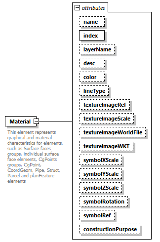 |
||||||||||||||||||||||||||||||||||||||||||||||||||||||||||||||||||||||||||||||||||||||||||||||||||||||
| namespace | http://www.landxml.org/schema/LandXML-2.0 | ||||||||||||||||||||||||||||||||||||||||||||||||||||||||||||||||||||||||||||||||||||||||||||||||||||||
| properties |
|
||||||||||||||||||||||||||||||||||||||||||||||||||||||||||||||||||||||||||||||||||||||||||||||||||||||
| used by |
|
||||||||||||||||||||||||||||||||||||||||||||||||||||||||||||||||||||||||||||||||||||||||||||||||||||||
| attributes |
|
||||||||||||||||||||||||||||||||||||||||||||||||||||||||||||||||||||||||||||||||||||||||||||||||||||||
| annotation |
|
||||||||||||||||||||||||||||||||||||||||||||||||||||||||||||||||||||||||||||||||||||||||||||||||||||||
| source | <xs:element name="Material"> <xs:annotation> <xs:documentation>This element represents graphical and material characteristics for elements, such as Surface faces groups, individual surface face elements, CgPoints groups, CgPoint, CoordGeom, Pipe, Struct, Parcel and planFeature elements</xs:documentation> <xs:documentation>Attribute values:</xs:documentation> <xs:documentation>name = the textual name of the element.</xs:documentation> <xs:documentation>index = the positive integer table index value of the element. All indice values begin at 1 in the LandXML schema.</xs:documentation> <xs:documentation>layerName = the textual name of the layer (or organizational catergory) element.</xs:documentation> <xs:documentation>color = RGB color string in the form of Red, Green, Blue each an integer value from 0 to 255.</xs:documentation> <xs:documentation>Example: color="255,0,0" is the RGB color value of Red</xs:documentation> <xs:documentation>textureImageRef = references a named TextImage element that contains the texture binary image in a hex encoded string</xs:documentation> <xs:documentation>symbolRef = references a named Symbol element that contains a 2D or 3D DXF graphics symbol</xs:documentation> <xs:documentation>symbolXScale = the X scale value applied to the Symbol element</xs:documentation> <xs:documentation>symbolYScale = the Y scale value applied to the Symbol element</xs:documentation> <xs:documentation>symbolZScale = the Z scale value applied to the Symbol element</xs:documentation> <xs:documentation>symbolRotation = the rotation angle value applied to the Symbol element</xs:documentation> <xs:documentation>contructionPurpose = the contruction purpose (suitable for layout of utilites, buildins, driveways, etc) for the area contain</xs:documentation> </xs:annotation> <xs:complexType> <xs:attribute name="name" type="xs:string" use="optional"/> <xs:attribute name="index" type="xs:integer" use="required"/> <xs:attribute name="layerName" type="xs:string" use="optional"/> <xs:attribute name="desc" type="xs:string" use="optional"/> <xs:attribute name="color" type="xs:string" use="optional"/> <xs:attribute name="lineType" type="lineTypes" use="optional"/> <xs:attribute name="textureImageRef" type="xs:string" use="optional"/> <xs:attribute name="textureImageScale" type="xs:double" use="optional"/> <xs:attribute name="textureImageWorldFile" type="xs:string" use="optional"/> <xs:attribute name="textureImageWKT" type="xs:string" use="optional"/> <xs:attribute name="symbolXScale" type="xs:double" use="optional"/> <xs:attribute name="symbolYScale" type="xs:double" use="optional"/> <xs:attribute name="symbolZScale" type="xs:double" use="optional"/> <xs:attribute name="symbolRotation" type="angle" use="optional"/> <xs:attribute name="symbolRef" type="xs:string" use="optional"/> <xs:attribute name="constructionPurpose" type="contructionPurposeType" use="optional"/> </xs:complexType> </xs:element> |
attribute Material/@name
| type | xs:string | ||
| properties |
|
||
| source | <xs:attribute name="name" type="xs:string" use="optional"/> |
attribute Material/@index
| type | xs:integer | ||
| properties |
|
||
| source | <xs:attribute name="index" type="xs:integer" use="required"/> |
attribute Material/@layerName
| type | xs:string | ||
| properties |
|
||
| source | <xs:attribute name="layerName" type="xs:string" use="optional"/> |
attribute Material/@desc
| type | xs:string | ||
| properties |
|
||
| source | <xs:attribute name="desc" type="xs:string" use="optional"/> |
attribute Material/@color
| type | xs:string | ||
| properties |
|
||
| source | <xs:attribute name="color" type="xs:string" use="optional"/> |
attribute Material/@lineType
| type | lineTypes | |||||||||||||||||||||
| properties |
|
|||||||||||||||||||||
| facets |
|
|||||||||||||||||||||
| source | <xs:attribute name="lineType" type="lineTypes" use="optional"/> |
attribute Material/@textureImageRef
| type | xs:string | ||
| properties |
|
||
| source | <xs:attribute name="textureImageRef" type="xs:string" use="optional"/> |
attribute Material/@textureImageScale
| type | xs:double | ||
| properties |
|
||
| source | <xs:attribute name="textureImageScale" type="xs:double" use="optional"/> |
attribute Material/@textureImageWorldFile
| type | xs:string | ||
| properties |
|
||
| source | <xs:attribute name="textureImageWorldFile" type="xs:string" use="optional"/> |
attribute Material/@textureImageWKT
| type | xs:string | ||
| properties |
|
||
| source | <xs:attribute name="textureImageWKT" type="xs:string" use="optional"/> |
attribute Material/@symbolXScale
| type | xs:double | ||
| properties |
|
||
| source | <xs:attribute name="symbolXScale" type="xs:double" use="optional"/> |
attribute Material/@symbolYScale
| type | xs:double | ||
| properties |
|
||
| source | <xs:attribute name="symbolYScale" type="xs:double" use="optional"/> |
attribute Material/@symbolZScale
| type | xs:double | ||
| properties |
|
||
| source | <xs:attribute name="symbolZScale" type="xs:double" use="optional"/> |
attribute Material/@symbolRotation
| type | angle | ||
| properties |
|
||
| source | <xs:attribute name="symbolRotation" type="angle" use="optional"/> |
attribute Material/@symbolRef
| type | xs:string | ||
| properties |
|
||
| source | <xs:attribute name="symbolRef" type="xs:string" use="optional"/> |
attribute Material/@constructionPurpose
| type | contructionPurposeType | |||||||||||||||||||||||||||
| properties |
|
|||||||||||||||||||||||||||
| facets |
|
|||||||||||||||||||||||||||
| source | <xs:attribute name="constructionPurpose" type="contructionPurposeType" use="optional"/> |
element MaterialTable
| diagram | 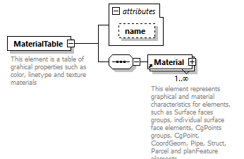 |
||||||||||||
| namespace | http://www.landxml.org/schema/LandXML-2.0 | ||||||||||||
| properties |
|
||||||||||||
| children | Material | ||||||||||||
| used by |
|
||||||||||||
| attributes |
|
||||||||||||
| annotation |
|
||||||||||||
| source | <xs:element name="MaterialTable"> <xs:annotation> <xs:documentation>This element is a table of grahical properties such as color, linetype and texture materials</xs:documentation> </xs:annotation> <xs:complexType> <xs:sequence> <xs:element ref="Material" maxOccurs="unbounded"/> </xs:sequence> <xs:attribute name="name" type="xs:string" use="optional"/> </xs:complexType> </xs:element> |
attribute MaterialTable/@name
| type | xs:string | ||
| properties |
|
||
| source | <xs:attribute name="name" type="xs:string" use="optional"/> |
element Metric
| diagram | 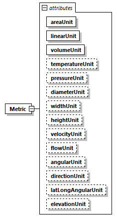 |
||||||||||||||||||||||||||||||||||||||||||||||||||||||||||||||||||||||||||||||||||||||||||
| namespace | http://www.landxml.org/schema/LandXML-2.0 | ||||||||||||||||||||||||||||||||||||||||||||||||||||||||||||||||||||||||||||||||||||||||||
| properties |
|
||||||||||||||||||||||||||||||||||||||||||||||||||||||||||||||||||||||||||||||||||||||||||
| used by |
|
||||||||||||||||||||||||||||||||||||||||||||||||||||||||||||||||||||||||||||||||||||||||||
| attributes |
|
||||||||||||||||||||||||||||||||||||||||||||||||||||||||||||||||||||||||||||||||||||||||||
| source | <xs:element name="Metric"> <xs:annotation> <xs:documentation/> </xs:annotation> <xs:complexType> <xs:attribute name="areaUnit" type="metArea" use="required"/> <xs:attribute name="linearUnit" type="metLinear" use="required"/> <xs:attribute name="volumeUnit" type="metVolume" use="required"/> <xs:attribute name="temperatureUnit" type="metTemperature" use="optional"/> <xs:attribute name="pressureUnit" type="metPressure" use="optional"/> <xs:attribute name="diameterUnit" type="metDiameter"/> <xs:attribute name="widthUnit" type="metWidth"/> <xs:attribute name="heightUnit" type="metHeight"/> <xs:attribute name="velocityUnit" type="metVelocity"/> <xs:attribute name="flowUnit" type="metFlow"/> <xs:attribute name="angularUnit" type="angularType" default="radians"/> <xs:attribute name="directionUnit" type="angularType" default="radians"/> <xs:attribute name="latLongAngularUnit" type="latLongAngularType" default="decimal degrees"/> <xs:attribute name="elevationUnit" type="elevationType" default="meter"/> <!-- FAA Additions start --> <!-- FAA Additions end --> </xs:complexType> </xs:element> |
attribute Metric/@areaUnit
| type | metArea | |||||||||||||||
| properties |
|
|||||||||||||||
| facets |
|
|||||||||||||||
| source | <xs:attribute name="areaUnit" type="metArea" use="required"/> |
attribute Metric/@linearUnit
| type | metLinear | |||||||||||||||
| properties |
|
|||||||||||||||
| facets |
|
|||||||||||||||
| source | <xs:attribute name="linearUnit" type="metLinear" use="required"/> |
attribute Metric/@volumeUnit
| type | metVolume | ||||||||||||
| properties |
|
||||||||||||
| facets |
|
||||||||||||
| source | <xs:attribute name="volumeUnit" type="metVolume" use="required"/> |
attribute Metric/@temperatureUnit
| type | metTemperature | |||||||||
| properties |
|
|||||||||
| facets |
|
|||||||||
| source | <xs:attribute name="temperatureUnit" type="metTemperature" use="optional"/> |
attribute Metric/@pressureUnit
| type | metPressure | |||||||||||||||
| properties |
|
|||||||||||||||
| facets |
|
|||||||||||||||
| source | <xs:attribute name="pressureUnit" type="metPressure" use="optional"/> |
attribute Metric/@diameterUnit
| type | metDiameter | |||||||||||||||
| facets |
|
|||||||||||||||
| source | <xs:attribute name="diameterUnit" type="metDiameter"/> |
attribute Metric/@widthUnit
| type | metWidth | |||||||||||||||
| facets |
|
|||||||||||||||
| source | <xs:attribute name="widthUnit" type="metWidth"/> |
attribute Metric/@heightUnit
| type | metHeight | |||||||||||||||
| facets |
|
|||||||||||||||
| source | <xs:attribute name="heightUnit" type="metHeight"/> |
attribute Metric/@velocityUnit
| type | metVelocity | |||||||||
| facets |
|
|||||||||
| source | <xs:attribute name="velocityUnit" type="metVelocity"/> |
attribute Metric/@flowUnit
| type | metFlow | ||||||||||||
| facets |
|
||||||||||||
| source | <xs:attribute name="flowUnit" type="metFlow"/> |
attribute Metric/@angularUnit
| type | angularType | |||||||||||||||
| properties |
|
|||||||||||||||
| facets |
|
|||||||||||||||
| source | <xs:attribute name="angularUnit" type="angularType" default="radians"/> |
attribute Metric/@directionUnit
| type | angularType | |||||||||||||||
| properties |
|
|||||||||||||||
| facets |
|
|||||||||||||||
| source | <xs:attribute name="directionUnit" type="angularType" default="radians"/> |
attribute Metric/@latLongAngularUnit
| type | latLongAngularType | |||||||||||||||
| properties |
|
|||||||||||||||
| facets |
|
|||||||||||||||
| source | <xs:attribute name="latLongAngularUnit" type="latLongAngularType" default="decimal degrees"/> |
attribute Metric/@elevationUnit
| type | elevationType | |||||||||||||||
| properties |
|
|||||||||||||||
| facets |
|
|||||||||||||||
| source | <xs:attribute name="elevationUnit" type="elevationType" default="meter"/> |
element Monument
| diagram | 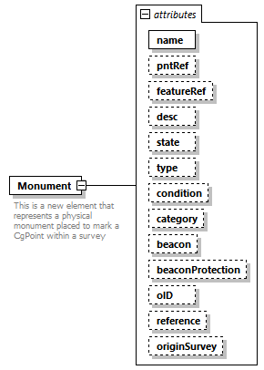 |
||||||||||||||||||||||||||||||||||||||||||||||||||||||||||||||||||||||||||||||||||||
| namespace | http://www.landxml.org/schema/LandXML-2.0 | ||||||||||||||||||||||||||||||||||||||||||||||||||||||||||||||||||||||||||||||||||||
| properties |
|
||||||||||||||||||||||||||||||||||||||||||||||||||||||||||||||||||||||||||||||||||||
| used by |
|
||||||||||||||||||||||||||||||||||||||||||||||||||||||||||||||||||||||||||||||||||||
| attributes |
|
||||||||||||||||||||||||||||||||||||||||||||||||||||||||||||||||||||||||||||||||||||
| annotation |
|
||||||||||||||||||||||||||||||||||||||||||||||||||||||||||||||||||||||||||||||||||||
| source | <xs:element name="Monument"> <xs:annotation> <xs:documentation>This is a new element that represents a physical monument placed to mark a CgPoint within a survey</xs:documentation> </xs:annotation> <xs:complexType> <xs:attribute name="name" type="xs:string" use="required"/> <xs:attribute name="pntRef" type="pointNameRef"/> <xs:attribute name="featureRef" type="featureNameRef" use="optional"/> <xs:attribute name="desc" type="xs:string"/> <xs:attribute name="state" type="monumentState"/> <xs:attribute name="type" type="monumentType"/> <xs:attribute name="condition" type="monumentCondition"/> <xs:attribute name="category" type="monumentCategory"/> <xs:attribute name="beacon" type="beaconType"/> <xs:attribute name="beaconProtection" type="beaconProtectionType"/> <xs:attribute name="oID" type="xs:string"/> <xs:attribute name="reference" type="xs:string"/> <xs:attribute name="originSurvey" type="xs:string"/> </xs:complexType> </xs:element> |
attribute Monument/@name
| type | xs:string | ||
| properties |
|
||
| source | <xs:attribute name="name" type="xs:string" use="required"/> |
attribute Monument/@pntRef
| type | pointNameRef |
| source | <xs:attribute name="pntRef" type="pointNameRef"/> |
attribute Monument/@featureRef
| type | featureNameRef | ||
| properties |
|
||
| source | <xs:attribute name="featureRef" type="featureNameRef" use="optional"/> |
attribute Monument/@desc
| type | xs:string |
| source | <xs:attribute name="desc" type="xs:string"/> |
attribute Monument/@state
| type | monumentState |
| source | <xs:attribute name="state" type="monumentState"/> |
attribute Monument/@type
| type | monumentType |
| source | <xs:attribute name="type" type="monumentType"/> |
attribute Monument/@condition
| type | monumentCondition |
| source | <xs:attribute name="condition" type="monumentCondition"/> |
attribute Monument/@category
| type | monumentCategory | |||||||||||||||||||||
| facets |
|
|||||||||||||||||||||
| source | <xs:attribute name="category" type="monumentCategory"/> |
attribute Monument/@beacon
| type | beaconType | ||||||||||||||||||||||||||||||||||||||||||||||||
| facets |
|
||||||||||||||||||||||||||||||||||||||||||||||||
| source | <xs:attribute name="beacon" type="beaconType"/> |
attribute Monument/@beaconProtection
| type | beaconProtectionType | |||||||||||||||||||||||||||
| facets |
|
|||||||||||||||||||||||||||
| source | <xs:attribute name="beaconProtection" type="beaconProtectionType"/> |
attribute Monument/@oID
| type | xs:string |
| source | <xs:attribute name="oID" type="xs:string"/> |
attribute Monument/@reference
| type | xs:string |
| source | <xs:attribute name="reference" type="xs:string"/> |
attribute Monument/@originSurvey
| type | xs:string |
| source | <xs:attribute name="originSurvey" type="xs:string"/> |
element Monuments
| diagram | 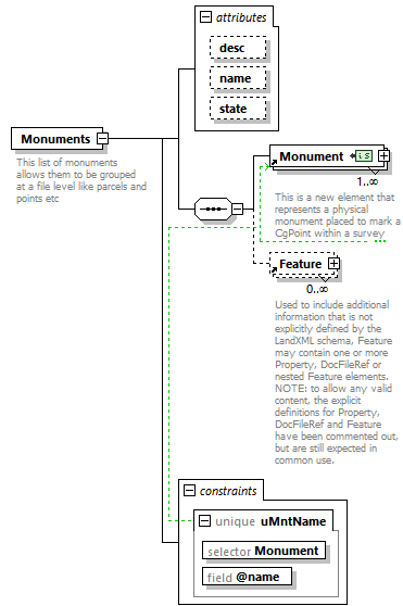 |
||||||||||||||||||||||||
| namespace | http://www.landxml.org/schema/LandXML-2.0 | ||||||||||||||||||||||||
| properties |
|
||||||||||||||||||||||||
| children | Monument Feature | ||||||||||||||||||||||||
| used by |
|
||||||||||||||||||||||||
| attributes |
|
||||||||||||||||||||||||
| identity constraints |
|
||||||||||||||||||||||||
| annotation |
|
||||||||||||||||||||||||
| source | <xs:element name="Monuments"> <xs:annotation> <xs:documentation>This list of monuments allows them to be grouped at a file level like parcels and points etc</xs:documentation> </xs:annotation> <xs:complexType> <xs:sequence> <xs:element ref="Monument" maxOccurs="unbounded"/> <xs:element ref="Feature" minOccurs="0" maxOccurs="unbounded"/> </xs:sequence> <xs:attribute name="desc" type="xs:string"/> <xs:attribute name="name" type="xs:string"/> <xs:attribute name="state" type="stateType"/> </xs:complexType> <xs:unique name="uMntName"> <xs:selector xpath="Monument"/> <xs:field xpath="@name"/> </xs:unique> </xs:element> |
attribute Monuments/@desc
| type | xs:string |
| source | <xs:attribute name="desc" type="xs:string"/> |
attribute Monuments/@name
| type | xs:string |
| source | <xs:attribute name="name" type="xs:string"/> |
attribute Monuments/@state
| type | stateType | |||||||||||||||
| facets |
|
|||||||||||||||
| source | <xs:attribute name="state" type="stateType"/> |
element NoPassingZone
| diagram | 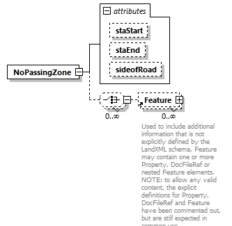 |
||||||||||||||||||||||||
| namespace | http://www.landxml.org/schema/LandXML-2.0 | ||||||||||||||||||||||||
| properties |
|
||||||||||||||||||||||||
| children | Feature | ||||||||||||||||||||||||
| used by |
|
||||||||||||||||||||||||
| attributes |
|
||||||||||||||||||||||||
| source | <xs:element name="NoPassingZone"> <xs:complexType> <xs:choice minOccurs="0" maxOccurs="unbounded"> <xs:element ref="Feature" minOccurs="0" maxOccurs="unbounded"/> </xs:choice> <xs:attribute name="staStart" type="station"/> <xs:attribute name="staEnd" type="station"/> <xs:attribute name="sideofRoad" type="sideofRoadType"/> </xs:complexType> </xs:element> |
attribute NoPassingZone/@staStart
| type | station |
| source | <xs:attribute name="staStart" type="station"/> |
attribute NoPassingZone/@staEnd
| type | station |
| source | <xs:attribute name="staEnd" type="station"/> |
attribute NoPassingZone/@sideofRoad
| type | sideofRoadType | ||||||||||||
| facets |
|
||||||||||||
| source | <xs:attribute name="sideofRoad" type="sideofRoadType"/> |
element ObservationGroup
| diagram | 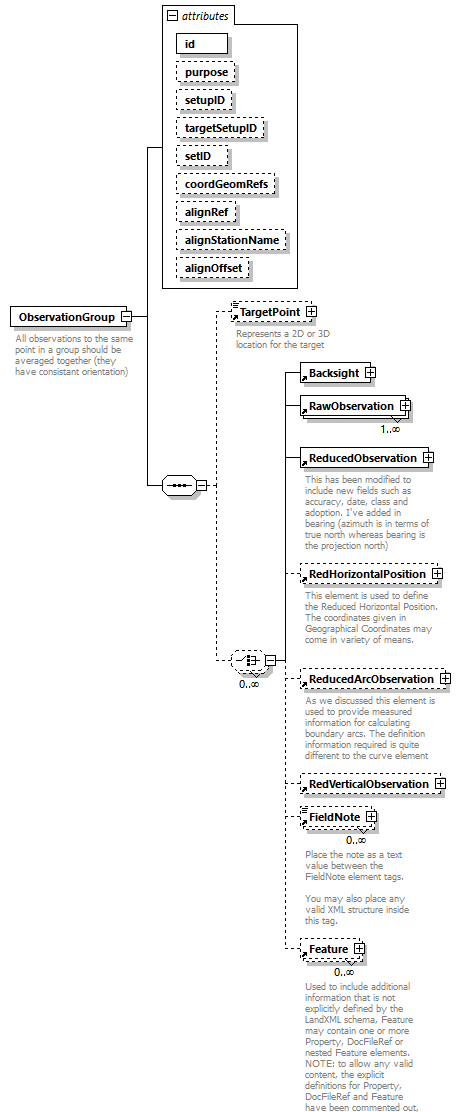 |
||||||||||||||||||||||||||||||||||||||||||||||||||||||||||||
| namespace | http://www.landxml.org/schema/LandXML-2.0 | ||||||||||||||||||||||||||||||||||||||||||||||||||||||||||||
| properties |
|
||||||||||||||||||||||||||||||||||||||||||||||||||||||||||||
| children | TargetPoint Backsight RawObservation ReducedObservation RedHorizontalPosition ReducedArcObservation RedVerticalObservation FieldNote Feature | ||||||||||||||||||||||||||||||||||||||||||||||||||||||||||||
| used by |
|
||||||||||||||||||||||||||||||||||||||||||||||||||||||||||||
| attributes |
|
||||||||||||||||||||||||||||||||||||||||||||||||||||||||||||
| annotation |
|
||||||||||||||||||||||||||||||||||||||||||||||||||||||||||||
| source | <xs:element name="ObservationGroup"> <xs:annotation> <xs:documentation>All observations to the same point in a group should be averaged together (they have consistant orientation)</xs:documentation> </xs:annotation> <xs:complexType> <xs:sequence> <xs:element ref="TargetPoint" minOccurs="0"/> <xs:choice minOccurs="0" maxOccurs="unbounded"> <xs:element ref="Backsight"/> <xs:element ref="RawObservation" maxOccurs="unbounded"/> <xs:element ref="ReducedObservation"/> <xs:element ref="RedHorizontalPosition" minOccurs="0"/> <xs:element ref="ReducedArcObservation" minOccurs="0"/> <xs:element ref="RedVerticalObservation" minOccurs="0"/> <xs:element ref="FieldNote" minOccurs="0" maxOccurs="unbounded"/> <xs:element ref="Feature" minOccurs="0" maxOccurs="unbounded"/> </xs:choice> </xs:sequence> <xs:attribute name="id" type="xs:ID" use="required"/> <xs:attribute name="purpose" type="purposeType"/> <xs:attribute name="setupID" type="xs:IDREF"/> <xs:attribute name="targetSetupID" type="xs:IDREF"/> <xs:attribute name="setID"/> <xs:attribute name="coordGeomRefs" type="coordGeomNameRefs"/> <xs:attribute name="alignRef" type="alignmentNameRef"/> <xs:attribute name="alignStationName" type="xs:string"/> <xs:attribute name="alignOffset" type="offsetDistance"/> <!-- coordGeomRefs identifies one or more 'name' values that link to specific <Line>, <Curve>, <Spiral> or <IrregularLine> in a <CoordGeom> element. This allows linking an survey observation to specific <Parcel>.<CoordGeom> based geometry. --> <!-- alignRef is the name of the alignment. alignStationName is the station value where the rod reading is taken. alignOffset is the signed (+/-) distance from the CL of the referenced alignment. --> </xs:complexType> </xs:element> |
attribute ObservationGroup/@id
| type | xs:ID | ||
| properties |
|
||
| source | <xs:attribute name="id" type="xs:ID" use="required"/> |
attribute ObservationGroup/@purpose
| type | purposeType | |||||||||||||||||||||||||||||||||||||||||||||
| facets |
|
|||||||||||||||||||||||||||||||||||||||||||||
| source | <xs:attribute name="purpose" type="purposeType"/> |
attribute ObservationGroup/@setupID
| type | xs:IDREF |
| source | <xs:attribute name="setupID" type="xs:IDREF"/> |
attribute ObservationGroup/@targetSetupID
| type | xs:IDREF |
| source | <xs:attribute name="targetSetupID" type="xs:IDREF"/> |
attribute ObservationGroup/@setID
| source | <xs:attribute name="setID"/> |
attribute ObservationGroup/@coordGeomRefs
| type | coordGeomNameRefs |
| source | <xs:attribute name="coordGeomRefs" type="coordGeomNameRefs"/> |
attribute ObservationGroup/@alignRef
| type | alignmentNameRef |
| source | <xs:attribute name="alignRef" type="alignmentNameRef"/> |
attribute ObservationGroup/@alignStationName
| type | xs:string |
| source | <xs:attribute name="alignStationName" type="xs:string"/> |
attribute ObservationGroup/@alignOffset
| type | offsetDistance |
| source | <xs:attribute name="alignOffset" type="offsetDistance"/> |
element ObstructionOffset
| diagram | 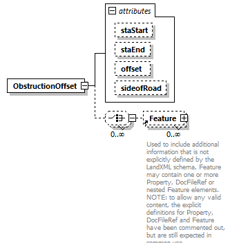 |
||||||||||||||||||||||||||||||
| namespace | http://www.landxml.org/schema/LandXML-2.0 | ||||||||||||||||||||||||||||||
| properties |
|
||||||||||||||||||||||||||||||
| children | Feature | ||||||||||||||||||||||||||||||
| used by |
|
||||||||||||||||||||||||||||||
| attributes |
|
||||||||||||||||||||||||||||||
| source | <xs:element name="ObstructionOffset"> <xs:complexType> <xs:choice minOccurs="0" maxOccurs="unbounded"> <xs:element ref="Feature" minOccurs="0" maxOccurs="unbounded"/> </xs:choice> <xs:attribute name="staStart" type="station"/> <xs:attribute name="staEnd" type="station"/> <xs:attribute name="offset" type="offsetDistance"/> <xs:attribute name="sideofRoad" type="sideofRoadType"/> </xs:complexType> </xs:element> |
attribute ObstructionOffset/@staStart
| type | station |
| source | <xs:attribute name="staStart" type="station"/> |
attribute ObstructionOffset/@staEnd
| type | station |
| source | <xs:attribute name="staEnd" type="station"/> |
attribute ObstructionOffset/@offset
| type | offsetDistance |
| source | <xs:attribute name="offset" type="offsetDistance"/> |
attribute ObstructionOffset/@sideofRoad
| type | sideofRoadType | ||||||||||||
| facets |
|
||||||||||||
| source | <xs:attribute name="sideofRoad" type="sideofRoadType"/> |
element OffsetLane
| diagram | 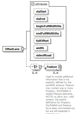 |
||||||||||||||||||||||||||||||||||||||||||||||||
| namespace | http://www.landxml.org/schema/LandXML-2.0 | ||||||||||||||||||||||||||||||||||||||||||||||||
| properties |
|
||||||||||||||||||||||||||||||||||||||||||||||||
| children | Feature | ||||||||||||||||||||||||||||||||||||||||||||||||
| used by |
|
||||||||||||||||||||||||||||||||||||||||||||||||
| attributes |
|
||||||||||||||||||||||||||||||||||||||||||||||||
| source | <xs:element name="OffsetLane"> <xs:complexType> <xs:choice minOccurs="0" maxOccurs="unbounded"> <xs:element ref="Feature" minOccurs="0" maxOccurs="unbounded"/> </xs:choice> <xs:attribute name="staStart" type="station"/> <xs:attribute name="staEnd" type="station"/> <xs:attribute name="beginFullWidthSta" type="station"/> <xs:attribute name="endFullWidthSta" type="station"/> <xs:attribute name="fullOffset" type="offsetDistance"/> <xs:attribute name="width" type="xs:double"/> <xs:attribute name="sideofRoad" type="sideofRoadType"/> </xs:complexType> </xs:element> |
attribute OffsetLane/@staStart
| type | station |
| source | <xs:attribute name="staStart" type="station"/> |
attribute OffsetLane/@staEnd
| type | station |
| source | <xs:attribute name="staEnd" type="station"/> |
attribute OffsetLane/@beginFullWidthSta
| type | station |
| source | <xs:attribute name="beginFullWidthSta" type="station"/> |
attribute OffsetLane/@endFullWidthSta
| type | station |
| source | <xs:attribute name="endFullWidthSta" type="station"/> |
attribute OffsetLane/@fullOffset
| type | offsetDistance |
| source | <xs:attribute name="fullOffset" type="offsetDistance"/> |
attribute OffsetLane/@width
| type | xs:double |
| source | <xs:attribute name="width" type="xs:double"/> |
attribute OffsetLane/@sideofRoad
| type | sideofRoadType | ||||||||||||
| facets |
|
||||||||||||
| source | <xs:attribute name="sideofRoad" type="sideofRoadType"/> |
element OffsetVals
| diagram |  |
||||||||||||||||||||||||
| namespace | http://www.landxml.org/schema/LandXML-2.0 | ||||||||||||||||||||||||
| properties |
|
||||||||||||||||||||||||
| used by |
|
||||||||||||||||||||||||
| attributes |
|
||||||||||||||||||||||||
| annotation |
|
||||||||||||||||||||||||
| source | <xs:element name="OffsetVals"> <xs:annotation> <xs:documentation>offsetInOut: -ve = offset in towards inst, +ve = offset away from inst </xs:documentation> <xs:documentation>offsetLeftRight: -ve = left, +ve = right (as viewed from instrument) </xs:documentation> <xs:documentation>offsetUpDown: -ve = down, +ve = up</xs:documentation> </xs:annotation> <xs:complexType> <xs:attribute name="offsetInOut" type="xs:double"/> <xs:attribute name="offsetLeftRight" type="xs:double"/> <xs:attribute name="offsetUpDown" type="xs:double"/> </xs:complexType> </xs:element> |
attribute OffsetVals/@offsetInOut
| type | xs:double |
| source | <xs:attribute name="offsetInOut" type="xs:double"/> |
attribute OffsetVals/@offsetLeftRight
| type | xs:double |
| source | <xs:attribute name="offsetLeftRight" type="xs:double"/> |
attribute OffsetVals/@offsetUpDown
| type | xs:double |
| source | <xs:attribute name="offsetUpDown" type="xs:double"/> |
element Outlet
| diagram |  |
||||||||||||||||||||||||||||||||||||||||||||||||||||||||||||||||||||||||
| namespace | http://www.landxml.org/schema/LandXML-2.0 | ||||||||||||||||||||||||||||||||||||||||||||||||||||||||||||||||||||||||
| type | extension of PointType3dReq | ||||||||||||||||||||||||||||||||||||||||||||||||||||||||||||||||||||||||
| properties |
|
||||||||||||||||||||||||||||||||||||||||||||||||||||||||||||||||||||||||
| used by |
|
||||||||||||||||||||||||||||||||||||||||||||||||||||||||||||||||||||||||
| facets |
|
||||||||||||||||||||||||||||||||||||||||||||||||||||||||||||||||||||||||
| attributes |
|
||||||||||||||||||||||||||||||||||||||||||||||||||||||||||||||||||||||||
| annotation |
|
||||||||||||||||||||||||||||||||||||||||||||||||||||||||||||||||||||||||
| source | <xs:element name="Outlet"> <xs:annotation> <xs:documentation>Identifies a drain point from the watershed with a space delimited "northing easting elevation" value.</xs:documentation> <xs:documentation>If it drains to another known watershed, then the name of that watershed is identified by the "refWs" attribute.</xs:documentation> </xs:annotation> <xs:complexType mixed="true"> <xs:simpleContent> <xs:extension base="PointType3dReq"> <xs:attribute name="refWS" type="waterShedNameRef"/> </xs:extension> </xs:simpleContent> </xs:complexType> </xs:element> |
attribute Outlet/@refWS
| type | waterShedNameRef |
| source | <xs:attribute name="refWS" type="waterShedNameRef"/> |
element OutletStruct
| diagram |  |
||||||||||||||||||||||||||||||||||||||||||||||||||||||
| namespace | http://www.landxml.org/schema/LandXML-2.0 | ||||||||||||||||||||||||||||||||||||||||||||||||||||||
| properties |
|
||||||||||||||||||||||||||||||||||||||||||||||||||||||
| children | Feature | ||||||||||||||||||||||||||||||||||||||||||||||||||||||
| used by |
|
||||||||||||||||||||||||||||||||||||||||||||||||||||||
| attributes |
|
||||||||||||||||||||||||||||||||||||||||||||||||||||||
| annotation |
|
||||||||||||||||||||||||||||||||||||||||||||||||||||||
| source | <xs:element name="OutletStruct"> <xs:annotation> <xs:documentation>Typically a headwall, so headwall parameters are used</xs:documentation> <xs:documentation>wingwallFlare = wingwall angle in degress</xs:documentation> </xs:annotation> <xs:complexType> <xs:sequence> <xs:element ref="Feature" minOccurs="0" maxOccurs="unbounded"/> </xs:sequence> <xs:attribute name="length" type="xs:double"/> <xs:attribute name="height" type="xs:double"/> <xs:attribute name="thickness" type="xs:double"/> <xs:attribute name="wingwallLength" type="xs:double"/> <xs:attribute name="wingwallHeight" type="xs:double"/> <xs:attribute name="wingwallThick" type="xs:double"/> <xs:attribute name="wingwallFlare" type="xs:double"/> <xs:attribute name="kineticEfficiency" type="xs:double"/> </xs:complexType> </xs:element> |
attribute OutletStruct/@length
| type | xs:double |
| source | <xs:attribute name="length" type="xs:double"/> |
attribute OutletStruct/@height
| type | xs:double |
| source | <xs:attribute name="height" type="xs:double"/> |
attribute OutletStruct/@thickness
| type | xs:double |
| source | <xs:attribute name="thickness" type="xs:double"/> |
attribute OutletStruct/@wingwallLength
| type | xs:double |
| source | <xs:attribute name="wingwallLength" type="xs:double"/> |
attribute OutletStruct/@wingwallHeight
| type | xs:double |
| source | <xs:attribute name="wingwallHeight" type="xs:double"/> |
attribute OutletStruct/@wingwallThick
| type | xs:double |
| source | <xs:attribute name="wingwallThick" type="xs:double"/> |
attribute OutletStruct/@wingwallFlare
| type | xs:double |
| source | <xs:attribute name="wingwallFlare" type="xs:double"/> |
attribute OutletStruct/@kineticEfficiency
| type | xs:double |
| source | <xs:attribute name="kineticEfficiency" type="xs:double"/> |
element OutSpiral
| diagram | 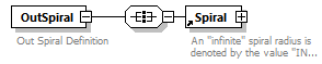 |
||
| namespace | http://www.landxml.org/schema/LandXML-2.0 | ||
| properties |
|
||
| children | Spiral | ||
| used by |
|
||
| annotation |
|
||
| source | <xs:element name="OutSpiral"> <xs:annotation> <xs:documentation>Out Spiral Definition</xs:documentation> </xs:annotation> <xs:complexType> <xs:all> <xs:element ref="Spiral"/> </xs:all> </xs:complexType> </xs:element> |
element P
| diagram | 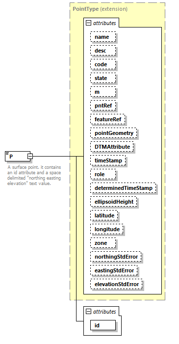 |
||||||||||||||||||||||||||||||||||||||||||||||||||||||||||||||||||||||||||||||||||||||||||||||||||||||||||||||||||||||||||||||
| namespace | http://www.landxml.org/schema/LandXML-2.0 | ||||||||||||||||||||||||||||||||||||||||||||||||||||||||||||||||||||||||||||||||||||||||||||||||||||||||||||||||||||||||||||||
| type | extension of PointType | ||||||||||||||||||||||||||||||||||||||||||||||||||||||||||||||||||||||||||||||||||||||||||||||||||||||||||||||||||||||||||||||
| properties |
|
||||||||||||||||||||||||||||||||||||||||||||||||||||||||||||||||||||||||||||||||||||||||||||||||||||||||||||||||||||||||||||||
| used by |
|
||||||||||||||||||||||||||||||||||||||||||||||||||||||||||||||||||||||||||||||||||||||||||||||||||||||||||||||||||||||||||||||
| facets |
|
||||||||||||||||||||||||||||||||||||||||||||||||||||||||||||||||||||||||||||||||||||||||||||||||||||||||||||||||||||||||||||||
| attributes |
|
||||||||||||||||||||||||||||||||||||||||||||||||||||||||||||||||||||||||||||||||||||||||||||||||||||||||||||||||||||||||||||||
| annotation |
|
||||||||||||||||||||||||||||||||||||||||||||||||||||||||||||||||||||||||||||||||||||||||||||||||||||||||||||||||||||||||||||||
| source | <xs:element name="P"> <xs:annotation> <xs:documentation>A surface point. it contains an id attribute and a space delimited "northing easting elevation" text value.</xs:documentation> <xs:documentation>The id values are referenced by the surface faces for the coordinate values.</xs:documentation> </xs:annotation> <xs:complexType mixed="true"> <xs:simpleContent> <xs:extension base="PointType"> <xs:attribute name="id" type="xs:positiveInteger" use="required"/> </xs:extension> </xs:simpleContent> </xs:complexType> </xs:element> |
attribute P/@id
| type | xs:positiveInteger | ||
| properties |
|
||
| source | <xs:attribute name="id" type="xs:positiveInteger" use="required"/> |
element ParaCurve
| diagram | 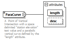 |
||||||||||||||||||
| namespace | http://www.landxml.org/schema/LandXML-2.0 | ||||||||||||||||||
| type | extension of Point2dReq | ||||||||||||||||||
| properties |
|
||||||||||||||||||
| used by |
|
||||||||||||||||||
| facets |
|
||||||||||||||||||
| attributes |
|
||||||||||||||||||
| annotation |
|
||||||||||||||||||
| source | <xs:element name="ParaCurve"> <xs:annotation> <xs:documentation>A Point of Vertical Intersection with a space delimited "station elevation" text value and a parabolic vertical curve defined by the "length" attribute.</xs:documentation> </xs:annotation> <xs:complexType mixed="true"> <xs:simpleContent> <xs:extension base="Point2dReq"> <xs:attribute name="length" type="xs:double" use="required"/> <xs:attribute name="desc" type="xs:string"/> </xs:extension> </xs:simpleContent> </xs:complexType> </xs:element> |
attribute ParaCurve/@length
| type | xs:double | ||
| properties |
|
||
| source | <xs:attribute name="length" type="xs:double" use="required"/> |
attribute ParaCurve/@desc
| type | xs:string |
| source | <xs:attribute name="desc" type="xs:string"/> |
element Parcel
| diagram | 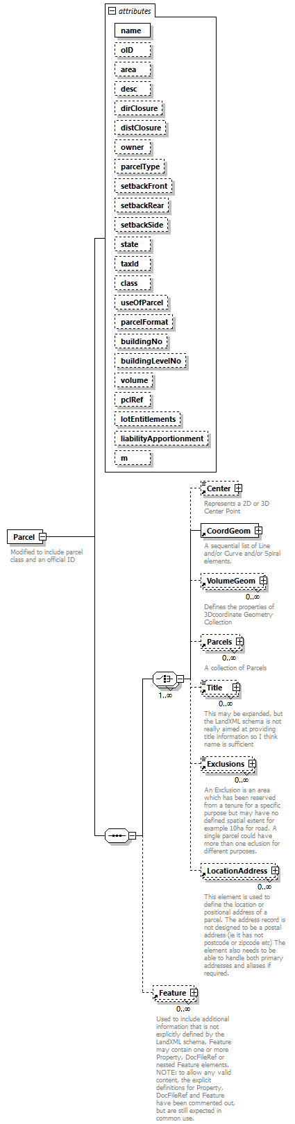 |
||||||||||||||||||||||||||||||||||||||||||||||||||||||||||||||||||||||||||||||||||||||||||||||||||||||||||||||||||||||||||||||||||||||||||||||||
| namespace | http://www.landxml.org/schema/LandXML-2.0 | ||||||||||||||||||||||||||||||||||||||||||||||||||||||||||||||||||||||||||||||||||||||||||||||||||||||||||||||||||||||||||||||||||||||||||||||||
| properties |
|
||||||||||||||||||||||||||||||||||||||||||||||||||||||||||||||||||||||||||||||||||||||||||||||||||||||||||||||||||||||||||||||||||||||||||||||||
| children | Center CoordGeom VolumeGeom Parcels Title Exclusions LocationAddress Feature | ||||||||||||||||||||||||||||||||||||||||||||||||||||||||||||||||||||||||||||||||||||||||||||||||||||||||||||||||||||||||||||||||||||||||||||||||
| used by |
|
||||||||||||||||||||||||||||||||||||||||||||||||||||||||||||||||||||||||||||||||||||||||||||||||||||||||||||||||||||||||||||||||||||||||||||||||
| attributes |
|
||||||||||||||||||||||||||||||||||||||||||||||||||||||||||||||||||||||||||||||||||||||||||||||||||||||||||||||||||||||||||||||||||||||||||||||||
| annotation |
|
||||||||||||||||||||||||||||||||||||||||||||||||||||||||||||||||||||||||||||||||||||||||||||||||||||||||||||||||||||||||||||||||||||||||||||||||
| source | <xs:element name="Parcel"> <xs:annotation> <xs:documentation>Modified to include parcel class and an official ID</xs:documentation> </xs:annotation> <xs:complexType> <xs:sequence> <xs:choice maxOccurs="unbounded"> <xs:element ref="Center" minOccurs="0"/> <xs:element ref="CoordGeom"/> <xs:element ref="VolumeGeom" minOccurs="0" maxOccurs="unbounded"/> <xs:element ref="Parcels" minOccurs="0" maxOccurs="unbounded"/> <xs:element ref="Title" minOccurs="0" maxOccurs="unbounded"/> <xs:element ref="Exclusions" minOccurs="0" maxOccurs="unbounded"/> <xs:element ref="LocationAddress" minOccurs="0" maxOccurs="unbounded"/> </xs:choice> <xs:element ref="Feature" minOccurs="0" maxOccurs="unbounded"/> </xs:sequence> <xs:attribute name="name" type="xs:string" use="required"/> <xs:attribute name="oID" type="xs:string"/> <xs:attribute name="area" type="xs:double"/> <xs:attribute name="desc" type="xs:string"/> <xs:attribute name="dirClosure" type="direction"/> <xs:attribute name="distClosure" type="xs:double"/> <xs:attribute name="owner" type="xs:string"/> <xs:attribute name="parcelType" type="xs:string"/> <xs:attribute name="setbackFront" type="xs:double"/> <xs:attribute name="setbackRear" type="xs:double"/> <xs:attribute name="setbackSide" type="xs:double"/> <xs:attribute name="state" type="parcelStateType"/> <xs:attribute name="taxId" type="xs:string"/> <xs:attribute name="class" type="parcelClass"/> <xs:attribute name="useOfParcel" type="useOfParcelType"/> <xs:attribute name="parcelFormat" type="parcelFormat"/> <xs:attribute name="buildingNo" type="xs:string"/> <xs:attribute name="buildingLevelNo" type="xs:string"/> <xs:attribute name="volume" type="xs:string"/> <xs:attribute name="pclRef" type="parcelNameRef"/> <xs:attribute name="lotEntitlements" type="xs:string"/> <xs:attribute name="liabilityApportionment" type="xs:string"/> <xs:attribute name="m" type="materialTableIndexRef"/> </xs:complexType> </xs:element> |
attribute Parcel/@name
| type | xs:string | ||
| properties |
|
||
| source | <xs:attribute name="name" type="xs:string" use="required"/> |
attribute Parcel/@oID
| type | xs:string |
| source | <xs:attribute name="oID" type="xs:string"/> |
attribute Parcel/@area
| type | xs:double |
| source | <xs:attribute name="area" type="xs:double"/> |
attribute Parcel/@desc
| type | xs:string |
| source | <xs:attribute name="desc" type="xs:string"/> |
attribute Parcel/@dirClosure
| type | direction |
| source | <xs:attribute name="dirClosure" type="direction"/> |
attribute Parcel/@distClosure
| type | xs:double |
| source | <xs:attribute name="distClosure" type="xs:double"/> |
attribute Parcel/@owner
| type | xs:string |
| source | <xs:attribute name="owner" type="xs:string"/> |
attribute Parcel/@parcelType
| type | xs:string |
| source | <xs:attribute name="parcelType" type="xs:string"/> |
attribute Parcel/@setbackFront
| type | xs:double |
| source | <xs:attribute name="setbackFront" type="xs:double"/> |
attribute Parcel/@setbackRear
| type | xs:double |
| source | <xs:attribute name="setbackRear" type="xs:double"/> |
attribute Parcel/@setbackSide
| type | xs:double |
| source | <xs:attribute name="setbackSide" type="xs:double"/> |
attribute Parcel/@state
| type | parcelStateType | |||||||||||||||||||||||||||
| facets |
|
|||||||||||||||||||||||||||
| source | <xs:attribute name="state" type="parcelStateType"/> |
attribute Parcel/@taxId
| type | xs:string |
| source | <xs:attribute name="taxId" type="xs:string"/> |
attribute Parcel/@class
| type | parcelClass |
| source | <xs:attribute name="class" type="parcelClass"/> |
attribute Parcel/@useOfParcel
| type | useOfParcelType |
| source | <xs:attribute name="useOfParcel" type="useOfParcelType"/> |
attribute Parcel/@parcelFormat
| type | parcelFormat |
| source | <xs:attribute name="parcelFormat" type="parcelFormat"/> |
attribute Parcel/@buildingNo
| type | xs:string |
| source | <xs:attribute name="buildingNo" type="xs:string"/> |
attribute Parcel/@buildingLevelNo
| type | xs:string |
| source | <xs:attribute name="buildingLevelNo" type="xs:string"/> |
attribute Parcel/@volume
| type | xs:string |
| source | <xs:attribute name="volume" type="xs:string"/> |
attribute Parcel/@pclRef
| type | parcelNameRef |
| source | <xs:attribute name="pclRef" type="parcelNameRef"/> |
attribute Parcel/@lotEntitlements
| type | xs:string |
| source | <xs:attribute name="lotEntitlements" type="xs:string"/> |
attribute Parcel/@liabilityApportionment
| type | xs:string |
| source | <xs:attribute name="liabilityApportionment" type="xs:string"/> |
attribute Parcel/@m
| type | materialTableIndexRef |
| source | <xs:attribute name="m" type="materialTableIndexRef"/> |
element Parcels
| diagram | 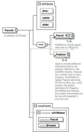 |
||||||||||||||||||||||||
| namespace | http://www.landxml.org/schema/LandXML-2.0 | ||||||||||||||||||||||||
| properties |
|
||||||||||||||||||||||||
| children | Parcel Feature | ||||||||||||||||||||||||
| used by |
|
||||||||||||||||||||||||
| attributes |
|
||||||||||||||||||||||||
| identity constraints |
|
||||||||||||||||||||||||
| annotation |
|
||||||||||||||||||||||||
| source | <xs:element name="Parcels"> <xs:annotation> <xs:documentation>A collection of Parcels</xs:documentation> </xs:annotation> <xs:complexType> <xs:sequence> <xs:element ref="Parcel" maxOccurs="unbounded"/> <xs:element ref="Feature" minOccurs="0" maxOccurs="unbounded"/> </xs:sequence> <xs:attribute name="desc" type="xs:string"/> <xs:attribute name="name" type="xs:string"/> <xs:attribute name="state" type="stateType"/> </xs:complexType> <xs:unique name="uPclName"> <xs:selector xpath="Parcel"/> <xs:field xpath="@name"/> </xs:unique> </xs:element> |
attribute Parcels/@desc
| type | xs:string |
| source | <xs:attribute name="desc" type="xs:string"/> |
attribute Parcels/@name
| type | xs:string |
| source | <xs:attribute name="name" type="xs:string"/> |
attribute Parcels/@state
| type | stateType | |||||||||||||||
| facets |
|
|||||||||||||||
| source | <xs:attribute name="state" type="stateType"/> |
element PassingLane
| diagram | 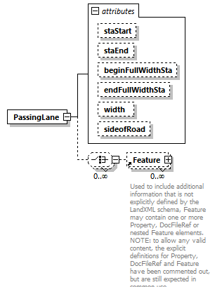 |
||||||||||||||||||||||||||||||||||||||||||
| namespace | http://www.landxml.org/schema/LandXML-2.0 | ||||||||||||||||||||||||||||||||||||||||||
| properties |
|
||||||||||||||||||||||||||||||||||||||||||
| children | Feature | ||||||||||||||||||||||||||||||||||||||||||
| used by |
|
||||||||||||||||||||||||||||||||||||||||||
| attributes |
|
||||||||||||||||||||||||||||||||||||||||||
| source | <xs:element name="PassingLane"> <xs:complexType> <xs:choice minOccurs="0" maxOccurs="unbounded"> <xs:element ref="Feature" minOccurs="0" maxOccurs="unbounded"/> </xs:choice> <xs:attribute name="staStart" type="station"/> <xs:attribute name="staEnd" type="station"/> <xs:attribute name="beginFullWidthSta" type="station"/> <xs:attribute name="endFullWidthSta" type="station"/> <xs:attribute name="width" type="xs:double"/> <xs:attribute name="sideofRoad" type="sideofRoadType"/> </xs:complexType> </xs:element> |
attribute PassingLane/@staStart
| type | station |
| source | <xs:attribute name="staStart" type="station"/> |
attribute PassingLane/@staEnd
| type | station |
| source | <xs:attribute name="staEnd" type="station"/> |
attribute PassingLane/@beginFullWidthSta
| type | station |
| source | <xs:attribute name="beginFullWidthSta" type="station"/> |
attribute PassingLane/@endFullWidthSta
| type | station |
| source | <xs:attribute name="endFullWidthSta" type="station"/> |
attribute PassingLane/@width
| type | xs:double |
| source | <xs:attribute name="width" type="xs:double"/> |
attribute PassingLane/@sideofRoad
| type | sideofRoadType | ||||||||||||
| facets |
|
||||||||||||
| source | <xs:attribute name="sideofRoad" type="sideofRoadType"/> |
element PeakHour
| diagram | 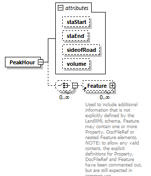 |
||||||||||||||||||||||||||||||
| namespace | http://www.landxml.org/schema/LandXML-2.0 | ||||||||||||||||||||||||||||||
| properties |
|
||||||||||||||||||||||||||||||
| children | Feature | ||||||||||||||||||||||||||||||
| used by |
|
||||||||||||||||||||||||||||||
| attributes |
|
||||||||||||||||||||||||||||||
| source | <xs:element name="PeakHour"> <xs:complexType> <xs:choice minOccurs="0" maxOccurs="unbounded"> <xs:element ref="Feature" minOccurs="0" maxOccurs="unbounded"/> </xs:choice> <xs:attribute name="staStart" type="station"/> <xs:attribute name="staEnd" type="station"/> <xs:attribute name="sideofRoad" type="sideofRoadType"/> <xs:attribute name="volume" type="xs:double"/> </xs:complexType> <!-- Peak Hour Volume - This item is the peak hour volume (PHV). The 30th highest volume of the year should be used as the PHV, which can be approximated as 15 percent of the average daily traffic (ADT). On two-lane rural highways, the DHV is the total traffic in both directions of travel. The unit of measure for this item is vehicles/hour. --> </xs:element> |
attribute PeakHour/@staStart
| type | station |
| source | <xs:attribute name="staStart" type="station"/> |
attribute PeakHour/@staEnd
| type | station |
| source | <xs:attribute name="staEnd" type="station"/> |
attribute PeakHour/@sideofRoad
| type | sideofRoadType | ||||||||||||
| facets |
|
||||||||||||
| source | <xs:attribute name="sideofRoad" type="sideofRoadType"/> |
attribute PeakHour/@volume
| type | xs:double |
| source | <xs:attribute name="volume" type="xs:double"/> |
element Personnel
| diagram | 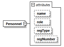 |
||||||||||||||||||||||||||||||
| namespace | http://www.landxml.org/schema/LandXML-2.0 | ||||||||||||||||||||||||||||||
| properties |
|
||||||||||||||||||||||||||||||
| used by |
|
||||||||||||||||||||||||||||||
| attributes |
|
||||||||||||||||||||||||||||||
| source | <xs:element name="Personnel"> <xs:complexType> <xs:attribute name="name" type="xs:string"/> <xs:attribute name="role" type="surveyorRoleType"/> <xs:attribute name="regType" type="registrationType"/> <xs:attribute name="regNumber" type="xs:string"/> </xs:complexType> </xs:element> |
attribute Personnel/@name
| type | xs:string |
| source | <xs:attribute name="name" type="xs:string"/> |
attribute Personnel/@role
| type | surveyorRoleType |
| source | <xs:attribute name="role" type="surveyorRoleType"/> |
attribute Personnel/@regType
| type | registrationType |
| source | <xs:attribute name="regType" type="registrationType"/> |
attribute Personnel/@regNumber
| type | xs:string |
| source | <xs:attribute name="regNumber" type="xs:string"/> |
element PI
| diagram | 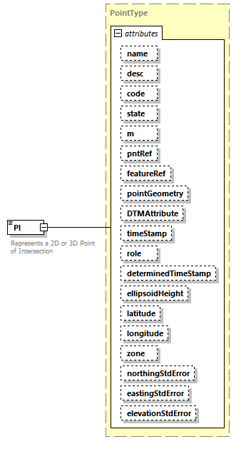 |
||||||||||||||||||||||||||||||||||||||||||||||||||||||||||||||||||||||||||||||||||||||||||||||||||||||||||||||||||||||||
| namespace | http://www.landxml.org/schema/LandXML-2.0 | ||||||||||||||||||||||||||||||||||||||||||||||||||||||||||||||||||||||||||||||||||||||||||||||||||||||||||||||||||||||||
| type | PointType | ||||||||||||||||||||||||||||||||||||||||||||||||||||||||||||||||||||||||||||||||||||||||||||||||||||||||||||||||||||||||
| properties |
|
||||||||||||||||||||||||||||||||||||||||||||||||||||||||||||||||||||||||||||||||||||||||||||||||||||||||||||||||||||||||
| used by |
|
||||||||||||||||||||||||||||||||||||||||||||||||||||||||||||||||||||||||||||||||||||||||||||||||||||||||||||||||||||||||
| facets |
|
||||||||||||||||||||||||||||||||||||||||||||||||||||||||||||||||||||||||||||||||||||||||||||||||||||||||||||||||||||||||
| attributes |
|
||||||||||||||||||||||||||||||||||||||||||||||||||||||||||||||||||||||||||||||||||||||||||||||||||||||||||||||||||||||||
| annotation |
|
||||||||||||||||||||||||||||||||||||||||||||||||||||||||||||||||||||||||||||||||||||||||||||||||||||||||||||||||||||||||
| source | <xs:element name="PI" type="PointType"> <xs:annotation> <xs:documentation>Represents a 2D or 3D Point of Intersection</xs:documentation> <xs:documentation>Defined by either a coordinate text value ("north east" or "north east elev") or a CgPoint number reference "pntRef" attribute.</xs:documentation> </xs:annotation> </xs:element> |
element Pipe
| diagram | 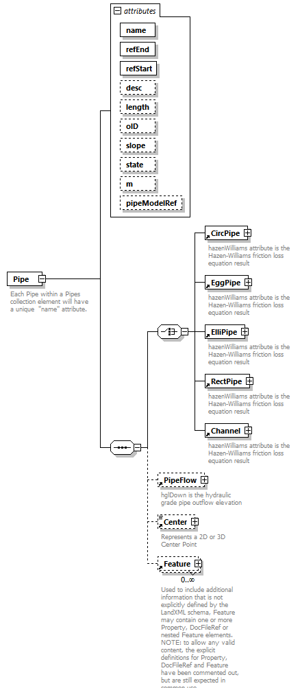 |
||||||||||||||||||||||||||||||||||||||||||||||||||||||||||||||||||
| namespace | http://www.landxml.org/schema/LandXML-2.0 | ||||||||||||||||||||||||||||||||||||||||||||||||||||||||||||||||||
| properties |
|
||||||||||||||||||||||||||||||||||||||||||||||||||||||||||||||||||
| children | CircPipe EggPipe ElliPipe RectPipe Channel PipeFlow Center Feature | ||||||||||||||||||||||||||||||||||||||||||||||||||||||||||||||||||
| used by |
|
||||||||||||||||||||||||||||||||||||||||||||||||||||||||||||||||||
| attributes |
|
||||||||||||||||||||||||||||||||||||||||||||||||||||||||||||||||||
| annotation |
|
||||||||||||||||||||||||||||||||||||||||||||||||||||||||||||||||||
| source | <xs:element name="Pipe"> <xs:annotation> <xs:documentation>Each Pipe within a Pipes collection element will have a unique "name" attribute.</xs:documentation> <xs:documentation>The pipe type can be determined by the existance of one of the following elements: CircPipe, ElliPipe or RectPipe.</xs:documentation> <xs:documentation>The "startRef and "endRef" attributes reference Struct "name" values.</xs:documentation> <xs:documentation>The start and end invert elevations for the pipe are defined in the Invert elements of referenced structures.</xs:documentation> <xs:documentation>Since a struct may have more than one Invert element, the Invert "pipeRef" attribute is used to select the correct invert element.</xs:documentation> </xs:annotation> <xs:complexType> <xs:sequence> <xs:choice> <xs:element ref="CircPipe"/> <xs:element ref="EggPipe"/> <xs:element ref="ElliPipe"/> <xs:element ref="RectPipe"/> <xs:element ref="Channel"/> </xs:choice> <xs:element ref="PipeFlow" minOccurs="0"/> <!-- <Center> point of the Pipe is the point of center on the curved pipe arc. If this optional element is specified, then the pipe starts at refStart, passes through the <Center> point, and end at refEnd. --> <xs:element ref="Center" minOccurs="0"/> <xs:element ref="Feature" minOccurs="0" maxOccurs="unbounded"/> </xs:sequence> <xs:attribute name="name" type="xs:string" use="required"/> <xs:attribute name="refEnd" type="structNameRef" use="required"/> <xs:attribute name="refStart" type="structNameRef" use="required"/> <xs:attribute name="desc" type="xs:string"/> <xs:attribute name="length" type="xs:double"/> <xs:attribute name="oID" type="xs:string"/> <xs:attribute name="slope" type="slope"/> <xs:attribute name="state" type="stateType"/> <xs:attribute name="m" type="materialTableIndexRef"/> <xs:attribute name="pipeModelRef" type="pipeModelNameRef"/> </xs:complexType> </xs:element> |
attribute Pipe/@name
| type | xs:string | ||
| properties |
|
||
| source | <xs:attribute name="name" type="xs:string" use="required"/> |
attribute Pipe/@refEnd
| type | structNameRef | ||
| properties |
|
||
| source | <xs:attribute name="refEnd" type="structNameRef" use="required"/> |
attribute Pipe/@refStart
| type | structNameRef | ||
| properties |
|
||
| source | <xs:attribute name="refStart" type="structNameRef" use="required"/> |
attribute Pipe/@desc
| type | xs:string |
| source | <xs:attribute name="desc" type="xs:string"/> |
attribute Pipe/@length
| type | xs:double |
| source | <xs:attribute name="length" type="xs:double"/> |
attribute Pipe/@oID
| type | xs:string |
| source | <xs:attribute name="oID" type="xs:string"/> |
attribute Pipe/@slope
| type | slope |
| source | <xs:attribute name="slope" type="slope"/> |
attribute Pipe/@state
| type | stateType | |||||||||||||||
| facets |
|
|||||||||||||||
| source | <xs:attribute name="state" type="stateType"/> |
attribute Pipe/@m
| type | materialTableIndexRef |
| source | <xs:attribute name="m" type="materialTableIndexRef"/> |
attribute Pipe/@pipeModelRef
| type | pipeModelNameRef |
| source | <xs:attribute name="pipeModelRef" type="pipeModelNameRef"/> |
element PipeFlow
| diagram | 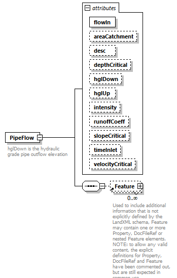 |
||||||||||||||||||||||||||||||||||||||||||||||||||||||||||||||||||||||||
| namespace | http://www.landxml.org/schema/LandXML-2.0 | ||||||||||||||||||||||||||||||||||||||||||||||||||||||||||||||||||||||||
| properties |
|
||||||||||||||||||||||||||||||||||||||||||||||||||||||||||||||||||||||||
| children | Feature | ||||||||||||||||||||||||||||||||||||||||||||||||||||||||||||||||||||||||
| used by |
|
||||||||||||||||||||||||||||||||||||||||||||||||||||||||||||||||||||||||
| attributes |
|
||||||||||||||||||||||||||||||||||||||||||||||||||||||||||||||||||||||||
| annotation |
|
||||||||||||||||||||||||||||||||||||||||||||||||||||||||||||||||||||||||
| source | <xs:element name="PipeFlow"> <xs:annotation> <xs:documentation>hglDown is the hydraulic grade pipe outflow elevation</xs:documentation> <xs:documentation>hglUp is the hydraulic grade pipe inflow elevation</xs:documentation> </xs:annotation> <xs:complexType> <xs:sequence> <xs:element ref="Feature" minOccurs="0" maxOccurs="unbounded"/> </xs:sequence> <xs:attribute name="flowIn" type="pipeFlow" use="required"/> <xs:attribute name="areaCatchment" type="xs:double"/> <xs:attribute name="desc" type="xs:string"/> <xs:attribute name="depthCritical" type="xs:double"/> <xs:attribute name="hglDown" type="xs:double"/> <xs:attribute name="hglUp" type="xs:double"/> <xs:attribute name="intensity" type="xs:double"/> <xs:attribute name="runoffCoeff" type="xs:double"/> <xs:attribute name="slopeCritical" type="slope"/> <xs:attribute name="timeInlet" type="xs:double"/> <xs:attribute name="velocityCritical" type="pipeFlow"/> </xs:complexType> </xs:element> |
attribute PipeFlow/@flowIn
| type | pipeFlow | ||
| properties |
|
||
| source | <xs:attribute name="flowIn" type="pipeFlow" use="required"/> |
attribute PipeFlow/@areaCatchment
| type | xs:double |
| source | <xs:attribute name="areaCatchment" type="xs:double"/> |
attribute PipeFlow/@desc
| type | xs:string |
| source | <xs:attribute name="desc" type="xs:string"/> |
attribute PipeFlow/@depthCritical
| type | xs:double |
| source | <xs:attribute name="depthCritical" type="xs:double"/> |
attribute PipeFlow/@hglDown
| type | xs:double |
| source | <xs:attribute name="hglDown" type="xs:double"/> |
attribute PipeFlow/@hglUp
| type | xs:double |
| source | <xs:attribute name="hglUp" type="xs:double"/> |
attribute PipeFlow/@intensity
| type | xs:double |
| source | <xs:attribute name="intensity" type="xs:double"/> |
attribute PipeFlow/@runoffCoeff
| type | xs:double |
| source | <xs:attribute name="runoffCoeff" type="xs:double"/> |
attribute PipeFlow/@slopeCritical
| type | slope |
| source | <xs:attribute name="slopeCritical" type="slope"/> |
attribute PipeFlow/@timeInlet
| type | xs:double |
| source | <xs:attribute name="timeInlet" type="xs:double"/> |
attribute PipeFlow/@velocityCritical
| type | pipeFlow |
| source | <xs:attribute name="velocityCritical" type="pipeFlow"/> |
element PipeModel
| diagram | 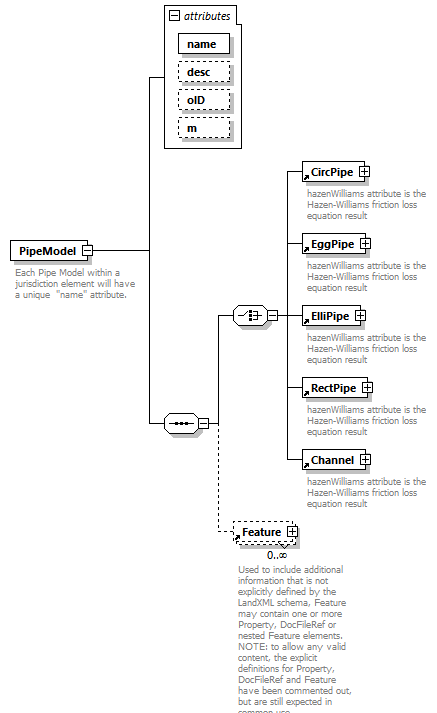 |
||||||||||||||||||||||||||||||
| namespace | http://www.landxml.org/schema/LandXML-2.0 | ||||||||||||||||||||||||||||||
| properties |
|
||||||||||||||||||||||||||||||
| children | CircPipe EggPipe ElliPipe RectPipe Channel Feature | ||||||||||||||||||||||||||||||
| used by |
|
||||||||||||||||||||||||||||||
| attributes |
|
||||||||||||||||||||||||||||||
| annotation |
|
||||||||||||||||||||||||||||||
| source | <xs:element name="PipeModel"> <xs:annotation> <xs:documentation>Each Pipe Model within a jurisdiction element will have a unique "name" attribute.</xs:documentation> <xs:documentation>Use the oID attribute to describe based on jurisdiction nameing conventions.</xs:documentation> <xs:documentation>The pipe ype and shape is required and determined by the one of the following elements: CircPipe, ElliPipe or RectPipe.</xs:documentation> </xs:annotation> <xs:complexType> <xs:sequence> <xs:choice minOccurs="1" maxOccurs="1"> <xs:element ref="CircPipe"/> <xs:element ref="EggPipe"/> <xs:element ref="ElliPipe"/> <xs:element ref="RectPipe"/> <xs:element ref="Channel"/> </xs:choice> <xs:element ref="Feature" minOccurs="0" maxOccurs="unbounded"/> </xs:sequence> <xs:attribute name="name" type="xs:string" use="required"/> <xs:attribute name="desc" type="xs:string"/> <xs:attribute name="oID" type="xs:string"/> <xs:attribute name="m" type="materialTableIndexRef"/> </xs:complexType> </xs:element> |
attribute PipeModel/@name
| type | xs:string | ||
| properties |
|
||
| source | <xs:attribute name="name" type="xs:string" use="required"/> |
attribute PipeModel/@desc
| type | xs:string |
| source | <xs:attribute name="desc" type="xs:string"/> |
attribute PipeModel/@oID
| type | xs:string |
| source | <xs:attribute name="oID" type="xs:string"/> |
attribute PipeModel/@m
| type | materialTableIndexRef |
| source | <xs:attribute name="m" type="materialTableIndexRef"/> |
element PipeModels
| diagram | 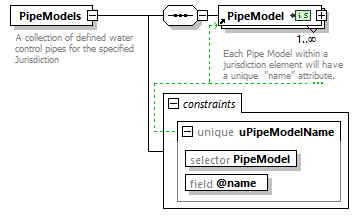 |
||||||||||||
| namespace | http://www.landxml.org/schema/LandXML-2.0 | ||||||||||||
| properties |
|
||||||||||||
| children | PipeModel | ||||||||||||
| used by |
|
||||||||||||
| identity constraints |
|
||||||||||||
| annotation |
|
||||||||||||
| source | <xs:element name="PipeModels"> <xs:annotation> <xs:documentation>A collection of defined water control pipes for the specified Jurisdiction</xs:documentation> </xs:annotation> <xs:complexType> <xs:sequence> <xs:element ref="PipeModel" minOccurs="1" maxOccurs="unbounded"/> </xs:sequence> </xs:complexType> <xs:unique name="uPipeModelName"> <xs:selector xpath="PipeModel"/> <xs:field xpath="@name"/> </xs:unique> </xs:element> |
element PipeNetwork
| diagram | 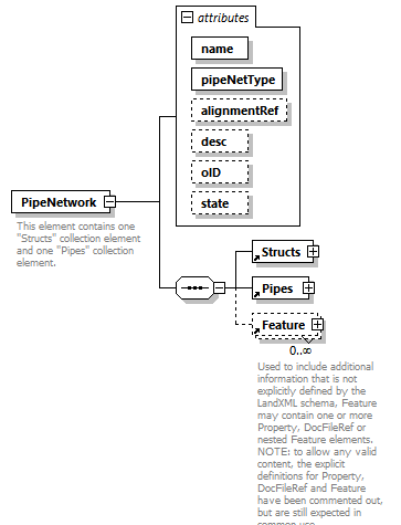 |
||||||||||||||||||||||||||||||||||||||||||
| namespace | http://www.landxml.org/schema/LandXML-2.0 | ||||||||||||||||||||||||||||||||||||||||||
| properties |
|
||||||||||||||||||||||||||||||||||||||||||
| children | Structs Pipes Feature | ||||||||||||||||||||||||||||||||||||||||||
| used by |
|
||||||||||||||||||||||||||||||||||||||||||
| attributes |
|
||||||||||||||||||||||||||||||||||||||||||
| annotation |
|
||||||||||||||||||||||||||||||||||||||||||
| source | <xs:element name="PipeNetwork"> <xs:annotation> <xs:documentation>This element contains one "Structs" collection element and one "Pipes" collection element.</xs:documentation> <xs:documentation>keyRef is a Schema validation mechanism that ensures that the "structRef" and "pipeRef" attribute values have corresponding Pipe and Struct "name" values"</xs:documentation> </xs:annotation> <xs:complexType> <xs:sequence> <xs:element ref="Structs"/> <xs:element ref="Pipes"/> <xs:element ref="Feature" minOccurs="0" maxOccurs="unbounded"/> </xs:sequence> <xs:attribute name="name" type="xs:string" use="required"/> <xs:attribute name="pipeNetType" type="pipeNetworkType" use="required"/> <xs:attribute name="alignmentRef" type="alignmentNameRef"/> <xs:attribute name="desc" type="xs:string"/> <xs:attribute name="oID" type="xs:string"/> <xs:attribute name="state" type="stateType"/> </xs:complexType> </xs:element> |
attribute PipeNetwork/@name
| type | xs:string | ||
| properties |
|
||
| source | <xs:attribute name="name" type="xs:string" use="required"/> |
attribute PipeNetwork/@pipeNetType
| type | pipeNetworkType | ||||||||||||||||||||||||
| properties |
|
||||||||||||||||||||||||
| facets |
|
||||||||||||||||||||||||
| source | <xs:attribute name="pipeNetType" type="pipeNetworkType" use="required"/> |
attribute PipeNetwork/@alignmentRef
| type | alignmentNameRef |
| source | <xs:attribute name="alignmentRef" type="alignmentNameRef"/> |
attribute PipeNetwork/@desc
| type | xs:string |
| source | <xs:attribute name="desc" type="xs:string"/> |
attribute PipeNetwork/@oID
| type | xs:string |
| source | <xs:attribute name="oID" type="xs:string"/> |
attribute PipeNetwork/@state
| type | stateType | |||||||||||||||
| facets |
|
|||||||||||||||
| source | <xs:attribute name="state" type="stateType"/> |
element PipeNetworks
| diagram | 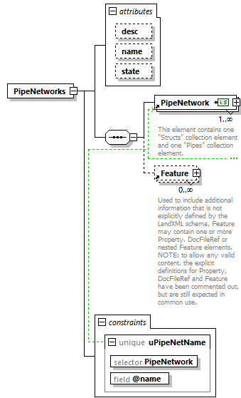 |
||||||||||||||||||||||||
| namespace | http://www.landxml.org/schema/LandXML-2.0 | ||||||||||||||||||||||||
| properties |
|
||||||||||||||||||||||||
| children | PipeNetwork Feature | ||||||||||||||||||||||||
| used by |
|
||||||||||||||||||||||||
| attributes |
|
||||||||||||||||||||||||
| identity constraints |
|
||||||||||||||||||||||||
| source | <xs:element name="PipeNetworks"> <xs:annotation> <xs:documentation/> </xs:annotation> <xs:complexType> <xs:sequence> <xs:element ref="PipeNetwork" maxOccurs="unbounded"/> <xs:element ref="Feature" minOccurs="0" maxOccurs="unbounded"/> </xs:sequence> <xs:attribute name="desc" type="xs:string"/> <xs:attribute name="name" type="xs:string"/> <xs:attribute name="state" type="stateType"/> </xs:complexType> <xs:unique name="uPipeNetName"> <xs:selector xpath="PipeNetwork"/> <xs:field xpath="@name"/> </xs:unique> </xs:element> |
attribute PipeNetworks/@desc
| type | xs:string |
| source | <xs:attribute name="desc" type="xs:string"/> |
attribute PipeNetworks/@name
| type | xs:string |
| source | <xs:attribute name="name" type="xs:string"/> |
attribute PipeNetworks/@state
| type | stateType | |||||||||||||||
| facets |
|
|||||||||||||||
| source | <xs:attribute name="state" type="stateType"/> |
element Pipes
| diagram | 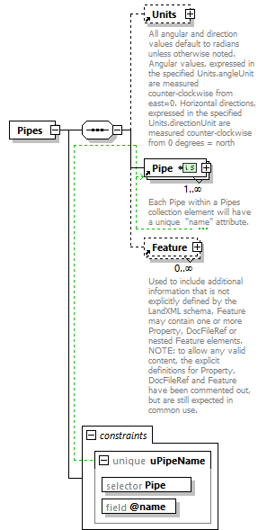 |
||||||||||||
| namespace | http://www.landxml.org/schema/LandXML-2.0 | ||||||||||||
| properties |
|
||||||||||||
| children | Units Pipe Feature | ||||||||||||
| used by |
|
||||||||||||
| identity constraints |
|
||||||||||||
| source | <xs:element name="Pipes"> <xs:annotation> <xs:documentation/> </xs:annotation> <xs:complexType> <xs:sequence> <xs:element ref="Units" minOccurs="0"/> <xs:element ref="Pipe" maxOccurs="unbounded"/> <xs:element ref="Feature" minOccurs="0" maxOccurs="unbounded"/> </xs:sequence> </xs:complexType> <xs:unique name="uPipeName"> <xs:selector xpath="Pipe"/> <xs:field xpath="@name"/> </xs:unique> </xs:element> |
element PlanFeature
| diagram | 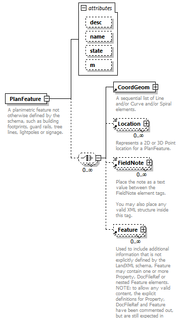 |
||||||||||||||||||||||||||||||
| namespace | http://www.landxml.org/schema/LandXML-2.0 | ||||||||||||||||||||||||||||||
| properties |
|
||||||||||||||||||||||||||||||
| children | CoordGeom Location FieldNote Feature | ||||||||||||||||||||||||||||||
| used by |
|
||||||||||||||||||||||||||||||
| attributes |
|
||||||||||||||||||||||||||||||
| annotation |
|
||||||||||||||||||||||||||||||
| source | <xs:element name="PlanFeature"> <xs:annotation> <xs:documentation>A planimetric feature not otherwise defined by the schema, such as building footprints, guard rails, tree lines, lightpoles or signage.</xs:documentation> </xs:annotation> <xs:complexType> <xs:choice minOccurs="0" maxOccurs="unbounded"> <xs:element ref="CoordGeom"/> <xs:element ref="Location" minOccurs="0" maxOccurs="unbounded"/> <xs:element ref="FieldNote" minOccurs="0" maxOccurs="unbounded"/> <xs:element ref="Feature" minOccurs="0" maxOccurs="unbounded"/> </xs:choice> <xs:attribute name="desc" type="xs:string"/> <xs:attribute name="name" type="xs:string"/> <xs:attribute name="state" type="stateType"/> <xs:attribute name="m" type="materialTableIndexRef"/> </xs:complexType> </xs:element> |
attribute PlanFeature/@desc
| type | xs:string |
| source | <xs:attribute name="desc" type="xs:string"/> |
attribute PlanFeature/@name
| type | xs:string |
| source | <xs:attribute name="name" type="xs:string"/> |
attribute PlanFeature/@state
| type | stateType | |||||||||||||||
| facets |
|
|||||||||||||||
| source | <xs:attribute name="state" type="stateType"/> |
attribute PlanFeature/@m
| type | materialTableIndexRef |
| source | <xs:attribute name="m" type="materialTableIndexRef"/> |
element PlanFeatures
| diagram | 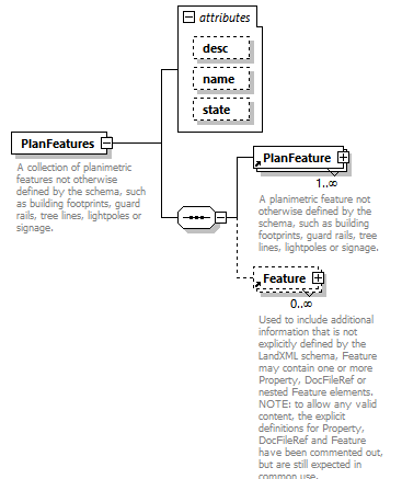 |
||||||||||||||||||||||||
| namespace | http://www.landxml.org/schema/LandXML-2.0 | ||||||||||||||||||||||||
| properties |
|
||||||||||||||||||||||||
| children | PlanFeature Feature | ||||||||||||||||||||||||
| used by |
|
||||||||||||||||||||||||
| attributes |
|
||||||||||||||||||||||||
| annotation |
|
||||||||||||||||||||||||
| source | <xs:element name="PlanFeatures"> <xs:annotation> <xs:documentation>A collection of planimetric features not otherwise defined by the schema, such as building footprints, guard rails, tree lines, lightpoles or signage.</xs:documentation> <xs:documentation>Typically a PlanFeatures element will contain a collection of similar items.</xs:documentation> </xs:annotation> <xs:complexType> <xs:sequence> <xs:element ref="PlanFeature" maxOccurs="unbounded"/> <xs:element ref="Feature" minOccurs="0" maxOccurs="unbounded"/> </xs:sequence> <xs:attribute name="desc" type="xs:string"/> <xs:attribute name="name" type="xs:string"/> <xs:attribute name="state" type="stateType"/> </xs:complexType> </xs:element> |
attribute PlanFeatures/@desc
| type | xs:string |
| source | <xs:attribute name="desc" type="xs:string"/> |
attribute PlanFeatures/@name
| type | xs:string |
| source | <xs:attribute name="name" type="xs:string"/> |
attribute PlanFeatures/@state
| type | stateType | |||||||||||||||
| facets |
|
|||||||||||||||
| source | <xs:attribute name="state" type="stateType"/> |
element PntList2D
| diagram |  |
||||||
| namespace | http://www.landxml.org/schema/LandXML-2.0 | ||||||
| type | restriction of Point | ||||||
| properties |
|
||||||
| used by |
|
||||||
| facets |
|
||||||
| annotation |
|
||||||
| source | <xs:element name="PntList2D"> <xs:annotation> <xs:documentation>A sequential space delimited list of 2D coordinates with a minimum of 2 points (4 values). </xs:documentation> <xs:documentation>It is primarily used for ProfileSurf to hold the list of station/elevations and CrossSectSurf for offset/elevation. </xs:documentation> <xs:documentation>Example: "0.000 86.52 6.267 86.89 12.413 87.01 26.020 87.83" </xs:documentation> </xs:annotation> <xs:simpleType> <xs:restriction base="Point"> <xs:minLength value="2"/> </xs:restriction> </xs:simpleType> </xs:element> |
element PntList3D
| diagram |  |
||||||
| namespace | http://www.landxml.org/schema/LandXML-2.0 | ||||||
| type | restriction of Point | ||||||
| properties |
|
||||||
| used by |
|
||||||
| facets |
|
||||||
| annotation |
|
||||||
| source | <xs:element name="PntList3D"> <xs:annotation> <xs:documentation>A sequential space delimited list of 3D coordinates with a minimum of 2 points (6 values). </xs:documentation> <xs:documentation>Primarily used to store lists of northing/easting/elevation for Terrain Surface data. </xs:documentation> <xs:documentation>Example: "0.000 86.52 50.0 6.267 86.89 50.0 12.413 87.01 50.0 26.020 87.83 50.0" </xs:documentation> </xs:annotation> <xs:simpleType> <xs:restriction base="Point"> <xs:minLength value="3"/> </xs:restriction> </xs:simpleType> </xs:element> |
element Pnts
| diagram | 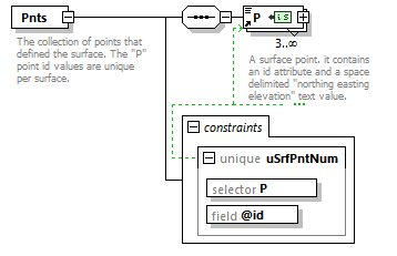 |
||||||||||||
| namespace | http://www.landxml.org/schema/LandXML-2.0 | ||||||||||||
| properties |
|
||||||||||||
| children | P | ||||||||||||
| used by |
|
||||||||||||
| identity constraints |
|
||||||||||||
| annotation |
|
||||||||||||
| source | <xs:element name="Pnts"> <xs:annotation> <xs:documentation>The collection of points that defined the surface. The "P" point id values are unique per surface.</xs:documentation> <xs:documentation>The id values are referenced by the surface faces and breaklines.</xs:documentation> </xs:annotation> <xs:complexType> <xs:sequence> <xs:element ref="P" minOccurs="3" maxOccurs="unbounded"/> </xs:sequence> </xs:complexType> <xs:unique name="uSrfPntNum"> <xs:selector xpath="P"/> <xs:field xpath="@id"/> </xs:unique> </xs:element> |
element PointFile
| diagram | 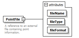 |
||||||||||||||||||||||||
| namespace | http://www.landxml.org/schema/LandXML-2.0 | ||||||||||||||||||||||||
| properties |
|
||||||||||||||||||||||||
| used by |
|
||||||||||||||||||||||||
| attributes |
|
||||||||||||||||||||||||
| annotation |
|
||||||||||||||||||||||||
| source | <xs:element name="PointFile"> <xs:annotation> <xs:documentation>A reference to an external file containing point information.</xs:documentation> <xs:documentation>The format of the information is defined by the order and delimeter attributes.</xs:documentation> </xs:annotation> <xs:complexType> <xs:attribute name="fileName" use="required"/> <xs:attribute name="fileType" use="required"/> <xs:attribute name="fileFormat" use="required"/> </xs:complexType> </xs:element> |
attribute PointFile/@fileName
| properties |
|
||
| source | <xs:attribute name="fileName" use="required"/> |
attribute PointFile/@fileType
| properties |
|
||
| source | <xs:attribute name="fileType" use="required"/> |
attribute PointFile/@fileFormat
| properties |
|
||
| source | <xs:attribute name="fileFormat" use="required"/> |
element PointFiles
| diagram | 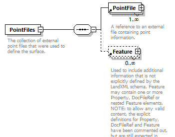 |
||||
| namespace | http://www.landxml.org/schema/LandXML-2.0 | ||||
| properties |
|
||||
| children | PointFile Feature | ||||
| used by |
|
||||
| annotation |
|
||||
| source | <xs:element name="PointFiles"> <xs:annotation> <xs:documentation>The collection of external point files that were used to define the surface.</xs:documentation> <xs:documentation>Use is optional.</xs:documentation> </xs:annotation> <xs:complexType> <xs:sequence> <xs:element ref="PointFile" maxOccurs="unbounded"/> <xs:element ref="Feature" minOccurs="0" maxOccurs="unbounded"/> </xs:sequence> </xs:complexType> </xs:element> |
element PointResults
| diagram | 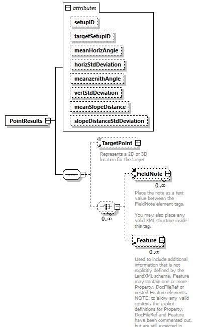 |
||||||||||||||||||||||||||||||||||||||||||||||||||||||
| namespace | http://www.landxml.org/schema/LandXML-2.0 | ||||||||||||||||||||||||||||||||||||||||||||||||||||||
| properties |
|
||||||||||||||||||||||||||||||||||||||||||||||||||||||
| children | TargetPoint FieldNote Feature | ||||||||||||||||||||||||||||||||||||||||||||||||||||||
| used by |
|
||||||||||||||||||||||||||||||||||||||||||||||||||||||
| attributes |
|
||||||||||||||||||||||||||||||||||||||||||||||||||||||
| source | <xs:element name="PointResults"> <xs:annotation> <xs:documentation/> </xs:annotation> <xs:complexType> <xs:sequence> <xs:element ref="TargetPoint" minOccurs="0"/> <xs:choice minOccurs="0" maxOccurs="unbounded"> <xs:element ref="FieldNote" minOccurs="0" maxOccurs="unbounded"/> <xs:element ref="Feature" minOccurs="0" maxOccurs="unbounded"/> </xs:choice> </xs:sequence> <xs:attribute name="setupID" type="xs:IDREF"/> <xs:attribute name="targetSetupID" type="xs:IDREF"/> <xs:attribute name="meanHorizAngle" type="xs:double"/> <xs:attribute name="horizStdDeviation" type="xs:double"/> <xs:attribute name="meanzenithAngle" type="zenithAngle"/> <xs:attribute name="vertStdDeviation" type="xs:double"/> <xs:attribute name="meanSlopeDistance" type="xs:double"/> <xs:attribute name="slopeDistanceStdDeviation" type="xs:double"/> </xs:complexType> </xs:element> |
attribute PointResults/@setupID
| type | xs:IDREF |
| source | <xs:attribute name="setupID" type="xs:IDREF"/> |
attribute PointResults/@targetSetupID
| type | xs:IDREF |
| source | <xs:attribute name="targetSetupID" type="xs:IDREF"/> |
attribute PointResults/@meanHorizAngle
| type | xs:double |
| source | <xs:attribute name="meanHorizAngle" type="xs:double"/> |
attribute PointResults/@horizStdDeviation
| type | xs:double |
| source | <xs:attribute name="horizStdDeviation" type="xs:double"/> |
attribute PointResults/@meanzenithAngle
| type | zenithAngle |
| source | <xs:attribute name="meanzenithAngle" type="zenithAngle"/> |
attribute PointResults/@vertStdDeviation
| type | xs:double |
| source | <xs:attribute name="vertStdDeviation" type="xs:double"/> |
attribute PointResults/@meanSlopeDistance
| type | xs:double |
| source | <xs:attribute name="meanSlopeDistance" type="xs:double"/> |
attribute PointResults/@slopeDistanceStdDeviation
| type | xs:double |
| source | <xs:attribute name="slopeDistanceStdDeviation" type="xs:double"/> |
element Pond
| diagram | 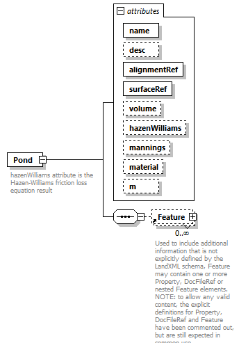 |
||||||||||||||||||||||||||||||||||||||||||||||||||||||||||||
| namespace | http://www.landxml.org/schema/LandXML-2.0 | ||||||||||||||||||||||||||||||||||||||||||||||||||||||||||||
| properties |
|
||||||||||||||||||||||||||||||||||||||||||||||||||||||||||||
| children | Feature | ||||||||||||||||||||||||||||||||||||||||||||||||||||||||||||
| used by |
|
||||||||||||||||||||||||||||||||||||||||||||||||||||||||||||
| attributes |
|
||||||||||||||||||||||||||||||||||||||||||||||||||||||||||||
| annotation |
|
||||||||||||||||||||||||||||||||||||||||||||||||||||||||||||
| source | <xs:element name="Pond"> <xs:annotation> <xs:documentation>hazenWilliams attribute is the Hazen-Williams friction loss equation result</xs:documentation> <xs:documentation>mannings attribute is the Mannings coeffecient of roughness</xs:documentation> </xs:annotation> <xs:complexType> <xs:sequence> <xs:element ref="Feature" minOccurs="0" maxOccurs="unbounded"/> </xs:sequence> <xs:attribute name="name" type="xs:string" use="required"/> <xs:attribute name="desc" type="xs:string"/> <xs:attribute name="alignmentRef" type="alignmentNameRef" use="required"/> <xs:attribute name="surfaceRef" type="surfaceNameRef" use="required"/> <xs:attribute name="volume" type="xs:double"/> <xs:attribute name="hazenWilliams" type="xs:double"/> <xs:attribute name="mannings" type="xs:double"/> <xs:attribute name="material" type="pipeMaterialType"/> <xs:attribute name="m" type="materialTableIndexRef"/> </xs:complexType> </xs:element> |
attribute Pond/@name
| type | xs:string | ||
| properties |
|
||
| source | <xs:attribute name="name" type="xs:string" use="required"/> |
attribute Pond/@desc
| type | xs:string |
| source | <xs:attribute name="desc" type="xs:string"/> |
attribute Pond/@alignmentRef
| type | alignmentNameRef | ||
| properties |
|
||
| source | <xs:attribute name="alignmentRef" type="alignmentNameRef" use="required"/> |
attribute Pond/@surfaceRef
| type | surfaceNameRef | ||
| properties |
|
||
| source | <xs:attribute name="surfaceRef" type="surfaceNameRef" use="required"/> |
attribute Pond/@volume
| type | xs:double |
| source | <xs:attribute name="volume" type="xs:double"/> |
attribute Pond/@hazenWilliams
| type | xs:double |
| source | <xs:attribute name="hazenWilliams" type="xs:double"/> |
attribute Pond/@mannings
| type | xs:double |
| source | <xs:attribute name="mannings" type="xs:double"/> |
attribute Pond/@material
| type | pipeMaterialType | ||||||||||||||||||||||||||||||
| facets |
|
||||||||||||||||||||||||||||||
| source | <xs:attribute name="material" type="pipeMaterialType"/> |
attribute Pond/@m
| type | materialTableIndexRef |
| source | <xs:attribute name="m" type="materialTableIndexRef"/> |
element PostedSpeed
| diagram | 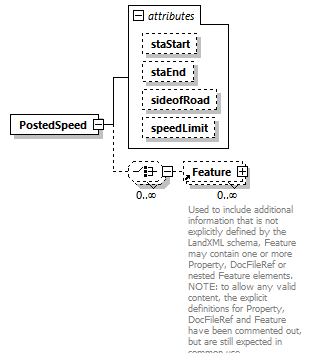 |
||||||||||||||||||||||||||||||
| namespace | http://www.landxml.org/schema/LandXML-2.0 | ||||||||||||||||||||||||||||||
| properties |
|
||||||||||||||||||||||||||||||
| children | Feature | ||||||||||||||||||||||||||||||
| used by |
|
||||||||||||||||||||||||||||||
| attributes |
|
||||||||||||||||||||||||||||||
| source | <xs:element name="PostedSpeed"> <xs:complexType> <xs:choice minOccurs="0" maxOccurs="unbounded"> <xs:element ref="Feature" minOccurs="0" maxOccurs="unbounded"/> </xs:choice> <xs:attribute name="staStart" type="station"/> <xs:attribute name="staEnd" type="station"/> <xs:attribute name="sideofRoad" type="sideofRoadType"/> <xs:attribute name="speedLimit" type="speed"/> </xs:complexType> </xs:element> |
attribute PostedSpeed/@staStart
| type | station |
| source | <xs:attribute name="staStart" type="station"/> |
attribute PostedSpeed/@staEnd
| type | station |
| source | <xs:attribute name="staEnd" type="station"/> |
attribute PostedSpeed/@sideofRoad
| type | sideofRoadType | ||||||||||||
| facets |
|
||||||||||||
| source | <xs:attribute name="sideofRoad" type="sideofRoadType"/> |
attribute PostedSpeed/@speedLimit
| type | speed |
| source | <xs:attribute name="speedLimit" type="speed"/> |
element ProfAlign
| diagram | 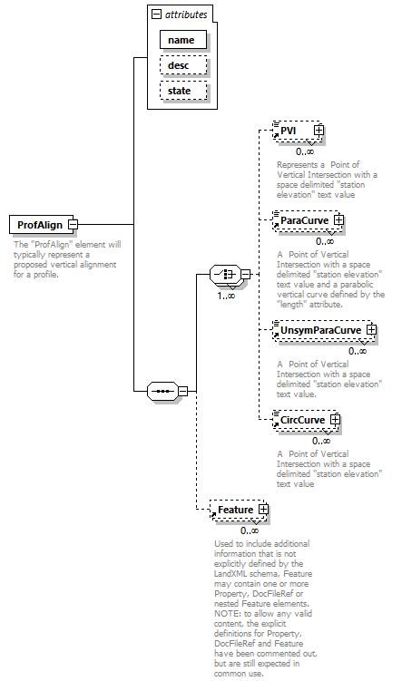 |
||||||||||||||||||||||||
| namespace | http://www.landxml.org/schema/LandXML-2.0 | ||||||||||||||||||||||||
| properties |
|
||||||||||||||||||||||||
| children | PVI ParaCurve UnsymParaCurve CircCurve Feature | ||||||||||||||||||||||||
| used by |
|
||||||||||||||||||||||||
| attributes |
|
||||||||||||||||||||||||
| annotation |
|
||||||||||||||||||||||||
| source | <xs:element name="ProfAlign"> <xs:annotation> <xs:documentation>The "ProfAlign" element will typically represent a proposed vertical alignment for a profile.</xs:documentation> <xs:documentation>It is defined by a sequential series of any combination of the four "PVI" element types.</xs:documentation> </xs:annotation> <xs:complexType> <xs:sequence> <xs:choice maxOccurs="unbounded"> <xs:element ref="PVI" minOccurs="0" maxOccurs="unbounded"/> <xs:element ref="ParaCurve" minOccurs="0" maxOccurs="unbounded"/> <xs:element ref="UnsymParaCurve" minOccurs="0" maxOccurs="unbounded"/> <xs:element ref="CircCurve" minOccurs="0" maxOccurs="unbounded"/> </xs:choice> <xs:element ref="Feature" minOccurs="0" maxOccurs="unbounded"/> </xs:sequence> <xs:attribute name="name" type="xs:string" use="required"/> <xs:attribute name="desc" type="xs:string"/> <xs:attribute name="state" type="stateType"/> </xs:complexType> </xs:element> |
attribute ProfAlign/@name
| type | xs:string | ||
| properties |
|
||
| source | <xs:attribute name="name" type="xs:string" use="required"/> |
attribute ProfAlign/@desc
| type | xs:string |
| source | <xs:attribute name="desc" type="xs:string"/> |
attribute ProfAlign/@state
| type | stateType | |||||||||||||||
| facets |
|
|||||||||||||||
| source | <xs:attribute name="state" type="stateType"/> |
element Profile
| diagram | 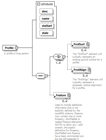 |
||||||||||||||||||||||||||||||
| namespace | http://www.landxml.org/schema/LandXML-2.0 | ||||||||||||||||||||||||||||||
| properties |
|
||||||||||||||||||||||||||||||
| children | ProfSurf ProfAlign Feature | ||||||||||||||||||||||||||||||
| used by |
|
||||||||||||||||||||||||||||||
| attributes |
|
||||||||||||||||||||||||||||||
| annotation |
|
||||||||||||||||||||||||||||||
| source | <xs:element name="Profile"> <xs:annotation> <xs:documentation>A profile or long section</xs:documentation> </xs:annotation> <xs:complexType> <xs:sequence> <xs:choice maxOccurs="unbounded"> <xs:element ref="ProfSurf" minOccurs="0" maxOccurs="unbounded"/> <xs:element ref="ProfAlign" minOccurs="0" maxOccurs="unbounded"/> </xs:choice> <xs:element ref="Feature" minOccurs="0" maxOccurs="unbounded"/> </xs:sequence> <xs:attribute name="desc" type="xs:string"/> <xs:attribute name="name" type="xs:string"/> <xs:attribute name="staStart" type="xs:double"/> <xs:attribute name="state" type="stateType"/> </xs:complexType> </xs:element> |
attribute Profile/@desc
| type | xs:string |
| source | <xs:attribute name="desc" type="xs:string"/> |
attribute Profile/@name
| type | xs:string |
| source | <xs:attribute name="name" type="xs:string"/> |
attribute Profile/@staStart
| type | xs:double |
| source | <xs:attribute name="staStart" type="xs:double"/> |
attribute Profile/@state
| type | stateType | |||||||||||||||
| facets |
|
|||||||||||||||
| source | <xs:attribute name="state" type="stateType"/> |
element ProfSurf
| diagram | 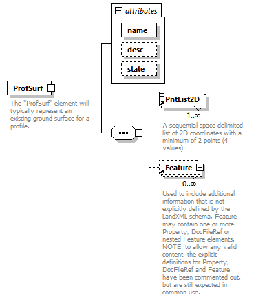 |
||||||||||||||||||||||||
| namespace | http://www.landxml.org/schema/LandXML-2.0 | ||||||||||||||||||||||||
| properties |
|
||||||||||||||||||||||||
| children | PntList2D Feature | ||||||||||||||||||||||||
| used by |
|
||||||||||||||||||||||||
| attributes |
|
||||||||||||||||||||||||
| annotation |
|
||||||||||||||||||||||||
| source | <xs:element name="ProfSurf"> <xs:annotation> <xs:documentation>The "ProfSurf" element will typically represent an existing ground surface for a profile. </xs:documentation> <xs:documentation>It is defined with a space delimited PntList2D of station/elevations pairs. </xs:documentation> <xs:documentation>Example: "0.000 86.52 6.267 86.89 12.413 87.01 26.020 87.83" </xs:documentation> <xs:documentation>Note: Gaps in the profile are handled by having 2 or more PntList2D elements.</xs:documentation> </xs:annotation> <xs:complexType> <xs:sequence> <xs:element ref="PntList2D" maxOccurs="unbounded"/> <xs:element ref="Feature" minOccurs="0" maxOccurs="unbounded"/> </xs:sequence> <xs:attribute name="name" type="xs:string" use="required"/> <xs:attribute name="desc" type="xs:string"/> <xs:attribute name="state" type="stateType"/> </xs:complexType> </xs:element> |
attribute ProfSurf/@name
| type | xs:string | ||
| properties |
|
||
| source | <xs:attribute name="name" type="xs:string" use="required"/> |
attribute ProfSurf/@desc
| type | xs:string |
| source | <xs:attribute name="desc" type="xs:string"/> |
attribute ProfSurf/@state
| type | stateType | |||||||||||||||
| facets |
|
|||||||||||||||
| source | <xs:attribute name="state" type="stateType"/> |
element Project
| diagram | 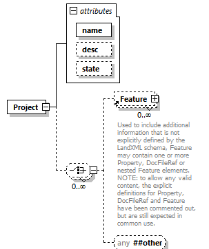 |
||||||||||||||||||||||||
| namespace | http://www.landxml.org/schema/LandXML-2.0 | ||||||||||||||||||||||||
| properties |
|
||||||||||||||||||||||||
| children | Feature | ||||||||||||||||||||||||
| used by |
|
||||||||||||||||||||||||
| attributes |
|
||||||||||||||||||||||||
| source | <xs:element name="Project"> <xs:complexType> <xs:choice minOccurs="0" maxOccurs="unbounded"> <xs:element ref="Feature" minOccurs="0" maxOccurs="unbounded"/> <xs:any namespace="##other" processContents="skip" minOccurs="0"/> </xs:choice> <xs:attribute name="name" type="xs:string" use="required"/> <xs:attribute name="desc" type="xs:string"/> <xs:attribute name="state" type="stateType"/> </xs:complexType> </xs:element> |
attribute Project/@name
| type | xs:string | ||
| properties |
|
||
| source | <xs:attribute name="name" type="xs:string" use="required"/> |
attribute Project/@desc
| type | xs:string |
| source | <xs:attribute name="desc" type="xs:string"/> |
attribute Project/@state
| type | stateType | |||||||||||||||
| facets |
|
|||||||||||||||
| source | <xs:attribute name="state" type="stateType"/> |
element Property
| diagram | 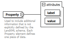 |
||||||||||||||||||
| namespace | http://www.landxml.org/schema/LandXML-2.0 | ||||||||||||||||||
| properties |
|
||||||||||||||||||
| used by |
|
||||||||||||||||||
| attributes |
|
||||||||||||||||||
| annotation |
|
||||||||||||||||||
| source | <xs:element name="Property"> <xs:annotation> <xs:documentation>Used to include additional information that is not explicitly defined by the LandXML schema. Each Property element defines one piece of data.</xs:documentation> <xs:documentation>The "label" attribute defines the name of the value held in the "value" attribute.</xs:documentation> </xs:annotation> <xs:complexType> <xs:attribute name="label" use="required"/> <xs:attribute name="value" use="required"/> </xs:complexType> </xs:element> |
attribute Property/@label
| properties |
|
||
| source | <xs:attribute name="label" use="required"/> |
attribute Property/@value
| properties |
|
||
| source | <xs:attribute name="value" use="required"/> |
element PurposeOfSurvey
| diagram | 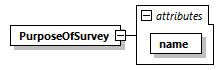 |
||||||||||||
| namespace | http://www.landxml.org/schema/LandXML-2.0 | ||||||||||||
| properties |
|
||||||||||||
| used by |
|
||||||||||||
| attributes |
|
||||||||||||
| source | <xs:element name="PurposeOfSurvey"> <xs:complexType> <xs:attribute name="name" type="purpSurvType" use="required"/> </xs:complexType> </xs:element> |
attribute PurposeOfSurvey/@name
| type | purpSurvType | ||
| properties |
|
||
| source | <xs:attribute name="name" type="purpSurvType" use="required"/> |
element PVI
| diagram | 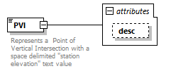 |
||||||||||||
| namespace | http://www.landxml.org/schema/LandXML-2.0 | ||||||||||||
| type | extension of Point2dReq | ||||||||||||
| properties |
|
||||||||||||
| used by |
|
||||||||||||
| facets |
|
||||||||||||
| attributes |
|
||||||||||||
| annotation |
|
||||||||||||
| source | <xs:element name="PVI"> <xs:annotation> <xs:documentation>Represents a Point of Vertical Intersection with a space delimited "station elevation" text value</xs:documentation> </xs:annotation> <xs:complexType mixed="true"> <xs:simpleContent> <xs:extension base="Point2dReq"> <xs:attribute name="desc" type="xs:string"/> </xs:extension> </xs:simpleContent> </xs:complexType> </xs:element> |
attribute PVI/@desc
| type | xs:string |
| source | <xs:attribute name="desc" type="xs:string"/> |
element RawObservation
| diagram |  |
||||||||||||||||||||||||||||||||||||||||||||||||||||||||||||||||||||||||||||||||||||||||||||||||||||||||||||||||||||||||||||||||||||||||||||||||
| namespace | http://www.landxml.org/schema/LandXML-2.0 | ||||||||||||||||||||||||||||||||||||||||||||||||||||||||||||||||||||||||||||||||||||||||||||||||||||||||||||||||||||||||||||||||||||||||||||||||
| type | extension of RawObservationType | ||||||||||||||||||||||||||||||||||||||||||||||||||||||||||||||||||||||||||||||||||||||||||||||||||||||||||||||||||||||||||||||||||||||||||||||||
| properties |
|
||||||||||||||||||||||||||||||||||||||||||||||||||||||||||||||||||||||||||||||||||||||||||||||||||||||||||||||||||||||||||||||||||||||||||||||||
| children | TargetPoint OffsetVals FieldNote Feature | ||||||||||||||||||||||||||||||||||||||||||||||||||||||||||||||||||||||||||||||||||||||||||||||||||||||||||||||||||||||||||||||||||||||||||||||||
| used by |
|
||||||||||||||||||||||||||||||||||||||||||||||||||||||||||||||||||||||||||||||||||||||||||||||||||||||||||||||||||||||||||||||||||||||||||||||||
| attributes |
|
||||||||||||||||||||||||||||||||||||||||||||||||||||||||||||||||||||||||||||||||||||||||||||||||||||||||||||||||||||||||||||||||||||||||||||||||
| source | <xs:element name="RawObservation"> <xs:complexType mixed="false"> <xs:complexContent> <xs:extension base="RawObservationType"/> </xs:complexContent> </xs:complexType> </xs:element> |
element RectPipe
| diagram |  |
||||||||||||||||||||||||||||||||||||||||||||||||
| namespace | http://www.landxml.org/schema/LandXML-2.0 | ||||||||||||||||||||||||||||||||||||||||||||||||
| properties |
|
||||||||||||||||||||||||||||||||||||||||||||||||
| children | Feature | ||||||||||||||||||||||||||||||||||||||||||||||||
| used by |
|
||||||||||||||||||||||||||||||||||||||||||||||||
| attributes |
|
||||||||||||||||||||||||||||||||||||||||||||||||
| annotation |
|
||||||||||||||||||||||||||||||||||||||||||||||||
| source | <xs:element name="RectPipe"> <xs:annotation> <xs:documentation>hazenWilliams attribute is the Hazen-Williams friction loss equation result</xs:documentation> <xs:documentation>mannings attribute is the Mannings coeffecient of roughness</xs:documentation> </xs:annotation> <xs:complexType> <xs:sequence> <xs:element ref="Feature" minOccurs="0" maxOccurs="unbounded"/> </xs:sequence> <xs:attribute name="height" type="xs:double" use="required"/> <xs:attribute name="width" type="xs:double" use="required"/> <xs:attribute name="desc" type="xs:string"/> <xs:attribute name="hazenWilliams" type="xs:double"/> <xs:attribute name="mannings" type="xs:double"/> <xs:attribute name="material" type="pipeMaterialType"/> <xs:attribute name="thickness" type="xs:double"/> </xs:complexType> </xs:element> |
attribute RectPipe/@height
| type | xs:double | ||
| properties |
|
||
| source | <xs:attribute name="height" type="xs:double" use="required"/> |
attribute RectPipe/@width
| type | xs:double | ||
| properties |
|
||
| source | <xs:attribute name="width" type="xs:double" use="required"/> |
attribute RectPipe/@desc
| type | xs:string |
| source | <xs:attribute name="desc" type="xs:string"/> |
attribute RectPipe/@hazenWilliams
| type | xs:double |
| source | <xs:attribute name="hazenWilliams" type="xs:double"/> |
attribute RectPipe/@mannings
| type | xs:double |
| source | <xs:attribute name="mannings" type="xs:double"/> |
attribute RectPipe/@material
| type | pipeMaterialType | ||||||||||||||||||||||||||||||
| facets |
|
||||||||||||||||||||||||||||||
| source | <xs:attribute name="material" type="pipeMaterialType"/> |
attribute RectPipe/@thickness
| type | xs:double |
| source | <xs:attribute name="thickness" type="xs:double"/> |
element RectStruct
| diagram |  |
||||||||||||||||||||||||||||||||||||||||||||||||||||||||||||||||||||||||
| namespace | http://www.landxml.org/schema/LandXML-2.0 | ||||||||||||||||||||||||||||||||||||||||||||||||||||||||||||||||||||||||
| properties |
|
||||||||||||||||||||||||||||||||||||||||||||||||||||||||||||||||||||||||
| children | Feature | ||||||||||||||||||||||||||||||||||||||||||||||||||||||||||||||||||||||||
| used by |
|
||||||||||||||||||||||||||||||||||||||||||||||||||||||||||||||||||||||||
| attributes |
|
||||||||||||||||||||||||||||||||||||||||||||||||||||||||||||||||||||||||
| annotation |
|
||||||||||||||||||||||||||||||||||||||||||||||||||||||||||||||||||||||||
| source | <xs:element name="RectStruct"> <xs:annotation> <xs:documentation>Typically for catchbasins and cleanouts</xs:documentation> </xs:annotation> <xs:complexType> <xs:sequence> <xs:element ref="Feature" minOccurs="0" maxOccurs="unbounded"/> </xs:sequence> <xs:attribute name="length" type="xs:double" use="required"/> <xs:attribute name="lengthDir" type="direction" use="optional"/> <xs:attribute name="width" type="xs:double" use="required"/> <xs:attribute name="desc" type="xs:string"/> <xs:attribute name="inletCase"/> <xs:attribute name="lossCoeff" type="xs:double"/> <xs:attribute name="material"/> <xs:attribute name="thickness" type="xs:double"/> <xs:attribute name="sumpDepth" type="xs:double"/> <xs:attribute name="junctionDrop" type="xs:double"/> <xs:attribute name="structureDepth" type="xs:double"/> </xs:complexType> </xs:element> |
attribute RectStruct/@length
| type | xs:double | ||
| properties |
|
||
| source | <xs:attribute name="length" type="xs:double" use="required"/> |
attribute RectStruct/@lengthDir
| type | direction | ||
| properties |
|
||
| source | <xs:attribute name="lengthDir" type="direction" use="optional"/> |
attribute RectStruct/@width
| type | xs:double | ||
| properties |
|
||
| source | <xs:attribute name="width" type="xs:double" use="required"/> |
attribute RectStruct/@desc
| type | xs:string |
| source | <xs:attribute name="desc" type="xs:string"/> |
attribute RectStruct/@inletCase
| source | <xs:attribute name="inletCase"/> |
attribute RectStruct/@lossCoeff
| type | xs:double |
| source | <xs:attribute name="lossCoeff" type="xs:double"/> |
attribute RectStruct/@material
| source | <xs:attribute name="material"/> |
attribute RectStruct/@thickness
| type | xs:double |
| source | <xs:attribute name="thickness" type="xs:double"/> |
attribute RectStruct/@sumpDepth
| type | xs:double |
| source | <xs:attribute name="sumpDepth" type="xs:double"/> |
attribute RectStruct/@junctionDrop
| type | xs:double |
| source | <xs:attribute name="junctionDrop" type="xs:double"/> |
attribute RectStruct/@structureDepth
| type | xs:double |
| source | <xs:attribute name="structureDepth" type="xs:double"/> |
element RedHorizontalPosition
| diagram | 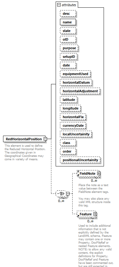 |
||||||||||||||||||||||||||||||||||||||||||||||||||||||||||||||||||||||||||||||||||||||||||||||||||||||||||||||||||
| namespace | http://www.landxml.org/schema/LandXML-2.0 | ||||||||||||||||||||||||||||||||||||||||||||||||||||||||||||||||||||||||||||||||||||||||||||||||||||||||||||||||||
| properties |
|
||||||||||||||||||||||||||||||||||||||||||||||||||||||||||||||||||||||||||||||||||||||||||||||||||||||||||||||||||
| children | FieldNote Feature | ||||||||||||||||||||||||||||||||||||||||||||||||||||||||||||||||||||||||||||||||||||||||||||||||||||||||||||||||||
| used by |
|
||||||||||||||||||||||||||||||||||||||||||||||||||||||||||||||||||||||||||||||||||||||||||||||||||||||||||||||||||
| attributes |
|
||||||||||||||||||||||||||||||||||||||||||||||||||||||||||||||||||||||||||||||||||||||||||||||||||||||||||||||||||
| annotation |
|
||||||||||||||||||||||||||||||||||||||||||||||||||||||||||||||||||||||||||||||||||||||||||||||||||||||||||||||||||
| source | <xs:element name="RedHorizontalPosition"> <xs:annotation> <xs:documentation>This element is used to define the Reduced Horizontal Position. The coordinates given in Geographical Coordinates may come in variety of means. </xs:documentation> </xs:annotation> <xs:complexType> <xs:choice minOccurs="0" maxOccurs="unbounded"> <xs:element ref="FieldNote" minOccurs="0" maxOccurs="unbounded"/> <xs:element ref="Feature" minOccurs="0" maxOccurs="unbounded"/> </xs:choice> <xs:attribute name="desc" type="xs:string"/> <xs:attribute name="name" type="xs:string" use="required"/> <xs:attribute name="state" type="xs:string"/> <xs:attribute name="oID" type="xs:string"/> <xs:attribute name="purpose" type="purposeType"/> <xs:attribute name="setupID" type="xs:IDREF"/> <xs:attribute name="date" type="xs:date"/> <xs:attribute name="equipmentUsed" type="equipmentType"/> <xs:attribute name="horizontalDatum" type="xs:string"/> <xs:attribute name="horizontalAdjustment" type="xs:string"/> <xs:attribute name="latitude" type="xs:string"/> <xs:attribute name="longitude" type="xs:string"/> <xs:attribute name="horizontalFix" type="xs:string"/> <xs:attribute name="currencyDate" type="xs:string"/> <xs:attribute name="localUncertainity" type="xs:double"/> <xs:attribute name="class" type="xs:string"/> <xs:attribute name="order" type="xs:string"/> <xs:attribute name="positionalUncertainity" type="xs:double"/> </xs:complexType> </xs:element> |
attribute RedHorizontalPosition/@desc
| type | xs:string |
| source | <xs:attribute name="desc" type="xs:string"/> |
attribute RedHorizontalPosition/@name
| type | xs:string | ||
| properties |
|
||
| source | <xs:attribute name="name" type="xs:string" use="required"/> |
attribute RedHorizontalPosition/@state
| type | xs:string |
| source | <xs:attribute name="state" type="xs:string"/> |
attribute RedHorizontalPosition/@oID
| type | xs:string |
| source | <xs:attribute name="oID" type="xs:string"/> |
attribute RedHorizontalPosition/@purpose
| type | purposeType | |||||||||||||||||||||||||||||||||||||||||||||
| facets |
|
|||||||||||||||||||||||||||||||||||||||||||||
| source | <xs:attribute name="purpose" type="purposeType"/> |
attribute RedHorizontalPosition/@setupID
| type | xs:IDREF |
| source | <xs:attribute name="setupID" type="xs:IDREF"/> |
attribute RedHorizontalPosition/@date
| type | xs:date |
| source | <xs:attribute name="date" type="xs:date"/> |
attribute RedHorizontalPosition/@equipmentUsed
| type | equipmentType |
| source | <xs:attribute name="equipmentUsed" type="equipmentType"/> |
attribute RedHorizontalPosition/@horizontalDatum
| type | xs:string |
| source | <xs:attribute name="horizontalDatum" type="xs:string"/> |
attribute RedHorizontalPosition/@horizontalAdjustment
| type | xs:string |
| source | <xs:attribute name="horizontalAdjustment" type="xs:string"/> |
attribute RedHorizontalPosition/@latitude
| type | xs:string |
| source | <xs:attribute name="latitude" type="xs:string"/> |
attribute RedHorizontalPosition/@longitude
| type | xs:string |
| source | <xs:attribute name="longitude" type="xs:string"/> |
attribute RedHorizontalPosition/@horizontalFix
| type | xs:string |
| source | <xs:attribute name="horizontalFix" type="xs:string"/> |
attribute RedHorizontalPosition/@currencyDate
| type | xs:string |
| source | <xs:attribute name="currencyDate" type="xs:string"/> |
attribute RedHorizontalPosition/@localUncertainity
| type | xs:double |
| source | <xs:attribute name="localUncertainity" type="xs:double"/> |
attribute RedHorizontalPosition/@class
| type | xs:string |
| source | <xs:attribute name="class" type="xs:string"/> |
attribute RedHorizontalPosition/@order
| type | xs:string |
| source | <xs:attribute name="order" type="xs:string"/> |
attribute RedHorizontalPosition/@positionalUncertainity
| type | xs:double |
| source | <xs:attribute name="positionalUncertainity" type="xs:double"/> |
element ReducedArcObservation
| diagram | 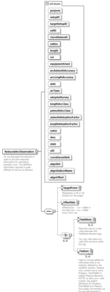 |
||||||||||||||||||||||||||||||||||||||||||||||||||||||||||||||||||||||||||||||||||||||||||||||||||||||||||||||||||||||||||||||||||||||||||||||||||||||||||||||||||
| namespace | http://www.landxml.org/schema/LandXML-2.0 | ||||||||||||||||||||||||||||||||||||||||||||||||||||||||||||||||||||||||||||||||||||||||||||||||||||||||||||||||||||||||||||||||||||||||||||||||||||||||||||||||||
| properties |
|
||||||||||||||||||||||||||||||||||||||||||||||||||||||||||||||||||||||||||||||||||||||||||||||||||||||||||||||||||||||||||||||||||||||||||||||||||||||||||||||||||
| children | TargetPoint OffsetVals FieldNote Feature | ||||||||||||||||||||||||||||||||||||||||||||||||||||||||||||||||||||||||||||||||||||||||||||||||||||||||||||||||||||||||||||||||||||||||||||||||||||||||||||||||||
| used by |
|
||||||||||||||||||||||||||||||||||||||||||||||||||||||||||||||||||||||||||||||||||||||||||||||||||||||||||||||||||||||||||||||||||||||||||||||||||||||||||||||||||
| attributes |
|
||||||||||||||||||||||||||||||||||||||||||||||||||||||||||||||||||||||||||||||||||||||||||||||||||||||||||||||||||||||||||||||||||||||||||||||||||||||||||||||||||
| annotation |
|
||||||||||||||||||||||||||||||||||||||||||||||||||||||||||||||||||||||||||||||||||||||||||||||||||||||||||||||||||||||||||||||||||||||||||||||||||||||||||||||||||
| source | <xs:element name="ReducedArcObservation"> <xs:annotation> <xs:documentation>As we discussed this element is used to provide measured information for calculating boundary arcs. The definition information required is quite different to the curve element</xs:documentation> </xs:annotation> <xs:complexType> <xs:sequence> <xs:element ref="TargetPoint" minOccurs="0"/> <xs:element ref="OffsetVals" minOccurs="0"/> <xs:choice minOccurs="0" maxOccurs="unbounded"> <xs:element ref="FieldNote" minOccurs="0" maxOccurs="unbounded"/> <xs:element ref="Feature" minOccurs="0" maxOccurs="unbounded"/> </xs:choice> </xs:sequence> <xs:attribute name="purpose" type="purposeType"/> <xs:attribute name="setupID" type="xs:IDREF"/> <xs:attribute name="targetSetupID" type="xs:IDREF"/> <xs:attribute name="setID"/> <xs:attribute name="chordAzimuth" type="direction" use="required"/> <xs:attribute name="radius" type="xs:double" use="required"/> <xs:attribute name="length" type="xs:double" use="required"/> <xs:attribute name="rot" type="clockwise" use="required"/> <xs:attribute name="equipmentUsed" type="equipmentType"/> <xs:attribute name="arcAzimuthAccuracy" type="xs:double"/> <xs:attribute name="arcLengthAccuracy" type="xs:double"/> <xs:attribute name="date" type="xs:date"/> <xs:attribute name="arcType" type="xs:string"/> <xs:attribute name="adoptedSurvey" type="xs:string"/> <xs:attribute name="lengthAccClass" type="xs:string"/> <xs:attribute name="azimuthAccClass" type="xs:string"/> <xs:attribute name="azimuthAdoptionFactor" type="xs:double"/> <xs:attribute name="lengthAdoptionFactor" type="xs:double"/> <xs:attribute name="name" type="xs:string"/> <xs:attribute name="desc" type="xs:string"/> <xs:attribute name="state" type="stateType"/> <xs:attribute name="oID" type="xs:string"/> <xs:attribute name="coordGeomRefs" type="coordGeomNameRefs"/> <xs:attribute name="alignRef" type="alignmentNameRef"/> <xs:attribute name="alignStationName" type="xs:string"/> <xs:attribute name="alignOffset" type="offsetDistance"/> <!-- coordGeomRefs identifies one or more 'name' values that link to specific <Line>, <Curve>, <Spiral> or <IrregularLine> in a <CoordGeom> element. This allows linking an survey observation to specific <Parcel>.<CoordGeom> based geometry. --> <!-- alignRef is the name of the alignment. alignStationName is the station value where the rod reading is taken. alignOffset is the signed (+/-) distance from the CL of the referenced alignment. --> </xs:complexType> </xs:element> |
attribute ReducedArcObservation/@purpose
| type | purposeType | |||||||||||||||||||||||||||||||||||||||||||||
| facets |
|
|||||||||||||||||||||||||||||||||||||||||||||
| source | <xs:attribute name="purpose" type="purposeType"/> |
attribute ReducedArcObservation/@setupID
| type | xs:IDREF |
| source | <xs:attribute name="setupID" type="xs:IDREF"/> |
attribute ReducedArcObservation/@targetSetupID
| type | xs:IDREF |
| source | <xs:attribute name="targetSetupID" type="xs:IDREF"/> |
attribute ReducedArcObservation/@setID
| source | <xs:attribute name="setID"/> |
attribute ReducedArcObservation/@chordAzimuth
| type | direction | ||
| properties |
|
||
| source | <xs:attribute name="chordAzimuth" type="direction" use="required"/> |
attribute ReducedArcObservation/@radius
| type | xs:double | ||
| properties |
|
||
| source | <xs:attribute name="radius" type="xs:double" use="required"/> |
attribute ReducedArcObservation/@length
| type | xs:double | ||
| properties |
|
||
| source | <xs:attribute name="length" type="xs:double" use="required"/> |
attribute ReducedArcObservation/@rot
| type | clockwise | |||||||||
| properties |
|
|||||||||
| facets |
|
|||||||||
| source | <xs:attribute name="rot" type="clockwise" use="required"/> |
attribute ReducedArcObservation/@equipmentUsed
| type | equipmentType |
| source | <xs:attribute name="equipmentUsed" type="equipmentType"/> |
attribute ReducedArcObservation/@arcAzimuthAccuracy
| type | xs:double |
| source | <xs:attribute name="arcAzimuthAccuracy" type="xs:double"/> |
attribute ReducedArcObservation/@arcLengthAccuracy
| type | xs:double |
| source | <xs:attribute name="arcLengthAccuracy" type="xs:double"/> |
attribute ReducedArcObservation/@date
| type | xs:date |
| source | <xs:attribute name="date" type="xs:date"/> |
attribute ReducedArcObservation/@arcType
| type | xs:string |
| source | <xs:attribute name="arcType" type="xs:string"/> |
attribute ReducedArcObservation/@adoptedSurvey
| type | xs:string |
| source | <xs:attribute name="adoptedSurvey" type="xs:string"/> |
attribute ReducedArcObservation/@lengthAccClass
| type | xs:string |
| source | <xs:attribute name="lengthAccClass" type="xs:string"/> |
attribute ReducedArcObservation/@azimuthAccClass
| type | xs:string |
| source | <xs:attribute name="azimuthAccClass" type="xs:string"/> |
attribute ReducedArcObservation/@azimuthAdoptionFactor
| type | xs:double |
| source | <xs:attribute name="azimuthAdoptionFactor" type="xs:double"/> |
attribute ReducedArcObservation/@lengthAdoptionFactor
| type | xs:double |
| source | <xs:attribute name="lengthAdoptionFactor" type="xs:double"/> |
attribute ReducedArcObservation/@name
| type | xs:string |
| source | <xs:attribute name="name" type="xs:string"/> |
attribute ReducedArcObservation/@desc
| type | xs:string |
| source | <xs:attribute name="desc" type="xs:string"/> |
attribute ReducedArcObservation/@state
| type | stateType | |||||||||||||||
| facets |
|
|||||||||||||||
| source | <xs:attribute name="state" type="stateType"/> |
attribute ReducedArcObservation/@oID
| type | xs:string |
| source | <xs:attribute name="oID" type="xs:string"/> |
attribute ReducedArcObservation/@coordGeomRefs
| type | coordGeomNameRefs |
| source | <xs:attribute name="coordGeomRefs" type="coordGeomNameRefs"/> |
attribute ReducedArcObservation/@alignRef
| type | alignmentNameRef |
| source | <xs:attribute name="alignRef" type="alignmentNameRef"/> |
attribute ReducedArcObservation/@alignStationName
| type | xs:string |
| source | <xs:attribute name="alignStationName" type="xs:string"/> |
attribute ReducedArcObservation/@alignOffset
| type | offsetDistance |
| source | <xs:attribute name="alignOffset" type="offsetDistance"/> |
element ReducedObservation
| diagram | 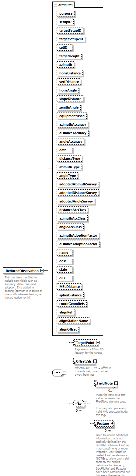 |
||||||||||||||||||||||||||||||||||||||||||||||||||||||||||||||||||||||||||||||||||||||||||||||||||||||||||||||||||||||||||||||||||||||||||||||||||||||||||||||||||||||||||||||||||||||||||||||||||||||||||||||||||||||||||||||||||||||||||
| namespace | http://www.landxml.org/schema/LandXML-2.0 | ||||||||||||||||||||||||||||||||||||||||||||||||||||||||||||||||||||||||||||||||||||||||||||||||||||||||||||||||||||||||||||||||||||||||||||||||||||||||||||||||||||||||||||||||||||||||||||||||||||||||||||||||||||||||||||||||||||||||||
| properties |
|
||||||||||||||||||||||||||||||||||||||||||||||||||||||||||||||||||||||||||||||||||||||||||||||||||||||||||||||||||||||||||||||||||||||||||||||||||||||||||||||||||||||||||||||||||||||||||||||||||||||||||||||||||||||||||||||||||||||||||
| children | TargetPoint OffsetVals FieldNote Feature | ||||||||||||||||||||||||||||||||||||||||||||||||||||||||||||||||||||||||||||||||||||||||||||||||||||||||||||||||||||||||||||||||||||||||||||||||||||||||||||||||||||||||||||||||||||||||||||||||||||||||||||||||||||||||||||||||||||||||||
| used by |
|
||||||||||||||||||||||||||||||||||||||||||||||||||||||||||||||||||||||||||||||||||||||||||||||||||||||||||||||||||||||||||||||||||||||||||||||||||||||||||||||||||||||||||||||||||||||||||||||||||||||||||||||||||||||||||||||||||||||||||
| attributes |
|
||||||||||||||||||||||||||||||||||||||||||||||||||||||||||||||||||||||||||||||||||||||||||||||||||||||||||||||||||||||||||||||||||||||||||||||||||||||||||||||||||||||||||||||||||||||||||||||||||||||||||||||||||||||||||||||||||||||||||
| annotation |
|
||||||||||||||||||||||||||||||||||||||||||||||||||||||||||||||||||||||||||||||||||||||||||||||||||||||||||||||||||||||||||||||||||||||||||||||||||||||||||||||||||||||||||||||||||||||||||||||||||||||||||||||||||||||||||||||||||||||||||
| source | <xs:element name="ReducedObservation"> <xs:annotation> <xs:documentation>This has been modified to include new fields such as accuracy, date, class and adoption. I've added in bearing (azimuth is in terms of true north whereas bearing is the projection north) </xs:documentation> <xs:documentation> - maybe this doesn't matter, may need to discuss</xs:documentation> </xs:annotation> <xs:complexType> <xs:sequence> <xs:element ref="TargetPoint" minOccurs="0"/> <xs:element ref="OffsetVals" minOccurs="0"/> <xs:choice minOccurs="0" maxOccurs="unbounded"> <xs:element ref="FieldNote" minOccurs="0" maxOccurs="unbounded"/> <xs:element ref="Feature" minOccurs="0" maxOccurs="unbounded"/> </xs:choice> </xs:sequence> <xs:attribute name="purpose" type="purposeType"/> <xs:attribute name="setupID" type="xs:IDREF"/> <xs:attribute name="targetSetupID" type="xs:IDREF"/> <xs:attribute name="targetSetup2ID" type="xs:IDREF"/> <xs:attribute name="setID"/> <xs:attribute name="targetHeight" type="xs:double"/> <xs:attribute name="azimuth" type="direction" use="optional"/> <xs:attribute name="horizDistance" type="xs:double" use="optional"/> <xs:attribute name="vertDistance" type="xs:double" use="optional"/> <xs:attribute name="horizAngle" type="angle" use="optional"/> <xs:attribute name="slopeDistance" type="xs:double" use="optional"/> <xs:attribute name="zenithAngle" type="zenithAngle" use="optional"/> <xs:attribute name="equipmentUsed" type="equipmentType"/> <xs:attribute name="azimuthAccuracy" type="xs:double"/> <xs:attribute name="distanceAccuracy" type="xs:double"/> <xs:attribute name="angleAccuracy" type="xs:double"/> <xs:attribute name="date" type="xs:date"/> <xs:attribute name="distanceType" type="observationType"/> <xs:attribute name="azimuthType" type="observationType"/> <xs:attribute name="angleType" type="observationType"/> <xs:attribute name="adoptedAzimuthSurvey" type="xs:string"/> <xs:attribute name="adoptedDistanceSurvey" type="xs:string"/> <xs:attribute name="adoptedAngleSurvey" type="xs:string"/> <xs:attribute name="distanceAccClass" type="xs:string"/> <xs:attribute name="azimuthAccClass" type="xs:string"/> <xs:attribute name="angleAccClass" type="xs:string"/> <xs:attribute name="azimuthAdoptionFactor" type="xs:double"/> <xs:attribute name="distanceAdoptionFactor" type="xs:double"/> <xs:attribute name="name" type="xs:string"/> <xs:attribute name="desc" type="xs:string"/> <xs:attribute name="state" type="stateType"/> <xs:attribute name="oID" type="xs:string"/> <xs:attribute name="MSLDistance" type="xs:string"/> <xs:attribute name="spherDistance" type="xs:string"/> <xs:attribute name="coordGeomRefs" type="coordGeomNameRefs"/> <xs:attribute name="alignRef" type="alignmentNameRef"/> <xs:attribute name="alignStationName" type="xs:string"/> <xs:attribute name="alignOffset" type="offsetDistance"/> <!-- coordGeomRefs identifies one or more 'name' values that link to specific <Line>, <Curve>, <Spiral> or <IrregularLine> in a <CoordGeom> element. This allows linking an survey observation to specific <Parcel>.<CoordGeom> based geometry. --> <!-- alignRef is the name of the alignment. alignStationName is the station value where the rod reading is taken. alignOffset is the signed (+/-) distance from the CL of the referenced alignment. --> </xs:complexType> </xs:element> |
attribute ReducedObservation/@purpose
| type | purposeType | |||||||||||||||||||||||||||||||||||||||||||||
| facets |
|
|||||||||||||||||||||||||||||||||||||||||||||
| source | <xs:attribute name="purpose" type="purposeType"/> |
attribute ReducedObservation/@setupID
| type | xs:IDREF |
| source | <xs:attribute name="setupID" type="xs:IDREF"/> |
attribute ReducedObservation/@targetSetupID
| type | xs:IDREF |
| source | <xs:attribute name="targetSetupID" type="xs:IDREF"/> |
attribute ReducedObservation/@targetSetup2ID
| type | xs:IDREF |
| source | <xs:attribute name="targetSetup2ID" type="xs:IDREF"/> |
attribute ReducedObservation/@setID
| source | <xs:attribute name="setID"/> |
attribute ReducedObservation/@targetHeight
| type | xs:double |
| source | <xs:attribute name="targetHeight" type="xs:double"/> |
attribute ReducedObservation/@azimuth
| type | direction | ||
| properties |
|
||
| source | <xs:attribute name="azimuth" type="direction" use="optional"/> |
attribute ReducedObservation/@horizDistance
| type | xs:double | ||
| properties |
|
||
| source | <xs:attribute name="horizDistance" type="xs:double" use="optional"/> |
attribute ReducedObservation/@vertDistance
| type | xs:double | ||
| properties |
|
||
| source | <xs:attribute name="vertDistance" type="xs:double" use="optional"/> |
attribute ReducedObservation/@horizAngle
| type | angle | ||
| properties |
|
||
| source | <xs:attribute name="horizAngle" type="angle" use="optional"/> |
attribute ReducedObservation/@slopeDistance
| type | xs:double | ||
| properties |
|
||
| source | <xs:attribute name="slopeDistance" type="xs:double" use="optional"/> |
attribute ReducedObservation/@zenithAngle
| type | zenithAngle | ||
| properties |
|
||
| source | <xs:attribute name="zenithAngle" type="zenithAngle" use="optional"/> |
attribute ReducedObservation/@equipmentUsed
| type | equipmentType |
| source | <xs:attribute name="equipmentUsed" type="equipmentType"/> |
attribute ReducedObservation/@azimuthAccuracy
| type | xs:double |
| source | <xs:attribute name="azimuthAccuracy" type="xs:double"/> |
attribute ReducedObservation/@distanceAccuracy
| type | xs:double |
| source | <xs:attribute name="distanceAccuracy" type="xs:double"/> |
attribute ReducedObservation/@angleAccuracy
| type | xs:double |
| source | <xs:attribute name="angleAccuracy" type="xs:double"/> |
attribute ReducedObservation/@date
| type | xs:date |
| source | <xs:attribute name="date" type="xs:date"/> |
attribute ReducedObservation/@distanceType
| type | observationType |
| source | <xs:attribute name="distanceType" type="observationType"/> |
attribute ReducedObservation/@azimuthType
| type | observationType |
| source | <xs:attribute name="azimuthType" type="observationType"/> |
attribute ReducedObservation/@angleType
| type | observationType |
| source | <xs:attribute name="angleType" type="observationType"/> |
attribute ReducedObservation/@adoptedAzimuthSurvey
| type | xs:string |
| source | <xs:attribute name="adoptedAzimuthSurvey" type="xs:string"/> |
attribute ReducedObservation/@adoptedDistanceSurvey
| type | xs:string |
| source | <xs:attribute name="adoptedDistanceSurvey" type="xs:string"/> |
attribute ReducedObservation/@adoptedAngleSurvey
| type | xs:string |
| source | <xs:attribute name="adoptedAngleSurvey" type="xs:string"/> |
attribute ReducedObservation/@distanceAccClass
| type | xs:string |
| source | <xs:attribute name="distanceAccClass" type="xs:string"/> |
attribute ReducedObservation/@azimuthAccClass
| type | xs:string |
| source | <xs:attribute name="azimuthAccClass" type="xs:string"/> |
attribute ReducedObservation/@angleAccClass
| type | xs:string |
| source | <xs:attribute name="angleAccClass" type="xs:string"/> |
attribute ReducedObservation/@azimuthAdoptionFactor
| type | xs:double |
| source | <xs:attribute name="azimuthAdoptionFactor" type="xs:double"/> |
attribute ReducedObservation/@distanceAdoptionFactor
| type | xs:double |
| source | <xs:attribute name="distanceAdoptionFactor" type="xs:double"/> |
attribute ReducedObservation/@name
| type | xs:string |
| source | <xs:attribute name="name" type="xs:string"/> |
attribute ReducedObservation/@desc
| type | xs:string |
| source | <xs:attribute name="desc" type="xs:string"/> |
attribute ReducedObservation/@state
| type | stateType | |||||||||||||||
| facets |
|
|||||||||||||||
| source | <xs:attribute name="state" type="stateType"/> |
attribute ReducedObservation/@oID
| type | xs:string |
| source | <xs:attribute name="oID" type="xs:string"/> |
attribute ReducedObservation/@MSLDistance
| type | xs:string |
| source | <xs:attribute name="MSLDistance" type="xs:string"/> |
attribute ReducedObservation/@spherDistance
| type | xs:string |
| source | <xs:attribute name="spherDistance" type="xs:string"/> |
attribute ReducedObservation/@coordGeomRefs
| type | coordGeomNameRefs |
| source | <xs:attribute name="coordGeomRefs" type="coordGeomNameRefs"/> |
attribute ReducedObservation/@alignRef
| type | alignmentNameRef |
| source | <xs:attribute name="alignRef" type="alignmentNameRef"/> |
attribute ReducedObservation/@alignStationName
| type | xs:string |
| source | <xs:attribute name="alignStationName" type="xs:string"/> |
attribute ReducedObservation/@alignOffset
| type | offsetDistance |
| source | <xs:attribute name="alignOffset" type="offsetDistance"/> |
element RedVerticalObservation
| diagram | 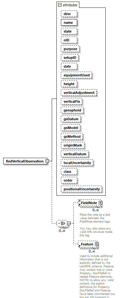 |
||||||||||||||||||||||||||||||||||||||||||||||||||||||||||||||||||||||||||||||||||||||||||||||||||||||||||||||||||||||||||||||||||||
| namespace | http://www.landxml.org/schema/LandXML-2.0 | ||||||||||||||||||||||||||||||||||||||||||||||||||||||||||||||||||||||||||||||||||||||||||||||||||||||||||||||||||||||||||||||||||||
| properties |
|
||||||||||||||||||||||||||||||||||||||||||||||||||||||||||||||||||||||||||||||||||||||||||||||||||||||||||||||||||||||||||||||||||||
| children | FieldNote Feature | ||||||||||||||||||||||||||||||||||||||||||||||||||||||||||||||||||||||||||||||||||||||||||||||||||||||||||||||||||||||||||||||||||||
| used by |
|
||||||||||||||||||||||||||||||||||||||||||||||||||||||||||||||||||||||||||||||||||||||||||||||||||||||||||||||||||||||||||||||||||||
| attributes |
|
||||||||||||||||||||||||||||||||||||||||||||||||||||||||||||||||||||||||||||||||||||||||||||||||||||||||||||||||||||||||||||||||||||
| source | <xs:element name="RedVerticalObservation"> <xs:complexType> <xs:choice minOccurs="0" maxOccurs="unbounded"> <xs:element ref="FieldNote" minOccurs="0" maxOccurs="unbounded"/> <xs:element ref="Feature" minOccurs="0" maxOccurs="unbounded"/> </xs:choice> <xs:attribute name="desc" type="xs:string"/> <xs:attribute name="name" type="xs:string" use="required"/> <xs:attribute name="state" type="xs:string"/> <xs:attribute name="oID" type="xs:string"/> <xs:attribute name="purpose" type="purposeType"/> <xs:attribute name="setupID" type="xs:IDREF"/> <xs:attribute name="date" type="xs:date"/> <xs:attribute name="equipmentUsed" type="equipmentType"/> <xs:attribute name="height" type="xs:double"/> <xs:attribute name="verticalAdjustment" type="xs:string"/> <xs:attribute name="verticalFix" type="xs:string"/> <xs:attribute name="geosphoid" type="xs:double"/> <xs:attribute name="gsDatum" type="xs:string"/> <xs:attribute name="gsModel" type="xs:string"/> <xs:attribute name="gsMethod" type="xs:string"/> <xs:attribute name="originMark" type="xs:string"/> <xs:attribute name="verticalDatum" type="xs:string"/> <xs:attribute name="localUncertainity" type="xs:double"/> <xs:attribute name="class" type="xs:string"/> <xs:attribute name="order" type="xs:string"/> <xs:attribute name="positionalUncertainity" type="xs:double"/> </xs:complexType> </xs:element> |
attribute RedVerticalObservation/@desc
| type | xs:string |
| source | <xs:attribute name="desc" type="xs:string"/> |
attribute RedVerticalObservation/@name
| type | xs:string | ||
| properties |
|
||
| source | <xs:attribute name="name" type="xs:string" use="required"/> |
attribute RedVerticalObservation/@state
| type | xs:string |
| source | <xs:attribute name="state" type="xs:string"/> |
attribute RedVerticalObservation/@oID
| type | xs:string |
| source | <xs:attribute name="oID" type="xs:string"/> |
attribute RedVerticalObservation/@purpose
| type | purposeType | |||||||||||||||||||||||||||||||||||||||||||||
| facets |
|
|||||||||||||||||||||||||||||||||||||||||||||
| source | <xs:attribute name="purpose" type="purposeType"/> |
attribute RedVerticalObservation/@setupID
| type | xs:IDREF |
| source | <xs:attribute name="setupID" type="xs:IDREF"/> |
attribute RedVerticalObservation/@date
| type | xs:date |
| source | <xs:attribute name="date" type="xs:date"/> |
attribute RedVerticalObservation/@equipmentUsed
| type | equipmentType |
| source | <xs:attribute name="equipmentUsed" type="equipmentType"/> |
attribute RedVerticalObservation/@height
| type | xs:double |
| source | <xs:attribute name="height" type="xs:double"/> |
attribute RedVerticalObservation/@verticalAdjustment
| type | xs:string |
| source | <xs:attribute name="verticalAdjustment" type="xs:string"/> |
attribute RedVerticalObservation/@verticalFix
| type | xs:string |
| source | <xs:attribute name="verticalFix" type="xs:string"/> |
attribute RedVerticalObservation/@geosphoid
| type | xs:double |
| source | <xs:attribute name="geosphoid" type="xs:double"/> |
attribute RedVerticalObservation/@gsDatum
| type | xs:string |
| source | <xs:attribute name="gsDatum" type="xs:string"/> |
attribute RedVerticalObservation/@gsModel
| type | xs:string |
| source | <xs:attribute name="gsModel" type="xs:string"/> |
attribute RedVerticalObservation/@gsMethod
| type | xs:string |
| source | <xs:attribute name="gsMethod" type="xs:string"/> |
attribute RedVerticalObservation/@originMark
| type | xs:string |
| source | <xs:attribute name="originMark" type="xs:string"/> |
attribute RedVerticalObservation/@verticalDatum
| type | xs:string |
| source | <xs:attribute name="verticalDatum" type="xs:string"/> |
attribute RedVerticalObservation/@localUncertainity
| type | xs:double |
| source | <xs:attribute name="localUncertainity" type="xs:double"/> |
attribute RedVerticalObservation/@class
| type | xs:string |
| source | <xs:attribute name="class" type="xs:string"/> |
attribute RedVerticalObservation/@order
| type | xs:string |
| source | <xs:attribute name="order" type="xs:string"/> |
attribute RedVerticalObservation/@positionalUncertainity
| type | xs:double |
| source | <xs:attribute name="positionalUncertainity" type="xs:double"/> |
element RetWall
| diagram | 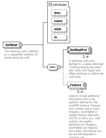 |
||||||||||||||||||||||||||||||
| namespace | http://www.landxml.org/schema/LandXML-2.0 | ||||||||||||||||||||||||||||||
| properties |
|
||||||||||||||||||||||||||||||
| children | RetWallPnt Feature | ||||||||||||||||||||||||||||||
| used by |
|
||||||||||||||||||||||||||||||
| attributes |
|
||||||||||||||||||||||||||||||
| annotation |
|
||||||||||||||||||||||||||||||
| source | <xs:element name="RetWall"> <xs:annotation> <xs:documentation>The retaining wall is defined by a sequential collection of points along the wall.</xs:documentation> <xs:documentation>Each point has a location (northing/easting/elevation), height of wall and offset to the wall point.</xs:documentation> </xs:annotation> <xs:complexType> <xs:sequence> <xs:element ref="RetWallPnt" minOccurs="2" maxOccurs="unbounded"/> <xs:element ref="Feature" minOccurs="0" maxOccurs="unbounded"/> </xs:sequence> <xs:attribute name="desc" type="xs:string"/> <xs:attribute name="name" type="xs:string"/> <xs:attribute name="state" type="stateType"/> <xs:attribute name="m" type="materialTableIndexRef" use="optional"/> </xs:complexType> </xs:element> |
attribute RetWall/@desc
| type | xs:string |
| source | <xs:attribute name="desc" type="xs:string"/> |
attribute RetWall/@name
| type | xs:string |
| source | <xs:attribute name="name" type="xs:string"/> |
attribute RetWall/@state
| type | stateType | |||||||||||||||
| facets |
|
|||||||||||||||
| source | <xs:attribute name="state" type="stateType"/> |
attribute RetWall/@m
| type | materialTableIndexRef | ||
| properties |
|
||
| source | <xs:attribute name="m" type="materialTableIndexRef" use="optional"/> |
element RetWallPnt
| diagram | 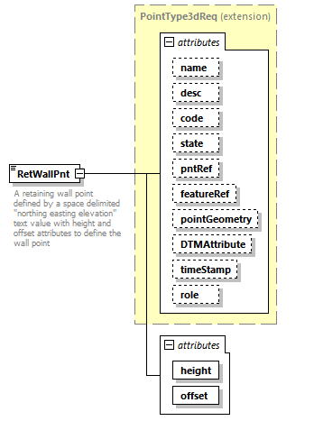 |
||||||||||||||||||||||||||||||||||||||||||||||||||||||||||||||||||||||||||||||
| namespace | http://www.landxml.org/schema/LandXML-2.0 | ||||||||||||||||||||||||||||||||||||||||||||||||||||||||||||||||||||||||||||||
| type | extension of PointType3dReq | ||||||||||||||||||||||||||||||||||||||||||||||||||||||||||||||||||||||||||||||
| properties |
|
||||||||||||||||||||||||||||||||||||||||||||||||||||||||||||||||||||||||||||||
| used by |
|
||||||||||||||||||||||||||||||||||||||||||||||||||||||||||||||||||||||||||||||
| facets |
|
||||||||||||||||||||||||||||||||||||||||||||||||||||||||||||||||||||||||||||||
| attributes |
|
||||||||||||||||||||||||||||||||||||||||||||||||||||||||||||||||||||||||||||||
| annotation |
|
||||||||||||||||||||||||||||||||||||||||||||||||||||||||||||||||||||||||||||||
| source | <xs:element name="RetWallPnt"> <xs:annotation> <xs:documentation>A retaining wall point defined by a space delimited "northing easting elevation" text value with height and offset attributes to define the wall point</xs:documentation> <xs:documentation>The height value is positive if the northing/easting/elevation point is at the bottom of the wall, negative if the point is at the top of the wall.</xs:documentation> <xs:documentation>The offset value is negative for left and positive for right.</xs:documentation> </xs:annotation> <xs:complexType mixed="true"> <xs:simpleContent> <xs:extension base="PointType3dReq"> <xs:attribute name="height" type="xs:double" use="required"/> <xs:attribute name="offset" type="xs:double" use="required"/> </xs:extension> </xs:simpleContent> </xs:complexType> </xs:element> |
attribute RetWallPnt/@height
| type | xs:double | ||
| properties |
|
||
| source | <xs:attribute name="height" type="xs:double" use="required"/> |
attribute RetWallPnt/@offset
| type | xs:double | ||
| properties |
|
||
| source | <xs:attribute name="offset" type="xs:double" use="required"/> |
element RoadName
| diagram |  |
||||||||||||||||||||||||||||||||||||
| namespace | http://www.landxml.org/schema/LandXML-2.0 | ||||||||||||||||||||||||||||||||||||
| properties |
|
||||||||||||||||||||||||||||||||||||
| used by |
|
||||||||||||||||||||||||||||||||||||
| attributes |
|
||||||||||||||||||||||||||||||||||||
| source | <xs:element name="RoadName"> <xs:complexType> <xs:attribute name="roadNameType" type="roadNameTypeType"/> <xs:attribute name="roadName" type="xs:string"/> <xs:attribute name="roadNameSuffix" type="roadNameSuffixType"/> <xs:attribute name="roadType" type="roadTypeType"/> <xs:attribute name="pclRef" type="parcelNameRefs"/> </xs:complexType> </xs:element> |
attribute RoadName/@roadNameType
| type | roadNameTypeType |
| source | <xs:attribute name="roadNameType" type="roadNameTypeType"/> |
attribute RoadName/@roadName
| type | xs:string |
| source | <xs:attribute name="roadName" type="xs:string"/> |
attribute RoadName/@roadNameSuffix
| type | roadNameSuffixType |
| source | <xs:attribute name="roadNameSuffix" type="roadNameSuffixType"/> |
attribute RoadName/@roadType
| type | roadTypeType |
| source | <xs:attribute name="roadType" type="roadTypeType"/> |
attribute RoadName/@pclRef
| type | parcelNameRefs |
| source | <xs:attribute name="pclRef" type="parcelNameRefs"/> |
element Roadside
| diagram | 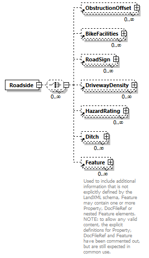 |
||
| namespace | http://www.landxml.org/schema/LandXML-2.0 | ||
| properties |
|
||
| children | ObstructionOffset BikeFacilities RoadSign DrivewayDensity HazardRating Ditch Feature | ||
| used by |
|
||
| source | <xs:element name="Roadside"> <xs:complexType> <xs:choice minOccurs="0" maxOccurs="unbounded"> <xs:element ref="ObstructionOffset" minOccurs="0" maxOccurs="unbounded"/> <xs:element ref="BikeFacilities" minOccurs="0" maxOccurs="unbounded"/> <xs:element ref="RoadSign" minOccurs="0" maxOccurs="unbounded"/> <xs:element ref="DrivewayDensity" minOccurs="0" maxOccurs="unbounded"/> <xs:element ref="HazardRating" minOccurs="0" maxOccurs="unbounded"/> <xs:element ref="Ditch" minOccurs="0" maxOccurs="unbounded"/> <xs:element ref="Feature" minOccurs="0" maxOccurs="unbounded"/> </xs:choice> </xs:complexType> </xs:element> |
element RoadSign
| diagram | 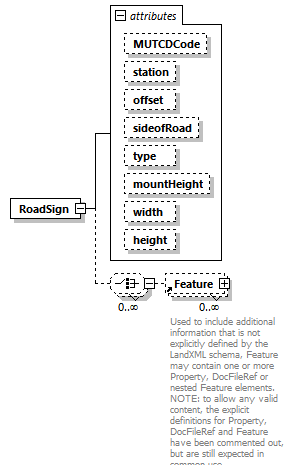 |
||||||||||||||||||||||||||||||||||||||||||||||||||||||
| namespace | http://www.landxml.org/schema/LandXML-2.0 | ||||||||||||||||||||||||||||||||||||||||||||||||||||||
| properties |
|
||||||||||||||||||||||||||||||||||||||||||||||||||||||
| children | Feature | ||||||||||||||||||||||||||||||||||||||||||||||||||||||
| used by |
|
||||||||||||||||||||||||||||||||||||||||||||||||||||||
| attributes |
|
||||||||||||||||||||||||||||||||||||||||||||||||||||||
| source | <xs:element name="RoadSign"> <xs:complexType> <xs:choice minOccurs="0" maxOccurs="unbounded"> <xs:element ref="Feature" minOccurs="0" maxOccurs="unbounded"/> </xs:choice> <xs:attribute name="MUTCDCode" type="xs:string"/> <xs:attribute name="station" type="station"/> <xs:attribute name="offset" type="offsetDistance"/> <xs:attribute name="sideofRoad" type="sideofRoadType"/> <xs:attribute name="type" type="roadSignType"/> <xs:attribute name="mountHeight" type="xs:double"/> <xs:attribute name="width" type="xs:double"/> <xs:attribute name="height" type="xs:double"/> </xs:complexType> </xs:element> |
attribute RoadSign/@MUTCDCode
| type | xs:string |
| source | <xs:attribute name="MUTCDCode" type="xs:string"/> |
attribute RoadSign/@station
| type | station |
| source | <xs:attribute name="station" type="station"/> |
attribute RoadSign/@offset
| type | offsetDistance |
| source | <xs:attribute name="offset" type="offsetDistance"/> |
attribute RoadSign/@sideofRoad
| type | sideofRoadType | ||||||||||||
| facets |
|
||||||||||||
| source | <xs:attribute name="sideofRoad" type="sideofRoadType"/> |
attribute RoadSign/@type
| type | roadSignType | ||||||||||||||||||||||||
| facets |
|
||||||||||||||||||||||||
| source | <xs:attribute name="type" type="roadSignType"/> |
attribute RoadSign/@mountHeight
| type | xs:double |
| source | <xs:attribute name="mountHeight" type="xs:double"/> |
attribute RoadSign/@width
| type | xs:double |
| source | <xs:attribute name="width" type="xs:double"/> |
attribute RoadSign/@height
| type | xs:double |
| source | <xs:attribute name="height" type="xs:double"/> |
element Roadway
| diagram | 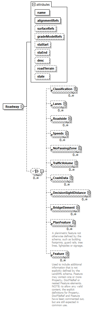 |
||||||||||||||||||||||||||||||||||||||||||||||||||||||||||||
| namespace | http://www.landxml.org/schema/LandXML-2.0 | ||||||||||||||||||||||||||||||||||||||||||||||||||||||||||||
| properties |
|
||||||||||||||||||||||||||||||||||||||||||||||||||||||||||||
| children | Classification Lanes Roadside Speeds NoPassingZone TrafficVolume CrashData DecisionSightDistance BridgeElement PlanFeature Feature | ||||||||||||||||||||||||||||||||||||||||||||||||||||||||||||
| used by |
|
||||||||||||||||||||||||||||||||||||||||||||||||||||||||||||
| attributes |
|
||||||||||||||||||||||||||||||||||||||||||||||||||||||||||||
| source | <xs:element name="Roadway"> <xs:complexType> <xs:choice minOccurs="0" maxOccurs="unbounded"> <xs:element ref="Classification" minOccurs="0" maxOccurs="unbounded"/> <xs:element ref="Lanes" minOccurs="0" maxOccurs="unbounded"/> <xs:element ref="Roadside" minOccurs="0" maxOccurs="unbounded"/> <xs:element ref="Speeds" minOccurs="0" maxOccurs="unbounded"/> <xs:element ref="NoPassingZone" minOccurs="0" maxOccurs="unbounded"/> <xs:element ref="TrafficVolume" minOccurs="0" maxOccurs="unbounded"/> <xs:element ref="CrashData" minOccurs="0" maxOccurs="unbounded"/> <xs:element ref="DecisionSightDistance" minOccurs="0" maxOccurs="unbounded"/> <xs:element ref="BridgeElement" minOccurs="0" maxOccurs="unbounded"/> <xs:element ref="PlanFeature" minOccurs="0" maxOccurs="unbounded"/> <xs:element ref="Feature" minOccurs="0" maxOccurs="unbounded"/> </xs:choice> <xs:attribute name="name" type="xs:string" use="required"/> <xs:attribute name="alignmentRefs" type="alignmentNameRefs" use="required"/> <xs:attribute name="surfaceRefs" type="surfaceNameRefs"/> <xs:attribute name="gradeModelRefs" type="gradeModelNameRefs"/> <xs:attribute name="staStart" type="station"/> <xs:attribute name="staEnd" type="station"/> <xs:attribute name="desc" type="xs:string"/> <xs:attribute name="roadTerrain" type="roadTerrainType"/> <xs:attribute name="state" type="stateType"/> </xs:complexType> </xs:element> |
attribute Roadway/@name
| type | xs:string | ||
| properties |
|
||
| source | <xs:attribute name="name" type="xs:string" use="required"/> |
attribute Roadway/@alignmentRefs
| type | alignmentNameRefs | ||
| properties |
|
||
| source | <xs:attribute name="alignmentRefs" type="alignmentNameRefs" use="required"/> |
attribute Roadway/@surfaceRefs
| type | surfaceNameRefs |
| source | <xs:attribute name="surfaceRefs" type="surfaceNameRefs"/> |
attribute Roadway/@gradeModelRefs
| type | gradeModelNameRefs |
| source | <xs:attribute name="gradeModelRefs" type="gradeModelNameRefs"/> |
attribute Roadway/@staStart
| type | station |
| source | <xs:attribute name="staStart" type="station"/> |
attribute Roadway/@staEnd
| type | station |
| source | <xs:attribute name="staEnd" type="station"/> |
attribute Roadway/@desc
| type | xs:string |
| source | <xs:attribute name="desc" type="xs:string"/> |
attribute Roadway/@roadTerrain
| type | roadTerrainType | ||||||||||||
| facets |
|
||||||||||||
| source | <xs:attribute name="roadTerrain" type="roadTerrainType"/> |
attribute Roadway/@state
| type | stateType | |||||||||||||||
| facets |
|
|||||||||||||||
| source | <xs:attribute name="state" type="stateType"/> |
element Roadways
| diagram | 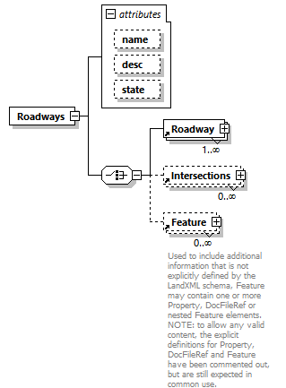 |
||||||||||||||||||||||||
| namespace | http://www.landxml.org/schema/LandXML-2.0 | ||||||||||||||||||||||||
| properties |
|
||||||||||||||||||||||||
| children | Roadway Intersections Feature | ||||||||||||||||||||||||
| used by |
|
||||||||||||||||||||||||
| attributes |
|
||||||||||||||||||||||||
| source | <xs:element name="Roadways"> <xs:complexType> <xs:choice> <xs:element ref="Roadway" maxOccurs="unbounded"/> <xs:element ref="Intersections" minOccurs="0" maxOccurs="unbounded"/> <xs:element ref="Feature" minOccurs="0" maxOccurs="unbounded"/> </xs:choice> <xs:attribute name="name" type="xs:string"/> <xs:attribute name="desc" type="xs:string"/> <xs:attribute name="state" type="stateType"/> </xs:complexType> </xs:element> |
attribute Roadways/@name
| type | xs:string |
| source | <xs:attribute name="name" type="xs:string"/> |
attribute Roadways/@desc
| type | xs:string |
| source | <xs:attribute name="desc" type="xs:string"/> |
attribute Roadways/@state
| type | stateType | |||||||||||||||
| facets |
|
|||||||||||||||
| source | <xs:attribute name="state" type="stateType"/> |
element RunoffSta
| diagram |  |
||||
| namespace | http://www.landxml.org/schema/LandXML-2.0 | ||||
| type | station | ||||
| properties |
|
||||
| used by |
|
||||
| source | <xs:element name="RunoffSta" type="station" nillable="true"/> |
element SanitarySewerNetwork
| diagram | 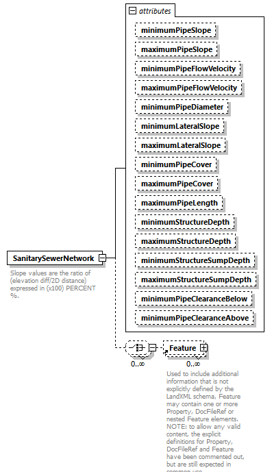 |
||||||||||||||||||||||||||||||||||||||||||||||||||||||||||||||||||||||||||||||||||||||||||||||||||||||
| namespace | http://www.landxml.org/schema/LandXML-2.0 | ||||||||||||||||||||||||||||||||||||||||||||||||||||||||||||||||||||||||||||||||||||||||||||||||||||||
| properties |
|
||||||||||||||||||||||||||||||||||||||||||||||||||||||||||||||||||||||||||||||||||||||||||||||||||||||
| children | Feature | ||||||||||||||||||||||||||||||||||||||||||||||||||||||||||||||||||||||||||||||||||||||||||||||||||||||
| used by |
|
||||||||||||||||||||||||||||||||||||||||||||||||||||||||||||||||||||||||||||||||||||||||||||||||||||||
| attributes |
|
||||||||||||||||||||||||||||||||||||||||||||||||||||||||||||||||||||||||||||||||||||||||||||||||||||||
| annotation |
|
||||||||||||||||||||||||||||||||||||||||||||||||||||||||||||||||||||||||||||||||||||||||||||||||||||||
| source | <xs:element name="SanitarySewerNetwork"> <xs:annotation> <xs:documentation>Slope values are the ratio of (elevation diff/2D distance) expressed in (x100) PERCENT %.</xs:documentation> <xs:documentation>Flow Velocity [fluid volume/second] is expressed in the defined velocity units</xs:documentation> <xs:documentation>Clearance is the vertical distance between utility network pipes</xs:documentation> <xs:documentation>Cover is the vertical distance between utility network pipes and the finished ground surface</xs:documentation> <xs:documentation>Length, Depth, Clearance, Sump depth, and Cover attributes are expressed in the defined linear units</xs:documentation> <xs:documentation>Lateral attributes refer to lateral pipe and structure connections to the primary pipe network</xs:documentation> </xs:annotation> <xs:complexType> <xs:choice minOccurs="0" maxOccurs="unbounded"> <xs:element ref="Feature" minOccurs="0" maxOccurs="unbounded"/> </xs:choice> <xs:attribute name="minimumPipeSlope" type="slope" default="1.0"/> <xs:attribute name="maximumPipeSlope" type="slope" default="10.0"/> <xs:attribute name="minimumPipeFlowVelocity" type="pipeFlow"/> <xs:attribute name="maximumPipeFlowVelocity" type="pipeFlow"/> <xs:attribute name="minimumPipeDiameter" type="xs:double"/> <xs:attribute name="minimumLateralSlope" type="slope" default="1.0"/> <xs:attribute name="maximumLateralSlope" type="slope" default="10.0"/> <xs:attribute name="minimumPipeCover" type="xs:double"/> <xs:attribute name="maximumPipeCover" type="xs:double"/> <xs:attribute name="maximumPipeLength" type="xs:double"/> <xs:attribute name="minimumStructureDepth" type="xs:double"/> <xs:attribute name="maximumStructureDepth" type="xs:double"/> <xs:attribute name="minimumStructureSumpDepth" type="xs:double"/> <xs:attribute name="maximumStructureSumpDepth" type="xs:double"/> <xs:attribute name="minimumPipeClearanceBelow" type="xs:double"/> <xs:attribute name="minimumPipeClearanceAbove" type="xs:double"/> </xs:complexType> </xs:element> |
attribute SanitarySewerNetwork/@minimumPipeSlope
| type | slope | ||
| properties |
|
||
| source | <xs:attribute name="minimumPipeSlope" type="slope" default="1.0"/> |
attribute SanitarySewerNetwork/@maximumPipeSlope
| type | slope | ||
| properties |
|
||
| source | <xs:attribute name="maximumPipeSlope" type="slope" default="10.0"/> |
attribute SanitarySewerNetwork/@minimumPipeFlowVelocity
| type | pipeFlow |
| source | <xs:attribute name="minimumPipeFlowVelocity" type="pipeFlow"/> |
attribute SanitarySewerNetwork/@maximumPipeFlowVelocity
| type | pipeFlow |
| source | <xs:attribute name="maximumPipeFlowVelocity" type="pipeFlow"/> |
attribute SanitarySewerNetwork/@minimumPipeDiameter
| type | xs:double |
| source | <xs:attribute name="minimumPipeDiameter" type="xs:double"/> |
attribute SanitarySewerNetwork/@minimumLateralSlope
| type | slope | ||
| properties |
|
||
| source | <xs:attribute name="minimumLateralSlope" type="slope" default="1.0"/> |
attribute SanitarySewerNetwork/@maximumLateralSlope
| type | slope | ||
| properties |
|
||
| source | <xs:attribute name="maximumLateralSlope" type="slope" default="10.0"/> |
attribute SanitarySewerNetwork/@minimumPipeCover
| type | xs:double |
| source | <xs:attribute name="minimumPipeCover" type="xs:double"/> |
attribute SanitarySewerNetwork/@maximumPipeCover
| type | xs:double |
| source | <xs:attribute name="maximumPipeCover" type="xs:double"/> |
attribute SanitarySewerNetwork/@maximumPipeLength
| type | xs:double |
| source | <xs:attribute name="maximumPipeLength" type="xs:double"/> |
attribute SanitarySewerNetwork/@minimumStructureDepth
| type | xs:double |
| source | <xs:attribute name="minimumStructureDepth" type="xs:double"/> |
attribute SanitarySewerNetwork/@maximumStructureDepth
| type | xs:double |
| source | <xs:attribute name="maximumStructureDepth" type="xs:double"/> |
attribute SanitarySewerNetwork/@minimumStructureSumpDepth
| type | xs:double |
| source | <xs:attribute name="minimumStructureSumpDepth" type="xs:double"/> |
attribute SanitarySewerNetwork/@maximumStructureSumpDepth
| type | xs:double |
| source | <xs:attribute name="maximumStructureSumpDepth" type="xs:double"/> |
attribute SanitarySewerNetwork/@minimumPipeClearanceBelow
| type | xs:double |
| source | <xs:attribute name="minimumPipeClearanceBelow" type="xs:double"/> |
attribute SanitarySewerNetwork/@minimumPipeClearanceAbove
| type | xs:double |
| source | <xs:attribute name="minimumPipeClearanceAbove" type="xs:double"/> |
element SlottedInlet
| diagram | 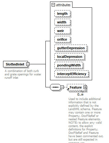 |
||||||||||||||||||||||||||||||||||||||||||||||||||||||
| namespace | http://www.landxml.org/schema/LandXML-2.0 | ||||||||||||||||||||||||||||||||||||||||||||||||||||||
| properties |
|
||||||||||||||||||||||||||||||||||||||||||||||||||||||
| children | Feature | ||||||||||||||||||||||||||||||||||||||||||||||||||||||
| used by |
|
||||||||||||||||||||||||||||||||||||||||||||||||||||||
| attributes |
|
||||||||||||||||||||||||||||||||||||||||||||||||||||||
| annotation |
|
||||||||||||||||||||||||||||||||||||||||||||||||||||||
| source | <xs:element name="SlottedInlet"> <xs:annotation> <xs:documentation>A combination of both curb and grate openings for water runoff inlet</xs:documentation> <xs:documentation>interceptEfficiency = % of inflow that gets intercepted by vegetation and doesn't enter inlet or % of inflow that isn't intercepted</xs:documentation> <xs:documentation>Weir = 2.48 or 1.4 default. It's dimensionality based depth probably, as length is above in SlotLength so SlotWeir is probably the depth of water that gets blocked and doesn't pass into inlet.</xs:documentation> </xs:annotation> <xs:complexType> <xs:sequence> <xs:element ref="Feature" minOccurs="0" maxOccurs="unbounded"/> </xs:sequence> <xs:attribute name="length" type="xs:double"/> <xs:attribute name="width" type="xs:double"/> <xs:attribute name="weir" type="xs:double"/> <xs:attribute name="orifice" type="xs:double"/> <xs:attribute name="gutterDepression" type="xs:double"/> <xs:attribute name="localDepression" type="xs:double"/> <xs:attribute name="pondingWidth" type="xs:double"/> <xs:attribute name="interceptEfficiency" type="xs:double"/> </xs:complexType> </xs:element> |
attribute SlottedInlet/@length
| type | xs:double |
| source | <xs:attribute name="length" type="xs:double"/> |
attribute SlottedInlet/@width
| type | xs:double |
| source | <xs:attribute name="width" type="xs:double"/> |
attribute SlottedInlet/@weir
| type | xs:double |
| source | <xs:attribute name="weir" type="xs:double"/> |
attribute SlottedInlet/@orifice
| type | xs:double |
| source | <xs:attribute name="orifice" type="xs:double"/> |
attribute SlottedInlet/@gutterDepression
| type | xs:double |
| source | <xs:attribute name="gutterDepression" type="xs:double"/> |
attribute SlottedInlet/@localDepression
| type | xs:double |
| source | <xs:attribute name="localDepression" type="xs:double"/> |
attribute SlottedInlet/@pondingWidth
| type | xs:double |
| source | <xs:attribute name="pondingWidth" type="xs:double"/> |
attribute SlottedInlet/@interceptEfficiency
| type | xs:double |
| source | <xs:attribute name="interceptEfficiency" type="xs:double"/> |
element SourceData
| diagram | 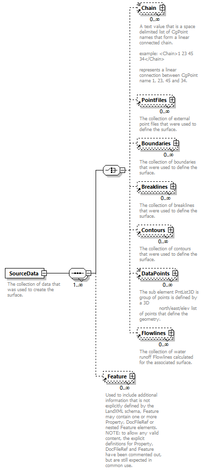 |
||
| namespace | http://www.landxml.org/schema/LandXML-2.0 | ||
| properties |
|
||
| children | Chain PointFiles Boundaries Breaklines Contours DataPoints Flowlines Feature | ||
| used by |
|
||
| annotation |
|
||
| source | <xs:element name="SourceData"> <xs:annotation> <xs:documentation>The collection of data that was used to create the surface.</xs:documentation> </xs:annotation> <xs:complexType> <xs:sequence maxOccurs="unbounded"> <xs:choice> <xs:element ref="Chain" minOccurs="0" maxOccurs="unbounded"/> <xs:element ref="PointFiles" minOccurs="0" maxOccurs="unbounded"/> <xs:element ref="Boundaries" minOccurs="0" maxOccurs="unbounded"/> <xs:element ref="Breaklines" minOccurs="0" maxOccurs="unbounded"/> <xs:element ref="Contours" minOccurs="0" maxOccurs="unbounded"/> <xs:element ref="DataPoints" minOccurs="0" maxOccurs="unbounded"/> <xs:element ref="Flowlines" minOccurs="0" maxOccurs="unbounded"/> </xs:choice> <xs:element ref="Feature" minOccurs="0" maxOccurs="unbounded"/> </xs:sequence> </xs:complexType> </xs:element> |
element Speeds
| diagram | 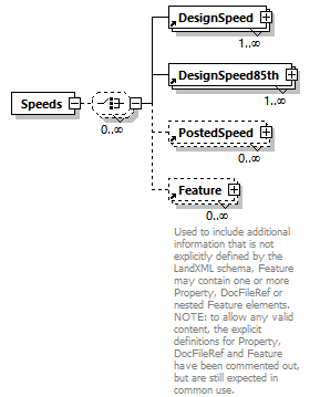 |
||
| namespace | http://www.landxml.org/schema/LandXML-2.0 | ||
| properties |
|
||
| children | DesignSpeed DesignSpeed85th PostedSpeed Feature | ||
| used by |
|
||
| source | <xs:element name="Speeds"> <xs:complexType> <xs:choice minOccurs="0" maxOccurs="unbounded"> <xs:element ref="DesignSpeed" maxOccurs="unbounded"/> <xs:element ref="DesignSpeed85th" maxOccurs="unbounded"/> <xs:element ref="PostedSpeed" minOccurs="0" maxOccurs="unbounded"/> <xs:element ref="Feature" minOccurs="0" maxOccurs="unbounded"/> </xs:choice> </xs:complexType> </xs:element> |
element SpeedStation
| diagram | 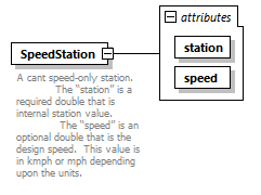 |
||||||||||||||||||
| namespace | http://www.landxml.org/schema/LandXML-2.0 | ||||||||||||||||||
| properties |
|
||||||||||||||||||
| used by |
|
||||||||||||||||||
| attributes |
|
||||||||||||||||||
| annotation |
|
||||||||||||||||||
| source | <xs:element name="SpeedStation"> <xs:annotation> <xs:documentation>A cant speed-only station. The “station” is a required double that is internal station value. The “speed” is an optional double that is the design speed. This value is in kmph or mph depending upon the units. </xs:documentation> </xs:annotation> <xs:complexType> <xs:attribute name="station" type="xs:double" use="required"/> <xs:attribute name="speed" type="xs:double" use="required"/> </xs:complexType> </xs:element> |
attribute SpeedStation/@station
| type | xs:double | ||
| properties |
|
||
| source | <xs:attribute name="station" type="xs:double" use="required"/> |
attribute SpeedStation/@speed
| type | xs:double | ||
| properties |
|
||
| source | <xs:attribute name="speed" type="xs:double" use="required"/> |
element Spiral
| diagram | 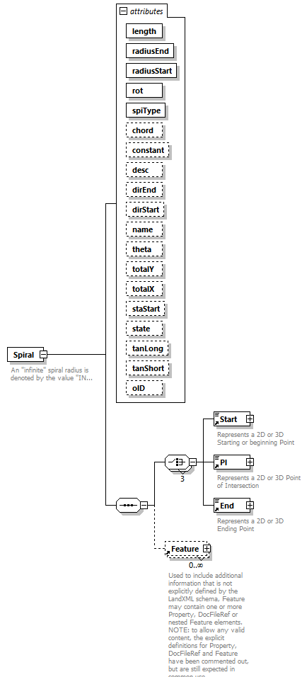 |
||||||||||||||||||||||||||||||||||||||||||||||||||||||||||||||||||||||||||||||||||||||||||||||||||||||||||||||||||||||||
| namespace | http://www.landxml.org/schema/LandXML-2.0 | ||||||||||||||||||||||||||||||||||||||||||||||||||||||||||||||||||||||||||||||||||||||||||||||||||||||||||||||||||||||||
| properties |
|
||||||||||||||||||||||||||||||||||||||||||||||||||||||||||||||||||||||||||||||||||||||||||||||||||||||||||||||||||||||||
| children | Start PI End Feature | ||||||||||||||||||||||||||||||||||||||||||||||||||||||||||||||||||||||||||||||||||||||||||||||||||||||||||||||||||||||||
| used by |
|
||||||||||||||||||||||||||||||||||||||||||||||||||||||||||||||||||||||||||||||||||||||||||||||||||||||||||||||||||||||||
| attributes |
|
||||||||||||||||||||||||||||||||||||||||||||||||||||||||||||||||||||||||||||||||||||||||||||||||||||||||||||||||||||||||
| annotation |
|
||||||||||||||||||||||||||||||||||||||||||||||||||||||||||||||||||||||||||||||||||||||||||||||||||||||||||||||||||||||||
| source | <xs:element name="Spiral"> <xs:annotation> <xs:documentation>An "infinite" spiral radius is denoted by the value "INF". </xs:documentation> <xs:documentation>This conforms to XML Schema which defines infinity as "INF" or "-INF" for all numeric datatypes </xs:documentation> </xs:annotation> <xs:complexType> <xs:sequence> <xs:choice minOccurs="3" maxOccurs="3"> <xs:element ref="Start"/> <xs:element ref="PI"/> <xs:element ref="End"/> </xs:choice> <xs:element ref="Feature" minOccurs="0" maxOccurs="unbounded"/> </xs:sequence> <xs:attribute name="length" type="xs:double" use="required"/> <xs:attribute name="radiusEnd" type="xs:double" use="required"/> <xs:attribute name="radiusStart" type="xs:double" use="required"/> <xs:attribute name="rot" type="clockwise" use="required"/> <xs:attribute name="spiType" type="spiralType" use="required"/> <xs:attribute name="chord" type="xs:double"/> <xs:attribute name="constant" type="xs:double"/> <xs:attribute name="desc" type="xs:string"/> <xs:attribute name="dirEnd" type="direction"/> <xs:attribute name="dirStart" type="direction"/> <xs:attribute name="name" type="xs:string"/> <xs:attribute name="theta" type="angle"/> <xs:attribute name="totalY" type="xs:double"/> <xs:attribute name="totalX" type="xs:double"/> <xs:attribute name="staStart" type="xs:double"/> <xs:attribute name="state" type="stateType"/> <xs:attribute name="tanLong" type="xs:double"/> <xs:attribute name="tanShort" type="xs:double"/> <xs:attribute name="oID" type="xs:string"/> </xs:complexType> </xs:element> |
attribute Spiral/@length
| type | xs:double | ||
| properties |
|
||
| source | <xs:attribute name="length" type="xs:double" use="required"/> |
attribute Spiral/@radiusEnd
| type | xs:double | ||
| properties |
|
||
| source | <xs:attribute name="radiusEnd" type="xs:double" use="required"/> |
attribute Spiral/@radiusStart
| type | xs:double | ||
| properties |
|
||
| source | <xs:attribute name="radiusStart" type="xs:double" use="required"/> |
attribute Spiral/@rot
| type | clockwise | |||||||||
| properties |
|
|||||||||
| facets |
|
|||||||||
| source | <xs:attribute name="rot" type="clockwise" use="required"/> |
attribute Spiral/@spiType
| type | spiralType | |||||||||||||||||||||||||||||||||||||||||||||||||||
| properties |
|
|||||||||||||||||||||||||||||||||||||||||||||||||||
| facets |
|
|||||||||||||||||||||||||||||||||||||||||||||||||||
| source | <xs:attribute name="spiType" type="spiralType" use="required"/> |
attribute Spiral/@chord
| type | xs:double |
| source | <xs:attribute name="chord" type="xs:double"/> |
attribute Spiral/@constant
| type | xs:double |
| source | <xs:attribute name="constant" type="xs:double"/> |
attribute Spiral/@desc
| type | xs:string |
| source | <xs:attribute name="desc" type="xs:string"/> |
attribute Spiral/@dirEnd
| type | direction |
| source | <xs:attribute name="dirEnd" type="direction"/> |
attribute Spiral/@dirStart
| type | direction |
| source | <xs:attribute name="dirStart" type="direction"/> |
attribute Spiral/@name
| type | xs:string |
| source | <xs:attribute name="name" type="xs:string"/> |
attribute Spiral/@theta
| type | angle |
| source | <xs:attribute name="theta" type="angle"/> |
attribute Spiral/@totalY
| type | xs:double |
| source | <xs:attribute name="totalY" type="xs:double"/> |
attribute Spiral/@totalX
| type | xs:double |
| source | <xs:attribute name="totalX" type="xs:double"/> |
attribute Spiral/@staStart
| type | xs:double |
| source | <xs:attribute name="staStart" type="xs:double"/> |
attribute Spiral/@state
| type | stateType | |||||||||||||||
| facets |
|
|||||||||||||||
| source | <xs:attribute name="state" type="stateType"/> |
attribute Spiral/@tanLong
| type | xs:double |
| source | <xs:attribute name="tanLong" type="xs:double"/> |
attribute Spiral/@tanShort
| type | xs:double |
| source | <xs:attribute name="tanShort" type="xs:double"/> |
attribute Spiral/@oID
| type | xs:string |
| source | <xs:attribute name="oID" type="xs:string"/> |
element StaEquation
| diagram | 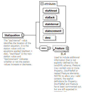 |
||||||||||||||||||||||||||||||||||||
| namespace | http://www.landxml.org/schema/LandXML-2.0 | ||||||||||||||||||||||||||||||||||||
| properties |
|
||||||||||||||||||||||||||||||||||||
| children | Feature | ||||||||||||||||||||||||||||||||||||
| used by |
|
||||||||||||||||||||||||||||||||||||
| attributes |
|
||||||||||||||||||||||||||||||||||||
| annotation |
|
||||||||||||||||||||||||||||||||||||
| source | <xs:element name="StaEquation"> <xs:annotation> <xs:documentation>The "staInternal" value identifies the location of the station equation. It is the station value with no equations applied (staStart + dist). "staAhead" is the new station value and "staIncrement" indicates whether or not the station values increase or decrease.</xs:documentation> </xs:annotation> <xs:complexType> <xs:sequence> <xs:element ref="Feature" minOccurs="0" maxOccurs="unbounded"/> </xs:sequence> <xs:attribute name="staAhead" type="xs:double" use="required"/> <xs:attribute name="staBack" type="xs:double"/> <xs:attribute name="staInternal" type="xs:double" use="required"/> <xs:attribute name="staIncrement" type="stationIncrementDirectionType" use="optional"/> <xs:attribute name="desc" type="xs:string"/> </xs:complexType> </xs:element> |
attribute StaEquation/@staAhead
| type | xs:double | ||
| properties |
|
||
| source | <xs:attribute name="staAhead" type="xs:double" use="required"/> |
attribute StaEquation/@staBack
| type | xs:double |
| source | <xs:attribute name="staBack" type="xs:double"/> |
attribute StaEquation/@staInternal
| type | xs:double | ||
| properties |
|
||
| source | <xs:attribute name="staInternal" type="xs:double" use="required"/> |
attribute StaEquation/@staIncrement
| type | stationIncrementDirectionType | |||||||||
| properties |
|
|||||||||
| facets |
|
|||||||||
| source | <xs:attribute name="staIncrement" type="stationIncrementDirectionType" use="optional"/> |
attribute StaEquation/@desc
| type | xs:string |
| source | <xs:attribute name="desc" type="xs:string"/> |
element Start
| diagram | 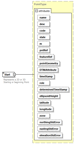 |
||||||||||||||||||||||||||||||||||||||||||||||||||||||||||||||||||||||||||||||||||||||||||||||||||||||||||||||||||||||||
| namespace | http://www.landxml.org/schema/LandXML-2.0 | ||||||||||||||||||||||||||||||||||||||||||||||||||||||||||||||||||||||||||||||||||||||||||||||||||||||||||||||||||||||||
| type | PointType | ||||||||||||||||||||||||||||||||||||||||||||||||||||||||||||||||||||||||||||||||||||||||||||||||||||||||||||||||||||||||
| properties |
|
||||||||||||||||||||||||||||||||||||||||||||||||||||||||||||||||||||||||||||||||||||||||||||||||||||||||||||||||||||||||
| used by |
|
||||||||||||||||||||||||||||||||||||||||||||||||||||||||||||||||||||||||||||||||||||||||||||||||||||||||||||||||||||||||
| facets |
|
||||||||||||||||||||||||||||||||||||||||||||||||||||||||||||||||||||||||||||||||||||||||||||||||||||||||||||||||||||||||
| attributes |
|
||||||||||||||||||||||||||||||||||||||||||||||||||||||||||||||||||||||||||||||||||||||||||||||||||||||||||||||||||||||||
| annotation |
|
||||||||||||||||||||||||||||||||||||||||||||||||||||||||||||||||||||||||||||||||||||||||||||||||||||||||||||||||||||||||
| source | <xs:element name="Start" type="PointType"> <xs:annotation> <xs:documentation>Represents a 2D or 3D Starting or beginning Point</xs:documentation> <xs:documentation>Defined by either a coordinate text value ("north east" or "north east elev") or a CgPoint number reference "pntRef" attribute.</xs:documentation> </xs:annotation> </xs:element> |
element StartofRunoutSta
| diagram |  |
||||
| namespace | http://www.landxml.org/schema/LandXML-2.0 | ||||
| type | station | ||||
| properties |
|
||||
| used by |
|
||||
| source | <xs:element name="StartofRunoutSta" type="station" nillable="true"/> |
element Station
| diagram |  |
||
| namespace | http://www.landxml.org/schema/LandXML-2.0 | ||
| type | xs:double | ||
| properties |
|
||
| used by |
|
||
| annotation |
|
||
| source | <xs:element name="Station" type="xs:double"> <xs:annotation> <xs:documentation>Station Name</xs:documentation> </xs:annotation> </xs:element> |
element StormWaterNetwork
| diagram | 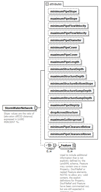 |
||||||||||||||||||||||||||||||||||||||||||||||||||||||||||||||||||||||||||||||||||||||||||||||||||||||||||||||||||
| namespace | http://www.landxml.org/schema/LandXML-2.0 | ||||||||||||||||||||||||||||||||||||||||||||||||||||||||||||||||||||||||||||||||||||||||||||||||||||||||||||||||||
| properties |
|
||||||||||||||||||||||||||||||||||||||||||||||||||||||||||||||||||||||||||||||||||||||||||||||||||||||||||||||||||
| children | Feature | ||||||||||||||||||||||||||||||||||||||||||||||||||||||||||||||||||||||||||||||||||||||||||||||||||||||||||||||||||
| used by |
|
||||||||||||||||||||||||||||||||||||||||||||||||||||||||||||||||||||||||||||||||||||||||||||||||||||||||||||||||||
| attributes |
|
||||||||||||||||||||||||||||||||||||||||||||||||||||||||||||||||||||||||||||||||||||||||||||||||||||||||||||||||||
| annotation |
|
||||||||||||||||||||||||||||||||||||||||||||||||||||||||||||||||||||||||||||||||||||||||||||||||||||||||||||||||||
| source | <xs:element name="StormWaterNetwork"> <xs:annotation> <xs:documentation>Slope values are the ratio of (elevation diff/2D distance) expressed in (x100) PERCENT %.</xs:documentation> <xs:documentation>Flow Velocity [fluid volume/second] is expressed in the defined velocity units</xs:documentation> <xs:documentation>Clearance is the vertical distance between utility network pipes</xs:documentation> <xs:documentation>Cover is the vertical distance between utility network pipes and the finished ground surface</xs:documentation> <xs:documentation>Length, Depth, Clearance, Drop, StepUp and Cover attributes are expressed in the defined linear units</xs:documentation> </xs:annotation> <xs:complexType> <xs:choice minOccurs="0" maxOccurs="unbounded"> <xs:element ref="Feature" minOccurs="0" maxOccurs="unbounded"/> </xs:choice> <xs:attribute name="minimumPipeSlope" type="slope" default="1.0"/> <xs:attribute name="maximumPipeSlope" type="slope" default="10.0"/> <xs:attribute name="minimumPipeFlowVelocity" type="pipeFlow"/> <xs:attribute name="maximumPipeFlowVelocity" type="pipeFlow"/> <xs:attribute name="minimumPipeDiameter" type="pipeDiameter"/> <xs:attribute name="minimumPipeCover" type="xs:double"/> <xs:attribute name="maximumPipeCover" type="xs:double"/> <xs:attribute name="maximumPipeLength" type="xs:double"/> <xs:attribute name="minimumStructureDepth" type="xs:double"/> <xs:attribute name="maximumStructureDepth" type="xs:double"/> <xs:attribute name="minimumStructureBottomSlope" type="xs:double"/> <xs:attribute name="minimumStructureSumpDepth" type="xs:double"/> <xs:attribute name="maximumStructureSumpDepth" type="xs:double"/> <xs:attribute name="maximumPipeStepUp" type="xs:double"/> <xs:attribute name="dropAcrossStructure" type="xs:double"/> <xs:attribute name="maximumGutterspread" type="xs:double"/> <xs:attribute name="minimumPipeClearanceBelow" type="xs:double"/> <xs:attribute name="minimumPipeClearanceAbove" type="xs:double"/> </xs:complexType> </xs:element> |
attribute StormWaterNetwork/@minimumPipeSlope
| type | slope | ||
| properties |
|
||
| source | <xs:attribute name="minimumPipeSlope" type="slope" default="1.0"/> |
attribute StormWaterNetwork/@maximumPipeSlope
| type | slope | ||
| properties |
|
||
| source | <xs:attribute name="maximumPipeSlope" type="slope" default="10.0"/> |
attribute StormWaterNetwork/@minimumPipeFlowVelocity
| type | pipeFlow |
| source | <xs:attribute name="minimumPipeFlowVelocity" type="pipeFlow"/> |
attribute StormWaterNetwork/@maximumPipeFlowVelocity
| type | pipeFlow |
| source | <xs:attribute name="maximumPipeFlowVelocity" type="pipeFlow"/> |
attribute StormWaterNetwork/@minimumPipeDiameter
| type | pipeDiameter |
| source | <xs:attribute name="minimumPipeDiameter" type="pipeDiameter"/> |
attribute StormWaterNetwork/@minimumPipeCover
| type | xs:double |
| source | <xs:attribute name="minimumPipeCover" type="xs:double"/> |
attribute StormWaterNetwork/@maximumPipeCover
| type | xs:double |
| source | <xs:attribute name="maximumPipeCover" type="xs:double"/> |
attribute StormWaterNetwork/@maximumPipeLength
| type | xs:double |
| source | <xs:attribute name="maximumPipeLength" type="xs:double"/> |
attribute StormWaterNetwork/@minimumStructureDepth
| type | xs:double |
| source | <xs:attribute name="minimumStructureDepth" type="xs:double"/> |
attribute StormWaterNetwork/@maximumStructureDepth
| type | xs:double |
| source | <xs:attribute name="maximumStructureDepth" type="xs:double"/> |
attribute StormWaterNetwork/@minimumStructureBottomSlope
| type | xs:double |
| source | <xs:attribute name="minimumStructureBottomSlope" type="xs:double"/> |
attribute StormWaterNetwork/@minimumStructureSumpDepth
| type | xs:double |
| source | <xs:attribute name="minimumStructureSumpDepth" type="xs:double"/> |
attribute StormWaterNetwork/@maximumStructureSumpDepth
| type | xs:double |
| source | <xs:attribute name="maximumStructureSumpDepth" type="xs:double"/> |
attribute StormWaterNetwork/@maximumPipeStepUp
| type | xs:double |
| source | <xs:attribute name="maximumPipeStepUp" type="xs:double"/> |
attribute StormWaterNetwork/@dropAcrossStructure
| type | xs:double |
| source | <xs:attribute name="dropAcrossStructure" type="xs:double"/> |
attribute StormWaterNetwork/@maximumGutterspread
| type | xs:double |
| source | <xs:attribute name="maximumGutterspread" type="xs:double"/> |
attribute StormWaterNetwork/@minimumPipeClearanceBelow
| type | xs:double |
| source | <xs:attribute name="minimumPipeClearanceBelow" type="xs:double"/> |
attribute StormWaterNetwork/@minimumPipeClearanceAbove
| type | xs:double |
| source | <xs:attribute name="minimumPipeClearanceAbove" type="xs:double"/> |
element StormWaterStructure
| diagram | 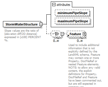 |
||||||||||||||||||
| namespace | http://www.landxml.org/schema/LandXML-2.0 | ||||||||||||||||||
| properties |
|
||||||||||||||||||
| children | Feature | ||||||||||||||||||
| attributes |
|
||||||||||||||||||
| annotation |
|
||||||||||||||||||
| source | <xs:element name="StormWaterStructure"> <xs:annotation> <xs:documentation>Slope values are the ratio of (elevation diff/2D distance) expressed in (x100) PERCENT %.</xs:documentation> <xs:documentation>Flow Velocity [fluid volume/second] is expressed in the defined velocity units</xs:documentation> <xs:documentation>Clearance is the vertical distance between utility network pipes</xs:documentation> <xs:documentation>Cover is the vertical distance between utility network pipes and the finished ground surface</xs:documentation> <xs:documentation>Length, Depth, Clearance, Drop, StepUp and Cover attributes are expressed in the defined linear units</xs:documentation> </xs:annotation> <xs:complexType> <xs:choice minOccurs="0" maxOccurs="unbounded"> <xs:element ref="Feature" minOccurs="0" maxOccurs="unbounded"/> </xs:choice> <xs:attribute name="minimumPipeSlope" type="slope" default="1.0"/> <xs:attribute name="maximumPipeSlope" type="slope" default="10.0"/> </xs:complexType> </xs:element> |
attribute StormWaterStructure/@minimumPipeSlope
| type | slope | ||
| properties |
|
||
| source | <xs:attribute name="minimumPipeSlope" type="slope" default="1.0"/> |
attribute StormWaterStructure/@maximumPipeSlope
| type | slope | ||
| properties |
|
||
| source | <xs:attribute name="maximumPipeSlope" type="slope" default="10.0"/> |
element Struct
| diagram | 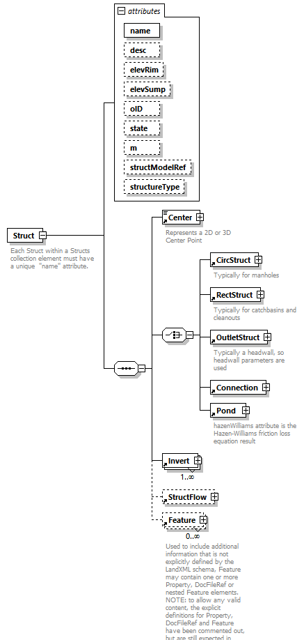 |
||||||||||||||||||||||||||||||||||||||||||||||||||||||||||||
| namespace | http://www.landxml.org/schema/LandXML-2.0 | ||||||||||||||||||||||||||||||||||||||||||||||||||||||||||||
| properties |
|
||||||||||||||||||||||||||||||||||||||||||||||||||||||||||||
| children | Center CircStruct RectStruct OutletStruct Connection Pond Invert StructFlow Feature | ||||||||||||||||||||||||||||||||||||||||||||||||||||||||||||
| used by |
|
||||||||||||||||||||||||||||||||||||||||||||||||||||||||||||
| attributes |
|
||||||||||||||||||||||||||||||||||||||||||||||||||||||||||||
| annotation |
|
||||||||||||||||||||||||||||||||||||||||||||||||||||||||||||
| source | <xs:element name="Struct"> <xs:annotation> <xs:documentation>Each Struct within a Structs collection element must have a unique "name" attribute.</xs:documentation> <xs:documentation>The structure type is optional here, but should be determined by the structModelNameRef reference</xs:documentation> <xs:documentation>The required Center element will contain the "north east" coordinate text value or a CgPoint "refPnt" attribute.</xs:documentation> <xs:documentation>Each Invert element contains a "refPipe" attribute to reference a Pipe element "name"</xs:documentation> </xs:annotation> <xs:complexType> <xs:sequence> <xs:element ref="Center" minOccurs="1" maxOccurs="1"/> <xs:choice> <xs:element ref="CircStruct"/> <xs:element ref="RectStruct"/> <xs:element ref="OutletStruct"/> <xs:element ref="Connection"/> <xs:element ref="Pond"/> </xs:choice> <xs:element ref="Invert" maxOccurs="unbounded"/> <xs:element ref="StructFlow" minOccurs="0"/> <xs:element ref="Feature" minOccurs="0" maxOccurs="unbounded"/> </xs:sequence> <xs:attribute name="name" type="xs:string" use="required"/> <xs:attribute name="desc" type="xs:string"/> <xs:attribute name="elevRim" type="xs:double"/> <xs:attribute name="elevSump" type="xs:double"/> <xs:attribute name="oID" type="xs:string"/> <xs:attribute name="state" type="stateType"/> <xs:attribute name="m" type="materialTableIndexRef"/> <xs:attribute name="structModelRef" type="structureModelNameRef"/> <xs:attribute name="structureType" type="stormWaterStructureType"/> </xs:complexType> </xs:element> |
attribute Struct/@name
| type | xs:string | ||
| properties |
|
||
| source | <xs:attribute name="name" type="xs:string" use="required"/> |
attribute Struct/@desc
| type | xs:string |
| source | <xs:attribute name="desc" type="xs:string"/> |
attribute Struct/@elevRim
| type | xs:double |
| source | <xs:attribute name="elevRim" type="xs:double"/> |
attribute Struct/@elevSump
| type | xs:double |
| source | <xs:attribute name="elevSump" type="xs:double"/> |
attribute Struct/@oID
| type | xs:string |
| source | <xs:attribute name="oID" type="xs:string"/> |
attribute Struct/@state
| type | stateType | |||||||||||||||
| facets |
|
|||||||||||||||
| source | <xs:attribute name="state" type="stateType"/> |
attribute Struct/@m
| type | materialTableIndexRef |
| source | <xs:attribute name="m" type="materialTableIndexRef"/> |
attribute Struct/@structModelRef
| type | structureModelNameRef |
| source | <xs:attribute name="structModelRef" type="structureModelNameRef"/> |
attribute Struct/@structureType
| type | stormWaterStructureType | |||||||||||||||
| facets |
|
|||||||||||||||
| source | <xs:attribute name="structureType" type="stormWaterStructureType"/> |
element StructFlow
| diagram | 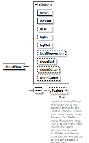 |
||||||||||||||||||||||||||||||||||||||||||||||||||||||||||||
| namespace | http://www.landxml.org/schema/LandXML-2.0 | ||||||||||||||||||||||||||||||||||||||||||||||||||||||||||||
| properties |
|
||||||||||||||||||||||||||||||||||||||||||||||||||||||||||||
| children | Feature | ||||||||||||||||||||||||||||||||||||||||||||||||||||||||||||
| used by |
|
||||||||||||||||||||||||||||||||||||||||||||||||||||||||||||
| attributes |
|
||||||||||||||||||||||||||||||||||||||||||||||||||||||||||||
| source | <xs:element name="StructFlow"> <xs:annotation> <xs:documentation/> </xs:annotation> <xs:complexType> <xs:sequence> <xs:element ref="Feature" minOccurs="0" maxOccurs="unbounded"/> </xs:sequence> <xs:attribute name="lossIn" type="xs:double" use="required"/> <xs:attribute name="lossOut" type="xs:double" use="required"/> <xs:attribute name="desc" type="xs:string"/> <xs:attribute name="hglIn" type="xs:double"/> <xs:attribute name="hglOut" type="xs:double"/> <xs:attribute name="localDepression" type="xs:double"/> <xs:attribute name="slopeSurf" type="slope"/> <xs:attribute name="slopeGutter" type="slope"/> <xs:attribute name="widthGutter" type="xs:double"/> </xs:complexType> </xs:element> |
attribute StructFlow/@lossIn
| type | xs:double | ||
| properties |
|
||
| source | <xs:attribute name="lossIn" type="xs:double" use="required"/> |
attribute StructFlow/@lossOut
| type | xs:double | ||
| properties |
|
||
| source | <xs:attribute name="lossOut" type="xs:double" use="required"/> |
attribute StructFlow/@desc
| type | xs:string |
| source | <xs:attribute name="desc" type="xs:string"/> |
attribute StructFlow/@hglIn
| type | xs:double |
| source | <xs:attribute name="hglIn" type="xs:double"/> |
attribute StructFlow/@hglOut
| type | xs:double |
| source | <xs:attribute name="hglOut" type="xs:double"/> |
attribute StructFlow/@localDepression
| type | xs:double |
| source | <xs:attribute name="localDepression" type="xs:double"/> |
attribute StructFlow/@slopeSurf
| type | slope |
| source | <xs:attribute name="slopeSurf" type="slope"/> |
attribute StructFlow/@slopeGutter
| type | slope |
| source | <xs:attribute name="slopeGutter" type="slope"/> |
attribute StructFlow/@widthGutter
| type | xs:double |
| source | <xs:attribute name="widthGutter" type="xs:double"/> |
element StructModel
| diagram | 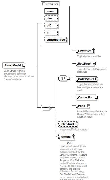 |
||||||||||||||||||||||||||||||||||||
| namespace | http://www.landxml.org/schema/LandXML-2.0 | ||||||||||||||||||||||||||||||||||||
| properties |
|
||||||||||||||||||||||||||||||||||||
| children | CircStruct RectStruct OutletStruct Connection Pond InletStruct Feature | ||||||||||||||||||||||||||||||||||||
| used by |
|
||||||||||||||||||||||||||||||||||||
| attributes |
|
||||||||||||||||||||||||||||||||||||
| annotation |
|
||||||||||||||||||||||||||||||||||||
| source | <xs:element name="StructModel"> <xs:annotation> <xs:documentation>Each Struct within a StructModel collection element must have a unique "name" attribute.</xs:documentation> <xs:documentation>Use the oID attribute to describe based on jurisdiction nameing conventions.</xs:documentation> <xs:documentation>The structure type is determined by the structureType and shape by one of the following elements: CircStruct, OutletStruct or RectStruct.</xs:documentation> <xs:documentation>The InletStruct defines water inlet parameters if applicable.</xs:documentation> </xs:annotation> <xs:complexType> <xs:sequence> <xs:choice> <xs:element ref="CircStruct"/> <xs:element ref="RectStruct"/> <xs:element ref="OutletStruct"/> <xs:element ref="Connection"/> <xs:element ref="Pond"/> </xs:choice> <xs:element ref="InletStruct" minOccurs="0" maxOccurs="1"/> <xs:element ref="Feature" minOccurs="0" maxOccurs="unbounded"/> </xs:sequence> <xs:attribute name="name" type="xs:string" use="required"/> <xs:attribute name="desc" type="xs:string"/> <xs:attribute name="oID" type="xs:string"/> <xs:attribute name="m" type="materialTableIndexRef"/> <xs:attribute name="structureType" type="stormWaterStructureType"/> </xs:complexType> </xs:element> |
attribute StructModel/@name
| type | xs:string | ||
| properties |
|
||
| source | <xs:attribute name="name" type="xs:string" use="required"/> |
attribute StructModel/@desc
| type | xs:string |
| source | <xs:attribute name="desc" type="xs:string"/> |
attribute StructModel/@oID
| type | xs:string |
| source | <xs:attribute name="oID" type="xs:string"/> |
attribute StructModel/@m
| type | materialTableIndexRef |
| source | <xs:attribute name="m" type="materialTableIndexRef"/> |
attribute StructModel/@structureType
| type | stormWaterStructureType | |||||||||||||||
| facets |
|
|||||||||||||||
| source | <xs:attribute name="structureType" type="stormWaterStructureType"/> |
element StructModels
| diagram | 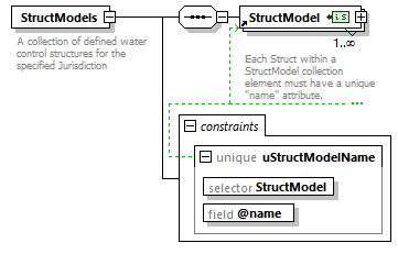 |
||||||||||||
| namespace | http://www.landxml.org/schema/LandXML-2.0 | ||||||||||||
| properties |
|
||||||||||||
| children | StructModel | ||||||||||||
| used by |
|
||||||||||||
| identity constraints |
|
||||||||||||
| annotation |
|
||||||||||||
| source | <xs:element name="StructModels"> <xs:annotation> <xs:documentation>A collection of defined water control structures for the specified Jurisdiction</xs:documentation> </xs:annotation> <xs:complexType> <xs:sequence> <xs:element ref="StructModel" minOccurs="1" maxOccurs="unbounded"/> </xs:sequence> </xs:complexType> <xs:unique name="uStructModelName"> <xs:selector xpath="StructModel"/> <xs:field xpath="@name"/> </xs:unique> </xs:element> |
element Structs
| diagram |  |
||||||||||||
| namespace | http://www.landxml.org/schema/LandXML-2.0 | ||||||||||||
| properties |
|
||||||||||||
| children | Units Struct Feature | ||||||||||||
| used by |
|
||||||||||||
| identity constraints |
|
||||||||||||
| source | <xs:element name="Structs"> <xs:annotation> <xs:documentation/> </xs:annotation> <xs:complexType> <xs:sequence> <xs:element ref="Units" minOccurs="0"/> <xs:element ref="Struct" minOccurs="2" maxOccurs="unbounded"/> <xs:element ref="Feature" minOccurs="0" maxOccurs="unbounded"/> </xs:sequence> </xs:complexType> <xs:unique name="uStructName"> <xs:selector xpath="Struct"/> <xs:field xpath="@name"/> </xs:unique> </xs:element> |
element Superelevation
| diagram |  |
||||||||||||||||||
| namespace | http://www.landxml.org/schema/LandXML-2.0 | ||||||||||||||||||
| properties |
|
||||||||||||||||||
| children | BeginRunoutSta BeginRunoffSta FullSuperSta FullSuperelev RunoffSta StartofRunoutSta EndofRunoutSta AdverseSE Feature | ||||||||||||||||||
| used by |
|
||||||||||||||||||
| attributes |
|
||||||||||||||||||
| source | <xs:element name="Superelevation"> <xs:complexType> <xs:choice maxOccurs="unbounded"> <xs:element ref="BeginRunoutSta" minOccurs="0" maxOccurs="unbounded"/> <xs:element ref="BeginRunoffSta" minOccurs="0" maxOccurs="unbounded"/> <xs:element ref="FullSuperSta" minOccurs="0" maxOccurs="unbounded"/> <xs:element ref="FullSuperelev" maxOccurs="unbounded"/> <xs:element ref="RunoffSta" minOccurs="0" maxOccurs="unbounded"/> <xs:element ref="StartofRunoutSta" minOccurs="0" maxOccurs="unbounded"/> <xs:element ref="EndofRunoutSta" minOccurs="0" maxOccurs="unbounded"/> <xs:element ref="AdverseSE" minOccurs="0" maxOccurs="unbounded"/> <xs:element ref="Feature" minOccurs="0" maxOccurs="unbounded"/> </xs:choice> <xs:attribute name="staStart" type="station"/> <xs:attribute name="staEnd" type="station"/> </xs:complexType> </xs:element> |
attribute Superelevation/@staStart
| type | station |
| source | <xs:attribute name="staStart" type="station"/> |
attribute Superelevation/@staEnd
| type | station |
| source | <xs:attribute name="staEnd" type="station"/> |
element SupplyGasNetwork
| diagram |  |
||||||||||||||||||||||||||||||||||||||||||||||||
| namespace | http://www.landxml.org/schema/LandXML-2.0 | ||||||||||||||||||||||||||||||||||||||||||||||||
| properties |
|
||||||||||||||||||||||||||||||||||||||||||||||||
| children | Feature | ||||||||||||||||||||||||||||||||||||||||||||||||
| used by |
|
||||||||||||||||||||||||||||||||||||||||||||||||
| attributes |
|
||||||||||||||||||||||||||||||||||||||||||||||||
| annotation |
|
||||||||||||||||||||||||||||||||||||||||||||||||
| source | <xs:element name="SupplyGasNetwork"> <xs:annotation> <xs:documentation>Slope values are the ratio of (elevation diff/2D distance) expressed in (x100) PERCENT %.</xs:documentation> <xs:documentation>Clearance is the vertical distance between utility network pipes</xs:documentation> <xs:documentation>Cover is the vertical distance between utility network pipes and the finished ground surface</xs:documentation> <xs:documentation>Length, Depth, Clearance and Cover attributes are expressed in the defined linear units</xs:documentation> </xs:annotation> <xs:complexType> <xs:choice minOccurs="0" maxOccurs="unbounded"> <xs:element ref="Feature" minOccurs="0" maxOccurs="unbounded"/> </xs:choice> <xs:attribute name="minimumPipeCover" type="xs:double"/> <xs:attribute name="maximumPipeCover" type="xs:double"/> <xs:attribute name="maximumPipeLength" type="xs:double"/> <xs:attribute name="minimumStructureDepth" type="xs:double"/> <xs:attribute name="maximumStructureDepth" type="xs:double"/> <xs:attribute name="minimumPipeClearanceBelow" type="xs:double"/> <xs:attribute name="minimumPipeClearanceAbove" type="xs:double"/> </xs:complexType> </xs:element> |
attribute SupplyGasNetwork/@minimumPipeCover
| type | xs:double |
| source | <xs:attribute name="minimumPipeCover" type="xs:double"/> |
attribute SupplyGasNetwork/@maximumPipeCover
| type | xs:double |
| source | <xs:attribute name="maximumPipeCover" type="xs:double"/> |
attribute SupplyGasNetwork/@maximumPipeLength
| type | xs:double |
| source | <xs:attribute name="maximumPipeLength" type="xs:double"/> |
attribute SupplyGasNetwork/@minimumStructureDepth
| type | xs:double |
| source | <xs:attribute name="minimumStructureDepth" type="xs:double"/> |
attribute SupplyGasNetwork/@maximumStructureDepth
| type | xs:double |
| source | <xs:attribute name="maximumStructureDepth" type="xs:double"/> |
attribute SupplyGasNetwork/@minimumPipeClearanceBelow
| type | xs:double |
| source | <xs:attribute name="minimumPipeClearanceBelow" type="xs:double"/> |
attribute SupplyGasNetwork/@minimumPipeClearanceAbove
| type | xs:double |
| source | <xs:attribute name="minimumPipeClearanceAbove" type="xs:double"/> |
element SupplyWaterNetwork
| diagram | 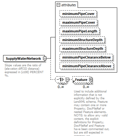 |
||||||||||||||||||||||||||||||||||||||||||||||||
| namespace | http://www.landxml.org/schema/LandXML-2.0 | ||||||||||||||||||||||||||||||||||||||||||||||||
| properties |
|
||||||||||||||||||||||||||||||||||||||||||||||||
| children | Feature | ||||||||||||||||||||||||||||||||||||||||||||||||
| used by |
|
||||||||||||||||||||||||||||||||||||||||||||||||
| attributes |
|
||||||||||||||||||||||||||||||||||||||||||||||||
| annotation |
|
||||||||||||||||||||||||||||||||||||||||||||||||
| source | <xs:element name="SupplyWaterNetwork"> <xs:annotation> <xs:documentation>Slope values are the ratio of (elevation diff/2D distance) expressed in (x100) PERCENT %.</xs:documentation> <xs:documentation>Clearance is the vertical distance between utility network pipes</xs:documentation> <xs:documentation>Cover is the vertical distance between utility network pipes and the finished ground surface</xs:documentation> <xs:documentation>Length, Depth, Clearance and Cover attributes are expressed in the defined linear units</xs:documentation> </xs:annotation> <xs:complexType> <xs:choice minOccurs="0" maxOccurs="unbounded"> <xs:element ref="Feature" minOccurs="0" maxOccurs="unbounded"/> </xs:choice> <xs:attribute name="minimumPipeCover" type="xs:double"/> <xs:attribute name="maximumPipeCover" type="xs:double"/> <xs:attribute name="maximumPipeLength" type="xs:double"/> <xs:attribute name="minimumStructureDepth" type="xs:double"/> <xs:attribute name="maximumStructureDepth" type="xs:double"/> <xs:attribute name="minimumPipeClearanceBelow" type="xs:double"/> <xs:attribute name="minimumPipeClearanceAbove" type="xs:double"/> </xs:complexType> </xs:element> |
attribute SupplyWaterNetwork/@minimumPipeCover
| type | xs:double |
| source | <xs:attribute name="minimumPipeCover" type="xs:double"/> |
attribute SupplyWaterNetwork/@maximumPipeCover
| type | xs:double |
| source | <xs:attribute name="maximumPipeCover" type="xs:double"/> |
attribute SupplyWaterNetwork/@maximumPipeLength
| type | xs:double |
| source | <xs:attribute name="maximumPipeLength" type="xs:double"/> |
attribute SupplyWaterNetwork/@minimumStructureDepth
| type | xs:double |
| source | <xs:attribute name="minimumStructureDepth" type="xs:double"/> |
attribute SupplyWaterNetwork/@maximumStructureDepth
| type | xs:double |
| source | <xs:attribute name="maximumStructureDepth" type="xs:double"/> |
attribute SupplyWaterNetwork/@minimumPipeClearanceBelow
| type | xs:double |
| source | <xs:attribute name="minimumPipeClearanceBelow" type="xs:double"/> |
attribute SupplyWaterNetwork/@minimumPipeClearanceAbove
| type | xs:double |
| source | <xs:attribute name="minimumPipeClearanceAbove" type="xs:double"/> |
element Surface
| diagram | 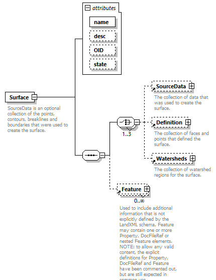 |
||||||||||||||||||||||||||||||
| namespace | http://www.landxml.org/schema/LandXML-2.0 | ||||||||||||||||||||||||||||||
| properties |
|
||||||||||||||||||||||||||||||
| children | SourceData Definition Watersheds Feature | ||||||||||||||||||||||||||||||
| used by |
|
||||||||||||||||||||||||||||||
| attributes |
|
||||||||||||||||||||||||||||||
| annotation |
|
||||||||||||||||||||||||||||||
| source | <xs:element name="Surface"> <xs:annotation> <xs:documentation>SourceData is an optional collection of the points, contours, breaklines and boundaries that were used to create the surface.</xs:documentation> <xs:documentation>Definition is a collection of points and faces that define the surface.</xs:documentation> <xs:documentation>Watersheds is a collection the watershed boundaries for the surface.</xs:documentation> </xs:annotation> <xs:complexType> <xs:sequence> <xs:choice maxOccurs="3"> <xs:element ref="SourceData" minOccurs="0"/> <xs:element ref="Definition" minOccurs="0"/> <xs:element ref="Watersheds" minOccurs="0"/> </xs:choice> <xs:element ref="Feature" minOccurs="0" maxOccurs="unbounded"/> </xs:sequence> <xs:attribute name="name" type="xs:string" use="required"/> <xs:attribute name="desc" type="xs:string"/> <xs:attribute name="OID" type="xs:string"/> <xs:attribute name="state" type="stateType"/> </xs:complexType> </xs:element> |
attribute Surface/@name
| type | xs:string | ||
| properties |
|
||
| source | <xs:attribute name="name" type="xs:string" use="required"/> |
attribute Surface/@desc
| type | xs:string |
| source | <xs:attribute name="desc" type="xs:string"/> |
attribute Surface/@OID
| type | xs:string |
| source | <xs:attribute name="OID" type="xs:string"/> |
attribute Surface/@state
| type | stateType | |||||||||||||||
| facets |
|
|||||||||||||||
| source | <xs:attribute name="state" type="stateType"/> |
element Surfaces
| diagram | 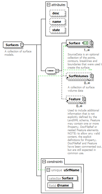 |
||||||||||||||||||||||||
| namespace | http://www.landxml.org/schema/LandXML-2.0 | ||||||||||||||||||||||||
| properties |
|
||||||||||||||||||||||||
| children | Surface SurfVolumes Feature | ||||||||||||||||||||||||
| used by |
|
||||||||||||||||||||||||
| attributes |
|
||||||||||||||||||||||||
| identity constraints |
|
||||||||||||||||||||||||
| annotation |
|
||||||||||||||||||||||||
| source | <xs:element name="Surfaces"> <xs:annotation> <xs:documentation>A collection of surface models.</xs:documentation> </xs:annotation> <xs:complexType> <xs:sequence> <xs:element ref="Surface" maxOccurs="unbounded"/> <xs:element ref="SurfVolumes" minOccurs="0" maxOccurs="unbounded"/> <xs:element ref="Feature" minOccurs="0" maxOccurs="unbounded"/> </xs:sequence> <xs:attribute name="desc" type="xs:string"/> <xs:attribute name="name" type="xs:string"/> <xs:attribute name="state" type="stateType"/> </xs:complexType> <xs:unique name="uSrfName"> <xs:selector xpath="Surface"/> <xs:field xpath="@name"/> </xs:unique> </xs:element> |
attribute Surfaces/@desc
| type | xs:string |
| source | <xs:attribute name="desc" type="xs:string"/> |
attribute Surfaces/@name
| type | xs:string |
| source | <xs:attribute name="name" type="xs:string"/> |
attribute Surfaces/@state
| type | stateType | |||||||||||||||
| facets |
|
|||||||||||||||
| source | <xs:attribute name="state" type="stateType"/> |
element SurfVolume
| diagram | 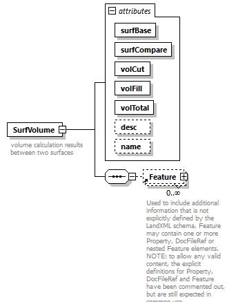 |
||||||||||||||||||||||||||||||||||||||||||||||||
| namespace | http://www.landxml.org/schema/LandXML-2.0 | ||||||||||||||||||||||||||||||||||||||||||||||||
| properties |
|
||||||||||||||||||||||||||||||||||||||||||||||||
| children | Feature | ||||||||||||||||||||||||||||||||||||||||||||||||
| used by |
|
||||||||||||||||||||||||||||||||||||||||||||||||
| attributes |
|
||||||||||||||||||||||||||||||||||||||||||||||||
| annotation |
|
||||||||||||||||||||||||||||||||||||||||||||||||
| source | <xs:element name="SurfVolume"> <xs:annotation> <xs:documentation>volume calculation results between two surfaces</xs:documentation> </xs:annotation> <xs:complexType> <xs:sequence> <xs:element ref="Feature" minOccurs="0" maxOccurs="unbounded"/> </xs:sequence> <xs:attribute name="surfBase" type="surfaceNameRef" use="required"/> <xs:attribute name="surfCompare" type="surfaceNameRef" use="required"/> <xs:attribute name="volCut" type="xs:double" use="required"/> <xs:attribute name="volFill" type="xs:double" use="required"/> <xs:attribute name="volTotal" type="xs:double" use="required"/> <xs:attribute name="desc" type="xs:string"/> <xs:attribute name="name" type="xs:string"/> </xs:complexType> </xs:element> |
attribute SurfVolume/@surfBase
| type | surfaceNameRef | ||
| properties |
|
||
| source | <xs:attribute name="surfBase" type="surfaceNameRef" use="required"/> |
attribute SurfVolume/@surfCompare
| type | surfaceNameRef | ||
| properties |
|
||
| source | <xs:attribute name="surfCompare" type="surfaceNameRef" use="required"/> |
attribute SurfVolume/@volCut
| type | xs:double | ||
| properties |
|
||
| source | <xs:attribute name="volCut" type="xs:double" use="required"/> |
attribute SurfVolume/@volFill
| type | xs:double | ||
| properties |
|
||
| source | <xs:attribute name="volFill" type="xs:double" use="required"/> |
attribute SurfVolume/@volTotal
| type | xs:double | ||
| properties |
|
||
| source | <xs:attribute name="volTotal" type="xs:double" use="required"/> |
attribute SurfVolume/@desc
| type | xs:string |
| source | <xs:attribute name="desc" type="xs:string"/> |
attribute SurfVolume/@name
| type | xs:string |
| source | <xs:attribute name="name" type="xs:string"/> |
element SurfVolumes
| diagram | 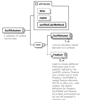 |
||||||||||||||||||||||||
| namespace | http://www.landxml.org/schema/LandXML-2.0 | ||||||||||||||||||||||||
| properties |
|
||||||||||||||||||||||||
| children | SurfVolume Feature | ||||||||||||||||||||||||
| used by |
|
||||||||||||||||||||||||
| attributes |
|
||||||||||||||||||||||||
| annotation |
|
||||||||||||||||||||||||
| source | <xs:element name="SurfVolumes"> <xs:annotation> <xs:documentation>A collection of surface volume data</xs:documentation> </xs:annotation> <xs:complexType> <xs:sequence> <xs:element ref="SurfVolume" maxOccurs="unbounded"/> <xs:element ref="Feature" minOccurs="0" maxOccurs="unbounded"/> </xs:sequence> <xs:attribute name="desc" type="xs:string"/> <xs:attribute name="name" type="xs:string"/> <xs:attribute name="surfVolCalcMethod" type="surfVolCMethodType" use="required"/> </xs:complexType> </xs:element> |
attribute SurfVolumes/@desc
| type | xs:string |
| source | <xs:attribute name="desc" type="xs:string"/> |
attribute SurfVolumes/@name
| type | xs:string |
| source | <xs:attribute name="name" type="xs:string"/> |
attribute SurfVolumes/@surfVolCalcMethod
| type | surfVolCMethodType | |||||||||
| properties |
|
|||||||||
| facets |
|
|||||||||
| source | <xs:attribute name="surfVolCalcMethod" type="surfVolCMethodType" use="required"/> |
element Survey
| diagram | 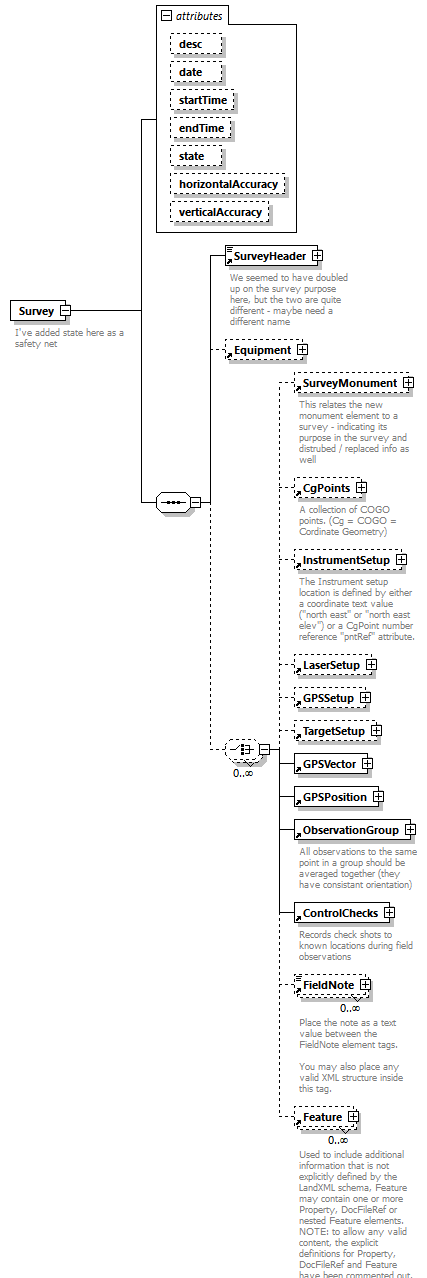 |
||||||||||||||||||||||||||||||||||||||||||||||||
| namespace | http://www.landxml.org/schema/LandXML-2.0 | ||||||||||||||||||||||||||||||||||||||||||||||||
| properties |
|
||||||||||||||||||||||||||||||||||||||||||||||||
| children | SurveyHeader Equipment SurveyMonument CgPoints InstrumentSetup LaserSetup GPSSetup TargetSetup GPSVector GPSPosition ObservationGroup ControlChecks FieldNote Feature | ||||||||||||||||||||||||||||||||||||||||||||||||
| used by |
|
||||||||||||||||||||||||||||||||||||||||||||||||
| attributes |
|
||||||||||||||||||||||||||||||||||||||||||||||||
| annotation |
|
||||||||||||||||||||||||||||||||||||||||||||||||
| source | <xs:element name="Survey"> <xs:annotation> <xs:documentation>I've added state here as a safety net</xs:documentation> </xs:annotation> <xs:complexType> <xs:sequence> <xs:element ref="SurveyHeader"/> <xs:element ref="Equipment" minOccurs="0"/> <xs:choice minOccurs="0" maxOccurs="unbounded"> <xs:element ref="SurveyMonument" minOccurs="0"/> <xs:element ref="CgPoints" minOccurs="0"/> <xs:element ref="InstrumentSetup" minOccurs="0"/> <xs:element ref="LaserSetup" minOccurs="0"/> <xs:element ref="GPSSetup" minOccurs="0"/> <xs:element ref="TargetSetup" minOccurs="0"/> <xs:element ref="GPSVector"/> <xs:element ref="GPSPosition"/> <xs:element ref="ObservationGroup"/> <xs:element ref="ControlChecks"/> <xs:element ref="FieldNote" minOccurs="0" maxOccurs="unbounded"/> <xs:element ref="Feature" minOccurs="0" maxOccurs="unbounded"/> </xs:choice> </xs:sequence> <xs:attribute name="desc" type="xs:string"/> <xs:attribute name="date" type="xs:date"/> <xs:attribute name="startTime" type="xs:dateTime"/> <xs:attribute name="endTime" type="xs:dateTime"/> <xs:attribute name="state" type="stateType"/> <xs:attribute name="horizontalAccuracy" type="xs:string"/> <xs:attribute name="verticalAccuracy" type="xs:string"/> </xs:complexType> </xs:element> |
attribute Survey/@desc
| type | xs:string |
| source | <xs:attribute name="desc" type="xs:string"/> |
attribute Survey/@date
| type | xs:date |
| source | <xs:attribute name="date" type="xs:date"/> |
attribute Survey/@startTime
| type | xs:dateTime |
| source | <xs:attribute name="startTime" type="xs:dateTime"/> |
attribute Survey/@endTime
| type | xs:dateTime |
| source | <xs:attribute name="endTime" type="xs:dateTime"/> |
attribute Survey/@state
| type | stateType | |||||||||||||||
| facets |
|
|||||||||||||||
| source | <xs:attribute name="state" type="stateType"/> |
attribute Survey/@horizontalAccuracy
| type | xs:string |
| source | <xs:attribute name="horizontalAccuracy" type="xs:string"/> |
attribute Survey/@verticalAccuracy
| type | xs:string |
| source | <xs:attribute name="verticalAccuracy" type="xs:string"/> |
element SurveyHeader
| diagram | 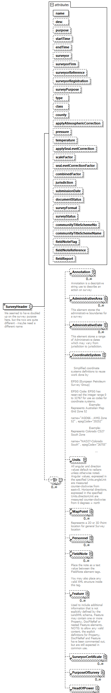 |
||||||||||||||||||||||||||||||||||||||||||||||||||||||||||||||||||||||||||||||||||||||||||||||||||||||||||||||||||||||||||||||||||||||||||||||||||||||||||||||||||||||||||||||||||||||||||
| namespace | http://www.landxml.org/schema/LandXML-2.0 | ||||||||||||||||||||||||||||||||||||||||||||||||||||||||||||||||||||||||||||||||||||||||||||||||||||||||||||||||||||||||||||||||||||||||||||||||||||||||||||||||||||||||||||||||||||||||||
| properties |
|
||||||||||||||||||||||||||||||||||||||||||||||||||||||||||||||||||||||||||||||||||||||||||||||||||||||||||||||||||||||||||||||||||||||||||||||||||||||||||||||||||||||||||||||||||||||||||
| children | Annotation AdministrativeArea AdministrativeDate CoordinateSystem Units MapPoint Personnel FieldNote Feature SurveyorCertificate PurposeOfSurvey HeadOfPower | ||||||||||||||||||||||||||||||||||||||||||||||||||||||||||||||||||||||||||||||||||||||||||||||||||||||||||||||||||||||||||||||||||||||||||||||||||||||||||||||||||||||||||||||||||||||||||
| used by |
|
||||||||||||||||||||||||||||||||||||||||||||||||||||||||||||||||||||||||||||||||||||||||||||||||||||||||||||||||||||||||||||||||||||||||||||||||||||||||||||||||||||||||||||||||||||||||||
| attributes |
|
||||||||||||||||||||||||||||||||||||||||||||||||||||||||||||||||||||||||||||||||||||||||||||||||||||||||||||||||||||||||||||||||||||||||||||||||||||||||||||||||||||||||||||||||||||||||||
| annotation |
|
||||||||||||||||||||||||||||||||||||||||||||||||||||||||||||||||||||||||||||||||||||||||||||||||||||||||||||||||||||||||||||||||||||||||||||||||||||||||||||||||||||||||||||||||||||||||||
| source | <xs:element name="SurveyHeader"> <xs:annotation> <xs:documentation>We seemed to have doubled up on the survey purpose here, but the two are quite different - maybe need a different name</xs:documentation> </xs:annotation> <xs:complexType mixed="true"> <xs:choice minOccurs="0" maxOccurs="unbounded"> <xs:element ref="Annotation" minOccurs="0" maxOccurs="unbounded"/> <xs:element ref="AdministrativeArea" minOccurs="0" maxOccurs="unbounded"/> <xs:element ref="AdministrativeDate" minOccurs="0" maxOccurs="unbounded"/> <xs:element ref="CoordinateSystem" minOccurs="0"/> <xs:element ref="Units" minOccurs="0"/> <xs:element ref="MapPoint" minOccurs="0" maxOccurs="unbounded"/> <xs:element ref="Personnel" minOccurs="0" maxOccurs="unbounded"/> <xs:element ref="FieldNote" minOccurs="0" maxOccurs="unbounded"/> <xs:element ref="Feature" minOccurs="0" maxOccurs="unbounded"/> <xs:element ref="SurveyorCertificate" minOccurs="0" maxOccurs="unbounded"/> <xs:element ref="PurposeOfSurvey" minOccurs="0" maxOccurs="unbounded"/> <xs:element ref="HeadOfPower" minOccurs="0" maxOccurs="unbounded"/> </xs:choice> <xs:attribute name="name" type="xs:string" use="required"/> <xs:attribute name="desc" type="xs:string"/> <xs:attribute name="purpose" type="purposeType"/> <xs:attribute name="startTime" type="xs:dateTime"/> <xs:attribute name="endTime" type="xs:dateTime"/> <xs:attribute name="surveyor" type="xs:string"/> <xs:attribute name="surveyorFirm" type="xs:string"/> <xs:attribute name="surveyorReference" type="xs:string"/> <xs:attribute name="surveyorRegistration" type="xs:string"/> <xs:attribute name="surveyPurpose" type="xs:string"/> <xs:attribute name="type" type="surveyType"/> <xs:attribute name="class" type="xs:string"/> <xs:attribute name="county" type="xs:string"/> <xs:attribute name="applyAtmosphericCorrection" type="xs:boolean"/> <xs:attribute name="pressure" type="xs:double"/> <xs:attribute name="temperature" type="xs:double"/> <xs:attribute name="applySeaLevelCorrection" type="xs:boolean"/> <xs:attribute name="scaleFactor" type="xs:double"/> <xs:attribute name="seaLevelCorrectionFactor" type="xs:double"/> <xs:attribute name="combinedFactor" type="xs:double"/> <xs:attribute name="jurisdiction" type="jurisdictionType"/> <xs:attribute name="submissionDate" type="xs:date"/> <xs:attribute name="documentStatus" type="documentStatusType"/> <xs:attribute name="surveyFormat" type="surveyFormatType"/> <xs:attribute name="surveyStatus" type="surveyStatusType"/> <xs:attribute name="communityTitleSchemeNo" type="xs:int"/> <xs:attribute name="communityTitleSchemeName" type="xs:string"/> <xs:attribute name="fieldNoteFlag" type="xs:boolean"/> <xs:attribute name="fieldNoteReference" type="xs:string"/> <xs:attribute name="fieldReport" type="xs:string"/> </xs:complexType> </xs:element> |
attribute SurveyHeader/@name
| type | xs:string | ||
| properties |
|
||
| source | <xs:attribute name="name" type="xs:string" use="required"/> |
attribute SurveyHeader/@desc
| type | xs:string |
| source | <xs:attribute name="desc" type="xs:string"/> |
attribute SurveyHeader/@purpose
| type | purposeType | |||||||||||||||||||||||||||||||||||||||||||||
| facets |
|
|||||||||||||||||||||||||||||||||||||||||||||
| source | <xs:attribute name="purpose" type="purposeType"/> |
attribute SurveyHeader/@startTime
| type | xs:dateTime |
| source | <xs:attribute name="startTime" type="xs:dateTime"/> |
attribute SurveyHeader/@endTime
| type | xs:dateTime |
| source | <xs:attribute name="endTime" type="xs:dateTime"/> |
attribute SurveyHeader/@surveyor
| type | xs:string |
| source | <xs:attribute name="surveyor" type="xs:string"/> |
attribute SurveyHeader/@surveyorFirm
| type | xs:string |
| source | <xs:attribute name="surveyorFirm" type="xs:string"/> |
attribute SurveyHeader/@surveyorReference
| type | xs:string |
| source | <xs:attribute name="surveyorReference" type="xs:string"/> |
attribute SurveyHeader/@surveyorRegistration
| type | xs:string |
| source | <xs:attribute name="surveyorRegistration" type="xs:string"/> |
attribute SurveyHeader/@surveyPurpose
| type | xs:string |
| source | <xs:attribute name="surveyPurpose" type="xs:string"/> |
attribute SurveyHeader/@type
| type | surveyType | ||||||||||||
| facets |
|
||||||||||||
| source | <xs:attribute name="type" type="surveyType"/> |
attribute SurveyHeader/@class
| type | xs:string |
| source | <xs:attribute name="class" type="xs:string"/> |
attribute SurveyHeader/@county
| type | xs:string |
| source | <xs:attribute name="county" type="xs:string"/> |
attribute SurveyHeader/@applyAtmosphericCorrection
| type | xs:boolean |
| source | <xs:attribute name="applyAtmosphericCorrection" type="xs:boolean"/> |
attribute SurveyHeader/@pressure
| type | xs:double |
| source | <xs:attribute name="pressure" type="xs:double"/> |
attribute SurveyHeader/@temperature
| type | xs:double |
| source | <xs:attribute name="temperature" type="xs:double"/> |
attribute SurveyHeader/@applySeaLevelCorrection
| type | xs:boolean |
| source | <xs:attribute name="applySeaLevelCorrection" type="xs:boolean"/> |
attribute SurveyHeader/@scaleFactor
| type | xs:double |
| source | <xs:attribute name="scaleFactor" type="xs:double"/> |
attribute SurveyHeader/@seaLevelCorrectionFactor
| type | xs:double |
| source | <xs:attribute name="seaLevelCorrectionFactor" type="xs:double"/> |
attribute SurveyHeader/@combinedFactor
| type | xs:double |
| source | <xs:attribute name="combinedFactor" type="xs:double"/> |
attribute SurveyHeader/@jurisdiction
| type | jurisdictionType |
| source | <xs:attribute name="jurisdiction" type="jurisdictionType"/> |
attribute SurveyHeader/@submissionDate
| type | xs:date |
| source | <xs:attribute name="submissionDate" type="xs:date"/> |
attribute SurveyHeader/@documentStatus
| type | documentStatusType |
| source | <xs:attribute name="documentStatus" type="documentStatusType"/> |
attribute SurveyHeader/@surveyFormat
| type | surveyFormatType |
| source | <xs:attribute name="surveyFormat" type="surveyFormatType"/> |
attribute SurveyHeader/@surveyStatus
| type | surveyStatusType |
| source | <xs:attribute name="surveyStatus" type="surveyStatusType"/> |
attribute SurveyHeader/@communityTitleSchemeNo
| type | xs:int |
| source | <xs:attribute name="communityTitleSchemeNo" type="xs:int"/> |
attribute SurveyHeader/@communityTitleSchemeName
| type | xs:string |
| source | <xs:attribute name="communityTitleSchemeName" type="xs:string"/> |
attribute SurveyHeader/@fieldNoteFlag
| type | xs:boolean |
| source | <xs:attribute name="fieldNoteFlag" type="xs:boolean"/> |
attribute SurveyHeader/@fieldNoteReference
| type | xs:string |
| source | <xs:attribute name="fieldNoteReference" type="xs:string"/> |
attribute SurveyHeader/@fieldReport
| type | xs:string |
| source | <xs:attribute name="fieldReport" type="xs:string"/> |
element SurveyMonument
| diagram | 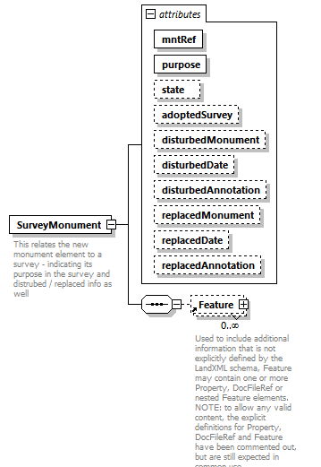 |
||||||||||||||||||||||||||||||||||||||||||||||||||||||||||||||||||
| namespace | http://www.landxml.org/schema/LandXML-2.0 | ||||||||||||||||||||||||||||||||||||||||||||||||||||||||||||||||||
| properties |
|
||||||||||||||||||||||||||||||||||||||||||||||||||||||||||||||||||
| children | Feature | ||||||||||||||||||||||||||||||||||||||||||||||||||||||||||||||||||
| used by |
|
||||||||||||||||||||||||||||||||||||||||||||||||||||||||||||||||||
| attributes |
|
||||||||||||||||||||||||||||||||||||||||||||||||||||||||||||||||||
| annotation |
|
||||||||||||||||||||||||||||||||||||||||||||||||||||||||||||||||||
| source | <xs:element name="SurveyMonument"> <xs:annotation> <xs:documentation>This relates the new monument element to a survey - indicating its purpose in the survey and distrubed / replaced info as well</xs:documentation> </xs:annotation> <xs:complexType> <xs:sequence> <xs:element ref="Feature" minOccurs="0" maxOccurs="unbounded"/> </xs:sequence> <xs:attribute name="mntRef" type="monumentNameRef" use="required"/> <xs:attribute name="purpose" type="monumentPurpose" use="required"/> <xs:attribute name="state" type="monumentState"/> <xs:attribute name="adoptedSurvey" type="xs:string"/> <xs:attribute name="disturbedMonument" type="xs:string"/> <xs:attribute name="disturbedDate" type="xs:date"/> <xs:attribute name="disturbedAnnotation" type="xs:string"/> <xs:attribute name="replacedMonument" type="xs:string"/> <xs:attribute name="replacedDate" type="xs:date"/> <xs:attribute name="replacedAnnotation" type="xs:string"/> </xs:complexType> </xs:element> |
attribute SurveyMonument/@mntRef
| type | monumentNameRef | ||
| properties |
|
||
| source | <xs:attribute name="mntRef" type="monumentNameRef" use="required"/> |
attribute SurveyMonument/@purpose
| type | monumentPurpose | ||
| properties |
|
||
| source | <xs:attribute name="purpose" type="monumentPurpose" use="required"/> |
attribute SurveyMonument/@state
| type | monumentState |
| source | <xs:attribute name="state" type="monumentState"/> |
attribute SurveyMonument/@adoptedSurvey
| type | xs:string |
| source | <xs:attribute name="adoptedSurvey" type="xs:string"/> |
attribute SurveyMonument/@disturbedMonument
| type | xs:string |
| source | <xs:attribute name="disturbedMonument" type="xs:string"/> |
attribute SurveyMonument/@disturbedDate
| type | xs:date |
| source | <xs:attribute name="disturbedDate" type="xs:date"/> |
attribute SurveyMonument/@disturbedAnnotation
| type | xs:string |
| source | <xs:attribute name="disturbedAnnotation" type="xs:string"/> |
attribute SurveyMonument/@replacedMonument
| type | xs:string |
| source | <xs:attribute name="replacedMonument" type="xs:string"/> |
attribute SurveyMonument/@replacedDate
| type | xs:date |
| source | <xs:attribute name="replacedDate" type="xs:date"/> |
attribute SurveyMonument/@replacedAnnotation
| type | xs:string |
| source | <xs:attribute name="replacedAnnotation" type="xs:string"/> |
element SurveyorCertificate
| diagram |  |
||||||||||||||||||||||||||||||
| namespace | http://www.landxml.org/schema/LandXML-2.0 | ||||||||||||||||||||||||||||||
| properties |
|
||||||||||||||||||||||||||||||
| used by |
|
||||||||||||||||||||||||||||||
| attributes |
|
||||||||||||||||||||||||||||||
| source | <xs:element name="SurveyorCertificate"> <xs:complexType> <xs:attribute name="name" type="xs:string" use="required"/> <xs:attribute name="certificateType" type="xs:string"/> <xs:attribute name="textCertificate" type="xs:string"/> <xs:attribute name="surveyDate" type="xs:date"/> </xs:complexType> </xs:element> |
attribute SurveyorCertificate/@name
| type | xs:string | ||
| properties |
|
||
| source | <xs:attribute name="name" type="xs:string" use="required"/> |
attribute SurveyorCertificate/@certificateType
| type | xs:string |
| source | <xs:attribute name="certificateType" type="xs:string"/> |
attribute SurveyorCertificate/@textCertificate
| type | xs:string |
| source | <xs:attribute name="textCertificate" type="xs:string"/> |
attribute SurveyorCertificate/@surveyDate
| type | xs:date |
| source | <xs:attribute name="surveyDate" type="xs:date"/> |
element Symbol
| diagram |  |
||||||||||||||||||
| namespace | http://www.landxml.org/schema/LandXML-2.0 | ||||||||||||||||||
| properties |
|
||||||||||||||||||
| children | SymbolHexString TextureImageNameRef | ||||||||||||||||||
| used by |
|
||||||||||||||||||
| attributes |
|
||||||||||||||||||
| annotation |
|
||||||||||||||||||
| source | <xs:element name="Symbol"> <xs:annotation> <xs:documentation>This element value contains a OBJ or DXF ascii or hex encoded string that represents a 2D or 3D CAD symbol</xs:documentation> <xs:documentation>type = format type of symbol, values are dxf or obj</xs:documentation> <xs:documentation>SymbolHexString = hex encoded symbol definiton of either zip compressed DXF or zip compressed OBJ file</xs:documentation> <xs:documentation>TextureImageNameRef = texture image reference(s) used by material definition</xs:documentation> </xs:annotation> <xs:complexType> <xs:sequence> <xs:element ref="SymbolHexString"/> <xs:element ref="TextureImageNameRef" minOccurs="0" maxOccurs="unbounded"/> </xs:sequence> <xs:attribute name="name" type="xs:string" use="required"/> <xs:attribute name="type" type="symbolType" use="required"/> </xs:complexType> </xs:element> |
attribute Symbol/@name
| type | xs:string | ||
| properties |
|
||
| source | <xs:attribute name="name" type="xs:string" use="required"/> |
attribute Symbol/@type
| type | symbolType | |||||||||
| properties |
|
|||||||||
| facets |
|
|||||||||
| source | <xs:attribute name="type" type="symbolType" use="required"/> |
element SymbolHexString
| diagram |  |
||
| namespace | http://www.landxml.org/schema/LandXML-2.0 | ||
| type | xs:hexBinary | ||
| properties |
|
||
| used by |
|
||
| source | <xs:element name="SymbolHexString" type="xs:hexBinary"/> |
element SymbolTable
| diagram |  |
||||||||||||
| namespace | http://www.landxml.org/schema/LandXML-2.0 | ||||||||||||
| properties |
|
||||||||||||
| children | Symbol | ||||||||||||
| used by |
|
||||||||||||
| attributes |
|
||||||||||||
| annotation |
|
||||||||||||
| source | <xs:element name="SymbolTable"> <xs:annotation> <xs:documentation>This element is a table of 2D or 3D CAD grahical symbols in DXF format</xs:documentation> </xs:annotation> <xs:complexType> <xs:sequence> <xs:element ref="Symbol" maxOccurs="unbounded"/> </xs:sequence> <xs:attribute name="name" type="xs:string" use="optional"/> </xs:complexType> </xs:element> |
attribute SymbolTable/@name
| type | xs:string | ||
| properties |
|
||
| source | <xs:attribute name="name" type="xs:string" use="optional"/> |
element TargetPoint
| diagram | 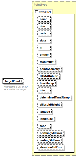 |
||||||||||||||||||||||||||||||||||||||||||||||||||||||||||||||||||||||||||||||||||||||||||||||||||||||||||||||||||||||||
| namespace | http://www.landxml.org/schema/LandXML-2.0 | ||||||||||||||||||||||||||||||||||||||||||||||||||||||||||||||||||||||||||||||||||||||||||||||||||||||||||||||||||||||||
| type | PointType | ||||||||||||||||||||||||||||||||||||||||||||||||||||||||||||||||||||||||||||||||||||||||||||||||||||||||||||||||||||||||
| properties |
|
||||||||||||||||||||||||||||||||||||||||||||||||||||||||||||||||||||||||||||||||||||||||||||||||||||||||||||||||||||||||
| used by |
|
||||||||||||||||||||||||||||||||||||||||||||||||||||||||||||||||||||||||||||||||||||||||||||||||||||||||||||||||||||||||
| facets |
|
||||||||||||||||||||||||||||||||||||||||||||||||||||||||||||||||||||||||||||||||||||||||||||||||||||||||||||||||||||||||
| attributes |
|
||||||||||||||||||||||||||||||||||||||||||||||||||||||||||||||||||||||||||||||||||||||||||||||||||||||||||||||||||||||||
| annotation |
|
||||||||||||||||||||||||||||||||||||||||||||||||||||||||||||||||||||||||||||||||||||||||||||||||||||||||||||||||||||||||
| source | <xs:element name="TargetPoint" type="PointType"> <xs:annotation> <xs:documentation>Represents a 2D or 3D location for the target</xs:documentation> <xs:documentation>It is defined by either a coordinate text value ("north east" or "north east elev") or a CgPoint number reference "pntRef" attribute.</xs:documentation> </xs:annotation> </xs:element> |
element TargetSetup
| diagram | 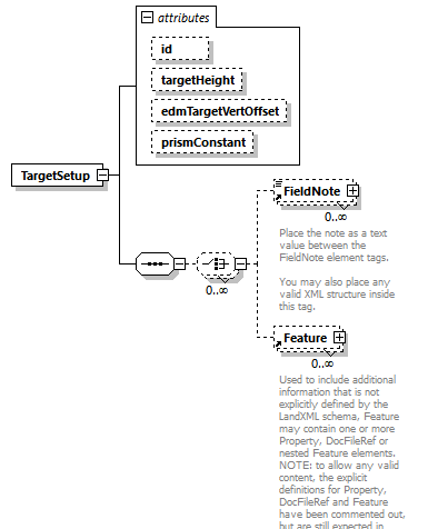 |
||||||||||||||||||||||||||||||
| namespace | http://www.landxml.org/schema/LandXML-2.0 | ||||||||||||||||||||||||||||||
| properties |
|
||||||||||||||||||||||||||||||
| children | FieldNote Feature | ||||||||||||||||||||||||||||||
| used by |
|
||||||||||||||||||||||||||||||
| attributes |
|
||||||||||||||||||||||||||||||
| source | <xs:element name="TargetSetup"> <xs:annotation> <xs:documentation/> </xs:annotation> <xs:complexType> <xs:sequence> <xs:choice minOccurs="0" maxOccurs="unbounded"> <xs:element ref="FieldNote" minOccurs="0" maxOccurs="unbounded"/> <xs:element ref="Feature" minOccurs="0" maxOccurs="unbounded"/> </xs:choice> </xs:sequence> <xs:attribute name="id" type="xs:ID"/> <xs:attribute name="targetHeight" type="xs:double"/> <xs:attribute name="edmTargetVertOffset" type="xs:double"/> <xs:attribute name="prismConstant" type="xs:double"/> <!-- To allow for older style EDM's --> </xs:complexType> </xs:element> |
attribute TargetSetup/@id
| type | xs:ID |
| source | <xs:attribute name="id" type="xs:ID"/> |
attribute TargetSetup/@targetHeight
| type | xs:double |
| source | <xs:attribute name="targetHeight" type="xs:double"/> |
attribute TargetSetup/@edmTargetVertOffset
| type | xs:double |
| source | <xs:attribute name="edmTargetVertOffset" type="xs:double"/> |
attribute TargetSetup/@prismConstant
| type | xs:double |
| source | <xs:attribute name="prismConstant" type="xs:double"/> |
element TestObservation
| diagram | 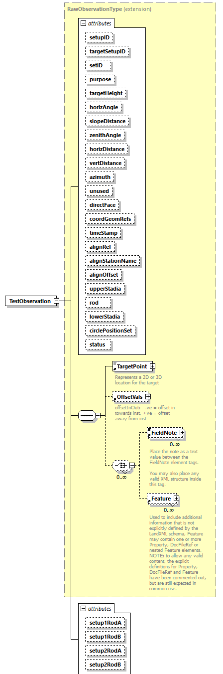 |
||||||||||||||||||||||||||||||||||||||||||||||||||||||||||||||||||||||||||||||||||||||||||||||||||||||||||||||||||||||||||||||||||||||||||||||||||||||||||||||||||||||||
| namespace | http://www.landxml.org/schema/LandXML-2.0 | ||||||||||||||||||||||||||||||||||||||||||||||||||||||||||||||||||||||||||||||||||||||||||||||||||||||||||||||||||||||||||||||||||||||||||||||||||||||||||||||||||||||||
| type | extension of RawObservationType | ||||||||||||||||||||||||||||||||||||||||||||||||||||||||||||||||||||||||||||||||||||||||||||||||||||||||||||||||||||||||||||||||||||||||||||||||||||||||||||||||||||||||
| properties |
|
||||||||||||||||||||||||||||||||||||||||||||||||||||||||||||||||||||||||||||||||||||||||||||||||||||||||||||||||||||||||||||||||||||||||||||||||||||||||||||||||||||||||
| children | TargetPoint OffsetVals FieldNote Feature | ||||||||||||||||||||||||||||||||||||||||||||||||||||||||||||||||||||||||||||||||||||||||||||||||||||||||||||||||||||||||||||||||||||||||||||||||||||||||||||||||||||||||
| used by |
|
||||||||||||||||||||||||||||||||||||||||||||||||||||||||||||||||||||||||||||||||||||||||||||||||||||||||||||||||||||||||||||||||||||||||||||||||||||||||||||||||||||||||
| attributes |
|
||||||||||||||||||||||||||||||||||||||||||||||||||||||||||||||||||||||||||||||||||||||||||||||||||||||||||||||||||||||||||||||||||||||||||||||||||||||||||||||||||||||||
| source | <xs:element name="TestObservation"> <xs:complexType mixed="false"> <xs:complexContent> <xs:extension base="RawObservationType"> <xs:attribute name="setup1RodA" type="xs:double"/> <xs:attribute name="setup1RodB" type="xs:double"/> <xs:attribute name="setup2RodA" type="xs:double"/> <xs:attribute name="setup2RodB" type="xs:double"/> </xs:extension> </xs:complexContent> </xs:complexType> </xs:element> |
attribute TestObservation/@setup1RodA
| type | xs:double |
| source | <xs:attribute name="setup1RodA" type="xs:double"/> |
attribute TestObservation/@setup1RodB
| type | xs:double |
| source | <xs:attribute name="setup1RodB" type="xs:double"/> |
attribute TestObservation/@setup2RodA
| type | xs:double |
| source | <xs:attribute name="setup2RodA" type="xs:double"/> |
attribute TestObservation/@setup2RodB
| type | xs:double |
| source | <xs:attribute name="setup2RodB" type="xs:double"/> |
element TextureHexString
| diagram |  |
||
| namespace | http://www.landxml.org/schema/LandXML-2.0 | ||
| type | xs:hexBinary | ||
| properties |
|
||
| used by |
|
||
| source | <xs:element name="TextureHexString" type="xs:hexBinary"/> |
element TextureImage
| diagram | 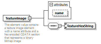 |
||||||||||||
| namespace | http://www.landxml.org/schema/LandXML-2.0 | ||||||||||||
| properties |
|
||||||||||||
| children | TextureHexString | ||||||||||||
| used by |
|
||||||||||||
| attributes |
|
||||||||||||
| annotation |
|
||||||||||||
| source | <xs:element name="TextureImage"> <xs:annotation> <xs:documentation>This element value contains a texture image element with a name attribute and a hex encoded CDATA section that represents a binary bitmap image</xs:documentation> </xs:annotation> <xs:complexType> <xs:sequence> <xs:element ref="TextureHexString"/> </xs:sequence> <xs:attribute name="name" type="xs:string" use="optional"/> </xs:complexType> </xs:element> |
attribute TextureImage/@name
| type | xs:string | ||
| properties |
|
||
| source | <xs:attribute name="name" type="xs:string" use="optional"/> |
element TextureImageNameRef
| diagram |  |
||
| namespace | http://www.landxml.org/schema/LandXML-2.0 | ||
| type | xs:string | ||
| properties |
|
||
| used by |
|
||
| source | <xs:element name="TextureImageNameRef" type="xs:string"/> |
element TextureImageTable
| diagram | 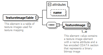 |
||||||||||||
| namespace | http://www.landxml.org/schema/LandXML-2.0 | ||||||||||||
| properties |
|
||||||||||||
| children | TextureImage | ||||||||||||
| used by |
|
||||||||||||
| attributes |
|
||||||||||||
| annotation |
|
||||||||||||
| source | <xs:element name="TextureImageTable"> <xs:annotation> <xs:documentation>This element is a table of texture images used for texture mapping</xs:documentation> </xs:annotation> <xs:complexType> <xs:sequence> <xs:element ref="TextureImage" maxOccurs="unbounded"/> </xs:sequence> <xs:attribute name="name" type="xs:string" use="optional"/> </xs:complexType> </xs:element> |
attribute TextureImageTable/@name
| type | xs:string | ||
| properties |
|
||
| source | <xs:attribute name="name" type="xs:string" use="optional"/> |
element ThruLane
| diagram | 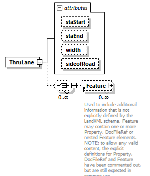 |
||||||||||||||||||||||||||||||
| namespace | http://www.landxml.org/schema/LandXML-2.0 | ||||||||||||||||||||||||||||||
| properties |
|
||||||||||||||||||||||||||||||
| children | Feature | ||||||||||||||||||||||||||||||
| used by |
|
||||||||||||||||||||||||||||||
| attributes |
|
||||||||||||||||||||||||||||||
| source | <xs:element name="ThruLane"> <xs:complexType> <xs:choice minOccurs="0" maxOccurs="unbounded"> <xs:element ref="Feature" minOccurs="0" maxOccurs="unbounded"/> </xs:choice> <xs:attribute name="staStart" type="station"/> <xs:attribute name="staEnd" type="station"/> <xs:attribute name="width" type="xs:double"/> <xs:attribute name="sideofRoad" type="sideofRoadType"/> </xs:complexType> </xs:element> |
attribute ThruLane/@staStart
| type | station |
| source | <xs:attribute name="staStart" type="station"/> |
attribute ThruLane/@staEnd
| type | station |
| source | <xs:attribute name="staEnd" type="station"/> |
attribute ThruLane/@width
| type | xs:double |
| source | <xs:attribute name="width" type="xs:double"/> |
attribute ThruLane/@sideofRoad
| type | sideofRoadType | ||||||||||||
| facets |
|
||||||||||||
| source | <xs:attribute name="sideofRoad" type="sideofRoadType"/> |
element Timing
| diagram | 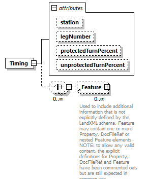 |
||||||||||||||||||||||||||||||
| namespace | http://www.landxml.org/schema/LandXML-2.0 | ||||||||||||||||||||||||||||||
| properties |
|
||||||||||||||||||||||||||||||
| children | Feature | ||||||||||||||||||||||||||||||
| used by |
|
||||||||||||||||||||||||||||||
| attributes |
|
||||||||||||||||||||||||||||||
| source | <xs:element name="Timing"> <xs:complexType> <xs:choice minOccurs="0" maxOccurs="unbounded"> <xs:element ref="Feature" minOccurs="0" maxOccurs="unbounded"/> </xs:choice> <xs:attribute name="station" type="station"/> <xs:attribute name="legNumber" type="xs:int"/> <xs:attribute name="protectedTurnPercent" type="xs:double"/> <xs:attribute name="unprotectedTurnPercent" type="xs:double"/> </xs:complexType> </xs:element> |
attribute Timing/@station
| type | station |
| source | <xs:attribute name="station" type="station"/> |
attribute Timing/@legNumber
| type | xs:int |
| source | <xs:attribute name="legNumber" type="xs:int"/> |
attribute Timing/@protectedTurnPercent
| type | xs:double |
| source | <xs:attribute name="protectedTurnPercent" type="xs:double"/> |
attribute Timing/@unprotectedTurnPercent
| type | xs:double |
| source | <xs:attribute name="unprotectedTurnPercent" type="xs:double"/> |
element Title
| diagram |  |
||||||||||||||||||
| namespace | http://www.landxml.org/schema/LandXML-2.0 | ||||||||||||||||||
| properties |
|
||||||||||||||||||
| used by |
|
||||||||||||||||||
| attributes |
|
||||||||||||||||||
| annotation |
|
||||||||||||||||||
| source | <xs:element name="Title"> <xs:annotation> <xs:documentation>This may be expanded, but the LandXML schema is not really aimed at providing title information so I think name is sufficient</xs:documentation> </xs:annotation> <xs:complexType mixed="true"> <xs:attribute name="name" type="xs:string" use="required"/> <xs:attribute name="titleType" type="xs:anySimpleType"/> </xs:complexType> </xs:element> |
attribute Title/@name
| type | xs:string | ||
| properties |
|
||
| source | <xs:attribute name="name" type="xs:string" use="required"/> |
attribute Title/@titleType
| type | xs:anySimpleType |
| source | <xs:attribute name="titleType" type="xs:anySimpleType"/> |
element TrafficControl
| diagram | 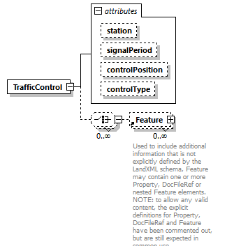 |
||||||||||||||||||||||||||||||
| namespace | http://www.landxml.org/schema/LandXML-2.0 | ||||||||||||||||||||||||||||||
| properties |
|
||||||||||||||||||||||||||||||
| children | Feature | ||||||||||||||||||||||||||||||
| used by |
|
||||||||||||||||||||||||||||||
| attributes |
|
||||||||||||||||||||||||||||||
| source | <xs:element name="TrafficControl"> <xs:complexType> <xs:choice minOccurs="0" maxOccurs="unbounded"> <xs:element ref="Feature" minOccurs="0" maxOccurs="unbounded"/> </xs:choice> <xs:attribute name="station" type="station"/> <xs:attribute name="signalPeriod" type="xs:double"/> <xs:attribute name="controlPosition" type="trafficControlPosition"/> <xs:attribute name="controlType" type="trafficControlType"/> </xs:complexType> </xs:element> |
attribute TrafficControl/@station
| type | station |
| source | <xs:attribute name="station" type="station"/> |
attribute TrafficControl/@signalPeriod
| type | xs:double |
| source | <xs:attribute name="signalPeriod" type="xs:double"/> |
attribute TrafficControl/@controlPosition
| type | trafficControlPosition | |||||||||
| facets |
|
|||||||||
| source | <xs:attribute name="controlPosition" type="trafficControlPosition"/> |
attribute TrafficControl/@controlType
| type | trafficControlType | |||||||||||||||
| facets |
|
|||||||||||||||
| source | <xs:attribute name="controlType" type="trafficControlType"/> |
element TrafficVolume
| diagram |  |
||
| namespace | http://www.landxml.org/schema/LandXML-2.0 | ||
| properties |
|
||
| children | DailyTrafficVolume DesignHour PeakHour Feature | ||
| used by |
|
||
| source | <xs:element name="TrafficVolume"> <xs:complexType> <xs:choice maxOccurs="unbounded"> <xs:element ref="DailyTrafficVolume"/> <xs:element ref="DesignHour"/> <xs:element ref="PeakHour"/> <xs:element ref="Feature" minOccurs="0" maxOccurs="unbounded"/> </xs:choice> </xs:complexType> </xs:element> |
element TurnLane
| diagram | 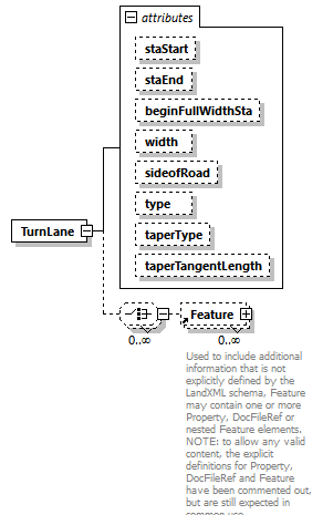 |
||||||||||||||||||||||||||||||||||||||||||||||||||||||
| namespace | http://www.landxml.org/schema/LandXML-2.0 | ||||||||||||||||||||||||||||||||||||||||||||||||||||||
| properties |
|
||||||||||||||||||||||||||||||||||||||||||||||||||||||
| children | Feature | ||||||||||||||||||||||||||||||||||||||||||||||||||||||
| used by |
|
||||||||||||||||||||||||||||||||||||||||||||||||||||||
| attributes |
|
||||||||||||||||||||||||||||||||||||||||||||||||||||||
| source | <xs:element name="TurnLane"> <xs:complexType> <xs:choice minOccurs="0" maxOccurs="unbounded"> <xs:element ref="Feature" minOccurs="0" maxOccurs="unbounded"/> </xs:choice> <xs:attribute name="staStart" type="station"/> <xs:attribute name="staEnd" type="station"/> <xs:attribute name="beginFullWidthSta" type="station"/> <xs:attribute name="width" type="xs:double"/> <xs:attribute name="sideofRoad" type="sideofRoadType"/> <xs:attribute name="type" type="turnLaneType"/> <xs:attribute name="taperType" type="laneTaperType"/> <xs:attribute name="taperTangentLength" type="xs:double"/> </xs:complexType> </xs:element> |
attribute TurnLane/@staStart
| type | station |
| source | <xs:attribute name="staStart" type="station"/> |
attribute TurnLane/@staEnd
| type | station |
| source | <xs:attribute name="staEnd" type="station"/> |
attribute TurnLane/@beginFullWidthSta
| type | station |
| source | <xs:attribute name="beginFullWidthSta" type="station"/> |
attribute TurnLane/@width
| type | xs:double |
| source | <xs:attribute name="width" type="xs:double"/> |
attribute TurnLane/@sideofRoad
| type | sideofRoadType | ||||||||||||
| facets |
|
||||||||||||
| source | <xs:attribute name="sideofRoad" type="sideofRoadType"/> |
attribute TurnLane/@type
| type | turnLaneType | |||||||||
| facets |
|
|||||||||
| source | <xs:attribute name="type" type="turnLaneType"/> |
attribute TurnLane/@taperType
| type | laneTaperType | |||||||||||||||
| facets |
|
|||||||||||||||
| source | <xs:attribute name="taperType" type="laneTaperType"/> |
attribute TurnLane/@taperTangentLength
| type | xs:double |
| source | <xs:attribute name="taperTangentLength" type="xs:double"/> |
element TurnRestriction
| diagram | 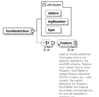 |
||||||||||||||||||||||||
| namespace | http://www.landxml.org/schema/LandXML-2.0 | ||||||||||||||||||||||||
| properties |
|
||||||||||||||||||||||||
| children | Feature | ||||||||||||||||||||||||
| used by |
|
||||||||||||||||||||||||
| attributes |
|
||||||||||||||||||||||||
| source | <xs:element name="TurnRestriction"> <xs:complexType> <xs:choice minOccurs="0" maxOccurs="unbounded"> <xs:element ref="Feature" minOccurs="0" maxOccurs="unbounded"/> </xs:choice> <xs:attribute name="station" type="station"/> <xs:attribute name="legNumber" type="xs:int"/> <xs:attribute name="type" type="trafficTurnRestriction"/> </xs:complexType> </xs:element> |
attribute TurnRestriction/@station
| type | station |
| source | <xs:attribute name="station" type="station"/> |
attribute TurnRestriction/@legNumber
| type | xs:int |
| source | <xs:attribute name="legNumber" type="xs:int"/> |
attribute TurnRestriction/@type
| type | trafficTurnRestriction | ||||||||||||||||||
| facets |
|
||||||||||||||||||
| source | <xs:attribute name="type" type="trafficTurnRestriction"/> |
element TurnSpeed
| diagram | 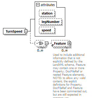 |
||||||||||||||||||||||||
| namespace | http://www.landxml.org/schema/LandXML-2.0 | ||||||||||||||||||||||||
| properties |
|
||||||||||||||||||||||||
| children | Feature | ||||||||||||||||||||||||
| used by |
|
||||||||||||||||||||||||
| attributes |
|
||||||||||||||||||||||||
| source | <xs:element name="TurnSpeed"> <xs:complexType> <xs:choice minOccurs="0" maxOccurs="unbounded"> <xs:element ref="Feature" minOccurs="0" maxOccurs="unbounded"/> </xs:choice> <xs:attribute name="station" type="station"/> <xs:attribute name="legNumber" type="xs:int"/> <xs:attribute name="speed" type="xs:double"/> </xs:complexType> </xs:element> |
attribute TurnSpeed/@station
| type | station |
| source | <xs:attribute name="station" type="station"/> |
attribute TurnSpeed/@legNumber
| type | xs:int |
| source | <xs:attribute name="legNumber" type="xs:int"/> |
attribute TurnSpeed/@speed
| type | xs:double |
| source | <xs:attribute name="speed" type="xs:double"/> |
element TwoWayLeftTurnLane
| diagram | 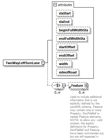 |
||||||||||||||||||||||||||||||||||||||||||||||||||||||
| namespace | http://www.landxml.org/schema/LandXML-2.0 | ||||||||||||||||||||||||||||||||||||||||||||||||||||||
| properties |
|
||||||||||||||||||||||||||||||||||||||||||||||||||||||
| children | Feature | ||||||||||||||||||||||||||||||||||||||||||||||||||||||
| used by |
|
||||||||||||||||||||||||||||||||||||||||||||||||||||||
| attributes |
|
||||||||||||||||||||||||||||||||||||||||||||||||||||||
| source | <xs:element name="TwoWayLeftTurnLane"> <xs:complexType> <xs:choice minOccurs="0" maxOccurs="unbounded"> <xs:element ref="Feature" minOccurs="0" maxOccurs="unbounded"/> </xs:choice> <xs:attribute name="staStart" type="station"/> <xs:attribute name="staEnd" type="station"/> <xs:attribute name="beginFullWidthSta" type="station"/> <xs:attribute name="endFullWidthSta" type="station"/> <xs:attribute name="startOffset" type="offsetDistance"/> <xs:attribute name="endOffset" type="offsetDistance"/> <xs:attribute name="width" type="xs:double"/> <xs:attribute name="sideofRoad" type="sideofRoadType"/> </xs:complexType> <!-- * Start Centerline Offset - Unit of measure: SHORT_DIST. Start Centerline Offset - This item is the starting lateral offset of the TWLTL relative to the roadway centerline. This item specifies the lateral offset of the start of the two-way left turn lane from the centerline of the roadway. A poistive value represents an offset to the right side of the road (relative to the direction of increasing stations) and a negative value represent represents an offset to the left side of the road. The unit of measure for this item is meters (feet). * Begin Full Width - Unit of measure: STATION. Begin Full Width - This item is the station location at which full lane width begins. It specifies the station at which the initial taper ends and the full width begins. Lane Width - Unit of measure: SHORT_DIST. Lane Width - This item is the width of lane. The unit of measure for this item is meters (feet). * End Full Width - Unit of measure: STATION. End Full Width - This item is the station location at which final taper begins. This item specifies the station at which the full width ends and the final taper begins. * End Centerline Offset - Unit of measure: SHORT_DIST. End Centerline Offset - This item is the ending lateral offset of the TWLTL relative to the roadway centerline. This item specifies the lateral offset of the end of the two-way left turn lane from the centerline of the roadway. A poistive value represents an offset to the right side of the road (relative to the direction of increasing stations) and a negative value represent represents an offset to the left side of the road. The unit of measure for this item is meters (feet). --> </xs:element> |
attribute TwoWayLeftTurnLane/@staStart
| type | station |
| source | <xs:attribute name="staStart" type="station"/> |
attribute TwoWayLeftTurnLane/@staEnd
| type | station |
| source | <xs:attribute name="staEnd" type="station"/> |
attribute TwoWayLeftTurnLane/@beginFullWidthSta
| type | station |
| source | <xs:attribute name="beginFullWidthSta" type="station"/> |
attribute TwoWayLeftTurnLane/@endFullWidthSta
| type | station |
| source | <xs:attribute name="endFullWidthSta" type="station"/> |
attribute TwoWayLeftTurnLane/@startOffset
| type | offsetDistance |
| source | <xs:attribute name="startOffset" type="offsetDistance"/> |
attribute TwoWayLeftTurnLane/@endOffset
| type | offsetDistance |
| source | <xs:attribute name="endOffset" type="offsetDistance"/> |
attribute TwoWayLeftTurnLane/@width
| type | xs:double |
| source | <xs:attribute name="width" type="xs:double"/> |
attribute TwoWayLeftTurnLane/@sideofRoad
| type | sideofRoadType | ||||||||||||
| facets |
|
||||||||||||
| source | <xs:attribute name="sideofRoad" type="sideofRoadType"/> |
element Units
| diagram | 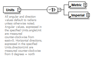 |
||
| namespace | http://www.landxml.org/schema/LandXML-2.0 | ||
| properties |
|
||
| children | Metric Imperial | ||
| used by |
|
||
| annotation |
|
||
| source | <xs:element name="Units"> <xs:annotation> <xs:documentation>All angular and direction values default to radians unless otherwise noted. Angular values, expressed in the specified Units.angleUnit are measured counter-clockwise from east=0. Horizontal directions, expressed in the specified Units.directionUnit are measured counter-clockwise from 0 degrees = north</xs:documentation> </xs:annotation> <xs:complexType> <xs:choice> <xs:element ref="Metric"/> <xs:element ref="Imperial"/> </xs:choice> </xs:complexType> </xs:element> |
element UnsymParaCurve
| diagram | 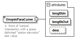 |
||||||||||||||||||||||||
| namespace | http://www.landxml.org/schema/LandXML-2.0 | ||||||||||||||||||||||||
| type | extension of Point2dReq | ||||||||||||||||||||||||
| properties |
|
||||||||||||||||||||||||
| used by |
|
||||||||||||||||||||||||
| facets |
|
||||||||||||||||||||||||
| attributes |
|
||||||||||||||||||||||||
| annotation |
|
||||||||||||||||||||||||
| source | <xs:element name="UnsymParaCurve"> <xs:annotation> <xs:documentation>A Point of Vertical Intersection with a space delimited "station elevation" text value.</xs:documentation> <xs:documentation>with an unsymetrical parabolic vertical curve defined by "lengthIn and "lengthOut" attributes.</xs:documentation> </xs:annotation> <xs:complexType mixed="true"> <xs:simpleContent> <xs:extension base="Point2dReq"> <xs:attribute name="lengthIn" type="xs:double" use="required"/> <xs:attribute name="lengthOut" type="xs:double" use="required"/> <xs:attribute name="desc" type="xs:string"/> </xs:extension> </xs:simpleContent> </xs:complexType> </xs:element> |
attribute UnsymParaCurve/@lengthIn
| type | xs:double | ||
| properties |
|
||
| source | <xs:attribute name="lengthIn" type="xs:double" use="required"/> |
attribute UnsymParaCurve/@lengthOut
| type | xs:double | ||
| properties |
|
||
| source | <xs:attribute name="lengthOut" type="xs:double" use="required"/> |
attribute UnsymParaCurve/@desc
| type | xs:string |
| source | <xs:attribute name="desc" type="xs:string"/> |
element UtilityConstraints
| diagram | 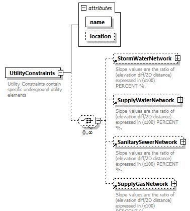 |
||||||||||||||||||
| namespace | http://www.landxml.org/schema/LandXML-2.0 | ||||||||||||||||||
| properties |
|
||||||||||||||||||
| children | StormWaterNetwork SupplyWaterNetwork SanitarySewerNetwork SupplyGasNetwork | ||||||||||||||||||
| used by |
|
||||||||||||||||||
| attributes |
|
||||||||||||||||||
| annotation |
|
||||||||||||||||||
| source | <xs:element name="UtilityConstraints"> <xs:annotation> <xs:documentation>Utility Constraints contain specific underground utility elements</xs:documentation> <xs:documentation>that define local design criteria for the specified engineering values</xs:documentation> </xs:annotation> <xs:complexType> <xs:choice minOccurs="0" maxOccurs="unbounded"> <xs:element ref="StormWaterNetwork" minOccurs="0" maxOccurs="1"/> <xs:element ref="SupplyWaterNetwork" minOccurs="0" maxOccurs="1"/> <xs:element ref="SanitarySewerNetwork" minOccurs="0" maxOccurs="1"/> <xs:element ref="SupplyGasNetwork" minOccurs="0" maxOccurs="1"/> </xs:choice> <xs:attribute name="name" type="xs:string" use="required"/> <xs:attribute name="location" type="xs:string"/> </xs:complexType> </xs:element> |
attribute UtilityConstraints/@name
| type | xs:string | ||
| properties |
|
||
| source | <xs:attribute name="name" type="xs:string" use="required"/> |
attribute UtilityConstraints/@location
| type | xs:string |
| source | <xs:attribute name="location" type="xs:string"/> |
element Volume
| diagram | 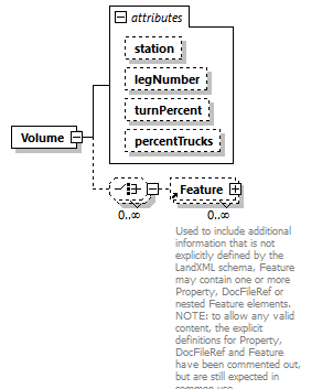 |
||||||||||||||||||||||||||||||
| namespace | http://www.landxml.org/schema/LandXML-2.0 | ||||||||||||||||||||||||||||||
| properties |
|
||||||||||||||||||||||||||||||
| children | Feature | ||||||||||||||||||||||||||||||
| used by |
|
||||||||||||||||||||||||||||||
| attributes |
|
||||||||||||||||||||||||||||||
| source | <xs:element name="Volume"> <xs:complexType> <xs:choice minOccurs="0" maxOccurs="unbounded"> <xs:element ref="Feature" minOccurs="0" maxOccurs="unbounded"/> </xs:choice> <xs:attribute name="station" type="station"/> <xs:attribute name="legNumber" type="xs:int"/> <xs:attribute name="turnPercent" type="xs:double"/> <xs:attribute name="percentTrucks" type="xs:double"/> </xs:complexType> </xs:element> |
attribute Volume/@station
| type | station |
| source | <xs:attribute name="station" type="station"/> |
attribute Volume/@legNumber
| type | xs:int |
| source | <xs:attribute name="legNumber" type="xs:int"/> |
attribute Volume/@turnPercent
| type | xs:double |
| source | <xs:attribute name="turnPercent" type="xs:double"/> |
attribute Volume/@percentTrucks
| type | xs:double |
| source | <xs:attribute name="percentTrucks" type="xs:double"/> |
element VolumeGeom
| diagram | 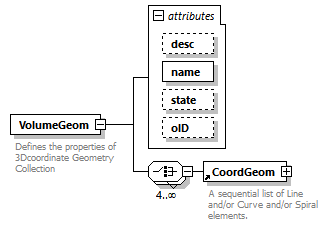 |
||||||||||||||||||||||||||||||
| namespace | http://www.landxml.org/schema/LandXML-2.0 | ||||||||||||||||||||||||||||||
| properties |
|
||||||||||||||||||||||||||||||
| children | CoordGeom | ||||||||||||||||||||||||||||||
| used by |
|
||||||||||||||||||||||||||||||
| attributes |
|
||||||||||||||||||||||||||||||
| annotation |
|
||||||||||||||||||||||||||||||
| source | <xs:element name="VolumeGeom"> <xs:annotation> <xs:documentation>Defines the properties of 3Dcoordinate Geometry Collection</xs:documentation> </xs:annotation> <xs:complexType> <xs:choice minOccurs="4" maxOccurs="unbounded"> <xs:element ref="CoordGeom"/> </xs:choice> <xs:attribute name="desc" type="xs:string"/> <xs:attribute name="name" type="xs:string" use="required"/> <xs:attribute name="state" type="stateType"/> <xs:attribute name="oID" type="xs:string"/> </xs:complexType> </xs:element> |
attribute VolumeGeom/@desc
| type | xs:string |
| source | <xs:attribute name="desc" type="xs:string"/> |
attribute VolumeGeom/@name
| type | xs:string | ||
| properties |
|
||
| source | <xs:attribute name="name" type="xs:string" use="required"/> |
attribute VolumeGeom/@state
| type | stateType | |||||||||||||||
| facets |
|
|||||||||||||||
| source | <xs:attribute name="state" type="stateType"/> |
attribute VolumeGeom/@oID
| type | xs:string |
| source | <xs:attribute name="oID" type="xs:string"/> |
element Watershed
| diagram | 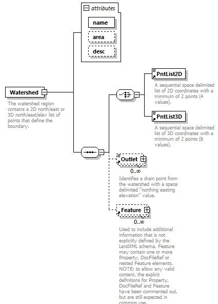 |
||||||||||||||||||||||||
| namespace | http://www.landxml.org/schema/LandXML-2.0 | ||||||||||||||||||||||||
| properties |
|
||||||||||||||||||||||||
| children | PntList2D PntList3D Outlet Feature | ||||||||||||||||||||||||
| used by |
|
||||||||||||||||||||||||
| attributes |
|
||||||||||||||||||||||||
| annotation |
|
||||||||||||||||||||||||
| source | <xs:element name="Watershed"> <xs:annotation> <xs:documentation>The watershed region contains a 2D north/east or 3D north/east/elev list of points that define the boundary.</xs:documentation> <xs:documentation>A watershed is identified by the "name" attribute.</xs:documentation> <xs:documentation>It may have 1 or more Outlet elements.</xs:documentation> </xs:annotation> <xs:complexType> <xs:sequence> <xs:choice> <xs:element ref="PntList2D"/> <xs:element ref="PntList3D"/> <!-- Here PntList2D represents 2D planametric coordinate pairs expressed as space delimited Northing Easting pairs. --> </xs:choice> <xs:element ref="Outlet" minOccurs="0" maxOccurs="unbounded"/> <xs:element ref="Feature" minOccurs="0" maxOccurs="unbounded"/> </xs:sequence> <xs:attribute name="name" type="xs:string" use="required"/> <xs:attribute name="area" type="xs:double"/> <xs:attribute name="desc" type="xs:string"/> </xs:complexType> </xs:element> |
attribute Watershed/@name
| type | xs:string | ||
| properties |
|
||
| source | <xs:attribute name="name" type="xs:string" use="required"/> |
attribute Watershed/@area
| type | xs:double |
| source | <xs:attribute name="area" type="xs:double"/> |
attribute Watershed/@desc
| type | xs:string |
| source | <xs:attribute name="desc" type="xs:string"/> |
element Watersheds
| diagram | 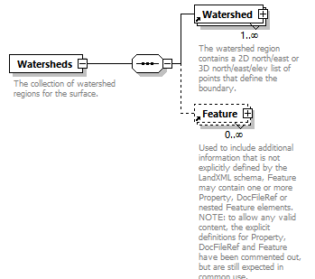 |
||
| namespace | http://www.landxml.org/schema/LandXML-2.0 | ||
| properties |
|
||
| children | Watershed Feature | ||
| used by |
|
||
| annotation |
|
||
| source | <xs:element name="Watersheds"> <xs:annotation> <xs:documentation>The collection of watershed regions for the surface.</xs:documentation> </xs:annotation> <xs:complexType> <xs:sequence> <xs:element ref="Watershed" maxOccurs="unbounded"/> <xs:element ref="Feature" minOccurs="0" maxOccurs="unbounded"/> </xs:sequence> </xs:complexType> </xs:element> |
element WideningLane
| diagram | 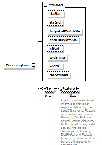 |
||||||||||||||||||||||||||||||||||||||||||||||||||||||
| namespace | http://www.landxml.org/schema/LandXML-2.0 | ||||||||||||||||||||||||||||||||||||||||||||||||||||||
| properties |
|
||||||||||||||||||||||||||||||||||||||||||||||||||||||
| children | Feature | ||||||||||||||||||||||||||||||||||||||||||||||||||||||
| used by |
|
||||||||||||||||||||||||||||||||||||||||||||||||||||||
| attributes |
|
||||||||||||||||||||||||||||||||||||||||||||||||||||||
| source | <xs:element name="WideningLane"> <xs:complexType> <xs:choice minOccurs="0" maxOccurs="unbounded"> <xs:element ref="Feature" minOccurs="0" maxOccurs="unbounded"/> </xs:choice> <xs:attribute name="staStart" type="station"/> <xs:attribute name="staEnd" type="station"/> <xs:attribute name="beginFullWidthSta" type="station"/> <xs:attribute name="endFullWidthSta" type="station"/> <xs:attribute name="offset" type="offsetDistance"/> <xs:attribute name="widening" type="xs:double"/> <xs:attribute name="width" type="xs:double"/> <xs:attribute name="sideofRoad" type="sideofRoadType"/> </xs:complexType> </xs:element> |
attribute WideningLane/@staStart
| type | station |
| source | <xs:attribute name="staStart" type="station"/> |
attribute WideningLane/@staEnd
| type | station |
| source | <xs:attribute name="staEnd" type="station"/> |
attribute WideningLane/@beginFullWidthSta
| type | station |
| source | <xs:attribute name="beginFullWidthSta" type="station"/> |
attribute WideningLane/@endFullWidthSta
| type | station |
| source | <xs:attribute name="endFullWidthSta" type="station"/> |
attribute WideningLane/@offset
| type | offsetDistance |
| source | <xs:attribute name="offset" type="offsetDistance"/> |
attribute WideningLane/@widening
| type | xs:double |
| source | <xs:attribute name="widening" type="xs:double"/> |
attribute WideningLane/@width
| type | xs:double |
| source | <xs:attribute name="width" type="xs:double"/> |
attribute WideningLane/@sideofRoad
| type | sideofRoadType | ||||||||||||
| facets |
|
||||||||||||
| source | <xs:attribute name="sideofRoad" type="sideofRoadType"/> |
element Zone
| diagram | 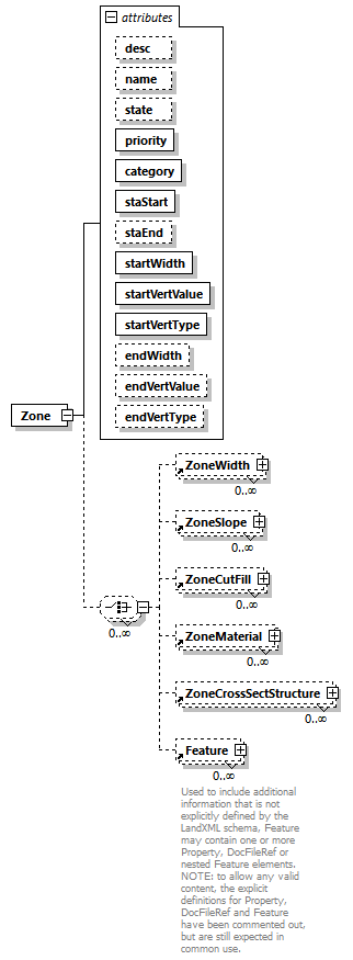 |
||||||||||||||||||||||||||||||||||||||||||||||||||||||||||||||||||||||||||||||||||||
| namespace | http://www.landxml.org/schema/LandXML-2.0 | ||||||||||||||||||||||||||||||||||||||||||||||||||||||||||||||||||||||||||||||||||||
| properties |
|
||||||||||||||||||||||||||||||||||||||||||||||||||||||||||||||||||||||||||||||||||||
| children | ZoneWidth ZoneSlope ZoneCutFill ZoneMaterial ZoneCrossSectStructure Feature | ||||||||||||||||||||||||||||||||||||||||||||||||||||||||||||||||||||||||||||||||||||
| used by |
|
||||||||||||||||||||||||||||||||||||||||||||||||||||||||||||||||||||||||||||||||||||
| attributes |
|
||||||||||||||||||||||||||||||||||||||||||||||||||||||||||||||||||||||||||||||||||||
| source | <xs:element name="Zone"> <xs:complexType> <xs:choice minOccurs="0" maxOccurs="unbounded"> <xs:element ref="ZoneWidth" minOccurs="0" maxOccurs="unbounded"/> <xs:element ref="ZoneSlope" minOccurs="0" maxOccurs="unbounded"/> <xs:element ref="ZoneCutFill" minOccurs="0" maxOccurs="unbounded"/> <xs:element ref="ZoneMaterial" minOccurs="0" maxOccurs="unbounded"/> <xs:element ref="ZoneCrossSectStructure" minOccurs="0" maxOccurs="unbounded"/> <xs:element ref="Feature" minOccurs="0" maxOccurs="unbounded"/> </xs:choice> <xs:attribute name="desc" type="xs:string"/> <xs:attribute name="name" type="xs:string"/> <xs:attribute name="state" type="stateType"/> <xs:attribute name="priority" type="xs:int" use="required"/> <xs:attribute name="category" type="zoneCategoryType" use="required"/> <xs:attribute name="staStart" type="station" use="required"/> <xs:attribute name="staEnd" type="station"/> <xs:attribute name="startWidth" type="xs:double" use="required"/> <xs:attribute name="startVertValue" type="xs:double" use="required"/> <xs:attribute name="startVertType" type="zoneVertType" use="required"/> <xs:attribute name="endWidth" type="xs:double"/> <xs:attribute name="endVertValue" type="xs:double"/> <xs:attribute name="endVertType" type="zoneVertType"/> </xs:complexType> </xs:element> |
attribute Zone/@desc
| type | xs:string |
| source | <xs:attribute name="desc" type="xs:string"/> |
attribute Zone/@name
| type | xs:string |
| source | <xs:attribute name="name" type="xs:string"/> |
attribute Zone/@state
| type | stateType | |||||||||||||||
| facets |
|
|||||||||||||||
| source | <xs:attribute name="state" type="stateType"/> |
attribute Zone/@priority
| type | xs:int | ||
| properties |
|
||
| source | <xs:attribute name="priority" type="xs:int" use="required"/> |
attribute Zone/@category
| type | zoneCategoryType | ||||||||||||||||||||||||||||||||||||||||||||||||||||||||||||
| properties |
|
||||||||||||||||||||||||||||||||||||||||||||||||||||||||||||
| facets |
|
||||||||||||||||||||||||||||||||||||||||||||||||||||||||||||
| source | <xs:attribute name="category" type="zoneCategoryType" use="required"/> |
attribute Zone/@staStart
| type | station | ||
| properties |
|
||
| source | <xs:attribute name="staStart" type="station" use="required"/> |
attribute Zone/@staEnd
| type | station |
| source | <xs:attribute name="staEnd" type="station"/> |
attribute Zone/@startWidth
| type | xs:double | ||
| properties |
|
||
| source | <xs:attribute name="startWidth" type="xs:double" use="required"/> |
attribute Zone/@startVertValue
| type | xs:double | ||
| properties |
|
||
| source | <xs:attribute name="startVertValue" type="xs:double" use="required"/> |
attribute Zone/@startVertType
| type | zoneVertType | |||||||||
| properties |
|
|||||||||
| facets |
|
|||||||||
| source | <xs:attribute name="startVertType" type="zoneVertType" use="required"/> |
attribute Zone/@endWidth
| type | xs:double |
| source | <xs:attribute name="endWidth" type="xs:double"/> |
attribute Zone/@endVertValue
| type | xs:double |
| source | <xs:attribute name="endVertValue" type="xs:double"/> |
attribute Zone/@endVertType
| type | zoneVertType | |||||||||
| facets |
|
|||||||||
| source | <xs:attribute name="endVertType" type="zoneVertType"/> |
element ZoneCrossSectStructure
| diagram | 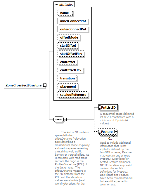 |
||||||||||||||||||||||||||||||||||||||||||||||||||||||||||||||||||||||||
| namespace | http://www.landxml.org/schema/LandXML-2.0 | ||||||||||||||||||||||||||||||||||||||||||||||||||||||||||||||||||||||||
| properties |
|
||||||||||||||||||||||||||||||||||||||||||||||||||||||||||||||||||||||||
| children | PntList2D Feature | ||||||||||||||||||||||||||||||||||||||||||||||||||||||||||||||||||||||||
| used by |
|
||||||||||||||||||||||||||||||||||||||||||||||||||||||||||||||||||||||||
| attributes |
|
||||||||||||||||||||||||||||||||||||||||||||||||||||||||||||||||||||||||
| source | <xs:element name="ZoneCrossSectStructure"> <xs:complexType> <xs:sequence> <xs:annotation> <xs:documentation> The PntList2D contains space delimited offsetDistance / elevation pairs describing a crossectional shape, typically a closed shape representing a retaining wall, traffic barriers or vertical pillars. As is common with road cross sections the origin is the Profile Grade Line (PGL) of the design road. The offsetDistance measure is the 2D distance from the PGL and the elevation values are absolute (real world) elevations for the entire data set.</xs:documentation> </xs:annotation> <xs:element ref="PntList2D"/> <xs:element ref="Feature" minOccurs="0" maxOccurs="unbounded"/> </xs:sequence> <xs:attribute name="name" type="xs:string"/> <xs:attribute name="innerConnectPnt" type="crossSectionPnt" use="required"/> <xs:attribute name="outerConnectPnt" type="crossSectionPnt" use="required"/> <xs:attribute name="offsetMode" type="zoneOffsetType" default="zone"/> <xs:attribute name="startOffset" type="offsetDistance" default="0.0"/> <xs:attribute name="startOffsetElev" type="offsetElevation" default="0.0"/> <xs:attribute name="endOffset" type="offsetDistance" default="0.0"/> <xs:attribute name="endOffsetElev" type="offsetElevation" default="0.0"/> <xs:attribute name="transition" type="zoneTransitionType" default="parallel"/> <xs:attribute name="placement" type="zonePlacementType" default="dependent"/> <xs:attribute name="catalogReference" type="xs:anyURI" use="optional"/> </xs:complexType> </xs:element> |
attribute ZoneCrossSectStructure/@name
| type | xs:string |
| source | <xs:attribute name="name" type="xs:string"/> |
attribute ZoneCrossSectStructure/@innerConnectPnt
| type | crossSectionPnt | ||||||
| properties |
|
||||||
| facets |
|
||||||
| source | <xs:attribute name="innerConnectPnt" type="crossSectionPnt" use="required"/> |
attribute ZoneCrossSectStructure/@outerConnectPnt
| type | crossSectionPnt | ||||||
| properties |
|
||||||
| facets |
|
||||||
| source | <xs:attribute name="outerConnectPnt" type="crossSectionPnt" use="required"/> |
attribute ZoneCrossSectStructure/@offsetMode
| type | zoneOffsetType | |||||||||
| properties |
|
|||||||||
| facets |
|
|||||||||
| source | <xs:attribute name="offsetMode" type="zoneOffsetType" default="zone"/> |
attribute ZoneCrossSectStructure/@startOffset
| type | offsetDistance | ||
| properties |
|
||
| source | <xs:attribute name="startOffset" type="offsetDistance" default="0.0"/> |
attribute ZoneCrossSectStructure/@startOffsetElev
| type | offsetElevation | ||
| properties |
|
||
| source | <xs:attribute name="startOffsetElev" type="offsetElevation" default="0.0"/> |
attribute ZoneCrossSectStructure/@endOffset
| type | offsetDistance | ||
| properties |
|
||
| source | <xs:attribute name="endOffset" type="offsetDistance" default="0.0"/> |
attribute ZoneCrossSectStructure/@endOffsetElev
| type | offsetElevation | ||
| properties |
|
||
| source | <xs:attribute name="endOffsetElev" type="offsetElevation" default="0.0"/> |
attribute ZoneCrossSectStructure/@transition
| type | zoneTransitionType | |||||||||
| properties |
|
|||||||||
| facets |
|
|||||||||
| source | <xs:attribute name="transition" type="zoneTransitionType" default="parallel"/> |
attribute ZoneCrossSectStructure/@placement
| type | zonePlacementType | |||||||||
| properties |
|
|||||||||
| facets |
|
|||||||||
| source | <xs:attribute name="placement" type="zonePlacementType" default="dependent"/> |
attribute ZoneCrossSectStructure/@catalogReference
| type | xs:anyURI | ||
| properties |
|
||
| source | <xs:attribute name="catalogReference" type="xs:anyURI" use="optional"/> |
element ZoneCutFill
| diagram | 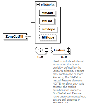 |
||||||||||||||||||||||||||||||
| namespace | http://www.landxml.org/schema/LandXML-2.0 | ||||||||||||||||||||||||||||||
| properties |
|
||||||||||||||||||||||||||||||
| children | Feature | ||||||||||||||||||||||||||||||
| used by |
|
||||||||||||||||||||||||||||||
| attributes |
|
||||||||||||||||||||||||||||||
| source | <xs:element name="ZoneCutFill"> <xs:complexType> <xs:choice minOccurs="0" maxOccurs="unbounded"> <xs:element ref="Feature" minOccurs="0" maxOccurs="unbounded"/> </xs:choice> <xs:attribute name="staStart" type="station" use="required"/> <xs:attribute name="staEnd" type="station" use="required"/> <xs:attribute name="cutSlope" type="crossSlope"/> <xs:attribute name="fillSlope" type="crossSlope"/> </xs:complexType> </xs:element> |
attribute ZoneCutFill/@staStart
| type | station | ||
| properties |
|
||
| source | <xs:attribute name="staStart" type="station" use="required"/> |
attribute ZoneCutFill/@staEnd
| type | station | ||
| properties |
|
||
| source | <xs:attribute name="staEnd" type="station" use="required"/> |
attribute ZoneCutFill/@cutSlope
| type | crossSlope |
| source | <xs:attribute name="cutSlope" type="crossSlope"/> |
attribute ZoneCutFill/@fillSlope
| type | crossSlope |
| source | <xs:attribute name="fillSlope" type="crossSlope"/> |
element ZoneHinge
| diagram | 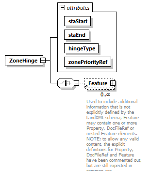 |
||||||||||||||||||||||||||||||
| namespace | http://www.landxml.org/schema/LandXML-2.0 | ||||||||||||||||||||||||||||||
| properties |
|
||||||||||||||||||||||||||||||
| children | Feature | ||||||||||||||||||||||||||||||
| used by |
|
||||||||||||||||||||||||||||||
| attributes |
|
||||||||||||||||||||||||||||||
| source | <xs:element name="ZoneHinge"> <xs:complexType> <xs:choice> <xs:element ref="Feature" minOccurs="0" maxOccurs="unbounded"/> </xs:choice> <xs:attribute name="staStart" type="station" use="required"/> <xs:attribute name="staEnd" type="station" use="required"/> <xs:attribute name="hingeType" type="zoneHingeType" use="required"/> <xs:attribute name="zonePriorityRef" type="xs:int" use="required"/> </xs:complexType> <!-- This element describes the non-center hinge point for superelevated roadways The zonePriorityRef should contain the zone priority number (zone identifier) where the hinge point is located. The hingeType attribute identifies the left or right side of the zone to use as the hinge point. --> </xs:element> |
attribute ZoneHinge/@staStart
| type | station | ||
| properties |
|
||
| source | <xs:attribute name="staStart" type="station" use="required"/> |
attribute ZoneHinge/@staEnd
| type | station | ||
| properties |
|
||
| source | <xs:attribute name="staEnd" type="station" use="required"/> |
attribute ZoneHinge/@hingeType
| type | zoneHingeType | ||||||||||||
| properties |
|
||||||||||||
| facets |
|
||||||||||||
| source | <xs:attribute name="hingeType" type="zoneHingeType" use="required"/> |
attribute ZoneHinge/@zonePriorityRef
| type | xs:int | ||
| properties |
|
||
| source | <xs:attribute name="zonePriorityRef" type="xs:int" use="required"/> |
element ZoneMaterial
| diagram | 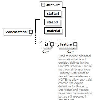 |
||||||||||||||||||||||||
| namespace | http://www.landxml.org/schema/LandXML-2.0 | ||||||||||||||||||||||||
| properties |
|
||||||||||||||||||||||||
| children | Feature | ||||||||||||||||||||||||
| used by |
|
||||||||||||||||||||||||
| attributes |
|
||||||||||||||||||||||||
| source | <xs:element name="ZoneMaterial"> <xs:complexType> <xs:choice minOccurs="0" maxOccurs="unbounded"> <xs:element ref="Feature" minOccurs="0" maxOccurs="unbounded"/> </xs:choice> <xs:attribute name="staStart" type="station" use="required"/> <xs:attribute name="staEnd" type="station" use="required"/> <xs:attribute name="material" type="zoneMaterialType" use="required"/> </xs:complexType> </xs:element> |
attribute ZoneMaterial/@staStart
| type | station | ||
| properties |
|
||
| source | <xs:attribute name="staStart" type="station" use="required"/> |
attribute ZoneMaterial/@staEnd
| type | station | ||
| properties |
|
||
| source | <xs:attribute name="staEnd" type="station" use="required"/> |
attribute ZoneMaterial/@material
| type | zoneMaterialType | ||||||||||||||||||||||||||||||||||||||||||||||||
| properties |
|
||||||||||||||||||||||||||||||||||||||||||||||||
| facets |
|
||||||||||||||||||||||||||||||||||||||||||||||||
| source | <xs:attribute name="material" type="zoneMaterialType" use="required"/> |
element Zones
| diagram | 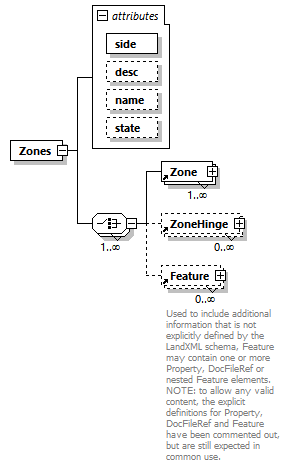 |
||||||||||||||||||||||||||||||
| namespace | http://www.landxml.org/schema/LandXML-2.0 | ||||||||||||||||||||||||||||||
| properties |
|
||||||||||||||||||||||||||||||
| children | Zone ZoneHinge Feature | ||||||||||||||||||||||||||||||
| used by |
|
||||||||||||||||||||||||||||||
| attributes |
|
||||||||||||||||||||||||||||||
| source | <xs:element name="Zones"> <xs:complexType> <xs:choice maxOccurs="unbounded"> <xs:element ref="Zone" maxOccurs="unbounded"/> <xs:element ref="ZoneHinge" minOccurs="0" maxOccurs="unbounded"/> <xs:element ref="Feature" minOccurs="0" maxOccurs="unbounded"/> </xs:choice> <xs:attribute name="side" type="sideofRoadType" use="required"/> <xs:attribute name="desc" type="xs:string"/> <xs:attribute name="name" type="xs:string"/> <xs:attribute name="state" type="stateType"/> </xs:complexType> </xs:element> |
attribute Zones/@side
| type | sideofRoadType | ||||||||||||
| properties |
|
||||||||||||
| facets |
|
||||||||||||
| source | <xs:attribute name="side" type="sideofRoadType" use="required"/> |
attribute Zones/@desc
| type | xs:string |
| source | <xs:attribute name="desc" type="xs:string"/> |
attribute Zones/@name
| type | xs:string |
| source | <xs:attribute name="name" type="xs:string"/> |
attribute Zones/@state
| type | stateType | |||||||||||||||
| facets |
|
|||||||||||||||
| source | <xs:attribute name="state" type="stateType"/> |
element ZoneSlope
| diagram | 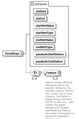 |
||||||||||||||||||||||||||||||||||||||||||||||||||||||
| namespace | http://www.landxml.org/schema/LandXML-2.0 | ||||||||||||||||||||||||||||||||||||||||||||||||||||||
| properties |
|
||||||||||||||||||||||||||||||||||||||||||||||||||||||
| children | Feature | ||||||||||||||||||||||||||||||||||||||||||||||||||||||
| used by |
|
||||||||||||||||||||||||||||||||||||||||||||||||||||||
| attributes |
|
||||||||||||||||||||||||||||||||||||||||||||||||||||||
| source | <xs:element name="ZoneSlope"> <xs:complexType> <xs:choice minOccurs="0" maxOccurs="unbounded"> <xs:element ref="Feature" minOccurs="0" maxOccurs="unbounded"/> </xs:choice> <xs:attribute name="staStart" type="station" use="required"/> <xs:attribute name="staEnd" type="station" use="required"/> <xs:attribute name="startVertValue" type="xs:double"/> <xs:attribute name="startVertType" type="zoneVertType"/> <xs:attribute name="endVertValue" type="xs:double" use="required"/> <xs:attribute name="endVertType" type="zoneVertType" use="required"/> <xs:attribute name="parabolicStartStation" type="station"/> <xs:attribute name="parabolicEndStation" type="station"/> <!-- changeType is a flag that indicates the use of slope or vertical change it can be either "slope" or "vertDistance"--> </xs:complexType> </xs:element> |
attribute ZoneSlope/@staStart
| type | station | ||
| properties |
|
||
| source | <xs:attribute name="staStart" type="station" use="required"/> |
attribute ZoneSlope/@staEnd
| type | station | ||
| properties |
|
||
| source | <xs:attribute name="staEnd" type="station" use="required"/> |
attribute ZoneSlope/@startVertValue
| type | xs:double |
| source | <xs:attribute name="startVertValue" type="xs:double"/> |
attribute ZoneSlope/@startVertType
| type | zoneVertType | |||||||||
| facets |
|
|||||||||
| source | <xs:attribute name="startVertType" type="zoneVertType"/> |
attribute ZoneSlope/@endVertValue
| type | xs:double | ||
| properties |
|
||
| source | <xs:attribute name="endVertValue" type="xs:double" use="required"/> |
attribute ZoneSlope/@endVertType
| type | zoneVertType | |||||||||
| properties |
|
|||||||||
| facets |
|
|||||||||
| source | <xs:attribute name="endVertType" type="zoneVertType" use="required"/> |
attribute ZoneSlope/@parabolicStartStation
| type | station |
| source | <xs:attribute name="parabolicStartStation" type="station"/> |
attribute ZoneSlope/@parabolicEndStation
| type | station |
| source | <xs:attribute name="parabolicEndStation" type="station"/> |
element ZoneWidth
| diagram | 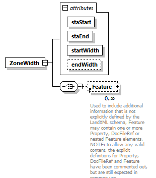 |
||||||||||||||||||||||||||||||
| namespace | http://www.landxml.org/schema/LandXML-2.0 | ||||||||||||||||||||||||||||||
| properties |
|
||||||||||||||||||||||||||||||
| children | Feature | ||||||||||||||||||||||||||||||
| used by |
|
||||||||||||||||||||||||||||||
| attributes |
|
||||||||||||||||||||||||||||||
| source | <xs:element name="ZoneWidth"> <xs:complexType> <xs:choice> <xs:element ref="Feature" minOccurs="0" maxOccurs="unbounded"/> </xs:choice> <xs:attribute name="staStart" type="station" use="required"/> <xs:attribute name="staEnd" type="station" use="required"/> <xs:attribute name="startWidth" type="xs:double" use="required"/> <xs:attribute name="endWidth" type="xs:double"/> </xs:complexType> </xs:element> |
attribute ZoneWidth/@staStart
| type | station | ||
| properties |
|
||
| source | <xs:attribute name="staStart" type="station" use="required"/> |
attribute ZoneWidth/@staEnd
| type | station | ||
| properties |
|
||
| source | <xs:attribute name="staEnd" type="station" use="required"/> |
attribute ZoneWidth/@startWidth
| type | xs:double | ||
| properties |
|
||
| source | <xs:attribute name="startWidth" type="xs:double" use="required"/> |
attribute ZoneWidth/@endWidth
| type | xs:double |
| source | <xs:attribute name="endWidth" type="xs:double"/> |
complexType PointType
| diagram | 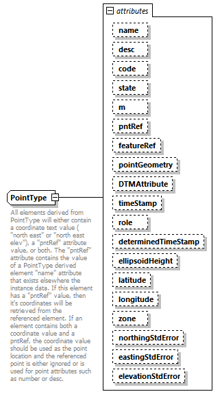 |
||||||||||||||||||||||||||||||||||||||||||||||||||||||||||||||||||||||||||||||||||||||||||||||||||||||||||||||||||||||||
| namespace | http://www.landxml.org/schema/LandXML-2.0 | ||||||||||||||||||||||||||||||||||||||||||||||||||||||||||||||||||||||||||||||||||||||||||||||||||||||||||||||||||||||||
| type | extension of Point3dOpt | ||||||||||||||||||||||||||||||||||||||||||||||||||||||||||||||||||||||||||||||||||||||||||||||||||||||||||||||||||||||||
| properties |
|
||||||||||||||||||||||||||||||||||||||||||||||||||||||||||||||||||||||||||||||||||||||||||||||||||||||||||||||||||||||||
| used by |
|
||||||||||||||||||||||||||||||||||||||||||||||||||||||||||||||||||||||||||||||||||||||||||||||||||||||||||||||||||||||||
| facets |
|
||||||||||||||||||||||||||||||||||||||||||||||||||||||||||||||||||||||||||||||||||||||||||||||||||||||||||||||||||||||||
| attributes |
|
||||||||||||||||||||||||||||||||||||||||||||||||||||||||||||||||||||||||||||||||||||||||||||||||||||||||||||||||||||||||
| annotation |
|
||||||||||||||||||||||||||||||||||||||||||||||||||||||||||||||||||||||||||||||||||||||||||||||||||||||||||||||||||||||||
| source | <xs:complexType name="PointType" mixed="true"> <xs:annotation> <xs:documentation>All elements derived from PointType will either contain a coordinate text value ( "north east" or "north east elev"), a "pntRef" attribute value, or both. The "pntRef" attribute contains the value of a PointType derived element "name" attribute that exists elsewhere the instance data. If this element has a "pntRef" value, then it's coordinates will be retrieved from the referenced element. If an element contains both a coordinate value and a pntRef, the coordinate value should be used as the point location and the referenced point is either ignored or is used for point attributes such as number or desc.</xs:documentation> <xs:documentation>The featureRef attribute points to a specific named Feature element that contains feature data related to the point. The suggested form is to refer to a feature element within the same CgPoints group or parent element of the point element. </xs:documentation> </xs:annotation> <xs:simpleContent> <xs:extension base="Point3dOpt"> <xs:attribute name="name" type="xs:string"/> <xs:attribute name="desc" type="xs:string"/> <xs:attribute name="code" type="xs:string"/> <xs:attribute name="state" type="stateType"/> <xs:attribute name="m" type="materialTableIndexRef" use="optional"/> <xs:attribute name="pntRef" type="pointNameRef"/> <xs:attribute name="featureRef" type="featureNameRef" use="optional"/> <xs:attribute name="pointGeometry" type="pointGeometryType"/> <xs:attribute name="DTMAttribute" type="DTMAttributeType"/> <xs:attribute name="timeStamp" type="xs:dateTime" use="optional"/> <xs:attribute name="role" type="surveyRoleType" use="optional"/> <xs:attribute name="determinedTimeStamp" type="xs:dateTime" use="optional"/> <xs:attribute name="ellipsoidHeight" type="ellipsoidHeightType" use="optional"/> <xs:attribute name="latitude" type="latLongAngle" use="optional"/> <xs:attribute name="longitude" type="latLongAngle" use="optional"/> <xs:attribute name="zone" type="xs:string" use="optional"/> <xs:attribute name="northingStdError" type="xs:double" use="optional"/> <xs:attribute name="eastingStdError" type="xs:double" use="optional"/> <xs:attribute name="elevationStdError" type="xs:double" use="optional"/> </xs:extension> </xs:simpleContent> </xs:complexType> |
attribute PointType/@name
| type | xs:string |
| source | <xs:attribute name="name" type="xs:string"/> |
attribute PointType/@desc
| type | xs:string |
| source | <xs:attribute name="desc" type="xs:string"/> |
attribute PointType/@code
| type | xs:string |
| source | <xs:attribute name="code" type="xs:string"/> |
attribute PointType/@state
| type | stateType | |||||||||||||||
| facets |
|
|||||||||||||||
| source | <xs:attribute name="state" type="stateType"/> |
attribute PointType/@m
| type | materialTableIndexRef | ||
| properties |
|
||
| source | <xs:attribute name="m" type="materialTableIndexRef" use="optional"/> |
attribute PointType/@pntRef
| type | pointNameRef |
| source | <xs:attribute name="pntRef" type="pointNameRef"/> |
attribute PointType/@featureRef
| type | featureNameRef | ||
| properties |
|
||
| source | <xs:attribute name="featureRef" type="featureNameRef" use="optional"/> |
attribute PointType/@pointGeometry
| type | pointGeometryType | |||||||||
| facets |
|
|||||||||
| source | <xs:attribute name="pointGeometry" type="pointGeometryType"/> |
attribute PointType/@DTMAttribute
| type | DTMAttributeType | |||||||||||||||||||||||||||||||||||||||||||||
| facets |
|
|||||||||||||||||||||||||||||||||||||||||||||
| source | <xs:attribute name="DTMAttribute" type="DTMAttributeType"/> |
attribute PointType/@timeStamp
| type | xs:dateTime | ||
| properties |
|
||
| source | <xs:attribute name="timeStamp" type="xs:dateTime" use="optional"/> |
attribute PointType/@role
| type | surveyRoleType | ||||||||||||||||||||||||
| properties |
|
||||||||||||||||||||||||
| facets |
|
||||||||||||||||||||||||
| source | <xs:attribute name="role" type="surveyRoleType" use="optional"/> |
attribute PointType/@determinedTimeStamp
| type | xs:dateTime | ||
| properties |
|
||
| source | <xs:attribute name="determinedTimeStamp" type="xs:dateTime" use="optional"/> |
attribute PointType/@ellipsoidHeight
| type | ellipsoidHeightType | ||
| properties |
|
||
| source | <xs:attribute name="ellipsoidHeight" type="ellipsoidHeightType" use="optional"/> |
attribute PointType/@latitude
| type | latLongAngle | ||
| properties |
|
||
| source | <xs:attribute name="latitude" type="latLongAngle" use="optional"/> |
attribute PointType/@longitude
| type | latLongAngle | ||
| properties |
|
||
| source | <xs:attribute name="longitude" type="latLongAngle" use="optional"/> |
attribute PointType/@zone
| type | xs:string | ||
| properties |
|
||
| source | <xs:attribute name="zone" type="xs:string" use="optional"/> |
attribute PointType/@northingStdError
| type | xs:double | ||
| properties |
|
||
| source | <xs:attribute name="northingStdError" type="xs:double" use="optional"/> |
attribute PointType/@eastingStdError
| type | xs:double | ||
| properties |
|
||
| source | <xs:attribute name="eastingStdError" type="xs:double" use="optional"/> |
attribute PointType/@elevationStdError
| type | xs:double | ||
| properties |
|
||
| source | <xs:attribute name="elevationStdError" type="xs:double" use="optional"/> |
complexType PointType3dReq
| diagram | 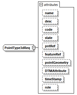 |
||||||||||||||||||||||||||||||||||||||||||||||||||||||||||||||||||
| namespace | http://www.landxml.org/schema/LandXML-2.0 | ||||||||||||||||||||||||||||||||||||||||||||||||||||||||||||||||||
| type | extension of Point3dReq | ||||||||||||||||||||||||||||||||||||||||||||||||||||||||||||||||||
| properties |
|
||||||||||||||||||||||||||||||||||||||||||||||||||||||||||||||||||
| used by |
|
||||||||||||||||||||||||||||||||||||||||||||||||||||||||||||||||||
| facets |
|
||||||||||||||||||||||||||||||||||||||||||||||||||||||||||||||||||
| attributes |
|
||||||||||||||||||||||||||||||||||||||||||||||||||||||||||||||||||
| source | <xs:complexType name="PointType3dReq"> <xs:simpleContent> <xs:extension base="Point3dReq"> <xs:attribute name="name" type="xs:string"/> <xs:attribute name="desc" type="xs:string"/> <xs:attribute name="code" type="xs:string"/> <xs:attribute name="state" type="stateType"/> <xs:attribute name="pntRef" type="pointNameRef"/> <xs:attribute name="featureRef" type="featureNameRef" use="optional"/> <xs:attribute name="pointGeometry" type="pointGeometryType"/> <xs:attribute name="DTMAttribute" type="DTMAttributeType"/> <xs:attribute name="timeStamp" type="xs:dateTime" use="optional"/> <xs:attribute name="role" type="surveyRoleType" use="optional"/> </xs:extension> </xs:simpleContent> </xs:complexType> |
attribute PointType3dReq/@name
| type | xs:string |
| source | <xs:attribute name="name" type="xs:string"/> |
attribute PointType3dReq/@desc
| type | xs:string |
| source | <xs:attribute name="desc" type="xs:string"/> |
attribute PointType3dReq/@code
| type | xs:string |
| source | <xs:attribute name="code" type="xs:string"/> |
attribute PointType3dReq/@state
| type | stateType | |||||||||||||||
| facets |
|
|||||||||||||||
| source | <xs:attribute name="state" type="stateType"/> |
attribute PointType3dReq/@pntRef
| type | pointNameRef |
| source | <xs:attribute name="pntRef" type="pointNameRef"/> |
attribute PointType3dReq/@featureRef
| type | featureNameRef | ||
| properties |
|
||
| source | <xs:attribute name="featureRef" type="featureNameRef" use="optional"/> |
attribute PointType3dReq/@pointGeometry
| type | pointGeometryType | |||||||||
| facets |
|
|||||||||
| source | <xs:attribute name="pointGeometry" type="pointGeometryType"/> |
attribute PointType3dReq/@DTMAttribute
| type | DTMAttributeType | |||||||||||||||||||||||||||||||||||||||||||||
| facets |
|
|||||||||||||||||||||||||||||||||||||||||||||
| source | <xs:attribute name="DTMAttribute" type="DTMAttributeType"/> |
attribute PointType3dReq/@timeStamp
| type | xs:dateTime | ||
| properties |
|
||
| source | <xs:attribute name="timeStamp" type="xs:dateTime" use="optional"/> |
attribute PointType3dReq/@role
| type | surveyRoleType | ||||||||||||||||||||||||
| properties |
|
||||||||||||||||||||||||
| facets |
|
||||||||||||||||||||||||
| source | <xs:attribute name="role" type="surveyRoleType" use="optional"/> |
complexType RawObservationType
| diagram | 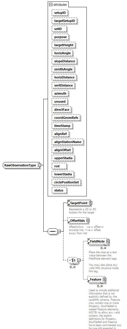 |
||||||||||||||||||||||||||||||||||||||||||||||||||||||||||||||||||||||||||||||||||||||||||||||||||||||||||||||||||||||||||||||||||||||||||||||||
| namespace | http://www.landxml.org/schema/LandXML-2.0 | ||||||||||||||||||||||||||||||||||||||||||||||||||||||||||||||||||||||||||||||||||||||||||||||||||||||||||||||||||||||||||||||||||||||||||||||||
| children | TargetPoint OffsetVals FieldNote Feature | ||||||||||||||||||||||||||||||||||||||||||||||||||||||||||||||||||||||||||||||||||||||||||||||||||||||||||||||||||||||||||||||||||||||||||||||||
| used by |
|
||||||||||||||||||||||||||||||||||||||||||||||||||||||||||||||||||||||||||||||||||||||||||||||||||||||||||||||||||||||||||||||||||||||||||||||||
| attributes |
|
||||||||||||||||||||||||||||||||||||||||||||||||||||||||||||||||||||||||||||||||||||||||||||||||||||||||||||||||||||||||||||||||||||||||||||||||
| source | <xs:complexType name="RawObservationType"> <xs:sequence> <xs:element ref="TargetPoint"/> <xs:element ref="OffsetVals" minOccurs="0"/> <xs:choice minOccurs="0" maxOccurs="unbounded"> <xs:element ref="FieldNote" minOccurs="0" maxOccurs="unbounded"/> <xs:element ref="Feature" minOccurs="0" maxOccurs="unbounded"/> </xs:choice> </xs:sequence> <xs:attribute name="setupID" type="xs:IDREF"/> <xs:attribute name="targetSetupID" type="xs:IDREF"/> <xs:attribute name="setID"/> <xs:attribute name="purpose" type="purposeType"/> <xs:attribute name="targetHeight" type="xs:double"/> <xs:attribute name="horizAngle" type="angle" use="optional"/> <xs:attribute name="slopeDistance" type="xs:double" use="optional"/> <xs:attribute name="zenithAngle" type="zenithAngle" use="optional"/> <xs:attribute name="horizDistance" type="xs:double"/> <xs:attribute name="vertDistance" type="xs:double"/> <xs:attribute name="azimuth" type="direction" use="optional"/> <xs:attribute name="unused" type="xs:boolean"/> <xs:attribute name="directFace" type="xs:boolean"/> <xs:attribute name="coordGeomRefs" type="coordGeomNameRefs"/> <xs:attribute name="timeStamp" type="xs:dateTime"/> <xs:attribute name="alignRef" type="alignmentNameRef"/> <xs:attribute name="alignStationName" type="xs:string"/> <xs:attribute name="alignOffset" type="offsetDistance"/> <xs:attribute name="upperStadia" type="xs:double"/> <xs:attribute name="rod" type="xs:double"/> <xs:attribute name="lowerStadia" type="xs:double"/> <xs:attribute name="circlePositionSet" type="xs:double"/> <xs:attribute name="status" type="observationStatusType"/> <!-- FDOT SURVEY ADDTIONS --> <!-- FDOT notes on RawObservations additions Where: alignRef is the name of the alignment. alignStationName is the station value where the rod reading is taken. alignOffset is the signed (+/-) distance from the CL of the referenced alignment. 3-wire level loop attributes: upperStadia is the upper stadia hair rod reading. rod is the middle hair rod reading. lowerStadia is the lower stadia hair rod reading. circlePositionSet represents the position of the reading circle. This optional attribute (assumed to be "1.0"), unless multiple reading circle positions were present from the same setup record. ‘unused’ = boolean attribute to indicate the record is not used. 'directFace' = indicates the scope is flipped – true if the scope is not flipped, false if it is. --> <!-- coordGeomRefs identifies one or more 'name' values that link to specific <Line>, <Curve>, <Spiral> or <IrregularLine> in a <CoordGeom> element. This allows linking an survey observation to specific <Parcel>.<CoordGeom> based geometry. --> </xs:complexType> |
attribute RawObservationType/@setupID
| type | xs:IDREF |
| source | <xs:attribute name="setupID" type="xs:IDREF"/> |
attribute RawObservationType/@targetSetupID
| type | xs:IDREF |
| source | <xs:attribute name="targetSetupID" type="xs:IDREF"/> |
attribute RawObservationType/@setID
| source | <xs:attribute name="setID"/> |
attribute RawObservationType/@purpose
| type | purposeType | |||||||||||||||||||||||||||||||||||||||||||||
| facets |
|
|||||||||||||||||||||||||||||||||||||||||||||
| source | <xs:attribute name="purpose" type="purposeType"/> |
attribute RawObservationType/@targetHeight
| type | xs:double |
| source | <xs:attribute name="targetHeight" type="xs:double"/> |
attribute RawObservationType/@horizAngle
| type | angle | ||
| properties |
|
||
| source | <xs:attribute name="horizAngle" type="angle" use="optional"/> |
attribute RawObservationType/@slopeDistance
| type | xs:double | ||
| properties |
|
||
| source | <xs:attribute name="slopeDistance" type="xs:double" use="optional"/> |
attribute RawObservationType/@zenithAngle
| type | zenithAngle | ||
| properties |
|
||
| source | <xs:attribute name="zenithAngle" type="zenithAngle" use="optional"/> |
attribute RawObservationType/@horizDistance
| type | xs:double |
| source | <xs:attribute name="horizDistance" type="xs:double"/> |
attribute RawObservationType/@vertDistance
| type | xs:double |
| source | <xs:attribute name="vertDistance" type="xs:double"/> |
attribute RawObservationType/@azimuth
| type | direction | ||
| properties |
|
||
| source | <xs:attribute name="azimuth" type="direction" use="optional"/> |
attribute RawObservationType/@unused
| type | xs:boolean |
| source | <xs:attribute name="unused" type="xs:boolean"/> |
attribute RawObservationType/@directFace
| type | xs:boolean |
| source | <xs:attribute name="directFace" type="xs:boolean"/> |
attribute RawObservationType/@coordGeomRefs
| type | coordGeomNameRefs |
| source | <xs:attribute name="coordGeomRefs" type="coordGeomNameRefs"/> |
attribute RawObservationType/@timeStamp
| type | xs:dateTime |
| source | <xs:attribute name="timeStamp" type="xs:dateTime"/> |
attribute RawObservationType/@alignRef
| type | alignmentNameRef |
| source | <xs:attribute name="alignRef" type="alignmentNameRef"/> |
attribute RawObservationType/@alignStationName
| type | xs:string |
| source | <xs:attribute name="alignStationName" type="xs:string"/> |
attribute RawObservationType/@alignOffset
| type | offsetDistance |
| source | <xs:attribute name="alignOffset" type="offsetDistance"/> |
attribute RawObservationType/@upperStadia
| type | xs:double |
| source | <xs:attribute name="upperStadia" type="xs:double"/> |
attribute RawObservationType/@rod
| type | xs:double |
| source | <xs:attribute name="rod" type="xs:double"/> |
attribute RawObservationType/@lowerStadia
| type | xs:double |
| source | <xs:attribute name="lowerStadia" type="xs:double"/> |
attribute RawObservationType/@circlePositionSet
| type | xs:double |
| source | <xs:attribute name="circlePositionSet" type="xs:double"/> |
attribute RawObservationType/@status
| type | observationStatusType | |||||||||
| facets |
|
|||||||||
| source | <xs:attribute name="status" type="observationStatusType"/> |
simpleType addressPointTypeType
| namespace | http://www.landxml.org/schema/LandXML-2.0 | ||
| type | xs:string | ||
| properties |
|
||
| used by |
|
||
| annotation |
|
||
| source | <xs:simpleType name="addressPointTypeType"> <xs:annotation> <xs:documentation>This is a string to define the type of Geocode that the address point is for examplecentroid of parcel, Access Point etc. This will be a jurisdictionally based list.</xs:documentation> </xs:annotation> <xs:restriction base="xs:string"/> </xs:simpleType> |
simpleType addressTypeType
| namespace | http://www.landxml.org/schema/LandXML-2.0 | ||
| type | xs:string | ||
| properties |
|
||
| used by |
|
||
| annotation |
|
||
| source | <xs:simpleType name="addressTypeType"> <xs:annotation> <xs:documentation>This Type is to define a ljurisdictional specific list of address types such a primary addres, alias, secondary, historical etc.</xs:documentation> </xs:annotation> <xs:restriction base="xs:string"/> </xs:simpleType> |
simpleType adminAreaTypeType
| namespace | http://www.landxml.org/schema/LandXML-2.0 | ||
| type | xs:string | ||
| properties |
|
||
| used by |
|
||
| annotation |
|
||
| source | <xs:simpleType name="adminAreaTypeType"> <xs:annotation> <xs:documentation>This is a jurdictionally specific list of types and may include parish, town, local government, locality etc</xs:documentation> </xs:annotation> <xs:restriction base="xs:string"/> </xs:simpleType> |
simpleType adminDateTypeType
| namespace | http://www.landxml.org/schema/LandXML-2.0 | ||
| type | xs:string | ||
| properties |
|
||
| used by |
|
||
| annotation |
|
||
| source | <xs:simpleType name="adminDateTypeType"> <xs:annotation> <xs:documentation>This is the name of the admin date type for the Survey</xs:documentation> </xs:annotation> <xs:restriction base="xs:string"/> </xs:simpleType> |
simpleType adverseSEType
| namespace | http://www.landxml.org/schema/LandXML-2.0 | |||||||||
| type | restriction of xs:string | |||||||||
| properties |
|
|||||||||
| used by |
|
|||||||||
| facets |
|
|||||||||
| source | <xs:simpleType name="adverseSEType"> <xs:restriction base="xs:string"> <xs:enumeration value="non-adverse"/> <xs:enumeration value="adverse"/> </xs:restriction> </xs:simpleType> |
simpleType alignmentNameRef
| namespace | http://www.landxml.org/schema/LandXML-2.0 | ||
| type | xs:string | ||
| properties |
|
||
| used by | |||
| annotation |
|
||
| source | <xs:simpleType name="alignmentNameRef"> <xs:annotation> <xs:documentation>A reference name value referring to Alignment.name attribute.</xs:documentation> </xs:annotation> <xs:restriction base="xs:string"/> </xs:simpleType> |
simpleType alignmentNameRefs
| namespace | http://www.landxml.org/schema/LandXML-2.0 | ||
| type | list of xs:string | ||
| properties |
|
||
| used by |
|
||
| annotation |
|
||
| source | <xs:simpleType name="alignmentNameRefs"> <xs:annotation> <xs:documentation>A list of reference names values refering to one or more Alignment.name attributes.</xs:documentation> </xs:annotation> <xs:list itemType="xs:string"/> </xs:simpleType> |
simpleType angle
| namespace | http://www.landxml.org/schema/LandXML-2.0 | ||
| type | xs:double | ||
| properties |
|
||
| used by |
|
||
| annotation |
|
||
| source | <xs:simpleType name="angle"> <xs:annotation> <xs:documentation>Represents a normalized angular value in the specified Angular units. Assume 0 degrees = east</xs:documentation> </xs:annotation> <xs:restriction base="xs:double"/> </xs:simpleType> |
simpleType angularType
| namespace | http://www.landxml.org/schema/LandXML-2.0 | |||||||||||||||
| type | restriction of xs:string | |||||||||||||||
| properties |
|
|||||||||||||||
| used by |
|
|||||||||||||||
| facets |
|
|||||||||||||||
| annotation |
|
|||||||||||||||
| source | <xs:simpleType name="angularType"> <xs:annotation> <xs:documentation>angular values expressed in "decimal dd.mm.ss" units have the numeric format "45.3025" representing 45 degrees 30 minutes and 25 seconds. Both the minutes and seconds must be two characters with a numeric range between 00 to 60. </xs:documentation> </xs:annotation> <xs:restriction base="xs:string"> <xs:enumeration value="radians"/> <xs:enumeration value="grads"/> <xs:enumeration value="decimal degrees"/> <xs:enumeration value="decimal dd.mm.ss"/> </xs:restriction> </xs:simpleType> |
simpleType annotationType
| namespace | http://www.landxml.org/schema/LandXML-2.0 | ||
| type | xs:string | ||
| properties |
|
||
| used by |
|
||
| annotation |
|
||
| source | <xs:simpleType name="annotationType"> <xs:annotation> <xs:documentation>An Annotation will be a specific type within a jurisdiction. </xs:documentation> </xs:annotation> <xs:restriction base="xs:string"/> </xs:simpleType> |
simpleType area
| namespace | http://www.landxml.org/schema/LandXML-2.0 | ||
| type | xs:double | ||
| properties |
|
||
| used by |
|
||
| annotation |
|
||
| source | <xs:simpleType name="area"> <xs:annotation> <xs:documentation>Represents the geometric area of a closed boundary in numeric decimal form expressed in area units</xs:documentation> </xs:annotation> <xs:restriction base="xs:double"/> </xs:simpleType> |
simpleType beaconProtectionType
| namespace | http://www.landxml.org/schema/LandXML-2.0 | |||||||||||||||||||||||||||
| type | restriction of xs:string | |||||||||||||||||||||||||||
| properties |
|
|||||||||||||||||||||||||||
| used by |
|
|||||||||||||||||||||||||||
| facets |
|
|||||||||||||||||||||||||||
| annotation |
|
|||||||||||||||||||||||||||
| source | <xs:simpleType name="beaconProtectionType"> <xs:annotation> <xs:documentation>Indicates any structure that protects the monument, these enumerations may need expanding</xs:documentation> </xs:annotation> <xs:restriction base="xs:string"> <xs:enumeration value="cover"/> <xs:enumeration value="cover and box"/> <xs:enumeration value="fence enclosure"/> <xs:enumeration value="marker post"/> <xs:enumeration value="no protection"/> <xs:enumeration value="other"/> <xs:enumeration value="quadripod"/> <xs:enumeration value="unknown"/> </xs:restriction> </xs:simpleType> |
simpleType beaconType
| namespace | http://www.landxml.org/schema/LandXML-2.0 | ||||||||||||||||||||||||||||||||||||||||||||||||
| type | restriction of xs:string | ||||||||||||||||||||||||||||||||||||||||||||||||
| properties |
|
||||||||||||||||||||||||||||||||||||||||||||||||
| used by |
|
||||||||||||||||||||||||||||||||||||||||||||||||
| facets |
|
||||||||||||||||||||||||||||||||||||||||||||||||
| annotation |
|
||||||||||||||||||||||||||||||||||||||||||||||||
| source | <xs:simpleType name="beaconType"> <xs:annotation> <xs:documentation>Indicates whether there is any physical structure for the monument - helps location, these enumerations may need expanding </xs:documentation> </xs:annotation> <xs:restriction base="xs:string"> <xs:enumeration value="cairn"/> <xs:enumeration value="chimney"/> <xs:enumeration value="large quadripod"/> <xs:enumeration value="lighthouse"/> <xs:enumeration value="marine beacon"/> <xs:enumeration value="mast"/> <xs:enumeration value="mast with targets"/> <xs:enumeration value="no beacon"/> <xs:enumeration value="other"/> <xs:enumeration value="pillar"/> <xs:enumeration value="post"/> <xs:enumeration value="small quadripod"/> <xs:enumeration value="tower"/> <xs:enumeration value="tripod"/> <xs:enumeration value="unknown"/> </xs:restriction> </xs:simpleType> |
simpleType breakLineType
| namespace | http://www.landxml.org/schema/LandXML-2.0 | |||||||||||||||
| type | restriction of xs:string | |||||||||||||||
| properties |
|
|||||||||||||||
| used by |
|
|||||||||||||||
| facets |
|
|||||||||||||||
| source | <xs:simpleType name="breakLineType"> <xs:restriction base="xs:string"> <xs:enumeration value="standard"/> <xs:enumeration value="wall"/> <xs:enumeration value="proximity"/> <xs:enumeration value="nondestructive"/> </xs:restriction> </xs:simpleType> |
simpleType bridgeProjectType
| namespace | http://www.landxml.org/schema/LandXML-2.0 | |||||||||
| type | restriction of xs:string | |||||||||
| properties |
|
|||||||||
| used by |
|
|||||||||
| facets |
|
|||||||||
| source | <xs:simpleType name="bridgeProjectType"> <xs:restriction base="xs:string"> <xs:enumeration value="new"/> <xs:enumeration value="existing"/> </xs:restriction> </xs:simpleType> |
simpleType cgPointsNameRef
| namespace | http://www.landxml.org/schema/LandXML-2.0 | ||
| type | xs:string | ||
| properties |
|
||
| annotation |
|
||
| source | <xs:simpleType name="cgPointsNameRef"> <xs:annotation> <xs:documentation>A reference name value referring to a CgPoints name attribute. An attribute if this type contains the value of a CgPoints element "name" attribute that exists elsewhere the instance data.</xs:documentation> </xs:annotation> <xs:restriction base="xs:string"/> </xs:simpleType> |
simpleType cgPointsNameRefs
| namespace | http://www.landxml.org/schema/LandXML-2.0 | ||
| type | list of xs:string | ||
| properties |
|
||
| annotation |
|
||
| source | <xs:simpleType name="cgPointsNameRefs"> <xs:annotation> <xs:documentation>A list of reference names values refering to one or more CgPoints element name attributes.</xs:documentation> </xs:annotation> <xs:list itemType="xs:string"/> </xs:simpleType> |
simpleType ChainType
| namespace | http://www.landxml.org/schema/LandXML-2.0 | ||
| type | list of pointNameRef | ||
| properties |
|
||
| used by |
|
||
| annotation |
|
||
| source | <xs:simpleType name="ChainType"> <xs:annotation> <xs:documentation>A text value that is a space delimited list of CgPoint names that form a linear connected chain. example: <Chain>1 23 45 34</Chain> represents a linear connection between CgPoint name 1, 23, 45 and 34. </xs:documentation> </xs:annotation> <xs:list itemType="pointNameRef"/> </xs:simpleType> |
simpleType circularTaperShape
| namespace | http://www.landxml.org/schema/LandXML-2.0 | ||||||||||||
| type | restriction of xs:string | ||||||||||||
| properties |
|
||||||||||||
| used by |
|
||||||||||||
| facets |
|
||||||||||||
| source | <xs:simpleType name="circularTaperShape"> <xs:restriction base="xs:string"> <xs:enumeration value="symmetric"/> <xs:enumeration value="taperUpstream"/> <xs:enumeration value="taperDownstream"/> </xs:restriction> </xs:simpleType> |
simpleType clockwise
| namespace | http://www.landxml.org/schema/LandXML-2.0 | |||||||||
| type | restriction of xs:string | |||||||||
| properties |
|
|||||||||
| used by |
|
|||||||||
| facets |
|
|||||||||
| source | <xs:simpleType name="clockwise"> <xs:restriction base="xs:string"> <xs:enumeration value="cw"/> <xs:enumeration value="ccw"/> </xs:restriction> </xs:simpleType> |
simpleType connectionType
| namespace | http://www.landxml.org/schema/LandXML-2.0 | ||||||||||||
| type | restriction of xs:string | ||||||||||||
| properties |
|
||||||||||||
| facets |
|
||||||||||||
| source | <xs:simpleType name="connectionType"> <xs:annotation> <xs:documentation/> </xs:annotation> <xs:restriction base="xs:string"> <xs:enumeration value="inner"/> <xs:enumeration value="outer"/> <xs:enumeration value="dayLight"/> </xs:restriction> </xs:simpleType> |
simpleType contructionPurposeType
| namespace | http://www.landxml.org/schema/LandXML-2.0 | |||||||||||||||||||||||||||
| type | restriction of xs:string | |||||||||||||||||||||||||||
| properties |
|
|||||||||||||||||||||||||||
| used by |
|
|||||||||||||||||||||||||||
| facets |
|
|||||||||||||||||||||||||||
| source | <xs:simpleType name="contructionPurposeType"> <xs:restriction base="xs:string"> <xs:enumeration value="building"/> <xs:enumeration value="aboveGroundUtility"/> <xs:enumeration value="belowGroundUtility"/> <xs:enumeration value="publicImperviousArea"/> <xs:enumeration value="privateImperviousArea"/> <xs:enumeration value="barrier"/> <xs:enumeration value="openSpaceArea"/> <xs:enumeration value="utilityEasement"/> </xs:restriction> </xs:simpleType> |
simpleType coordGeomNameRef
| namespace | http://www.landxml.org/schema/LandXML-2.0 | ||
| type | xs:string | ||
| properties |
|
||
| annotation |
|
||
| source | <xs:simpleType name="coordGeomNameRef"> <xs:annotation> <xs:documentation>A reference name value referring to CoordGeom.name attribute.</xs:documentation> </xs:annotation> <xs:restriction base="xs:string"/> </xs:simpleType> |
simpleType coordGeomNameRefs
| namespace | http://www.landxml.org/schema/LandXML-2.0 | ||
| type | list of xs:string | ||
| properties |
|
||
| used by |
|
||
| annotation |
|
||
| source | <xs:simpleType name="coordGeomNameRefs"> <xs:annotation> <xs:documentation>A list of reference names values refering to one or more CoordGeom.name attributes.</xs:documentation> </xs:annotation> <xs:list itemType="xs:string"/> </xs:simpleType> |
simpleType cornerType
| namespace | http://www.landxml.org/schema/LandXML-2.0 | ||||||
| type | restriction of xs:string | ||||||
| properties |
|
||||||
| used by |
|
||||||
| facets |
|
||||||
| source | <xs:simpleType name="cornerType"> <xs:restriction base="xs:string"> <xs:enumeration value="unknown"/> </xs:restriction> <!-- PLACEHOLDER NEED ENUMERATION VALUES ! --> </xs:simpleType> |
simpleType crashIntersectionRelation
| namespace | http://www.landxml.org/schema/LandXML-2.0 | ||||||||||||
| type | restriction of xs:string | ||||||||||||
| properties |
|
||||||||||||
| used by |
|
||||||||||||
| facets |
|
||||||||||||
| source | <xs:simpleType name="crashIntersectionRelation"> <xs:restriction base="xs:string"> <xs:enumeration value="unknown"/> <xs:enumeration value="non-intersection-related"/> <xs:enumeration value="intersection-related"/> </xs:restriction> </xs:simpleType> |
simpleType crashSeverityType
| namespace | http://www.landxml.org/schema/LandXML-2.0 | ||||||||||||
| type | restriction of xs:string | ||||||||||||
| properties |
|
||||||||||||
| used by |
|
||||||||||||
| facets |
|
||||||||||||
| source | <xs:simpleType name="crashSeverityType"> <xs:restriction base="xs:string"> <xs:enumeration value="fatal"/> <xs:enumeration value="nonfatal "/> <xs:enumeration value="propery-damage-only"/> </xs:restriction> </xs:simpleType> |
simpleType crossSectionPnt
| namespace | http://www.landxml.org/schema/LandXML-2.0 | ||||||
| type | Point2dReq | ||||||
| properties |
|
||||||
| used by |
|
||||||
| facets |
|
||||||
| annotation |
|
||||||
| source | <xs:simpleType name="crossSectionPnt"> <xs:annotation> <xs:documentation>Attribute that represents a space delimited, cross section offset/elevation pair. Example: crossSectionPnt="12.0 723.3456" </xs:documentation> </xs:annotation> <xs:restriction base="Point2dReq"/> </xs:simpleType> |
simpleType crossSectSurfaceArea
| namespace | http://www.landxml.org/schema/LandXML-2.0 | ||
| type | xs:double | ||
| properties |
|
||
| used by |
|
||
| annotation |
|
||
| source | <xs:simpleType name="crossSectSurfaceArea"> <xs:annotation> <xs:documentation>Represents the cross sectional surface area in numeric decimal form expressed in area units</xs:documentation> </xs:annotation> <xs:restriction base="xs:double"/> </xs:simpleType> |
simpleType crossSectSurfaceVolume
| namespace | http://www.landxml.org/schema/LandXML-2.0 | ||
| type | xs:double | ||
| properties |
|
||
| used by |
|
||
| annotation |
|
||
| source | <xs:simpleType name="crossSectSurfaceVolume"> <xs:annotation> <xs:documentation>Represents the cross section surface volume from the previous station to the current station in numeric decimal form expressed in volume units</xs:documentation> </xs:annotation> <xs:restriction base="xs:double"/> </xs:simpleType> |
simpleType crossSlope
| namespace | http://www.landxml.org/schema/LandXML-2.0 | ||
| type | xs:double | ||
| properties |
|
||
| used by |
|
||
| annotation |
|
||
| source | <xs:simpleType name="crossSlope"> <xs:annotation> <xs:documentation>This item is the cross slope, the slope of the traveled way as measure perpendicular to the horizontal alignment, negative when the shoulder has a lower elevation than the centerline. The unit of measure for this item is PERCENT %.</xs:documentation> </xs:annotation> <xs:restriction base="xs:double"/> </xs:simpleType> |
simpleType curbThroatType
| namespace | http://www.landxml.org/schema/LandXML-2.0 | ||||||||||||
| type | restriction of xs:string | ||||||||||||
| properties |
|
||||||||||||
| used by |
|
||||||||||||
| facets |
|
||||||||||||
| source | <xs:simpleType name="curbThroatType"> <xs:restriction base="xs:string"> <xs:enumeration value="horizontal"/> <xs:enumeration value="inclined"/> <xs:enumeration value="vertical"/> </xs:restriction> </xs:simpleType> |
simpleType curbType
| namespace | http://www.landxml.org/schema/LandXML-2.0 | ||||||
| type | restriction of xs:string | ||||||
| properties |
|
||||||
| used by |
|
||||||
| facets |
|
||||||
| source | <xs:simpleType name="curbType"> <xs:restriction base="xs:string"> <xs:enumeration value="unknown"/> </xs:restriction> <!-- PLACEHOLDER NEED ENUMERATION VALUES ! --> </xs:simpleType> |
simpleType curveType
| namespace | http://www.landxml.org/schema/LandXML-2.0 | |||||||||
| type | restriction of xs:string | |||||||||
| properties |
|
|||||||||
| used by |
|
|||||||||
| facets |
|
|||||||||
| source | <xs:simpleType name="curveType"> <xs:restriction base="xs:string"> <xs:enumeration value="arc"/> <xs:enumeration value="chord"/> </xs:restriction> </xs:simpleType> |
simpleType dataFormatType
| namespace | http://www.landxml.org/schema/LandXML-2.0 | |||||||||
| type | restriction of xs:string | |||||||||
| properties |
|
|||||||||
| used by |
|
|||||||||
| facets |
|
|||||||||
| source | <xs:simpleType name="dataFormatType"> <xs:annotation> <xs:documentation/> </xs:annotation> <xs:restriction base="xs:string"> <xs:enumeration value="Offset Elevation"/> <xs:enumeration value="Slope Distance"/> </xs:restriction> </xs:simpleType> |
simpleType DesignCrossSectionTemplateTableIndexRef
| namespace | http://www.landxml.org/schema/LandXML-2.0 | ||
| type | list of xs:integer | ||
| properties |
|
||
| used by |
|
||
| annotation |
|
||
| source | <xs:simpleType name="DesignCrossSectionTemplateTableIndexRef"> <xs:annotation> <xs:documentation>A integer based index value to a DesignCrossSectionTemplate element in the DesignCrossSectionTemplateTable.</xs:documentation> </xs:annotation> <xs:list itemType="xs:integer"/> </xs:simpleType> |
simpleType designLocationType
| namespace | http://www.landxml.org/schema/LandXML-2.0 | ||||||||||||
| type | restriction of xs:string | ||||||||||||
| properties |
|
||||||||||||
| facets |
|
||||||||||||
| source | <xs:simpleType name="designLocationType"> <xs:annotation> <xs:documentation/> </xs:annotation> <xs:restriction base="xs:string"> <xs:enumeration value="Final Surface"/> <xs:enumeration value="Datum"/> <xs:enumeration value="Intermediate"/> </xs:restriction> </xs:simpleType> |
simpleType direction
| namespace | http://www.landxml.org/schema/LandXML-2.0 | ||
| type | xs:double | ||
| properties |
|
||
| used by | |||
| annotation |
|
||
| source | <xs:simpleType name="direction"> <xs:annotation> <xs:documentation>Represents a normalized angular value that indicates a horizontal direction, expressed in the specified Direction units. Assume 0 degrees = north </xs:documentation> </xs:annotation> <xs:restriction base="xs:double"/> </xs:simpleType> |
simpleType ditchBottomShape
| namespace | http://www.landxml.org/schema/LandXML-2.0 | |||||||||||||||
| type | restriction of xs:string | |||||||||||||||
| properties |
|
|||||||||||||||
| used by |
|
|||||||||||||||
| facets |
|
|||||||||||||||
| source | <xs:simpleType name="ditchBottomShape"> <xs:restriction base="xs:string"> <xs:enumeration value="true-V"/> <xs:enumeration value="rounded-V"/> <xs:enumeration value="rounded-trapezoidal"/> <xs:enumeration value="flat-trapezoidal"/> </xs:restriction> </xs:simpleType> |
simpleType documentStatusType
| namespace | http://www.landxml.org/schema/LandXML-2.0 | ||
| type | xs:string | ||
| properties |
|
||
| used by |
|
||
| annotation |
|
||
| source | <xs:simpleType name="documentStatusType"> <xs:annotation> <xs:documentation>This field identifes the legal status for this document, for example it is the leagal record of survey, if was data captured from historical data etc. This is used to determine processing of the record</xs:documentation> </xs:annotation> <xs:restriction base="xs:string"/> </xs:simpleType> |
simpleType drivewayDensity
| namespace | http://www.landxml.org/schema/LandXML-2.0 | ||
| type | xs:double | ||
| properties |
|
||
| annotation |
|
||
| source | <xs:simpleType name="drivewayDensity"> <xs:annotation> <xs:documentation>This item is the driveway density for both sides of the roadway combined. The unit of measure for this item is driveways/kilometer for Metric units and driveways/mile for Imperial. </xs:documentation> </xs:annotation> <xs:restriction base="xs:double"/> </xs:simpleType> |
simpleType DTMAttributeType
| namespace | http://www.landxml.org/schema/LandXML-2.0 | |||||||||||||||||||||||||||||||||||||||||||||
| type | restriction of xs:string | |||||||||||||||||||||||||||||||||||||||||||||
| properties |
|
|||||||||||||||||||||||||||||||||||||||||||||
| used by |
|
|||||||||||||||||||||||||||||||||||||||||||||
| facets |
|
|||||||||||||||||||||||||||||||||||||||||||||
| source | <xs:simpleType name="DTMAttributeType"> <xs:restriction base="xs:string"> <xs:enumeration value="determinebyfeature"/> <xs:enumeration value="donotinclude"/> <xs:enumeration value="spot"/> <xs:enumeration value="spotandbreak"/> <xs:enumeration value="void"/> <xs:enumeration value="drapevoid"/> <xs:enumeration value="breakvoid"/> <xs:enumeration value="island"/> <xs:enumeration value="boundary"/> <xs:enumeration value="contour"/> <xs:enumeration value="feature"/> <xs:enumeration value="ground"/> <xs:enumeration value="xsection"/> <xs:enumeration value="user"/> </xs:restriction> </xs:simpleType> |
simpleType elevationType
| namespace | http://www.landxml.org/schema/LandXML-2.0 | |||||||||||||||
| type | restriction of xs:string | |||||||||||||||
| properties |
|
|||||||||||||||
| used by |
|
|||||||||||||||
| facets |
|
|||||||||||||||
| annotation |
|
|||||||||||||||
| source | <xs:simpleType name="elevationType"> <xs:annotation> <xs:documentation>Represents the elevation unit for elevation attribute values, such as ellipsoidHeight</xs:documentation> </xs:annotation> <xs:restriction base="xs:string"> <xs:enumeration value="meter"/> <xs:enumeration value="kilometer"/> <xs:enumeration value="feet"/> <xs:enumeration value="miles"/> </xs:restriction> </xs:simpleType> |
simpleType ellipsoidHeightType
| namespace | http://www.landxml.org/schema/LandXML-2.0 | ||
| type | xs:double | ||
| properties |
|
||
| used by |
|
||
| annotation |
|
||
| source | <xs:simpleType name="ellipsoidHeightType"> <xs:annotation> <xs:documentation>Represents the National Geodedic Survey ellipsiod height expressed in the unit height attribute value</xs:documentation> </xs:annotation> <xs:restriction base="xs:double"/> </xs:simpleType> |
simpleType encodingType
| namespace | http://www.landxml.org/schema/LandXML-2.0 | |||||||||
| type | restriction of xs:string | |||||||||
| properties |
|
|||||||||
| facets |
|
|||||||||
| source | <xs:simpleType name="encodingType"> <xs:restriction base="xs:string"> <xs:enumeration value="hex"/> <xs:enumeration value="ascii"/> </xs:restriction> </xs:simpleType> |
simpleType equipmentType
| namespace | http://www.landxml.org/schema/LandXML-2.0 | ||
| type | xs:string | ||
| properties |
|
||
| used by |
|
||
| annotation |
|
||
| source | <xs:simpleType name="equipmentType"> <xs:annotation> <xs:documentation>This gives a list of equipment used for the observation this list of equipment is used to estimate the accuracy of the observation.. </xs:documentation> </xs:annotation> <xs:restriction base="xs:string"/> </xs:simpleType> |
simpleType exclusType
| namespace | http://www.landxml.org/schema/LandXML-2.0 | ||
| type | xs:string | ||
| properties |
|
||
| used by |
|
||
| annotation |
|
||
| source | <xs:simpleType name="exclusType"> <xs:annotation> <xs:documentation>This is a jurisdictionally based list of exclusions for a Title example would be exclusions for Road, Track, Esplanade etc </xs:documentation> </xs:annotation> <xs:restriction base="xs:string"/> </xs:simpleType> |
simpleType FaceType
| namespace | http://www.landxml.org/schema/LandXML-2.0 | ||||
| type | list of xs:integer | ||||
| properties |
|
||||
| used by |
|
||||
| source | <xs:simpleType name="FaceType"> <xs:list itemType="xs:integer"/> </xs:simpleType> |
simpleType featureNameRef
| namespace | http://www.landxml.org/schema/LandXML-2.0 | ||
| type | xs:string | ||
| properties |
|
||
| used by |
|
||
| annotation |
|
||
| source | <xs:simpleType name="featureNameRef"> <xs:annotation> <xs:documentation>A Feature element name attribute reference value refering to one Feature.name attribute.</xs:documentation> </xs:annotation> <xs:restriction base="xs:string"/> </xs:simpleType> |
simpleType flatTypeType
| namespace | http://www.landxml.org/schema/LandXML-2.0 | ||
| type | xs:string | ||
| properties |
|
||
| used by |
|
||
| annotation |
|
||
| source | <xs:simpleType name="flatTypeType"> <xs:annotation> <xs:documentation>To define a Jurisdictional specific list of address living unit types for addressing</xs:documentation> </xs:annotation> <xs:restriction base="xs:string"/> </xs:simpleType> |
simpleType floorLevelTypeType
| namespace | http://www.landxml.org/schema/LandXML-2.0 | ||
| type | xs:string | ||
| properties |
|
||
| used by |
|
||
| annotation |
|
||
| source | <xs:simpleType name="floorLevelTypeType"> <xs:annotation> <xs:documentation>To define a jurisdictionally specific list of floo level types for example, Lower Ground Floor</xs:documentation> </xs:annotation> <xs:restriction base="xs:string"/> </xs:simpleType> |
simpleType functionalClassType
| namespace | http://www.landxml.org/schema/LandXML-2.0 | ||||||||||||
| type | restriction of xs:string | ||||||||||||
| properties |
|
||||||||||||
| used by |
|
||||||||||||
| facets |
|
||||||||||||
| source | <xs:simpleType name="functionalClassType"> <xs:restriction base="xs:string"> <xs:enumeration value="arterial"/> <xs:enumeration value="collector "/> <xs:enumeration value="local"/> </xs:restriction> </xs:simpleType> |
simpleType GPSSolutionFrequencyEnum
| namespace | http://www.landxml.org/schema/LandXML-2.0 | ||||||||||||||||||||||||
| type | restriction of xs:string | ||||||||||||||||||||||||
| properties |
|
||||||||||||||||||||||||
| used by |
|
||||||||||||||||||||||||
| facets |
|
||||||||||||||||||||||||
| annotation |
|
||||||||||||||||||||||||
| source | <xs:simpleType name="GPSSolutionFrequencyEnum"> <xs:annotation> <xs:documentation>The GPS solution frequency indicates the GPS frequencies used in the computed solution for a GPS vector or position </xs:documentation> </xs:annotation> <xs:restriction base="xs:string"> <xs:enumeration value="Unknown"/> <xs:enumeration value="L1"/> <xs:enumeration value="L2"/> <xs:enumeration value="L2 Squared"/> <xs:enumeration value="Wide Lane"/> <xs:enumeration value="Narrow Lane"/> <xs:enumeration value="Iono Free"/> </xs:restriction> </xs:simpleType> |
simpleType GPSSolutionTypeEnum
| namespace | http://www.landxml.org/schema/LandXML-2.0 | |||||||||||||||||||||||||||
| type | restriction of xs:string | |||||||||||||||||||||||||||
| properties |
|
|||||||||||||||||||||||||||
| used by |
|
|||||||||||||||||||||||||||
| facets |
|
|||||||||||||||||||||||||||
| annotation |
|
|||||||||||||||||||||||||||
| source | <xs:simpleType name="GPSSolutionTypeEnum"> <xs:annotation> <xs:documentation>The GPS solution type indicates the type of computed solution for a GPS vector or position</xs:documentation> </xs:annotation> <xs:restriction base="xs:string"> <xs:enumeration value="Unknown"/> <xs:enumeration value="Code"/> <xs:enumeration value="Float"/> <xs:enumeration value="Fixed"/> <xs:enumeration value="Network Float"/> <xs:enumeration value="Network Fixed"/> <xs:enumeration value="WAAS Float"/> <xs:enumeration value="WAAS Fixed"/> </xs:restriction> </xs:simpleType> |
simpleType GPSTime
| namespace | http://www.landxml.org/schema/LandXML-2.0 | ||
| type | xs:double | ||
| properties |
|
||
| used by |
|
||
| annotation |
|
||
| source | <xs:simpleType name="GPSTime"> <xs:annotation> <xs:documentation> GPS Time = Nbr of GPS weeks * 604800 (seconds in a week) + seconds in GPS week.</xs:documentation> </xs:annotation> <xs:restriction base="xs:double"/> <!-- GPS Time = Nbr of GPS weeks * 604800 (seconds in a week) + seconds in GPS week --> </xs:simpleType> |
simpleType gradeModelNameRef
| namespace | http://www.landxml.org/schema/LandXML-2.0 | ||
| type | xs:string | ||
| properties |
|
||
| annotation |
|
||
| source | <xs:simpleType name="gradeModelNameRef"> <xs:annotation> <xs:documentation>A reference name value referring to GradeModel.name attribute.</xs:documentation> </xs:annotation> <xs:restriction base="xs:string"/> </xs:simpleType> |
simpleType gradeModelNameRefs
| namespace | http://www.landxml.org/schema/LandXML-2.0 | ||
| type | list of xs:string | ||
| properties |
|
||
| used by |
|
||
| annotation |
|
||
| source | <xs:simpleType name="gradeModelNameRefs"> <xs:annotation> <xs:documentation>A list of reference names values refering to one or more GradeModel.name attributes.</xs:documentation> </xs:annotation> <xs:list itemType="xs:string"/> </xs:simpleType> |
simpleType headOfPowerType
| namespace | http://www.landxml.org/schema/LandXML-2.0 | ||
| type | xs:string | ||
| properties |
|
||
| used by |
|
||
| annotation |
|
||
| source | <xs:simpleType name="headOfPowerType"> <xs:annotation> <xs:documentation>Details the legislation or regulation under which the survey was conducted, for example the Land Title Act2003 This list will be juridictionnally specific.</xs:documentation> </xs:annotation> <xs:restriction base="xs:string"/> </xs:simpleType> |
simpleType impArea
| namespace | http://www.landxml.org/schema/LandXML-2.0 | |||||||||||||||
| type | restriction of xs:string | |||||||||||||||
| properties |
|
|||||||||||||||
| used by |
|
|||||||||||||||
| facets |
|
|||||||||||||||
| source | <xs:simpleType name="impArea"> <xs:restriction base="xs:string"> <xs:enumeration value="acre"/> <xs:enumeration value="squareFoot"/> <xs:enumeration value="squareInch"/> <xs:enumeration value="squareMiles"/> </xs:restriction> </xs:simpleType> |
simpleType impDiameter
| namespace | http://www.landxml.org/schema/LandXML-2.0 | ||||||||||||
| type | restriction of xs:string | ||||||||||||
| properties |
|
||||||||||||
| used by |
|
||||||||||||
| facets |
|
||||||||||||
| source | <xs:simpleType name="impDiameter"> <xs:restriction base="xs:string"> <xs:enumeration value="foot"/> <xs:enumeration value="USSurveyFoot"/> <xs:enumeration value="inch"/> </xs:restriction> </xs:simpleType> |
simpleType impFlow
| namespace | http://www.landxml.org/schema/LandXML-2.0 | |||||||||||||||||||||||||||
| type | restriction of xs:string | |||||||||||||||||||||||||||
| properties |
|
|||||||||||||||||||||||||||
| used by |
|
|||||||||||||||||||||||||||
| facets |
|
|||||||||||||||||||||||||||
| source | <xs:simpleType name="impFlow"> <xs:restriction base="xs:string"> <xs:enumeration value="US_gallonPerDay"/> <xs:enumeration value="IMP_gallonPerDay"/> <xs:enumeration value="cubicFeetDay"/> <xs:enumeration value="US_gallonPerMinute"/> <xs:enumeration value="IMP_gallonPerMinute"/> <xs:enumeration value="acreFeetDay"/> <xs:enumeration value="cubicFeetSecond"/> <xs:enumeration value="cubicMeterSecond"/> </xs:restriction> </xs:simpleType> |
simpleType impHeight
| namespace | http://www.landxml.org/schema/LandXML-2.0 | ||||||||||||
| type | restriction of xs:string | ||||||||||||
| properties |
|
||||||||||||
| used by |
|
||||||||||||
| facets |
|
||||||||||||
| source | <xs:simpleType name="impHeight"> <xs:restriction base="xs:string"> <xs:enumeration value="foot"/> <xs:enumeration value="USSurveyFoot"/> <xs:enumeration value="inch"/> </xs:restriction> </xs:simpleType> |
simpleType impLinear
| namespace | http://www.landxml.org/schema/LandXML-2.0 | |||||||||||||||
| type | restriction of xs:string | |||||||||||||||
| properties |
|
|||||||||||||||
| used by |
|
|||||||||||||||
| facets |
|
|||||||||||||||
| source | <xs:simpleType name="impLinear"> <xs:restriction base="xs:string"> <xs:enumeration value="foot"/> <xs:enumeration value="USSurveyFoot"/> <xs:enumeration value="inch"/> <xs:enumeration value="mile"/> </xs:restriction> </xs:simpleType> |
simpleType impPressure
| namespace | http://www.landxml.org/schema/LandXML-2.0 | |||||||||
| type | restriction of xs:string | |||||||||
| properties |
|
|||||||||
| used by |
|
|||||||||
| facets |
|
|||||||||
| source | <xs:simpleType name="impPressure"> <xs:restriction base="xs:string"> <xs:enumeration value="inchHG"/> <xs:enumeration value="inHG"/> </xs:restriction> </xs:simpleType> |
simpleType impTemperature
| namespace | http://www.landxml.org/schema/LandXML-2.0 | |||||||||
| type | restriction of xs:string | |||||||||
| properties |
|
|||||||||
| used by |
|
|||||||||
| facets |
|
|||||||||
| source | <xs:simpleType name="impTemperature"> <xs:restriction base="xs:string"> <xs:enumeration value="fahrenheit"/> <xs:enumeration value="kelvin"/> </xs:restriction> </xs:simpleType> |
simpleType impVelocity
| namespace | http://www.landxml.org/schema/LandXML-2.0 | |||||||||
| type | restriction of xs:string | |||||||||
| properties |
|
|||||||||
| used by |
|
|||||||||
| facets |
|
|||||||||
| source | <xs:simpleType name="impVelocity"> <xs:restriction base="xs:string"> <xs:enumeration value="feetPerSecond"/> <xs:enumeration value="milesPerHour"/> </xs:restriction> </xs:simpleType> |
simpleType impVolume
| namespace | http://www.landxml.org/schema/LandXML-2.0 | |||||||||||||||||||||
| type | restriction of xs:string | |||||||||||||||||||||
| properties |
|
|||||||||||||||||||||
| used by |
|
|||||||||||||||||||||
| facets |
|
|||||||||||||||||||||
| source | <xs:simpleType name="impVolume"> <xs:restriction base="xs:string"> <xs:enumeration value="US_gallon"/> <xs:enumeration value="IMP_gallon"/> <xs:enumeration value="cubicInch"/> <xs:enumeration value="cubicFeet"/> <xs:enumeration value="cubicYard"/> <xs:enumeration value="acreFeet"/> </xs:restriction> </xs:simpleType> |
simpleType impWidth
| namespace | http://www.landxml.org/schema/LandXML-2.0 | ||||||||||||
| type | restriction of xs:string | ||||||||||||
| properties |
|
||||||||||||
| used by |
|
||||||||||||
| facets |
|
||||||||||||
| source | <xs:simpleType name="impWidth"> <xs:restriction base="xs:string"> <xs:enumeration value="foot"/> <xs:enumeration value="USSurveyFoot"/> <xs:enumeration value="inch"/> </xs:restriction> </xs:simpleType> |
simpleType inletProfileType
| namespace | http://www.landxml.org/schema/LandXML-2.0 | |||||||||
| type | restriction of xs:string | |||||||||
| properties |
|
|||||||||
| facets |
|
|||||||||
| source | <xs:simpleType name="inletProfileType"> <xs:restriction base="xs:string"> <xs:enumeration value="sag"/> <xs:enumeration value="grade"/> </xs:restriction> </xs:simpleType> |
simpleType inOut
| namespace | http://www.landxml.org/schema/LandXML-2.0 | ||||||||||||
| type | restriction of xs:string | ||||||||||||
| properties |
|
||||||||||||
| used by |
|
||||||||||||
| facets |
|
||||||||||||
| source | <xs:simpleType name="inOut"> <xs:restriction base="xs:string"> <xs:enumeration value="in"/> <xs:enumeration value="out"/> <xs:enumeration value="both"/> </xs:restriction> </xs:simpleType> |
simpleType intersectionConstructionType
| namespace | http://www.landxml.org/schema/LandXML-2.0 | ||||||||||||
| type | restriction of xs:string | ||||||||||||
| properties |
|
||||||||||||
| used by |
|
||||||||||||
| facets |
|
||||||||||||
| source | <xs:simpleType name="intersectionConstructionType"> <xs:restriction base="xs:string"> <xs:enumeration value="existing"/> <xs:enumeration value="improvement"/> <xs:enumeration value="new"/> </xs:restriction> </xs:simpleType> |
simpleType jurisdictionType
| namespace | http://www.landxml.org/schema/LandXML-2.0 | ||
| type | xs:string | ||
| properties |
|
||
| used by |
|
||
| annotation |
|
||
| source | <xs:simpleType name="jurisdictionType"> <xs:annotation> <xs:documentation>This is the name of the juridiction in which the Survey Lies (ie which state)</xs:documentation> </xs:annotation> <xs:restriction base="xs:string"/> </xs:simpleType> |
simpleType laneTaperType
| namespace | http://www.landxml.org/schema/LandXML-2.0 | |||||||||||||||
| type | restriction of xs:string | |||||||||||||||
| properties |
|
|||||||||||||||
| used by |
|
|||||||||||||||
| facets |
|
|||||||||||||||
| source | <xs:simpleType name="laneTaperType"> <xs:restriction base="xs:string"> <xs:enumeration value="straight-line"/> <xs:enumeration value="partial-tangent"/> <xs:enumeration value="symmetrical-reverse-curve"/> <xs:enumeration value="asymmetrical-reverse-curve"/> </xs:restriction> </xs:simpleType> |
simpleType latLongAngle
| namespace | http://www.landxml.org/schema/LandXML-2.0 | ||
| type | xs:double | ||
| properties |
|
||
| used by |
|
||
| annotation |
|
||
| source | <xs:simpleType name="latLongAngle"> <xs:annotation> <xs:documentation>Latitude/Longitude coordinate angular values expressed in latLongAngularUnit. Latitude (range -90 to +90) positive values for the northern hemispher, negative indicate the southern. Longitude (range -180 to +180) positive values are to the east of the prime meridian, negative values are to the west. Values expressed in "decimal dd.mm.ss" units have the numeric format "45.3025" representing 45 degrees 30 minutes and 25 seconds. Both the minutes and seconds must be two characters with a numeric range between 00 to 60.</xs:documentation> </xs:annotation> <xs:restriction base="xs:double"/> </xs:simpleType> |
simpleType latLongAngularType
| namespace | http://www.landxml.org/schema/LandXML-2.0 | |||||||||||||||
| type | restriction of xs:string | |||||||||||||||
| properties |
|
|||||||||||||||
| used by |
|
|||||||||||||||
| facets |
|
|||||||||||||||
| annotation |
|
|||||||||||||||
| source | <xs:simpleType name="latLongAngularType"> <xs:annotation> <xs:documentation>Latitude/Longitude coordinate angular values. Latitude (range -90 to +90) positive values for the northern hemispher, negative indicate the southern. Longitude (range -180 to +180) positive values are to the east of the prime meridian, negative values are to the west. Values expressed in "decimal dd.mm.ss" units have the numeric format "45.3025" representing 45 degrees 30 minutes and 25 seconds. Both the minutes and seconds must be two characters with a numeric range between 00 to 60. </xs:documentation> </xs:annotation> <xs:restriction base="xs:string"> <xs:enumeration value="radians"/> <xs:enumeration value="grads"/> <xs:enumeration value="decimal degrees"/> <xs:enumeration value="decimal dd.mm.ss"/> </xs:restriction> </xs:simpleType> |
simpleType lineTypes
| namespace | http://www.landxml.org/schema/LandXML-2.0 | |||||||||||||||||||||
| type | restriction of xs:string | |||||||||||||||||||||
| properties |
|
|||||||||||||||||||||
| used by |
|
|||||||||||||||||||||
| facets |
|
|||||||||||||||||||||
| annotation |
|
|||||||||||||||||||||
| source | <xs:simpleType name="lineTypes"> <xs:annotation> <xs:documentation>basic CAD style line types</xs:documentation> </xs:annotation> <xs:restriction base="xs:string"> <xs:enumeration value="Dashed"/> <xs:enumeration value="Dot"/> <xs:enumeration value="Center"/> <xs:enumeration value="Divide"/> <xs:enumeration value="Hidden"/> <xs:enumeration value="Phantom"/> </xs:restriction> </xs:simpleType> |
simpleType maneuverType
| namespace | http://www.landxml.org/schema/LandXML-2.0 | |||||||||
| type | restriction of xs:string | |||||||||
| properties |
|
|||||||||
| used by |
|
|||||||||
| facets |
|
|||||||||
| source | <xs:simpleType name="maneuverType"> <xs:restriction base="xs:string"> <xs:enumeration value="A-stop-on-rural-road"/> <xs:enumeration value="C-speed-path-direction-change-on-rural-road"/> </xs:restriction> </xs:simpleType> |
simpleType materialTableIndexRef
| namespace | http://www.landxml.org/schema/LandXML-2.0 | ||
| type | list of xs:integer | ||
| properties |
|
||
| used by | |||
| annotation |
|
||
| source | <xs:simpleType name="materialTableIndexRef"> <xs:annotation> <xs:documentation>A integer based index value to a table item in the material table.</xs:documentation> </xs:annotation> <xs:list itemType="xs:integer"/> </xs:simpleType> |
simpleType metArea
| namespace | http://www.landxml.org/schema/LandXML-2.0 | |||||||||||||||
| type | restriction of xs:string | |||||||||||||||
| properties |
|
|||||||||||||||
| used by |
|
|||||||||||||||
| facets |
|
|||||||||||||||
| source | <xs:simpleType name="metArea"> <xs:restriction base="xs:string"> <xs:enumeration value="hectare"/> <xs:enumeration value="squareMeter"/> <xs:enumeration value="squareMillimeter"/> <xs:enumeration value="squareCentimeter"/> </xs:restriction> </xs:simpleType> |
simpleType metDiameter
| namespace | http://www.landxml.org/schema/LandXML-2.0 | |||||||||||||||
| type | restriction of xs:string | |||||||||||||||
| properties |
|
|||||||||||||||
| used by |
|
|||||||||||||||
| facets |
|
|||||||||||||||
| source | <xs:simpleType name="metDiameter"> <xs:restriction base="xs:string"> <xs:enumeration value="millimeter"/> <xs:enumeration value="centimeter"/> <xs:enumeration value="meter"/> <xs:enumeration value="kilometer"/> </xs:restriction> </xs:simpleType> |
simpleType metFlow
| namespace | http://www.landxml.org/schema/LandXML-2.0 | ||||||||||||
| type | restriction of xs:string | ||||||||||||
| properties |
|
||||||||||||
| used by |
|
||||||||||||
| facets |
|
||||||||||||
| source | <xs:simpleType name="metFlow"> <xs:restriction base="xs:string"> <xs:enumeration value="cubicMeterSecond"/> <xs:enumeration value="literPerSecond"/> <xs:enumeration value="literPerMinute"/> </xs:restriction> </xs:simpleType> |
simpleType metHeight
| namespace | http://www.landxml.org/schema/LandXML-2.0 | |||||||||||||||
| type | restriction of xs:string | |||||||||||||||
| properties |
|
|||||||||||||||
| used by |
|
|||||||||||||||
| facets |
|
|||||||||||||||
| source | <xs:simpleType name="metHeight"> <xs:restriction base="xs:string"> <xs:enumeration value="millimeter"/> <xs:enumeration value="centimeter"/> <xs:enumeration value="meter"/> <xs:enumeration value="kilometer"/> </xs:restriction> </xs:simpleType> |
simpleType metLinear
| namespace | http://www.landxml.org/schema/LandXML-2.0 | |||||||||||||||
| type | restriction of xs:string | |||||||||||||||
| properties |
|
|||||||||||||||
| used by |
|
|||||||||||||||
| facets |
|
|||||||||||||||
| source | <xs:simpleType name="metLinear"> <xs:restriction base="xs:string"> <xs:enumeration value="millimeter"/> <xs:enumeration value="centimeter"/> <xs:enumeration value="meter"/> <xs:enumeration value="kilometer"/> </xs:restriction> </xs:simpleType> |
simpleType metPressure
| namespace | http://www.landxml.org/schema/LandXML-2.0 | |||||||||||||||
| type | restriction of xs:string | |||||||||||||||
| properties |
|
|||||||||||||||
| used by |
|
|||||||||||||||
| facets |
|
|||||||||||||||
| source | <xs:simpleType name="metPressure"> <xs:restriction base="xs:string"> <xs:enumeration value="HPA"/> <xs:enumeration value="milliBars"/> <xs:enumeration value="mmHG"/> <xs:enumeration value="millimeterHG"/> </xs:restriction> </xs:simpleType> |
simpleType metTemperature
| namespace | http://www.landxml.org/schema/LandXML-2.0 | |||||||||
| type | restriction of xs:string | |||||||||
| properties |
|
|||||||||
| used by |
|
|||||||||
| facets |
|
|||||||||
| source | <xs:simpleType name="metTemperature"> <xs:restriction base="xs:string"> <xs:enumeration value="celsius"/> <xs:enumeration value="kelvin"/> </xs:restriction> </xs:simpleType> |
simpleType metVelocity
| namespace | http://www.landxml.org/schema/LandXML-2.0 | |||||||||
| type | restriction of xs:string | |||||||||
| properties |
|
|||||||||
| used by |
|
|||||||||
| facets |
|
|||||||||
| source | <xs:simpleType name="metVelocity"> <xs:restriction base="xs:string"> <xs:enumeration value="metersPerSecond"/> <xs:enumeration value="kilometersPerHour"/> </xs:restriction> </xs:simpleType> |
simpleType metVolume
| namespace | http://www.landxml.org/schema/LandXML-2.0 | ||||||||||||
| type | restriction of xs:string | ||||||||||||
| properties |
|
||||||||||||
| used by |
|
||||||||||||
| facets |
|
||||||||||||
| source | <xs:simpleType name="metVolume"> <xs:restriction base="xs:string"> <xs:enumeration value="cubicMeter"/> <xs:enumeration value="liter"/> <xs:enumeration value="hectareMeter"/> </xs:restriction> </xs:simpleType> |
simpleType metWidth
| namespace | http://www.landxml.org/schema/LandXML-2.0 | |||||||||||||||
| type | restriction of xs:string | |||||||||||||||
| properties |
|
|||||||||||||||
| used by |
|
|||||||||||||||
| facets |
|
|||||||||||||||
| source | <xs:simpleType name="metWidth"> <xs:restriction base="xs:string"> <xs:enumeration value="millimeter"/> <xs:enumeration value="centimeter"/> <xs:enumeration value="meter"/> <xs:enumeration value="kilometer"/> </xs:restriction> </xs:simpleType> |
simpleType monumentCategory
| namespace | http://www.landxml.org/schema/LandXML-2.0 | |||||||||||||||||||||
| type | restriction of xs:string | |||||||||||||||||||||
| properties |
|
|||||||||||||||||||||
| used by |
|
|||||||||||||||||||||
| facets |
|
|||||||||||||||||||||
| annotation |
|
|||||||||||||||||||||
| source | <xs:simpleType name="monumentCategory"> <xs:annotation> <xs:documentation>This indicates the category of a geodetic Monument</xs:documentation> </xs:annotation> <xs:restriction base="xs:string"> <xs:enumeration value="benchmark"/> <xs:enumeration value="central"/> <xs:enumeration value="reference"/> <xs:enumeration value="rural"/> <xs:enumeration value="standard traverse"/> <xs:enumeration value="urban standard traverse"/> </xs:restriction> </xs:simpleType> |
simpleType monumentCondition
| namespace | http://www.landxml.org/schema/LandXML-2.0 | ||
| type | xs:string | ||
| properties |
|
||
| used by |
|
||
| annotation |
|
||
| source | <xs:simpleType name="monumentCondition"> <xs:annotation> <xs:documentation>This gives a list of allowable local conditions defined by regulation can be defined by the jurisdiction. </xs:documentation> </xs:annotation> <xs:restriction base="xs:string"/> </xs:simpleType> |
simpleType monumentNameRef
| namespace | http://www.landxml.org/schema/LandXML-2.0 | ||
| type | xs:string | ||
| properties |
|
||
| used by |
|
||
| annotation |
|
||
| source | <xs:simpleType name="monumentNameRef"> <xs:annotation> <xs:documentation>A reference name value referring to monument.name attribute.</xs:documentation> </xs:annotation> <xs:restriction base="xs:string"/> </xs:simpleType> |
simpleType monumentPurpose
| namespace | http://www.landxml.org/schema/LandXML-2.0 | ||
| type | xs:string | ||
| properties |
|
||
| used by |
|
||
| annotation |
|
||
| source | <xs:simpleType name="monumentPurpose"> <xs:annotation> <xs:documentation>This is a list of purposes that the monument was used for on this survey. The desired list may be based on local regulations. </xs:documentation> </xs:annotation> <xs:restriction base="xs:string"/> </xs:simpleType> |
simpleType monumentState
| namespace | http://www.landxml.org/schema/LandXML-2.0 | ||
| type | xs:string | ||
| properties |
|
||
| used by |
|
||
| annotation |
|
||
| source | <xs:simpleType name="monumentState"> <xs:annotation> <xs:documentation>This is a list of states for a monument each jurisdiction may haqve a list defined by regulation. </xs:documentation> </xs:annotation> <xs:restriction base="xs:string"/> </xs:simpleType> |
simpleType monumentType
| namespace | http://www.landxml.org/schema/LandXML-2.0 | ||
| type | xs:string | ||
| properties |
|
||
| used by |
|
||
| annotation |
|
||
| source | <xs:simpleType name="monumentType"> <xs:annotation> <xs:documentation>This is a list of allowable monument types that can be used or identified for a survey, ie peg, spike, pillar etc. Local custom will define this list.</xs:documentation> </xs:annotation> <xs:restriction base="xs:string"/> </xs:simpleType> |
simpleType observationStatusType
| namespace | http://www.landxml.org/schema/LandXML-2.0 | |||||||||
| type | restriction of xs:string | |||||||||
| properties |
|
|||||||||
| used by |
|
|||||||||
| facets |
|
|||||||||
| source | <xs:simpleType name="observationStatusType"> <xs:restriction base="xs:string"> <xs:enumeration value="modified"/> <xs:enumeration value="deleted"/> </xs:restriction> </xs:simpleType> |
simpleType observationType
| namespace | http://www.landxml.org/schema/LandXML-2.0 | ||
| type | xs:string | ||
| properties |
|
||
| used by |
|
||
| annotation |
|
||
| source | <xs:simpleType name="observationType"> <xs:annotation> <xs:documentation>This is a list of defined observation types, different jurisdictions may have a list defined by regulation can be defined by the jurisdiction. </xs:documentation> </xs:annotation> <xs:restriction base="xs:string"/> </xs:simpleType> |
simpleType offsetDistance
| namespace | http://www.landxml.org/schema/LandXML-2.0 | ||
| type | xs:double | ||
| properties |
|
||
| used by | |||
| annotation |
|
||
| source | <xs:simpleType name="offsetDistance"> <xs:annotation> <xs:documentation>Represents a linear offset distance. When associated with horizontal (planametric) road or coordinate geometry, the offset is a 2D distance measured perpendicular to the road centerline or coordinate geometry used as the origin. When used in cross sections of long section (profile) the offset is a 2d linear measurement from the origin of the cross section or long section. In all cases a positive value indicates an offset to the RIGHT of the origin and negative values indicate and offset to the LEFT of the origin. The value is in decimal form expressed in length units.</xs:documentation> </xs:annotation> <xs:restriction base="xs:double"/> </xs:simpleType> |
simpleType offsetElevation
| namespace | http://www.landxml.org/schema/LandXML-2.0 | ||
| type | xs:double | ||
| properties |
|
||
| used by |
|
||
| annotation |
|
||
| source | <xs:simpleType name="offsetElevation"> <xs:annotation> <xs:documentation>Represents a vertical offset distance or elevational shift. In all cases a positive value indicates a vertical elevational shift above the origin and negative values indicate a vertical elevational shift below the origin. The value is in decimal form expressed in length units.</xs:documentation> </xs:annotation> <xs:restriction base="xs:double"/> </xs:simpleType> |
simpleType parcelClass
| namespace | http://www.landxml.org/schema/LandXML-2.0 | ||
| type | xs:string | ||
| properties |
|
||
| used by |
|
||
| annotation |
|
||
| source | <xs:simpleType name="parcelClass"> <xs:annotation> <xs:documentation>This is a list of parcel classes which may be jurisdictionally specific defined by regulation and legislation.</xs:documentation> </xs:annotation> <xs:restriction base="xs:string"/> </xs:simpleType> |
simpleType parcelFormat
| namespace | http://www.landxml.org/schema/LandXML-2.0 | ||
| type | xs:string | ||
| properties |
|
||
| used by |
|
||
| annotation |
|
||
| source | <xs:simpleType name="parcelFormat"> <xs:annotation> <xs:documentation>Parcel Format describes how the parcel is described , ie Standard (2D), Volumertric (3D)</xs:documentation> </xs:annotation> <xs:restriction base="xs:string"/> </xs:simpleType> |
simpleType parcelNameRef
| namespace | http://www.landxml.org/schema/LandXML-2.0 | ||
| type | xs:string | ||
| properties |
|
||
| used by |
|
||
| annotation |
|
||
| source | <xs:simpleType name="parcelNameRef"> <xs:annotation> <xs:documentation>A reference name value referring to Parcel.name attribute.</xs:documentation> </xs:annotation> <xs:restriction base="xs:string"/> </xs:simpleType> |
simpleType parcelNameRefs
| namespace | http://www.landxml.org/schema/LandXML-2.0 | ||
| type | list of xs:string | ||
| properties |
|
||
| used by |
|
||
| annotation |
|
||
| source | <xs:simpleType name="parcelNameRefs"> <xs:annotation> <xs:documentation>A list of reference names values refering to one or more Parcel.name attributes.</xs:documentation> </xs:annotation> <xs:list itemType="xs:string"/> </xs:simpleType> |
simpleType parcelStateType
| namespace | http://www.landxml.org/schema/LandXML-2.0 | |||||||||||||||||||||||||||
| type | restriction of xs:string | |||||||||||||||||||||||||||
| properties |
|
|||||||||||||||||||||||||||
| used by |
|
|||||||||||||||||||||||||||
| facets |
|
|||||||||||||||||||||||||||
| annotation |
|
|||||||||||||||||||||||||||
| source | <xs:simpleType name="parcelStateType"> <xs:annotation> <xs:documentation>This is an extension of the LandXML state type, but is specific to parcels</xs:documentation> </xs:annotation> <xs:restriction base="xs:string"> <xs:enumeration value="affected"/> <xs:enumeration value="created"/> <xs:enumeration value="encroached"/> <xs:enumeration value="extinguished"/> <xs:enumeration value="referenced"/> <xs:enumeration value="proposed"/> <xs:enumeration value="existing"/> <xs:enumeration value="adjoining"/> </xs:restriction> </xs:simpleType> |
simpleType pavementSurfaceType
| namespace | http://www.landxml.org/schema/LandXML-2.0 | ||||||||||||
| type | restriction of xs:string | ||||||||||||
| properties |
|
||||||||||||
| facets |
|
||||||||||||
| source | <xs:simpleType name="pavementSurfaceType"> <xs:restriction base="xs:string"> <xs:enumeration value="high-type"/> <xs:enumeration value="intermediate-type"/> <xs:enumeration value="low-type"/> </xs:restriction> </xs:simpleType> |
simpleType pipeDiameter
| namespace | http://www.landxml.org/schema/LandXML-2.0 | ||
| type | xs:double | ||
| properties |
|
||
| used by |
|
||
| annotation |
|
||
| source | <xs:simpleType name="pipeDiameter"> <xs:annotation> <xs:documentation>The circular pipe diameter expressed by the Units.diameterUnit.</xs:documentation> </xs:annotation> <xs:restriction base="xs:double"/> </xs:simpleType> |
simpleType pipeFlow
| namespace | http://www.landxml.org/schema/LandXML-2.0 | ||
| type | xs:double | ||
| properties |
|
||
| used by | |||
| annotation |
|
||
| source | <xs:simpleType name="pipeFlow"> <xs:annotation> <xs:documentation>The water pipe flow expressed by the Units.flowUnit.</xs:documentation> </xs:annotation> <xs:restriction base="xs:double"/> </xs:simpleType> |
simpleType pipeMaterialType
| namespace | http://www.landxml.org/schema/LandXML-2.0 | ||||||||||||||||||||||||||||||
| type | restriction of xs:string | ||||||||||||||||||||||||||||||
| properties |
|
||||||||||||||||||||||||||||||
| used by |
|
||||||||||||||||||||||||||||||
| facets |
|
||||||||||||||||||||||||||||||
| source | <xs:simpleType name="pipeMaterialType"> <xs:restriction base="xs:string"> <xs:enumeration value="RCP"/> <xs:enumeration value="RCPIII"/> <xs:enumeration value="RCPIV"/> <xs:enumeration value="RCPV"/> <xs:enumeration value="PVC"/> <xs:enumeration value="HDPE"/> <xs:enumeration value="CMP"/> <xs:enumeration value="CLAY"/> <xs:enumeration value="DIP"/> </xs:restriction> </xs:simpleType> |
simpleType pipeModelNameRef
| namespace | http://www.landxml.org/schema/LandXML-2.0 | ||
| type | xs:string | ||
| properties |
|
||
| used by |
|
||
| annotation |
|
||
| source | <xs:simpleType name="pipeModelNameRef"> <xs:annotation> <xs:documentation>A reference name value referring to a pipeModel name attribute that exists in Jurisdiction PipeModels collection in the instance data.</xs:documentation> </xs:annotation> <xs:restriction base="xs:string"/> </xs:simpleType> |
simpleType pipeNameRef
| namespace | http://www.landxml.org/schema/LandXML-2.0 | ||
| type | xs:string | ||
| properties |
|
||
| used by |
|
||
| annotation |
|
||
| source | <xs:simpleType name="pipeNameRef"> <xs:annotation> <xs:documentation>A reference name value referring to Pipe.name attribute.</xs:documentation> </xs:annotation> <xs:restriction base="xs:string"/> </xs:simpleType> |
simpleType pipeNameRefs
| namespace | http://www.landxml.org/schema/LandXML-2.0 | ||
| type | list of xs:string | ||
| properties |
|
||
| annotation |
|
||
| source | <xs:simpleType name="pipeNameRefs"> <xs:annotation> <xs:documentation>A list of reference names values refering to one or more Pipe.name attributes.</xs:documentation> </xs:annotation> <xs:list itemType="xs:string"/> </xs:simpleType> |
simpleType pipeNetworkType
| namespace | http://www.landxml.org/schema/LandXML-2.0 | ||||||||||||||||||||||||
| type | restriction of xs:string | ||||||||||||||||||||||||
| properties |
|
||||||||||||||||||||||||
| used by |
|
||||||||||||||||||||||||
| facets |
|
||||||||||||||||||||||||
| source | <xs:simpleType name="pipeNetworkType"> <xs:restriction base="xs:string"> <xs:enumeration value="sanitary"/> <xs:enumeration value="storm"/> <xs:enumeration value="water"/> <xs:enumeration value="gas"/> <xs:enumeration value="electric"/> <xs:enumeration value="communications"/> <xs:enumeration value="other"/> </xs:restriction> </xs:simpleType> |
simpleType planFeatureNameRef
| namespace | http://www.landxml.org/schema/LandXML-2.0 | ||
| type | xs:string | ||
| properties |
|
||
| used by |
|
||
| annotation |
|
||
| source | <xs:simpleType name="planFeatureNameRef"> <xs:annotation> <xs:documentation>A reference name value referring to PlanFeature.name attribute.</xs:documentation> </xs:annotation> <xs:restriction base="xs:string"/> </xs:simpleType> |
simpleType planFeatureNameRefs
| namespace | http://www.landxml.org/schema/LandXML-2.0 | ||
| type | list of xs:string | ||
| properties |
|
||
| annotation |
|
||
| source | <xs:simpleType name="planFeatureNameRefs"> <xs:annotation> <xs:documentation>A list of reference names values refering to one or more PlanFeature.name attributes.</xs:documentation> </xs:annotation> <xs:list itemType="xs:string"/> </xs:simpleType> |
simpleType Point
| namespace | http://www.landxml.org/schema/LandXML-2.0 | ||||
| type | list of xs:double | ||||
| properties |
|
||||
| used by |
|
||||
| annotation |
|
||||
| source | <xs:simpleType name="Point"> <xs:annotation> <xs:documentation>A text value that is a space delimited list of doubles. It is used as the base type to define point coordinates in the form of "northing easting" or "northing easting elevation" as well as point lists of 2D or 3D points with items such as surface boundaries or "station elevation", "station offset" lists for items such as profiles and cross sections: Example, "1632.546 2391.045 240.30"</xs:documentation> </xs:annotation> <xs:list itemType="xs:double"/> </xs:simpleType> |
simpleType Point2dReq
| namespace | http://www.landxml.org/schema/LandXML-2.0 | ||||||
| type | restriction of Point | ||||||
| properties |
|
||||||
| used by |
|
||||||
| facets |
|
||||||
| source | <xs:simpleType name="Point2dReq"> <xs:restriction base="Point"> <xs:length value="2"/> </xs:restriction> </xs:simpleType> |
simpleType Point3dOpt
| namespace | http://www.landxml.org/schema/LandXML-2.0 | |||||||||
| type | restriction of Point | |||||||||
| properties |
|
|||||||||
| used by |
|
|||||||||
| facets |
|
|||||||||
| source | <xs:simpleType name="Point3dOpt"> <xs:restriction base="Point"> <xs:minLength value="0"/> <xs:maxLength value="3"/> </xs:restriction> </xs:simpleType> |
simpleType Point3dReq
| namespace | http://www.landxml.org/schema/LandXML-2.0 | |||||||||
| type | restriction of Point | |||||||||
| properties |
|
|||||||||
| used by |
|
|||||||||
| facets |
|
|||||||||
| source | <xs:simpleType name="Point3dReq"> <xs:restriction base="Point"> <xs:minLength value="0"/> <xs:maxLength value="3"/> </xs:restriction> </xs:simpleType> |
simpleType pointGeometryType
| namespace | http://www.landxml.org/schema/LandXML-2.0 | |||||||||
| type | restriction of xs:string | |||||||||
| properties |
|
|||||||||
| used by |
|
|||||||||
| facets |
|
|||||||||
| source | <xs:simpleType name="pointGeometryType"> <xs:restriction base="xs:string"> <xs:enumeration value="point"/> <xs:enumeration value="curve"/> </xs:restriction> </xs:simpleType> |
simpleType pointNameRef
| namespace | http://www.landxml.org/schema/LandXML-2.0 | ||||
| type | xs:string | ||||
| properties |
|
||||
| used by |
|
||||
| annotation |
|
||||
| source | <xs:simpleType name="pointNameRef"> <xs:annotation> <xs:documentation>A reference name value referring to a PointType derived name attribute. An attribute if this type contains the value of a PointType derived element "name" attribute that exists elsewhere the instance data.</xs:documentation> </xs:annotation> <xs:restriction base="xs:string"/> </xs:simpleType> |
simpleType pointNameRefs
| namespace | http://www.landxml.org/schema/LandXML-2.0 | ||
| type | list of xs:string | ||
| properties |
|
||
| used by |
|
||
| annotation |
|
||
| source | <xs:simpleType name="pointNameRefs"> <xs:annotation> <xs:documentation>A list of reference names values refering to one or more PointType derived name attributes.</xs:documentation> </xs:annotation> <xs:list itemType="xs:string"/> </xs:simpleType> |
simpleType purposeType
| namespace | http://www.landxml.org/schema/LandXML-2.0 | |||||||||||||||||||||||||||||||||||||||||||||
| type | restriction of xs:string | |||||||||||||||||||||||||||||||||||||||||||||
| properties |
|
|||||||||||||||||||||||||||||||||||||||||||||
| used by | ||||||||||||||||||||||||||||||||||||||||||||||
| facets |
|
|||||||||||||||||||||||||||||||||||||||||||||
| annotation |
|
|||||||||||||||||||||||||||||||||||||||||||||
| source | <xs:simpleType name="purposeType"> <xs:annotation> <xs:documentation>Used by many of the Survey elements</xs:documentation> </xs:annotation> <xs:restriction base="xs:string"> <xs:enumeration value="normal"/> <xs:enumeration value="check"/> <xs:enumeration value="backsight"/> <xs:enumeration value="foresight"/> <xs:enumeration value="traverse"/> <xs:enumeration value="sideshot"/> <xs:enumeration value="resection"/> <xs:enumeration value="levelLoop"/> <xs:enumeration value="digitalLevel"/> <xs:enumeration value="remoteElevation"/> <xs:enumeration value="recipricalObservation"/> <xs:enumeration value="topo"/> <xs:enumeration value="cutSheets"/> <xs:enumeration value="asbuilt"/> </xs:restriction> </xs:simpleType> |
simpleType purpSurvType
| namespace | http://www.landxml.org/schema/LandXML-2.0 | ||
| type | xs:string | ||
| properties |
|
||
| used by |
|
||
| annotation |
|
||
| source | <xs:simpleType name="purpSurvType"> <xs:annotation> <xs:documentation>This is a jurisdictionally based list of purposes of Survey and can be jurisdictionally specific for example Subdivision, Identification (re-peg), Amalgamation (Consolidation) etc</xs:documentation> </xs:annotation> <xs:restriction base="xs:string"/> </xs:simpleType> |
simpleType registrationType
| namespace | http://www.landxml.org/schema/LandXML-2.0 | ||
| type | xs:string | ||
| properties |
|
||
| used by |
|
||
| annotation |
|
||
| source | <xs:simpleType name="registrationType"> <xs:annotation> <xs:documentation>This is a jurisdictionally based list of classes of registration for a surveyor. This allows validation of the surveyors role in the survey for legal traceablity.</xs:documentation> </xs:annotation> <xs:restriction base="xs:string"/> </xs:simpleType> |
simpleType roadNameSuffixType
| namespace | http://www.landxml.org/schema/LandXML-2.0 | ||
| type | xs:string | ||
| properties |
|
||
| used by |
|
||
| annotation |
|
||
| source | <xs:simpleType name="roadNameSuffixType"> <xs:annotation> <xs:documentation>to Allow a list of specific road suffixes to be specified, ie east, upper etc (ie Fred Street East)</xs:documentation> </xs:annotation> <xs:restriction base="xs:string"/> </xs:simpleType> |
simpleType roadNameTypeType
| namespace | http://www.landxml.org/schema/LandXML-2.0 | ||
| type | xs:string | ||
| properties |
|
||
| used by |
|
||
| annotation |
|
||
| source | <xs:simpleType name="roadNameTypeType"> <xs:annotation> <xs:documentation>to define a jurisdictionally specific list of Road name types such a street, road, avenue etc.</xs:documentation> </xs:annotation> <xs:restriction base="xs:string"/> </xs:simpleType> |
simpleType roadSignType
| namespace | http://www.landxml.org/schema/LandXML-2.0 | ||||||||||||||||||||||||
| type | restriction of xs:string | ||||||||||||||||||||||||
| properties |
|
||||||||||||||||||||||||
| used by |
|
||||||||||||||||||||||||
| facets |
|
||||||||||||||||||||||||
| source | <xs:simpleType name="roadSignType"> <xs:restriction base="xs:string"> <xs:enumeration value="regulatory"/> <xs:enumeration value="guide"/> <xs:enumeration value="warning"/> <xs:enumeration value="specificService"/> <xs:enumeration value="tourist"/> <xs:enumeration value="recreation-cultural"/> <xs:enumeration value="emergencyManagement"/> </xs:restriction> </xs:simpleType> |
simpleType roadTerrainType
| namespace | http://www.landxml.org/schema/LandXML-2.0 | ||||||||||||
| type | restriction of xs:string | ||||||||||||
| properties |
|
||||||||||||
| used by |
|
||||||||||||
| facets |
|
||||||||||||
| source | <xs:simpleType name="roadTerrainType"> <xs:restriction base="xs:string"> <xs:enumeration value="flat"/> <xs:enumeration value="rolling"/> <xs:enumeration value="mountainous"/> </xs:restriction> </xs:simpleType> |
simpleType roadTypeType
| namespace | http://www.landxml.org/schema/LandXML-2.0 | ||
| type | xs:string | ||
| properties |
|
||
| used by |
|
||
| annotation |
|
||
| source | <xs:simpleType name="roadTypeType"> <xs:annotation> <xs:documentation>To define if the road is a public or private road.</xs:documentation> </xs:annotation> <xs:restriction base="xs:string"/> </xs:simpleType> |
simpleType roadwayNameRef
| namespace | http://www.landxml.org/schema/LandXML-2.0 | ||
| type | xs:string | ||
| properties |
|
||
| used by |
|
||
| annotation |
|
||
| source | <xs:simpleType name="roadwayNameRef"> <xs:annotation> <xs:documentation>A reference name value referring to Raodway.name attribute.</xs:documentation> </xs:annotation> <xs:restriction base="xs:string"/> </xs:simpleType> |
simpleType roadwayNameRefs
| namespace | http://www.landxml.org/schema/LandXML-2.0 | ||
| type | list of xs:string | ||
| properties |
|
||
| annotation |
|
||
| source | <xs:simpleType name="roadwayNameRefs"> <xs:annotation> <xs:documentation>A list of reference names values refering to one or more Roadway.name attributes. </xs:documentation> </xs:annotation> <xs:list itemType="xs:string"/> </xs:simpleType> |
simpleType shoulderCategoryType
| namespace | http://www.landxml.org/schema/LandXML-2.0 | |||||||||
| type | restriction of xs:string | |||||||||
| properties |
|
|||||||||
| facets |
|
|||||||||
| source | <xs:simpleType name="shoulderCategoryType"> <xs:restriction base="xs:string"> <xs:enumeration value="usable"/> <xs:enumeration value="graded"/> </xs:restriction> </xs:simpleType> |
simpleType shoulderMaterialType
| namespace | http://www.landxml.org/schema/LandXML-2.0 | |||||||||||||||
| type | restriction of xs:string | |||||||||||||||
| properties |
|
|||||||||||||||
| facets |
|
|||||||||||||||
| source | <xs:simpleType name="shoulderMaterialType"> <xs:restriction base="xs:string"> <xs:enumeration value="turf"/> <xs:enumeration value="gravel"/> <xs:enumeration value="paved"/> <xs:enumeration value="composite"/> </xs:restriction> </xs:simpleType> |
simpleType sideofRoadType
| namespace | http://www.landxml.org/schema/LandXML-2.0 | ||||||||||||
| type | restriction of xs:string | ||||||||||||
| properties |
|
||||||||||||
| used by | |||||||||||||
| facets |
|
||||||||||||
| source | <xs:simpleType name="sideofRoadType"> <xs:restriction base="xs:string"> <xs:enumeration value="right"/> <xs:enumeration value="left"/> <xs:enumeration value="both"/> </xs:restriction> </xs:simpleType> |
simpleType sideType
| namespace | http://www.landxml.org/schema/LandXML-2.0 | |||||||||
| type | restriction of xs:string | |||||||||
| properties |
|
|||||||||
| facets |
|
|||||||||
| source | <xs:simpleType name="sideType"> <xs:restriction base="xs:string"> <xs:enumeration value="right"/> <xs:enumeration value="left"/> </xs:restriction> </xs:simpleType> |
simpleType slope
| namespace | http://www.landxml.org/schema/LandXML-2.0 | ||
| type | xs:double | ||
| properties |
|
||
| used by | |||
| annotation |
|
||
| source | <xs:simpleType name="slope"> <xs:annotation> <xs:documentation>The slope is the ratio [elevation diff/distance] expressed in PERCENT %.</xs:documentation> </xs:annotation> <xs:restriction base="xs:double"/> </xs:simpleType> |
simpleType speed
| namespace | http://www.landxml.org/schema/LandXML-2.0 | ||
| type | xs:double | ||
| properties |
|
||
| used by |
|
||
| annotation |
|
||
| source | <xs:simpleType name="speed"> <xs:annotation> <xs:documentation>This item is the speed or velocity of travel. The unit of measure for this item is kilometers/hour for Metric units and miles/hour for Imperial. </xs:documentation> </xs:annotation> <xs:restriction base="xs:double"/> </xs:simpleType> |
simpleType spiralType
| namespace | http://www.landxml.org/schema/LandXML-2.0 | |||||||||||||||||||||||||||||||||||||||||||||||||||
| type | restriction of xs:string | |||||||||||||||||||||||||||||||||||||||||||||||||||
| properties |
|
|||||||||||||||||||||||||||||||||||||||||||||||||||
| used by |
|
|||||||||||||||||||||||||||||||||||||||||||||||||||
| facets |
|
|||||||||||||||||||||||||||||||||||||||||||||||||||
| source | <xs:simpleType name="spiralType"> <xs:restriction base="xs:string"> <xs:enumeration value="biquadratic"/> <xs:enumeration value="bloss"/> <xs:enumeration value="clothoid"/> <xs:enumeration value="cosine"/> <xs:enumeration value="cubic"/> <xs:enumeration value="sinusoid"/> <xs:enumeration value="revBiquadratic"/> <xs:enumeration value="revBloss"/> <xs:enumeration value="revCosine"/> <xs:enumeration value="revSinusoid"/> <xs:enumeration value="sineHalfWave"/> <xs:enumeration value="biquadraticParabola"/> <xs:enumeration value="cubicParabola"/> <xs:enumeration value="japaneseCubic"/> <xs:enumeration value="radioid"/> <xs:enumeration value="weinerBogen"/> </xs:restriction> </xs:simpleType> |
simpleType stateType
simpleType station
| namespace | http://www.landxml.org/schema/LandXML-2.0 | ||||
| type | xs:double | ||||
| properties |
|
||||
| used by |
|
||||
| annotation |
|
||||
| source | <xs:simpleType name="station"> <xs:annotation> <xs:documentation>Represents the actual measured distance along the geometry in numeric decimal form expressed in linear units. Also known as the internal station value where no station equations are applied.</xs:documentation> </xs:annotation> <xs:restriction base="xs:double"/> </xs:simpleType> |
simpleType stationIncrementDirectionType
| namespace | http://www.landxml.org/schema/LandXML-2.0 | |||||||||
| type | restriction of xs:string | |||||||||
| properties |
|
|||||||||
| used by |
|
|||||||||
| facets |
|
|||||||||
| source | <xs:simpleType name="stationIncrementDirectionType"> <xs:restriction base="xs:string"> <xs:enumeration value="increasing"/> <xs:enumeration value="decreasing"/> </xs:restriction> </xs:simpleType> |
simpleType stormWaterStructureType
| namespace | http://www.landxml.org/schema/LandXML-2.0 | |||||||||||||||
| type | restriction of xs:string | |||||||||||||||
| properties |
|
|||||||||||||||
| used by |
|
|||||||||||||||
| facets |
|
|||||||||||||||
| source | <xs:simpleType name="stormWaterStructureType"> <xs:restriction base="xs:string"> <xs:enumeration value="catchbasin"/> <xs:enumeration value="manhole"/> <xs:enumeration value="headwall"/> <xs:enumeration value="dropInlet"/> </xs:restriction> </xs:simpleType> |
simpleType structNameRef
| namespace | http://www.landxml.org/schema/LandXML-2.0 | ||
| type | xs:string | ||
| properties |
|
||
| used by |
|
||
| annotation |
|
||
| source | <xs:simpleType name="structNameRef"> <xs:annotation> <xs:documentation>A reference name value referring to Struct.name attribute.</xs:documentation> </xs:annotation> <xs:restriction base="xs:string"/> </xs:simpleType> |
simpleType structNameRefs
| namespace | http://www.landxml.org/schema/LandXML-2.0 | ||
| type | list of xs:string | ||
| properties |
|
||
| annotation |
|
||
| source | <xs:simpleType name="structNameRefs"> <xs:annotation> <xs:documentation>A list of reference names values refering to one or more Struct.name attributes.</xs:documentation> </xs:annotation> <xs:list itemType="xs:string"/> </xs:simpleType> |
simpleType structureModelNameRef
| namespace | http://www.landxml.org/schema/LandXML-2.0 | ||
| type | xs:string | ||
| properties |
|
||
| used by |
|
||
| annotation |
|
||
| source | <xs:simpleType name="structureModelNameRef"> <xs:annotation> <xs:documentation>A reference name value referring to a structModel name attribute that exists in Jurisdiction StructModels collection in the instance data.</xs:documentation> </xs:annotation> <xs:restriction base="xs:string"/> </xs:simpleType> |
simpleType surfaceNameRef
| namespace | http://www.landxml.org/schema/LandXML-2.0 | ||
| type | xs:string | ||
| properties |
|
||
| used by |
|
||
| annotation |
|
||
| source | <xs:simpleType name="surfaceNameRef"> <xs:annotation> <xs:documentation>A reference name value referring to Surface.name attribute.</xs:documentation> </xs:annotation> <xs:restriction base="xs:string"/> </xs:simpleType> |
simpleType surfaceNameRefs
| namespace | http://www.landxml.org/schema/LandXML-2.0 | ||
| type | list of xs:string | ||
| properties |
|
||
| used by |
|
||
| annotation |
|
||
| source | <xs:simpleType name="surfaceNameRefs"> <xs:annotation> <xs:documentation>A list of reference names values refering to one or more Surface.name attributes.</xs:documentation> </xs:annotation> <xs:list itemType="xs:string"/> </xs:simpleType> |
simpleType surfBndType
| namespace | http://www.landxml.org/schema/LandXML-2.0 | |||||||||||||||
| type | restriction of xs:string | |||||||||||||||
| properties |
|
|||||||||||||||
| used by |
|
|||||||||||||||
| facets |
|
|||||||||||||||
| annotation |
|
|||||||||||||||
| source | <xs:simpleType name="surfBndType"> <xs:annotation> <xs:documentation>Surface boundaries can be one of three types: outer, void, island</xs:documentation> </xs:annotation> <xs:restriction base="xs:string"> <xs:enumeration value="outer"/> <xs:enumeration value="void"/> <xs:enumeration value="island"/> <xs:enumeration value="texture"/> </xs:restriction> </xs:simpleType> |
simpleType surfFaceType
| namespace | http://www.landxml.org/schema/LandXML-2.0 | ||||||||||
| type | list of xs:positiveInteger | ||||||||||
| properties |
|
||||||||||
| annotation |
|
||||||||||
| source | <xs:simpleType name="surfFaceType"> <xs:annotation> <xs:documentation>Represents a face on a 3D surface by referencing points from the Pnts collection"</xs:documentation> <xs:documentation>The number of poitns are determined by the surfType attrinute: 3 for TIN, 4 for grid</xs:documentation> <xs:documentation>Note: TIN is the acronym for "triangulated irregular network"</xs:documentation> <xs:documentation>The point references are stored as a space delimited text value in the form of "id id id"</xs:documentation> <xs:documentation>Example, "62 68 44" for TIN, ""62 68 44 71" for Grid</xs:documentation> </xs:annotation> <xs:list itemType="xs:positiveInteger"/> </xs:simpleType> |
simpleType surfTypeEnum
| namespace | http://www.landxml.org/schema/LandXML-2.0 | |||||||||
| type | restriction of xs:string | |||||||||
| properties |
|
|||||||||
| used by |
|
|||||||||
| facets |
|
|||||||||
| annotation |
|
|||||||||
| source | <xs:simpleType name="surfTypeEnum"> <xs:annotation> <xs:documentation>TIN is the acronym for "triangulated irregular network", a surface comprised of 3 point faces</xs:documentation> <xs:documentation>grid is a surface comprised of 4 point faces.</xs:documentation> </xs:annotation> <xs:restriction base="xs:string"> <xs:enumeration value="TIN"/> <xs:enumeration value="grid"/> </xs:restriction> </xs:simpleType> |
simpleType surfVolCMethodType
| namespace | http://www.landxml.org/schema/LandXML-2.0 | |||||||||
| type | restriction of xs:string | |||||||||
| properties |
|
|||||||||
| used by |
|
|||||||||
| facets |
|
|||||||||
| source | <xs:simpleType name="surfVolCMethodType"> <xs:restriction base="xs:string"> <xs:enumeration value="grid"/> <xs:enumeration value="composite"/> </xs:restriction> </xs:simpleType> |
simpleType surveyFormatType
| namespace | http://www.landxml.org/schema/LandXML-2.0 | ||
| type | xs:string | ||
| properties |
|
||
| used by |
|
||
| annotation |
|
||
| source | <xs:simpleType name="surveyFormatType"> <xs:annotation> <xs:documentation>Describes the format of the survey and is a jurisdictionally specific list for example a stand format survey, Building Format Survey.</xs:documentation> </xs:annotation> <xs:restriction base="xs:string"/> </xs:simpleType> |
simpleType surveyorRoleType
| namespace | http://www.landxml.org/schema/LandXML-2.0 | ||
| type | xs:string | ||
| properties |
|
||
| used by |
|
||
| annotation |
|
||
| source | <xs:simpleType name="surveyorRoleType"> <xs:annotation> <xs:documentation>This is a jurisdictionally based list of roles that a surveyor can undertake within a survey for example field hand, authorising surveyor, technician.</xs:documentation> </xs:annotation> <xs:restriction base="xs:string"/> </xs:simpleType> |
simpleType surveyRoleType
| namespace | http://www.landxml.org/schema/LandXML-2.0 | ||||||||||||||||||||||||
| type | restriction of xs:string | ||||||||||||||||||||||||
| properties |
|
||||||||||||||||||||||||
| used by |
|
||||||||||||||||||||||||
| facets |
|
||||||||||||||||||||||||
| source | <xs:simpleType name="surveyRoleType"> <xs:restriction base="xs:string"> <xs:enumeration value="measured"/> <xs:enumeration value="to stake out"/> <xs:enumeration value="staked out"/> <xs:enumeration value="calculated"/> <xs:enumeration value="assistance point"/> <xs:enumeration value="user entered point"/> <xs:enumeration value="control point"/> </xs:restriction> </xs:simpleType> |
simpleType surveyStatusType
| namespace | http://www.landxml.org/schema/LandXML-2.0 | ||
| type | xs:string | ||
| properties |
|
||
| used by |
|
||
| annotation |
|
||
| source | <xs:simpleType name="surveyStatusType"> <xs:annotation> <xs:documentation>Defines the status of this version of the file and will be a jurisdictionally specific list, for example "survey Record Only", Suitable for Registration" etc</xs:documentation> </xs:annotation> <xs:restriction base="xs:string"/> </xs:simpleType> |
simpleType surveyType
| namespace | http://www.landxml.org/schema/LandXML-2.0 | ||||||||||||
| type | restriction of xs:string | ||||||||||||
| properties |
|
||||||||||||
| used by |
|
||||||||||||
| facets |
|
||||||||||||
| annotation |
|
||||||||||||
| source | <xs:simpleType name="surveyType"> <xs:annotation> <xs:documentation>This enumeration indicates whether the survey was acutally performed in the field, compiled from a series of existing surveys, or simply computed using known observations and maths</xs:documentation> </xs:annotation> <xs:restriction base="xs:string"> <xs:enumeration value="compiled"/> <xs:enumeration value="computed"/> <xs:enumeration value="surveyed"/> </xs:restriction> </xs:simpleType> |
simpleType survPntType
| namespace | http://www.landxml.org/schema/LandXML-2.0 | |||||||||||||||||||||||||||
| type | restriction of xs:string | |||||||||||||||||||||||||||
| properties |
|
|||||||||||||||||||||||||||
| used by |
|
|||||||||||||||||||||||||||
| facets |
|
|||||||||||||||||||||||||||
| annotation |
|
|||||||||||||||||||||||||||
| source | <xs:simpleType name="survPntType"> <xs:annotation> <xs:documentation>Optional COGO Point attribute to designate the survey point type.</xs:documentation> </xs:annotation> <xs:restriction base="xs:string"> <xs:enumeration value="monument"/> <xs:enumeration value="control"/> <xs:enumeration value="sideshot"/> <xs:enumeration value="boundary"/> <xs:enumeration value="natural boundary"/> <xs:enumeration value="traverse"/> <xs:enumeration value="reference"/> <xs:enumeration value="administrative"/> </xs:restriction> </xs:simpleType> |
simpleType symbolType
| namespace | http://www.landxml.org/schema/LandXML-2.0 | |||||||||
| type | restriction of xs:string | |||||||||
| properties |
|
|||||||||
| used by |
|
|||||||||
| facets |
|
|||||||||
| source | <xs:simpleType name="symbolType"> <xs:restriction base="xs:string"> <xs:enumeration value="dxf"/> <xs:enumeration value="obj"/> </xs:restriction> </xs:simpleType> |
simpleType timeOfConcentration
| namespace | http://www.landxml.org/schema/LandXML-2.0 | ||
| type | xs:double | ||
| properties |
|
||
| used by |
|
||
| annotation |
|
||
| source | <xs:simpleType name="timeOfConcentration"> <xs:annotation> <xs:documentation>The time in seconds for water to travel the length of a defined flowline.</xs:documentation> </xs:annotation> <xs:restriction base="xs:double"/> </xs:simpleType> |
simpleType titleTypeType
| namespace | http://www.landxml.org/schema/LandXML-2.0 | ||
| type | xs:string | ||
| properties |
|
||
| annotation |
|
||
| source | <xs:simpleType name="titleTypeType"> <xs:annotation> <xs:documentation>Describes the type of title interest this parcel represents, the list will be jurisdictionally specific</xs:documentation> </xs:annotation> <xs:restriction base="xs:string"/> </xs:simpleType> |
simpleType trafficControlPosition
| namespace | http://www.landxml.org/schema/LandXML-2.0 | |||||||||
| type | restriction of xs:string | |||||||||
| properties |
|
|||||||||
| used by |
|
|||||||||
| facets |
|
|||||||||
| source | <xs:simpleType name="trafficControlPosition"> <xs:restriction base="xs:string"> <xs:enumeration value="side"/> <xs:enumeration value="overhead"/> </xs:restriction> </xs:simpleType> |
simpleType trafficControlType
| namespace | http://www.landxml.org/schema/LandXML-2.0 | |||||||||||||||
| type | restriction of xs:string | |||||||||||||||
| properties |
|
|||||||||||||||
| used by |
|
|||||||||||||||
| facets |
|
|||||||||||||||
| source | <xs:simpleType name="trafficControlType"> <xs:restriction base="xs:string"> <xs:enumeration value="none"/> <xs:enumeration value="signal"/> <xs:enumeration value="stop"/> <xs:enumeration value="yield"/> </xs:restriction> </xs:simpleType> |
simpleType trafficTurnRestriction
| namespace | http://www.landxml.org/schema/LandXML-2.0 | ||||||||||||||||||
| type | restriction of xs:string | ||||||||||||||||||
| properties |
|
||||||||||||||||||
| used by |
|
||||||||||||||||||
| facets |
|
||||||||||||||||||
| source | <xs:simpleType name="trafficTurnRestriction"> <xs:restriction base="xs:string"> <xs:enumeration value="none"/> <xs:enumeration value="no-left-turn"/> <xs:enumeration value="no-right-turn"/> <xs:enumeration value="no-U-turn "/> <xs:enumeration value="no-turn "/> </xs:restriction> </xs:simpleType> |
simpleType turnLaneType
| namespace | http://www.landxml.org/schema/LandXML-2.0 | |||||||||
| type | restriction of xs:string | |||||||||
| properties |
|
|||||||||
| used by |
|
|||||||||
| facets |
|
|||||||||
| source | <xs:simpleType name="turnLaneType"> <xs:restriction base="xs:string"> <xs:enumeration value="left"/> <xs:enumeration value="right"/> </xs:restriction> </xs:simpleType> |
simpleType useOfParcelType
| namespace | http://www.landxml.org/schema/LandXML-2.0 | ||
| type | xs:string | ||
| properties |
|
||
| used by |
|
||
| annotation |
|
||
| source | <xs:simpleType name="useOfParcelType"> <xs:annotation> <xs:documentation>Describes what the parcel is used for. This would be a jurisdictionally specific list.</xs:documentation> </xs:annotation> <xs:restriction base="xs:string"/> </xs:simpleType> |
simpleType volume
| namespace | http://www.landxml.org/schema/LandXML-2.0 | ||
| type | xs:double | ||
| properties |
|
||
| used by |
|
||
| annotation |
|
||
| source | <xs:simpleType name="volume"> <xs:annotation> <xs:documentation>Represents the geometric volume (area * height) of a closed boundary numeric decimal form expressed in volume units</xs:documentation> </xs:annotation> <xs:restriction base="xs:double"/> </xs:simpleType> |
simpleType waterShedNameRef
| namespace | http://www.landxml.org/schema/LandXML-2.0 | ||
| type | xs:string | ||
| properties |
|
||
| used by |
|
||
| annotation |
|
||
| source | <xs:simpleType name="waterShedNameRef"> <xs:annotation> <xs:documentation>A reference name value referring to WaterShed.name attribute.</xs:documentation> </xs:annotation> <xs:restriction base="xs:string"/> </xs:simpleType> |
simpleType xsVolCalcMethodType
| namespace | http://www.landxml.org/schema/LandXML-2.0 | |||||||||
| type | restriction of xs:string | |||||||||
| properties |
|
|||||||||
| used by |
|
|||||||||
| facets |
|
|||||||||
| source | <xs:simpleType name="xsVolCalcMethodType"> <xs:restriction base="xs:string"> <xs:enumeration value="AverageEndArea"/> <xs:enumeration value="Prismoidal"/> </xs:restriction> </xs:simpleType> |
simpleType zenithAngle
| namespace | http://www.landxml.org/schema/LandXML-2.0 | ||
| type | xs:double | ||
| properties |
|
||
| used by |
|
||
| annotation |
|
||
| source | <xs:simpleType name="zenithAngle"> <xs:annotation> <xs:documentation>Represents zenith angles with the 0 origin as straight up and measured in a clockwise direction in the specified Angular units.</xs:documentation> </xs:annotation> <xs:restriction base="xs:double"/> </xs:simpleType> |
simpleType zoneCategoryType
| namespace | http://www.landxml.org/schema/LandXML-2.0 | ||||||||||||||||||||||||||||||||||||||||||||||||||||||||||||
| type | restriction of xs:string | ||||||||||||||||||||||||||||||||||||||||||||||||||||||||||||
| properties |
|
||||||||||||||||||||||||||||||||||||||||||||||||||||||||||||
| used by |
|
||||||||||||||||||||||||||||||||||||||||||||||||||||||||||||
| facets |
|
||||||||||||||||||||||||||||||||||||||||||||||||||||||||||||
| source | <xs:simpleType name="zoneCategoryType"> <xs:restriction base="xs:string"> <xs:enumeration value="road surface"/> <xs:enumeration value="road subsurface"/> <xs:enumeration value="road shoulder"/> <xs:enumeration value="road foreSlope"/> <xs:enumeration value="road backSlope"/> <xs:enumeration value="road curb-gutter"/> <xs:enumeration value="bridge surface"/> <xs:enumeration value="bridge body"/> <xs:enumeration value="sidewalk"/> <xs:enumeration value="ground"/> <xs:enumeration value="ditch"/> <xs:enumeration value="wall"/> <xs:enumeration value="channel"/> <xs:enumeration value="bike facilities"/> <xs:enumeration value="obstruction offset"/> <xs:enumeration value="longitudinal barrier"/> <xs:enumeration value="sound barrier"/> <xs:enumeration value="bridge abutment"/> <xs:enumeration value="vertical pillar"/> </xs:restriction> </xs:simpleType> |
simpleType zoneHingeType
| namespace | http://www.landxml.org/schema/LandXML-2.0 | ||||||||||||
| type | restriction of xs:string | ||||||||||||
| properties |
|
||||||||||||
| used by |
|
||||||||||||
| facets |
|
||||||||||||
| source | <xs:simpleType name="zoneHingeType"> <xs:restriction base="xs:string"> <xs:enumeration value="center"/> <xs:enumeration value="left edge"/> <xs:enumeration value="right edge"/> </xs:restriction> </xs:simpleType> |
simpleType zoneMaterialType
| namespace | http://www.landxml.org/schema/LandXML-2.0 | ||||||||||||||||||||||||||||||||||||||||||||||||
| type | restriction of xs:string | ||||||||||||||||||||||||||||||||||||||||||||||||
| properties |
|
||||||||||||||||||||||||||||||||||||||||||||||||
| used by |
|
||||||||||||||||||||||||||||||||||||||||||||||||
| facets |
|
||||||||||||||||||||||||||||||||||||||||||||||||
| source | <xs:simpleType name="zoneMaterialType"> <xs:restriction base="xs:string"> <xs:enumeration value="pavement-high-type"/> <xs:enumeration value="pavement-intermediate-type"/> <xs:enumeration value="pavement-low-type"/> <xs:enumeration value="soil"/> <xs:enumeration value="concrete"/> <xs:enumeration value="stone"/> <xs:enumeration value="riprap"/> <xs:enumeration value="turf"/> <xs:enumeration value="gravel"/> <xs:enumeration value="paved"/> <xs:enumeration value="metal"/> <xs:enumeration value="metal grate"/> <xs:enumeration value="composite"/> <xs:enumeration value="timber"/> <xs:enumeration value="other"/> </xs:restriction> </xs:simpleType> |
simpleType zoneNumberType
| namespace | http://www.landxml.org/schema/LandXML-2.0 | |||||||||
| type | restriction of xs:positiveInteger | |||||||||
| properties |
|
|||||||||
| used by |
|
|||||||||
| facets |
|
|||||||||
| source | <xs:simpleType name="zoneNumberType"> <xs:restriction base="xs:positiveInteger"> <xs:minInclusive value="1"/> <xs:maxInclusive value="99"/> </xs:restriction> </xs:simpleType> |
simpleType zoneOffsetType
| namespace | http://www.landxml.org/schema/LandXML-2.0 | |||||||||
| type | restriction of xs:string | |||||||||
| properties |
|
|||||||||
| used by |
|
|||||||||
| facets |
|
|||||||||
| source | <xs:simpleType name="zoneOffsetType"> <xs:restriction base="xs:string"> <xs:enumeration value="centerline"/> <xs:enumeration value="zone"/> </xs:restriction> </xs:simpleType> |
simpleType zonePlacementType
| namespace | http://www.landxml.org/schema/LandXML-2.0 | |||||||||
| type | restriction of xs:string | |||||||||
| properties |
|
|||||||||
| used by |
|
|||||||||
| facets |
|
|||||||||
| source | <xs:simpleType name="zonePlacementType"> <xs:restriction base="xs:string"> <xs:enumeration value="dependent"/> <xs:enumeration value="independent"/> </xs:restriction> </xs:simpleType> |
simpleType zoneSurfaceType
| namespace | http://www.landxml.org/schema/LandXML-2.0 | |||||||||
| type | restriction of xs:string | |||||||||
| properties |
|
|||||||||
| used by |
|
|||||||||
| facets |
|
|||||||||
| source | <xs:simpleType name="zoneSurfaceType"> <xs:restriction base="xs:string"> <xs:enumeration value="finalSurface"/> <xs:enumeration value="subgrade"/> </xs:restriction> </xs:simpleType> |
simpleType zoneTransitionType
| namespace | http://www.landxml.org/schema/LandXML-2.0 | |||||||||
| type | restriction of xs:string | |||||||||
| properties |
|
|||||||||
| used by |
|
|||||||||
| facets |
|
|||||||||
| source | <xs:simpleType name="zoneTransitionType"> <xs:restriction base="xs:string"> <xs:enumeration value="parallel"/> <xs:enumeration value="linear"/> </xs:restriction> </xs:simpleType> |
simpleType zoneVertType
| namespace | http://www.landxml.org/schema/LandXML-2.0 | |||||||||
| type | restriction of xs:string | |||||||||
| properties |
|
|||||||||
| used by |
|
|||||||||
| facets |
|
|||||||||
| source | <xs:simpleType name="zoneVertType"> <xs:restriction base="xs:string"> <xs:enumeration value="slope"/> <xs:enumeration value="vertical distance"/> </xs:restriction> </xs:simpleType> |
XML Schema documentation generated by XMLSpy Schema Editor http://www.altova.com/xmlspy